$1,500 / Month
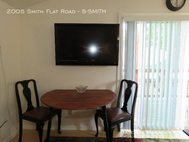
2005 Smith Flat Rd Unit 5-SMITH
Placerville, CA 95667
2 Weeks Ago
Favorites
2005 Smith Flat Rd Unit 5-SMITH

Favorites
Check Back Soon for Upcoming Availability
| Beds | Baths | Average SF |
|---|---|---|
| 2 Bedrooms 2 Bedrooms 2 Br | 1 Bath 1 Bath 1 Ba | 750 SF |
About This Property
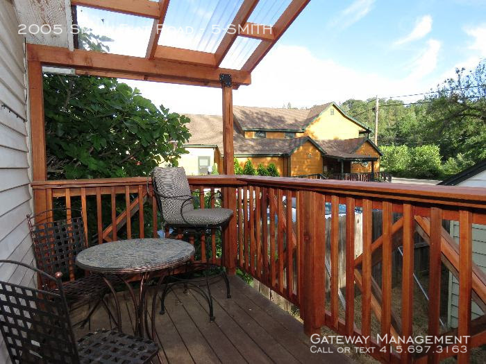
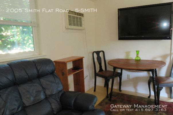
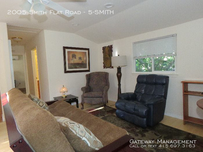
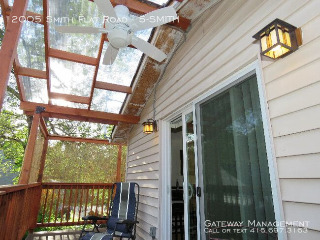
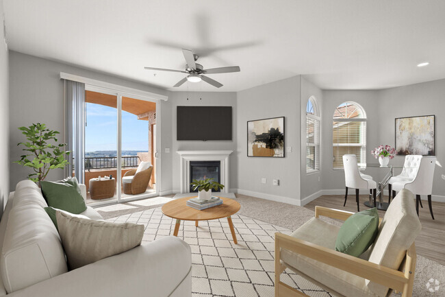
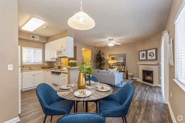
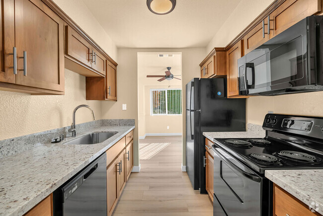
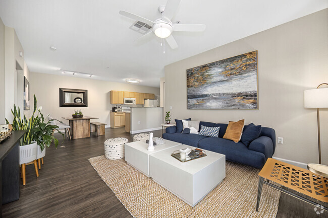
---- SCHEDULE A SHOWING ONLINE AT: http://showmojo.com/lac/b57f48306c ---- Live in the Sierra Foothills! Where the air is fresher, and history surrounds you. Large one bedroom with a great room connected to a wrap around 2nd-floor deck overlooking entry to historic Smith Flat House. Along the Southern side of the building is a huge fig tree much loved by the patrons who park in the Smith Flat House parking lot which shares a fence with this property. Modern newer galley kitchen with lots of counter and cabinet space. Double sink and gas stove. Table for 4. Full bathroom with tub/shower Downstairs garage/storage space has only a 6-foot ceiling Good Comcast WiFi and jacks in the unit. Unit 5 is on a one acre complex of 6 units. There is off-street parking NEIGHBORHOOD: Smith Flat is one of California's oldest communities known in the early days as being a settlement 3 miles from old town Placerville. This Carson Trail stagecoach stop marked the beginning of the ascent or end of the descent from the thousands who traveled to help found the State of California in the 1850s and 1860s. From 1852 on very rich surface diggings were found here in ancient gravel beds. Many tunnels were dug in the surrounding hills to locate more gold. One of the gold rush's richest mines has a preserved opening in the basement of Smith Flat House. This Blue Lead Mine extends all the way to the American River and has made Hangtown Creek which runs through old town Placerville a year round creek. This area became a prosperous mining camp as well. Ranching and logging kept the Smith’s Flat area going after the mines were shut down. Smith Flat Road became part of California's first state highway which was built in the 1890s connecting Placerville with Lake Tahoe. Old-timers recall when other nearby locations competed with the Smith Flat House as drinking and dancing establishments. The Smith Flat House reopened in 2009 as just a healing center based in part on the owner's belief that a large crystal layer, deep below the ground, contained extraordinary healing properties. Today Smith Flat House is again popular as a community gathering space and event center as well as an exceptional eating establishment. TRANSIT: Smith Flat is easily accessed by Exit 49 off Highway 50 and connects to the wineries and Apple Hill [fresh farm to fork] visitor attractions along Carson Road via Jacquier Road. Smith Flat Road and Broadway offer a relatively flat connection to downtown Placerville. Newtown Road connects to more rural communities of Pleasant Valley and Fair Play. This is also the exit used for the Placerville Airport. El Dorado Trail is a hiking / biking / equestrian trail which is over 30 miles long spanning through the Western Slope of El Dorado County on the former SP Railroad Line. This County trail within the old Michigan/California Railroad right-of-way originally served the old railroad ran from Placerville east through Smith Flat and up to Camino. The largest trailhead is located at Smith Flat with close access to a bridge over Highway 50 that allows trail users access to another 4 miles of trail of ascent into Camino where the forest is transformed into primarily evergreen trees better adapted to snow. Placerville Station Transit Center Mosquito Road and Clay Street [Exit 47 off Highway 50] Direct bus connection to downtown Sacramento Bus station and South Lake Tahoe via Amtrack bus Also, there is local service to Pollock Pines Free parking is available. Bamboo Wood Flooring Full Bath Full Bath W/ Tub Fully Furnished Futon Couch In Living Room Large Deck Queen Size Bed
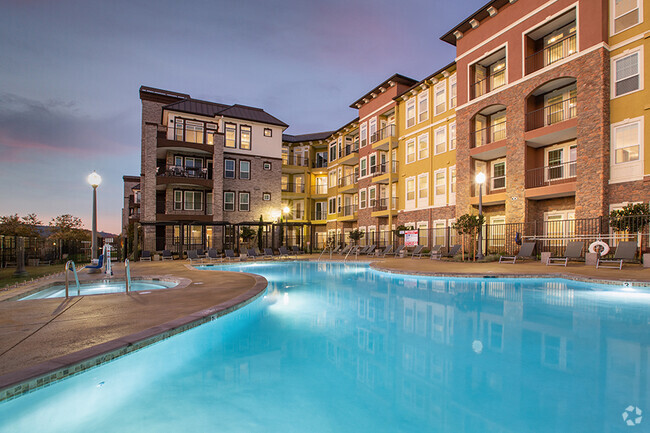
2005 Smith Flat Rd is an apartment community located in El Dorado County and the 95667 ZIP Code.
Features
- Air Conditioning
Fees and Policies
Location
Get Directions
Located halfway between Sacramento and South Lake Tahoe, Placerville offers residents access to a bevy of adventure and activity. Placerville is surrounded by forests, mountains, and lakes as well as farms, wineries, vineyards, and orchards, which all contribute to Placerville’s beauty and opportunities for outdoor activities.
Placerville’s charming downtown area exudes the atmosphere of the Gold Rush era with a modern twist, complete with delectable restaurants, unique shops, historical landmarks, and special events. Both the metropolitan amenities of Sacramento and the recreational possibilities of South Lake Tahoe are about an hour’s drive from Placerville. San Francisco is just a two-hour drive away as well. Commuting and traveling from Placerville is simple with access to Highways 49 and 50.
Learn more about living in Placerville
Amenities
- Air Conditioning
Education
| Colleges & Universities | Distance | ||
|---|---|---|---|
| Colleges & Universities | Distance | ||
| Drive: | 13 min | 7.7 mi | |
| Drive: | 33 min | 23.9 mi | |
| Drive: | 53 min | 37.6 mi | |
| Drive: | 55 min | 40.0 mi |
2005 Smith Flat Rd Unit 5-SMITH is within 13 minutes or 7.7 miles from Folsom Lake College, El Dorado. It is also near Folsom Lake College, Folsom and Sierra College, Rocklin Campus.
Transportation options available in Placerville include Glenn, located 26.8 miles from 2005 Smith Flat Rd Unit 5-SMITH.
| Transit / Subway | Distance | ||
|---|---|---|---|
| Transit / Subway | Distance | ||
|
|
Drive: | 35 min | 26.8 mi |
|
|
Drive: | 35 min | 27.5 mi |
|
|
Drive: | 36 min | 27.7 mi |
|
|
Drive: | 35 min | 28.0 mi |
|
|
Drive: | 39 min | 31.6 mi |
| Commuter Rail | Distance | ||
|---|---|---|---|
| Commuter Rail | Distance | ||
| Drive: | 50 min | 29.3 mi | |
|
|
Drive: | 51 min | 29.3 mi |
|
|
Drive: | 57 min | 39.9 mi |
|
|
Drive: | 55 min | 40.5 mi |
|
|
Drive: | 68 min | 44.4 mi |
Time and distance from 2005 Smith Flat Rd Unit 5-SMITH.
| Shopping Centers | Distance | ||
|---|---|---|---|
| Shopping Centers | Distance | ||
| Drive: | 2 min | 1.4 mi | |
| Drive: | 3 min | 1.7 mi | |
| Drive: | 3 min | 1.8 mi |
2005 Smith Flat Rd Unit 5-SMITH has 3 shopping centers within 1.8 miles, which is about a 3-minute drive. The miles and minutes will be for the farthest away property.
| Parks and Recreation | Distance | ||
|---|---|---|---|
| Parks and Recreation | Distance | ||
|
Marshall Gold Discovery State Historic Park
|
Drive: | 19 min | 11.4 mi |
|
Henningsen Lotus Park
|
Drive: | 21 min | 12.4 mi |
2005 Smith Flat Rd Unit 5-SMITH has 2 parks within 12.4 miles, including Marshall Gold Discovery State Historic Park, and Henningsen Lotus Park.
| Hospitals | Distance | ||
|---|---|---|---|
| Hospitals | Distance | ||
| Drive: | 5 min | 2.8 mi |
2005 Smith Flat Rd Unit 5-SMITH is 2.8 miles and a 5 minute drive from Marshall Medical Center.
| Military Bases | Distance | ||
|---|---|---|---|
| Military Bases | Distance | ||
| Drive: | 65 min | 43.3 mi |
2005 Smith Flat Rd Unit 5-SMITH is 43.3 miles and a 65 minute drive from McClellan Air Force Base.
You May Also Like
Similar Rentals Nearby
What Are Walk Score®, Transit Score®, and Bike Score® Ratings?
Walk Score® measures the walkability of any address. Transit Score® measures access to public transit. Bike Score® measures the bikeability of any address.
What is a Sound Score Rating?
A Sound Score Rating aggregates noise caused by vehicle traffic, airplane traffic and local sources

2005 Smith Flat Rd
Placerville, CA 95667