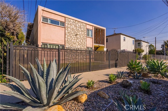
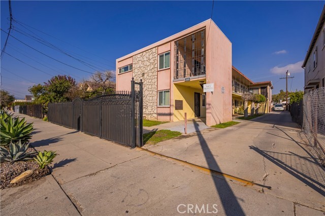
2008 Griffin Ave Unit 1
Los Angeles, CA 90031
Favorites

2008 Griffin Ave Unit 1
Favorites
Check Back Soon for Upcoming Availability
| Beds | Baths | Average SF |
|---|---|---|
| 1 Bedroom 1 Bedroom 1 Br | 1 Bath 1 Bath 1 Ba | 785 SF |
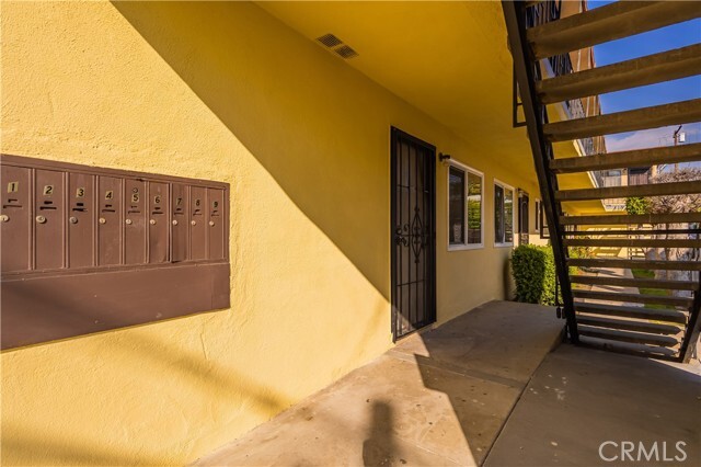
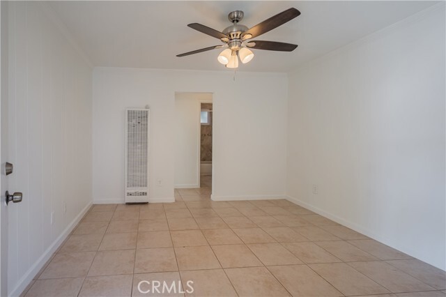
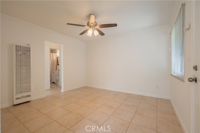
About This Property
Welcome to Lincoln Heights a highly desired area! Very close to downtown Los Angeles. This Unit features 1 bedroom and 1 bathroom, plus a very well sized kitchen and living room. The unit also comes with a 1 car parking space and the owner is also in charge of paying for trash & water. Come take a look this won't last very long. Very convenient location near all major bus stops. Close to schools as Griffin Elementary School, Sacred Heart Elementary School, Sacred Heart High School. Near to LA-USC Medical Center and Medical Plaza, Dodger Stadium, Famous Broadway Avenue, Chinatown, coffee shops, 7-Eleven, Mc-Donald's, Market and many more. Public transportation, bus stop right in the corner, and minutes away to Downtown Los Angeles area. Owner is looking to lease 1 year or more.
2008 Griffin Ave is an apartment community located in Los Angeles County and the 90031 ZIP Code.
Features
- Air Conditioning
Fees and Policies
The fees below are based on community-supplied data and may exclude additional fees and utilities.
- Parking
-
Other--Assigned Parking
Details
Utilities Included
-
Water
-
Trash Removal
Lease Options
-
12 Months
Property Address:
2008 Griffin Ave,
Los Angeles,
CA
90031
 This Property
 Available Property
Southeast Los Angeles is directly south of the Fashion District and east of the University of Southern California (USC). This large neighborhood is minutes from downtown Los Angeles, Hollywood, and Beverly Hills, with easy access to the 110 Freeway. This great location places you near sunny beaches, nature trails, and a bevy of leading employers. Students can access both USC and California State University Long Beach from their Southeast LA apartment.
This densely populated, diverse neighborhood features everything from food trucks and corner markets to wide sidewalks and residential areas filled with bungalows, ranch, and Spanish Colonial architecture. Southeast LA features palm trees and mountain views, tampered with gritty undertones to give it a cool, funky vibe.
As for outdoor fun, take your pick between Catalina Island, Venus Beach, or the Santa Monica Pier. Nearby, you’ll find more sunny beaches like White Point, Cabrillo, and Long Beach.
Learn more about living in Southeast Los AngelesBelow are rent ranges for similar nearby apartments
Amenities
- Air Conditioning
Expenses
Utilities Included
Water, Trash Removal
Included
Education
| Colleges & Universities | Distance | ||
|---|---|---|---|
| Colleges & Universities | Distance | ||
| Walk: | 13 min | 0.7 mi | |
| Drive: | 7 min | 3.2 mi | |
| Drive: | 7 min | 4.2 mi | |
| Drive: | 7 min | 4.2 mi |
2008 Griffin Ave Unit 1 is within 13 minutes or 0.7 mile from USC, Health Sciences Campus. It is also near Cal State Los Angeles and Golden Gate Univ, Los Angeles.
Transportation options available in Los Angeles include Lincoln Heights/Cypress Park Station, located 1.3 miles from 2008 Griffin Ave Unit 1. 2008 Griffin Ave Unit 1 is near Bob Hope, located 15.9 miles or 22 minutes away, and Los Angeles International, located 18.4 miles or 30 minutes away.
| Transit / Subway | Distance | ||
|---|---|---|---|
| Transit / Subway | Distance | ||
|
|
Drive: | 3 min | 1.3 mi |
|
|
Drive: | 4 min | 1.5 mi |
|
|
Drive: | 3 min | 1.7 mi |
|
|
Drive: | 3 min | 1.8 mi |
|
|
Drive: | 6 min | 2.2 mi |
| Commuter Rail | Distance | ||
|---|---|---|---|
| Commuter Rail | Distance | ||
|
|
Drive: | 6 min | 2.2 mi |
|
|
Drive: | 5 min | 2.3 mi |
|
|
Drive: | 9 min | 5.1 mi |
| Drive: | 8 min | 6.2 mi | |
|
|
Drive: | 15 min | 9.7 mi |
| Airports | Distance | ||
|---|---|---|---|
| Airports | Distance | ||
|
Bob Hope
|
Drive: | 22 min | 15.9 mi |
|
Los Angeles International
|
Drive: | 30 min | 18.4 mi |
Time and distance from 2008 Griffin Ave Unit 1.
| Shopping Centers | Distance | ||
|---|---|---|---|
| Shopping Centers | Distance | ||
| Walk: | 12 min | 0.6 mi | |
| Walk: | 15 min | 0.8 mi | |
| Walk: | 16 min | 0.8 mi |
2008 Griffin Ave Unit 1 has 3 shopping centers within 0.8 mile, which is about a 16-minute walk. The miles and minutes will be for the farthest away property.
| Parks and Recreation | Distance | ||
|---|---|---|---|
| Parks and Recreation | Distance | ||
|
Hollenbeck Lake
|
Drive: | 4 min | 2.2 mi |
|
Audubon Center at Debs Park
|
Drive: | 5 min | 2.3 mi |
|
Chavez Ravine Arboretum
|
Drive: | 6 min | 3.2 mi |
|
Elysian Park
|
Drive: | 9 min | 3.3 mi |
|
Elyria Canyon Park
|
Drive: | 8 min | 3.9 mi |
2008 Griffin Ave Unit 1 has 5 parks within 3.9 miles, including Hollenbeck Lake, Audubon Center at Debs Park, and Elysian Park.
| Hospitals | Distance | ||
|---|---|---|---|
| Hospitals | Distance | ||
| Walk: | 17 min | 0.9 mi | |
| Walk: | 22 min | 1.2 mi | |
| Drive: | 7 min | 4.2 mi |
2008 Griffin Ave Unit 1 has 3 hospitals within 4.2 miles, the nearest is Keck Hospital of USC which is 0.9 mile away and a 17 minutes drive.
| Military Bases | Distance | ||
|---|---|---|---|
| Military Bases | Distance | ||
| Drive: | 27 min | 19.9 mi |
2008 Griffin Ave Unit 1 is 19.9 miles and a 27 minutes from Los Angeles Air Force Base.
You May Also Like
Similar Rentals Nearby


What Are Walk Score®, Transit Score®, and Bike Score® Ratings?
Walk Score® measures the walkability of any address. Transit Score® measures access to public transit. Bike Score® measures the bikeability of any address.
What is a Sound Score Rating?
A Sound Score Rating aggregates noise caused by vehicle traffic, airplane traffic and local sources

2008 Griffin Ave
Los Angeles, CA 90031