1 / 14


Habitaciones
2
Baños
1
Pies cuadrados
810 pies²
Disponible
Disp. ahora

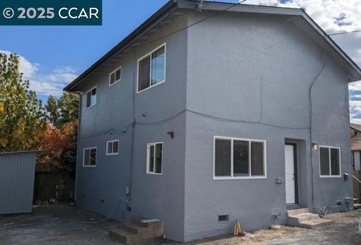
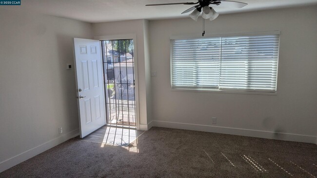
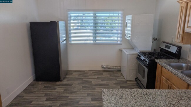
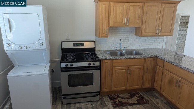
Updated 2 bd 1 bth upstairs apartment with driveway parking and plenty of street parking. Newer light fixtures,new interior paint and newer flooring. In-Unit Stackable Washer & Dryer.Tenant pays PG & E and water. Now available for viewing by appointment.
2008 Marin St se encuentra en Solano County en el código postal 94590.
Located about one mile northwest of the heart of Vallejo, Vallejo Heights is a tranquil neighborhood boasting rich diversity and sweeping views of the Napa River from its hilly landscape. Vallejo Heights is largely residential, offering an array of apartments and houses for rent in a beautiful locale.
Residents are typically drawn to the neighborhood’s natural beauty, scenic vistas, and overall peaceful atmosphere. Vallejo Heights contains numerous parks for the community to enjoy, including Terrace Park, Sheveland Park, and River Park. Vallejo Heights is also just a short drive from local attractions like Mare Island Naval Shipyard and Six Flags Discovery Kingdom, as well as Napa Wine Country and the San Francisco Bay Area.
Obtén más información sobre la vida en Vallejo Heights| Institutos y Universidades | Distancia de | ||
|---|---|---|---|
| Institutos y Universidades | Dist. | ||
| En coche: | 8 minutos | 3.7 mi | |
| En coche: | 16 minutos | 11.5 mi | |
| En coche: | 19 minutos | 13.1 mi | |
| En coche: | 21 minutos | 14.7 mi |
¿Qué son las clasificaciones Walk Score®, Transit Score® y Bike Score®?
Walk Score® mide la viabilidad peatonal de cualquier dirección. Transit Score® mide el acceso a transporte público. Bike Score® mide la infraestructura de rutas para bicicletas de cualquier dirección.
¿Qué es una clasificación de puntaje de ruido?
La clasificación de puntaje de ruido es el conjunto del ruido provocado por el transito de vehículos o de aviones y de fuentes locales.

2008 Marin St
Vallejo, CA 94590


