2034 San Anseline Ave
Long Beach, CA 90815

Check Back Soon for Upcoming Availability
| Beds | Baths | Average SF |
|---|---|---|
| 1 Bedroom 1 Bedroom 1 Br | 1 Bath 1 Bath 1 Ba | — |
About This Property
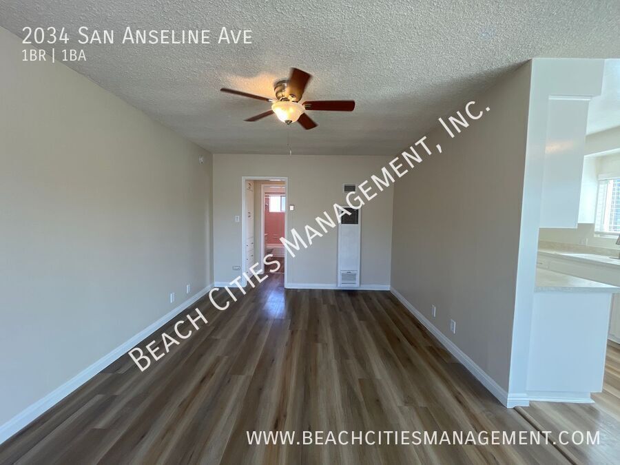
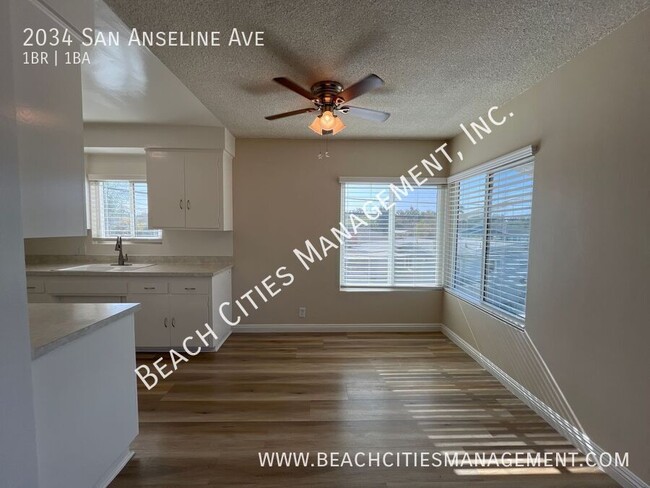
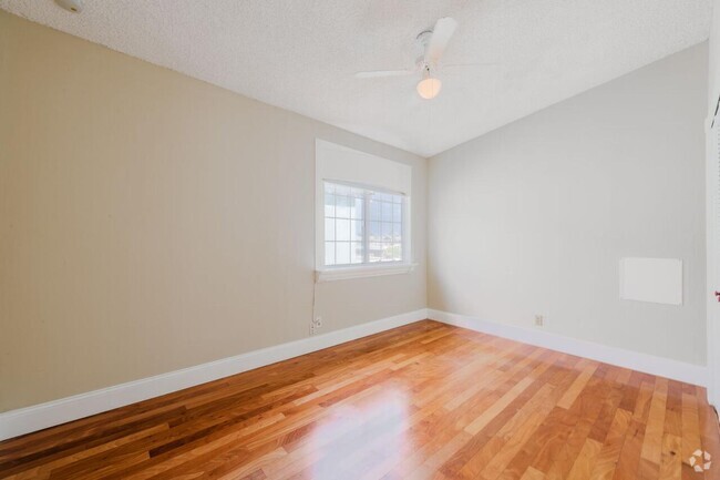
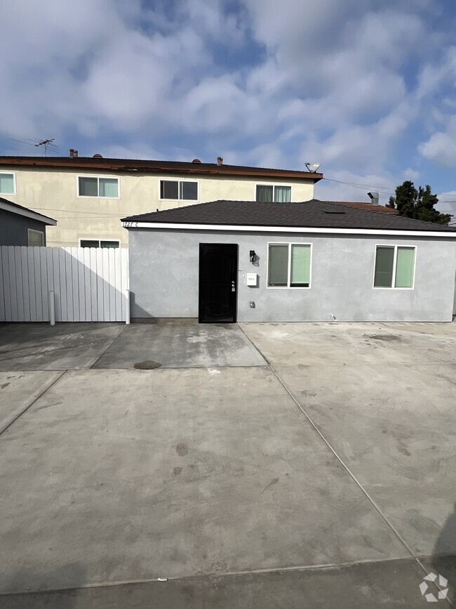
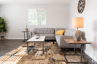
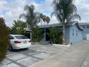
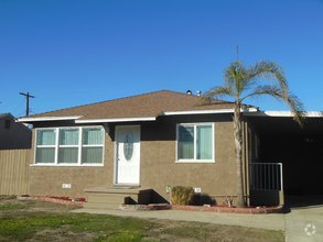
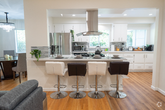
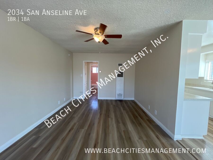
---- SCHEDULE A SHOWING ONLINE AT: ---- Welcome home! This property offers a spacious 1 bedroom 1 bath with a one car garage included. The property has natural lighting, with laminate flooring throughout. Stove included with fresh paint through out property. Property has ceiling fans and lots of closet and storage space. You do not want to miss out on the opportunity to call this place your new home. You may schedule a tour to view the property via our website Apply now as the property will not last long! Pet Policy:No pets Pet Application Required at ; No aggressive or dangerous dog breeds Smoking: Non-smoking unit PROPERTY DESCRIPTION DETAILS Property Type: Multi-Family Year Built:1950 Utilities Included: Water/Trash Appliances Included: Garage / Parking: 1 Car Garage Flooring: Laminate Yard: 3rd Party Payments: Accepted APPLICATION & SHOWING INSTRUCTIONS: Visit www.beachcitiesmanagement to Read our Screening Criteria before Applying Complete the Online Application Attached Required Documentation (Proof of Income and ID for each applicant) Pay the Application Fee Complete Pet Application(s), if applicable Be Sure Every Adult Completes their Own Application Showing Instructions: Schedule a showing online at APPLICATION, LEASE TERMS, AND FEES Application Fee: $45 Leasing Fee: $25 Monthly Application Turnaround Time: 2-3 business days Co-Signers / Guarantors: No Lease Length: 1 Year Lease to Purchase Option: No All information is deemed reliable but not guaranteed and is subject to change.*
2034 San Anseline Ave is a house located in Los Angeles County and the 90815 ZIP Code. This area is served by the Long Beach Unified attendance zone.
Located 28 miles outside of Los Angeles in east Long Beach is Los Altos, a family-friendly suburbia. This tree-lined neighborhood offers its residents a tranquil oasis within minutes of Downtown Long Beach. Shopping enthusiasts can head to Los Altos Shopping Center which houses popular retail stores such as Target, Trader Joe's, and T.J. Maxx.
Locals enjoy visiting the popular Walter Pyramid, the iconic 18-story blue pyramid-shaped stadium located on the California State University Long Beach campus. Other outdoor entertainment includes Whaley Park Community Center, home to baseball fields, basketball courts, volleyball, and even a roller hockey rink. Whether you enjoy the great outdoors, shopping or sightseeing, you'll delight in Los Altos. Stucco, ranch-style homes, and apartments are available to rent.
Learn more about living in Los AltosBelow are rent ranges for similar nearby apartments
| Colleges & Universities | Distance | ||
|---|---|---|---|
| Colleges & Universities | Distance | ||
| Drive: | 3 min | 1.3 mi | |
| Drive: | 9 min | 3.6 mi | |
| Drive: | 10 min | 3.8 mi | |
| Drive: | 16 min | 8.6 mi |
 The GreatSchools Rating helps parents compare schools within a state based on a variety of school quality indicators and provides a helpful picture of how effectively each school serves all of its students. Ratings are on a scale of 1 (below average) to 10 (above average) and can include test scores, college readiness, academic progress, advanced courses, equity, discipline and attendance data. We also advise parents to visit schools, consider other information on school performance and programs, and consider family needs as part of the school selection process.
View GreatSchools Rating Methodology
Transportation options available in Long Beach include Pacific Coast Highway Station, located 4.4 miles from 2034 San Anseline Ave. 2034 San Anseline Ave is near Long Beach (Daugherty Field), located 4.7 miles or 8 minutes away, and John Wayne/Orange County, located 18.1 miles or 24 minutes away.
| Transit / Subway | Distance | ||
|---|---|---|---|
| Transit / Subway | Distance | ||
|
|
Drive: | 10 min | 4.4 mi |
|
|
Drive: | 12 min | 4.9 mi |
|
|
Drive: | 12 min | 5.2 mi |
|
|
Drive: | 13 min | 5.5 mi |
|
|
Drive: | 10 min | 5.9 mi |
| Commuter Rail | Distance | ||
|---|---|---|---|
| Commuter Rail | Distance | ||
|
|
Drive: | 23 min | 13.3 mi |
|
|
Drive: | 21 min | 13.4 mi |
|
|
Drive: | 28 min | 16.7 mi |
|
|
Drive: | 26 min | 17.1 mi |
| Drive: | 25 min | 17.6 mi |
| Airports | Distance | ||
|---|---|---|---|
| Airports | Distance | ||
|
Long Beach (Daugherty Field)
|
Drive: | 8 min | 4.7 mi |
|
John Wayne/Orange County
|
Drive: | 24 min | 18.1 mi |
Time and distance from 2034 San Anseline Ave.
| Shopping Centers | Distance | ||
|---|---|---|---|
| Shopping Centers | Distance | ||
| Walk: | 5 min | 0.3 mi | |
| Walk: | 7 min | 0.4 mi | |
| Walk: | 16 min | 0.9 mi |
| Parks and Recreation | Distance | ||
|---|---|---|---|
| Parks and Recreation | Distance | ||
|
Earl Burns Miller Japanese Garden
|
Walk: | 14 min | 0.7 mi |
|
El Dorado East Regional Park
|
Drive: | 6 min | 2.2 mi |
|
Colorado Lagoon
|
Drive: | 6 min | 2.5 mi |
|
El Dorado Nature Center
|
Drive: | 5 min | 2.8 mi |
|
Los Cerritos Wetlands Trust
|
Drive: | 7 min | 3.4 mi |
| Hospitals | Distance | ||
|---|---|---|---|
| Hospitals | Distance | ||
| Drive: | 5 min | 2.5 mi | |
| Drive: | 8 min | 4.4 mi | |
| Drive: | 9 min | 4.6 mi |
| Military Bases | Distance | ||
|---|---|---|---|
| Military Bases | Distance | ||
| Drive: | 14 min | 8.0 mi | |
| Drive: | 27 min | 12.3 mi |
You May Also Like
Similar Rentals Nearby
What Are Walk Score®, Transit Score®, and Bike Score® Ratings?
Walk Score® measures the walkability of any address. Transit Score® measures access to public transit. Bike Score® measures the bikeability of any address.
What is a Sound Score Rating?
A Sound Score Rating aggregates noise caused by vehicle traffic, airplane traffic and local sources
