-
Monthly Rent
$6,500
-
Bedrooms
5 bd
-
Bathrooms
2 ba
-
Square Feet
1,375 sq ft
Details

About This Property
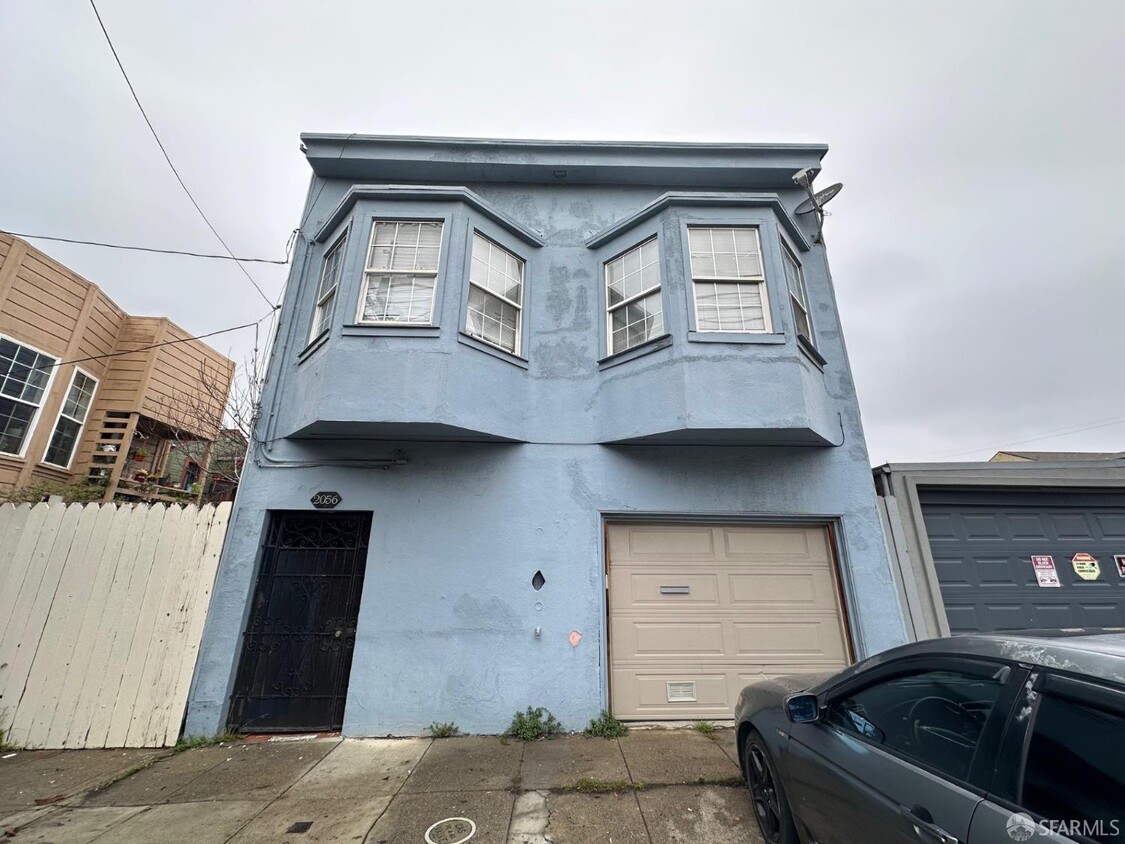
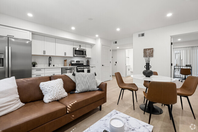
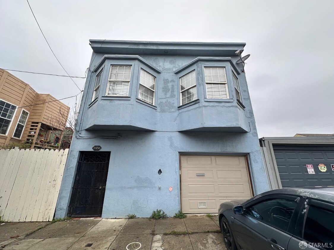
Bayview 5 bedroom 2 bath apartment. Well Maintained. Updated kitchen. Easy access to highways 101, 280, SFO and Downtown SF. Tenant responsible for all utilities.
2056 Jennings St is an apartment community located in San Francisco County and the 94124 ZIP Code.
Contact
Features
Air Conditioning
Hardwood Floors
Tub/Shower
Tile Floors
- Air Conditioning
- Smoke Free
- Tub/Shower
- Sprinkler System
- Oven
- Range
- Breakfast Nook
- Hardwood Floors
- Carpet
- Tile Floors
- Patio
Fees and Policies
The fees below are based on community-supplied data and may exclude additional fees and utilities.
- Parking
-
Surface Lot--
-
Garage--
 This Property
 Available Property
- Air Conditioning
- Smoke Free
- Tub/Shower
- Sprinkler System
- Oven
- Range
- Breakfast Nook
- Hardwood Floors
- Carpet
- Tile Floors
- Patio
Previously an industrial hub on the bay, Bayview is an up-and-coming neighborhood on the San Francisco Bay, offering diverse rental options and waterfront views. Residents enjoy the wide variety of options, from cozy single-family homes to modern, high-rise apartments. Bayview is home to neighborhood parks and small businesses like Heron’s Head Park, Candlestick Point State Recreation Area, and Laughing Monk Brewing. Bayview is bounded by U.S. Highway 101 and offers easy access to Interstate 280. This scenic neighborhood is just minutes from other major neighborhoods like Mission District, Balboa Park, and Mission Bay.
Learn more about living in Bayview| Colleges & Universities | Distance | ||
|---|---|---|---|
| Colleges & Universities | Distance | ||
| Drive: | 10 min | 3.8 mi | |
| Drive: | 10 min | 5.2 mi | |
| Drive: | 13 min | 5.5 mi | |
| Drive: | 11 min | 5.6 mi |
Transportation options available in San Francisco include Williams Station Outbound, located 0.3 miles from 2056 Jennings St. 2056 Jennings St is near San Francisco International, located 9.5 miles or 16 minutes away, and Metro Oakland International, located 23.2 miles or 37 minutes away.
| Transit / Subway | Distance | ||
|---|---|---|---|
| Transit / Subway | Distance | ||
|
|
Walk: | 6 min | 0.3 mi |
|
|
Walk: | 9 min | 0.5 mi |
|
|
Walk: | 9 min | 0.5 mi |
|
|
Walk: | 11 min | 0.6 mi |
|
|
Walk: | 12 min | 0.7 mi |
| Commuter Rail | Distance | ||
|---|---|---|---|
| Commuter Rail | Distance | ||
| Drive: | 5 min | 1.6 mi | |
| Drive: | 10 min | 3.5 mi | |
| Drive: | 10 min | 4.8 mi | |
| Drive: | 11 min | 6.1 mi | |
| Drive: | 13 min | 8.1 mi |
| Airports | Distance | ||
|---|---|---|---|
| Airports | Distance | ||
|
San Francisco International
|
Drive: | 16 min | 9.5 mi |
|
Metro Oakland International
|
Drive: | 37 min | 23.2 mi |
Time and distance from 2056 Jennings St.
| Shopping Centers | Distance | ||
|---|---|---|---|
| Shopping Centers | Distance | ||
| Drive: | 5 min | 1.3 mi | |
| Drive: | 9 min | 2.9 mi | |
| Drive: | 9 min | 3.8 mi |
| Parks and Recreation | Distance | ||
|---|---|---|---|
| Parks and Recreation | Distance | ||
|
Candlestick Point State Recreation Area
|
Drive: | 5 min | 1.1 mi |
|
Heron's Head Park
|
Drive: | 5 min | 1.4 mi |
|
Children's Creativity Museum
|
Drive: | 12 min | 5.1 mi |
|
Randall Museum
|
Drive: | 14 min | 5.8 mi |
|
San Bruno Mountain State Park
|
Drive: | 17 min | 6.8 mi |
| Hospitals | Distance | ||
|---|---|---|---|
| Hospitals | Distance | ||
| Drive: | 8 min | 2.6 mi | |
| Drive: | 10 min | 3.2 mi | |
| Drive: | 12 min | 5.4 mi |
| Military Bases | Distance | ||
|---|---|---|---|
| Military Bases | Distance | ||
| Drive: | 33 min | 17.5 mi | |
| Drive: | 34 min | 17.7 mi |
You May Also Like
Similar Rentals Nearby
-
-
-
-
-
-
-
-
-
1 / 9
-
1 / 36
What Are Walk Score®, Transit Score®, and Bike Score® Ratings?
Walk Score® measures the walkability of any address. Transit Score® measures access to public transit. Bike Score® measures the bikeability of any address.
What is a Sound Score Rating?
A Sound Score Rating aggregates noise caused by vehicle traffic, airplane traffic and local sources
