208 N East St
Mason, OH 45040

-
Monthly Rent
$1,150
-
Bedrooms
2 bd
-
Bathrooms
1 ba
-
Square Feet
Details

About This Property
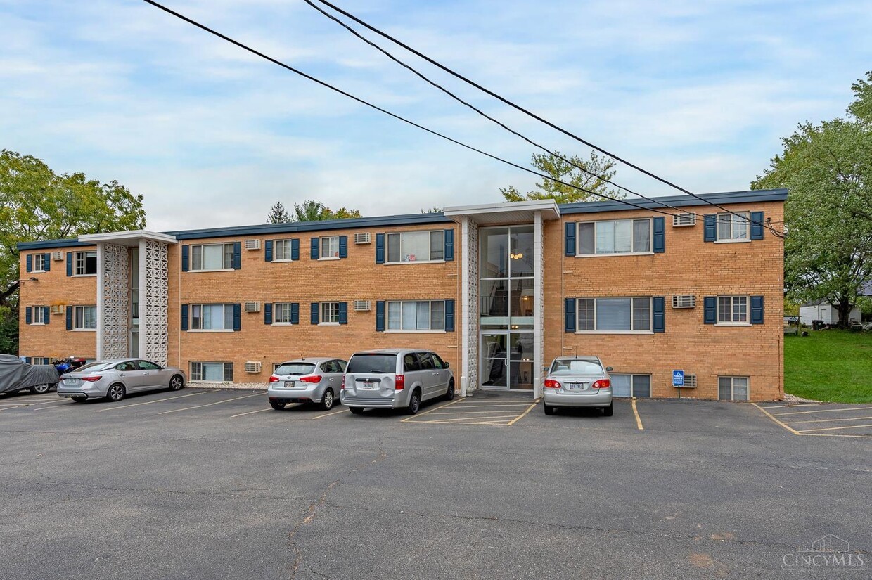
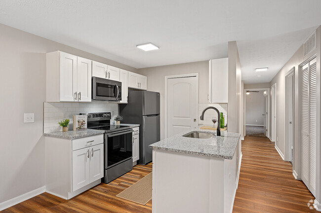
Take advantage of our limited-time offer: Move in now and receive 1/2 month off your first month's rent! Don't miss out on this incredible deal. This charming 2-bed,1-bath unit features a blend of hardwood and carpet floors throughout,complemented by ceiling fans for comfort. The modern kitchen offers granite countertops,hardwood cabinets,a full suite of appliances including a stove/oven,dishwasher,and refrigerator,along with elegant tile flooring. This cozy unit comes with a one-year lease and a no-smoking policy. Tenants are responsible for electric,and water/sewer,while trash removal and heat are included for added convenience. Enjoy a hassle-free lifestyle in a well-maintained space! Water fee is $45/month. Convenience is key with wall-mounted AC,off-street parking,and on-site laundry. The unit is cable ready,though not furnished,giving you a blank canvas to make it your own.
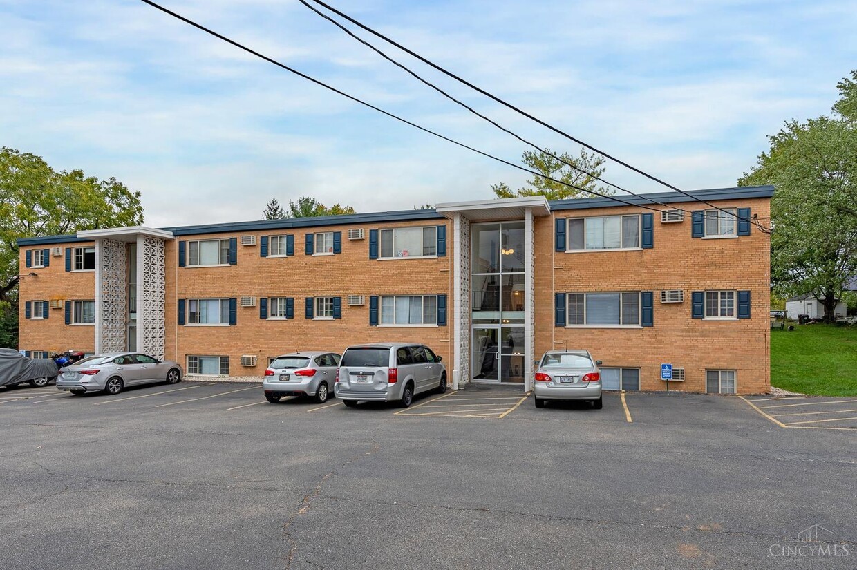
208 N East St is an apartment community located in Warren County and the 45040 ZIP Code.
Contact
 This Property
 Available Property
Located between Cincinnati and Dayton, Mason is the largest city in Warren County, serving as the anchor of “Ohio’s Largest Playground.” Attractions and outdoor recreation abound in Mason, with about 300 acres of parkland, Kings Island amusement park, a water park, and multiple golf courses situated within the city’s boundaries.
Mason is also home to the Lindner Family Tennis Center, one of the largest tennis stadiums in the world and the site of the esteemed Western and Southern Open. A variety of events bring the community together in Mason, including the annual Mason Heritage Festival, Christmas in Mason, and a bevy of classes and programs at the expansive Mason Community Center. Commuting and traveling from Mason is simple with access to I-71, I-75, and U.S. 42 as well as the Cincinnati-Northern Kentucky International Airport and the Dayton Airport.
Learn more about living in Mason| Colleges & Universities | Distance | ||
|---|---|---|---|
| Colleges & Universities | Distance | ||
| Drive: | 20 min | 10.6 mi | |
| Drive: | 22 min | 11.8 mi | |
| Drive: | 26 min | 16.0 mi | |
| Drive: | 28 min | 17.5 mi |
Transportation options available in Mason include Race & Liberty Station, located 23.5 miles from 208 N East St. 208 N East St is near Cincinnati/Northern Kentucky International, located 37.8 miles or 60 minutes away.
| Transit / Subway | Distance | ||
|---|---|---|---|
| Transit / Subway | Distance | ||
| Drive: | 35 min | 23.5 mi | |
| Drive: | 36 min | 23.7 mi | |
| Drive: | 36 min | 23.8 mi | |
| Drive: | 37 min | 23.9 mi | |
| Drive: | 36 min | 25.3 mi |
| Commuter Rail | Distance | ||
|---|---|---|---|
| Commuter Rail | Distance | ||
|
|
Drive: | 36 min | 25.3 mi |
| Airports | Distance | ||
|---|---|---|---|
| Airports | Distance | ||
|
Cincinnati/Northern Kentucky International
|
Drive: | 60 min | 37.8 mi |
Time and distance from 208 N East St.
| Shopping Centers | Distance | ||
|---|---|---|---|
| Shopping Centers | Distance | ||
| Drive: | 2 min | 1.1 mi | |
| Drive: | 3 min | 1.6 mi | |
| Drive: | 3 min | 1.6 mi |
| Parks and Recreation | Distance | ||
|---|---|---|---|
| Parks and Recreation | Distance | ||
|
Corwin M. Nixon Park
|
Walk: | 19 min | 1.0 mi |
|
Makino Park
|
Drive: | 3 min | 1.8 mi |
|
Voice of America MetroPark
|
Drive: | 8 min | 3.2 mi |
|
Keehner Park
|
Drive: | 10 min | 4.8 mi |
|
Liberty Park
|
Drive: | 13 min | 5.5 mi |
| Hospitals | Distance | ||
|---|---|---|---|
| Hospitals | Distance | ||
| Drive: | 8 min | 3.9 mi | |
| Drive: | 16 min | 8.2 mi | |
| Drive: | 19 min | 10.0 mi |
| Military Bases | Distance | ||
|---|---|---|---|
| Military Bases | Distance | ||
| Drive: | 48 min | 36.4 mi | |
| Drive: | 55 min | 41.5 mi | |
| Drive: | 57 min | 44.8 mi |
You May Also Like
Similar Rentals Nearby
What Are Walk Score®, Transit Score®, and Bike Score® Ratings?
Walk Score® measures the walkability of any address. Transit Score® measures access to public transit. Bike Score® measures the bikeability of any address.
What is a Sound Score Rating?
A Sound Score Rating aggregates noise caused by vehicle traffic, airplane traffic and local sources
