
$1,195 / Month
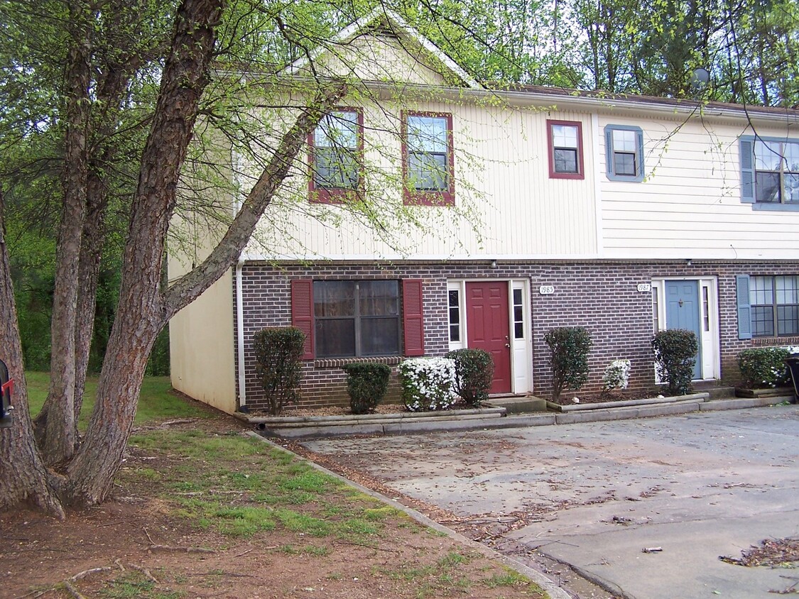
2093 Lenoa Ln Unit 2093
Austell, GA 30106
Today
Favorites
770-941-7745
-
Bedrooms
2
-
Bathrooms
2.5
-
Square Feet
--
-
Available
Available Now
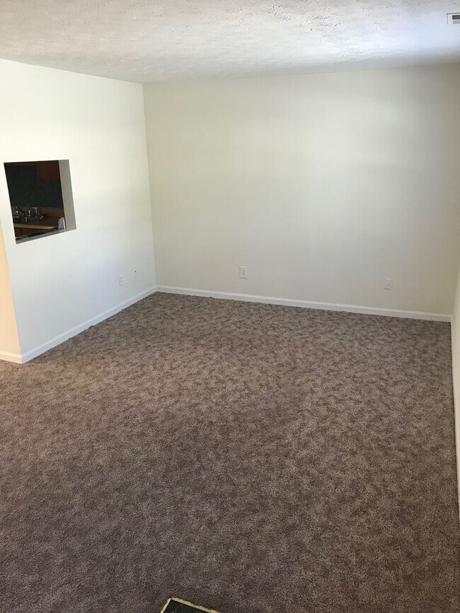
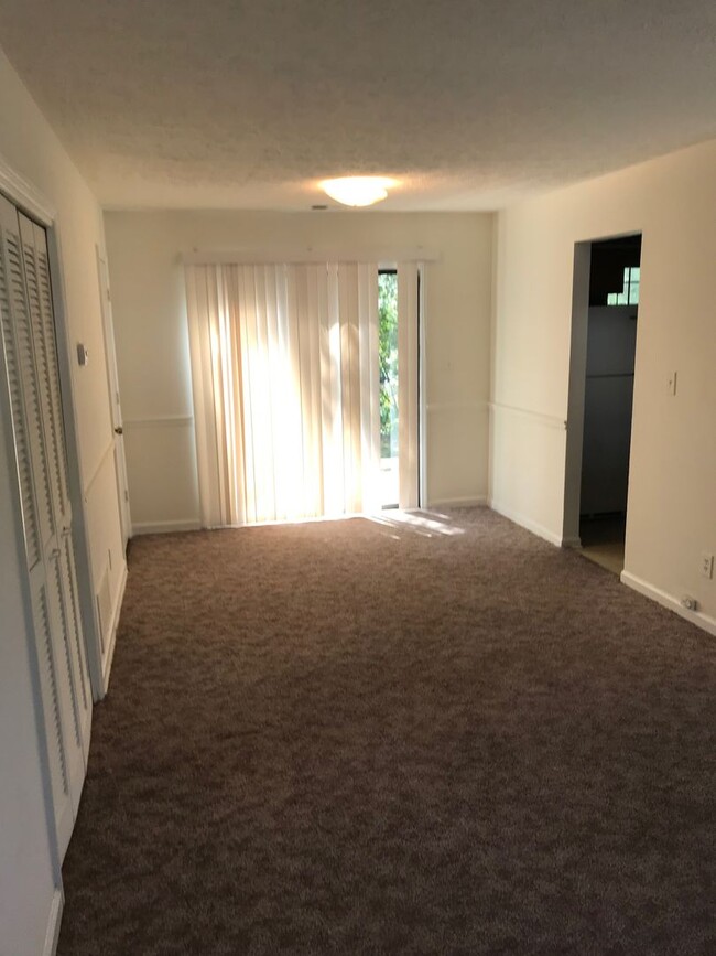
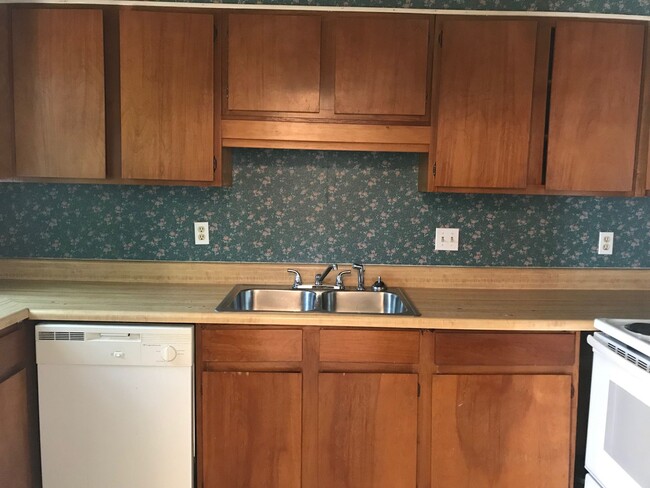
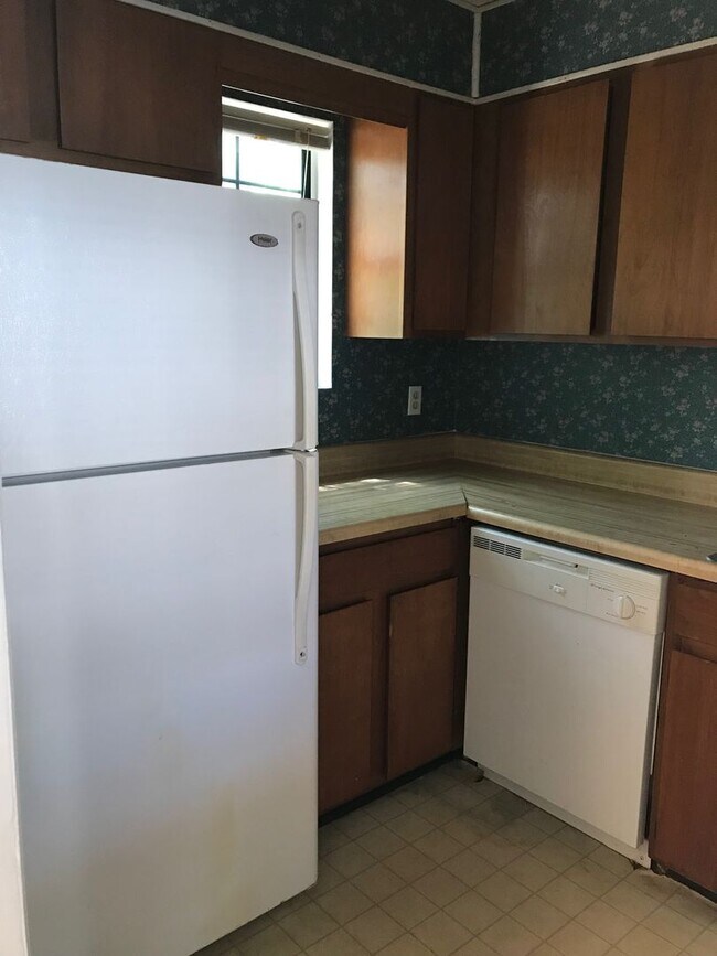
2093 Lenoa Ln Unit 2093

Favorites
2093 Lenoa Ln is an apartment community located in Cobb County and the 30106 ZIP Code.
* Price shown is base rent and may not include non-optional fees and utilities.
Price, availability, fees, and any applicable rent special are subject to change without notice.
* Square footage definitions vary. Displayed square footage is approximate.
Features
- Dishwasher
Fees and Policies
Contact
- Listed by Property Management Unlimited, Inc | Property Management Unlimited, Inc
- Phone Number
- Contact
Location
Get Directions
Amenities
- Dishwasher
Austell encompasses a relatively large part of Cobb County real estate just 17 miles west of Atlanta. You’ll find new residential developments comprised of affordable single-family homes and apartments in and around Sweetwater Creek and the locally owned businesses along U.S. Highway 78. There are three community parks in the center of Austell that add to the area’s park-like feel. Many residents commute into Atlanta and Marietta for work, and any commute is made easy thanks to the highways and nearby Perimeter (Interstate 285) that will connect you to the rest of Atlanta.
Learn more about living in Austell
Education
| Colleges & Universities | Distance | ||
|---|---|---|---|
| Colleges & Universities | Distance | ||
| Drive: | 8 min | 3.9 mi | |
| Drive: | 15 min | 7.5 mi | |
| Drive: | 19 min | 10.0 mi | |
| Drive: | 26 min | 14.7 mi |
2093 Lenoa Ln Unit 2093 is within 8 minutes or 3.9 miles from Chatt. Tech, Austell. It is also near Chatt. Tech, Marietta and Life University.
Transportation options available in Austell include Bankhead, located 13.5 miles from 2093 Lenoa Ln Unit 2093. 2093 Lenoa Ln Unit 2093 is near Hartsfield - Jackson Atlanta International, located 27.4 miles or 42 minutes away.
| Transit / Subway | Distance | ||
|---|---|---|---|
| Transit / Subway | Distance | ||
|
|
Drive: | 25 min | 13.5 mi |
|
|
Drive: | 23 min | 14.7 mi |
|
|
Drive: | 24 min | 15.7 mi |
|
|
Drive: | 27 min | 17.4 mi |
|
|
Drive: | 28 min | 18.1 mi |
| Commuter Rail | Distance | ||
|---|---|---|---|
| Commuter Rail | Distance | ||
|
|
Drive: | 32 min | 16.1 mi |
| Airports | Distance | ||
|---|---|---|---|
| Airports | Distance | ||
|
Hartsfield - Jackson Atlanta International
|
Drive: | 42 min | 27.4 mi |
Time and distance from 2093 Lenoa Ln Unit 2093.
| Shopping Centers | Distance | ||
|---|---|---|---|
| Shopping Centers | Distance | ||
| Drive: | 3 min | 1.1 mi | |
| Drive: | 3 min | 1.2 mi | |
| Drive: | 3 min | 1.3 mi |
2093 Lenoa Ln Unit 2093 has 3 shopping centers within 1.3 miles, which is about a 3-minute drive. The miles and minutes will be for the farthest away property.
| Parks and Recreation | Distance | ||
|---|---|---|---|
| Parks and Recreation | Distance | ||
|
Silver Comet Trail
|
Drive: | 14 min | 7.0 mi |
|
Sweetwater Creek State Park
|
Drive: | 18 min | 7.6 mi |
|
Marietta Tree Keepers
|
Drive: | 19 min | 9.7 mi |
|
Kennesaw Mountain National Battlefield Park
|
Drive: | 19 min | 9.9 mi |
2093 Lenoa Ln Unit 2093 has 4 parks within 9.9 miles, including Silver Comet Trail, Sweetwater Creek State Park, and Kennesaw Mountain National Battlefield Park.
| Hospitals | Distance | ||
|---|---|---|---|
| Hospitals | Distance | ||
| Drive: | 4 min | 1.7 mi | |
| Drive: | 15 min | 7.8 mi | |
| Drive: | 22 min | 10.7 mi |
2093 Lenoa Ln Unit 2093 has 3 hospitals within 10.7 miles, the nearest is WellStar Cobb Hospital which is 1.7 miles away and a 4 minute drive.
| Military Bases | Distance | ||
|---|---|---|---|
| Military Bases | Distance | ||
| Drive: | 20 min | 9.7 mi | |
| Drive: | 32 min | 20.2 mi |
2093 Lenoa Ln Unit 2093 is 9.7 miles from Dobbins Air Force Base, and is convenient to other military bases, including Fort McPherson.
You May Also Like
Similar Rentals Nearby


What Are Walk Score®, Transit Score®, and Bike Score® Ratings?
Walk Score® measures the walkability of any address. Transit Score® measures access to public transit. Bike Score® measures the bikeability of any address.
What is a Sound Score Rating?
A Sound Score Rating aggregates noise caused by vehicle traffic, airplane traffic and local sources
2093 Lenoa Ln
Austell, GA 30106