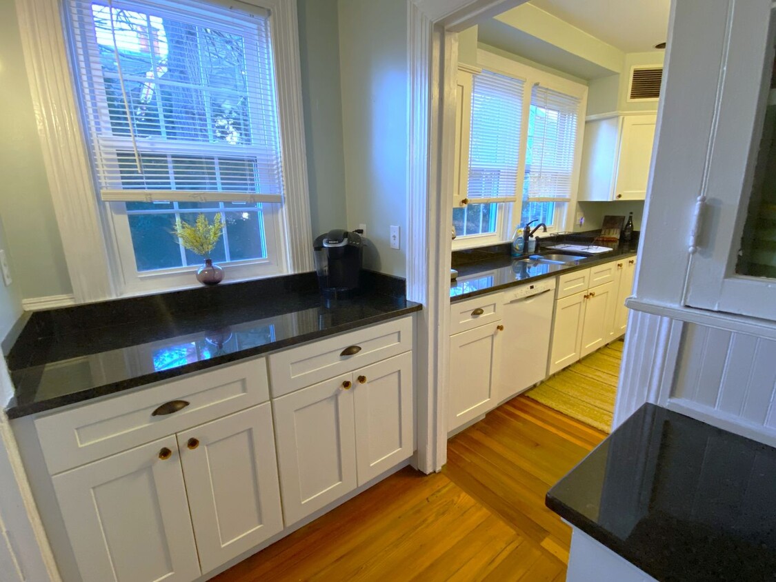
21 Elton St Unit 1
Providence, RI 02906
-
Bedrooms
3
-
Bathrooms
1
-
Square Feet
1,600 sq ft
-
Available
Available Now

Contact
- Listed by Real | Real Property Management Providence
- Phone Number
- Contact
Neighboring historic College Hill, Wayland is known as one of Providence’s best neighborhoods to live in. Along with being within walking or biking distance of Brown University and the Rhode Island School of Design, Wayland gives residents an easy, two-mile commute to Downtown Provide. You can leave your car behind and take one of the several RIPTA bus lines that cross the neighborhood. Wayland resembles the classic New England neighborhood with quaint architecture including Georgian and Victorian-style homes. Perfect for all renters, Wayland has a wide variety of affordable and upscale rentals available for rent.
Proximity to several two colleges gives Wayland a youthful presence as well. Along Wayland Avenue you’ll find Wayland Square, a small yet lively commercial district with casual eateries, laid-back cafes, shops, and more. Wayland is pedestrian-friendly so you’ll see locals walking or biking to this small hub daily.
Learn more about living in Wayland| Colleges & Universities | Distance | ||
|---|---|---|---|
| Colleges & Universities | Distance | ||
| Walk: | 15 min | 0.8 mi | |
| Drive: | 4 min | 1.5 mi | |
| Drive: | 5 min | 1.8 mi | |
| Drive: | 6 min | 2.0 mi |
Transportation options available in Providence include Mattapan Station, located 37.5 miles from 21 Elton St Unit 1. 21 Elton St Unit 1 is near Rhode Island Tf Green International, located 9.5 miles or 20 minutes away.
| Transit / Subway | Distance | ||
|---|---|---|---|
| Transit / Subway | Distance | ||
|
|
Drive: | 53 min | 37.5 mi |
|
|
Drive: | 54 min | 37.9 mi |
|
|
Drive: | 54 min | 38.0 mi |
|
|
Drive: | 53 min | 38.9 mi |
|
|
Drive: | 56 min | 39.7 mi |
| Commuter Rail | Distance | ||
|---|---|---|---|
| Commuter Rail | Distance | ||
|
|
Drive: | 4 min | 1.5 mi |
| Drive: | 9 min | 3.9 mi | |
|
|
Drive: | 12 min | 6.4 mi |
| Drive: | 16 min | 8.8 mi | |
|
|
Drive: | 19 min | 11.2 mi |
| Airports | Distance | ||
|---|---|---|---|
| Airports | Distance | ||
|
Rhode Island Tf Green International
|
Drive: | 20 min | 9.5 mi |
Time and distance from 21 Elton St Unit 1.
| Shopping Centers | Distance | ||
|---|---|---|---|
| Shopping Centers | Distance | ||
| Walk: | 6 min | 0.3 mi | |
| Walk: | 13 min | 0.7 mi | |
| Drive: | 4 min | 1.4 mi |
| Parks and Recreation | Distance | ||
|---|---|---|---|
| Parks and Recreation | Distance | ||
|
Ladd Observatory
|
Walk: | 16 min | 0.8 mi |
|
Roger Williams National Memorial
|
Drive: | 4 min | 1.4 mi |
|
Providence Children's Museum
|
Drive: | 5 min | 2.4 mi |
|
Roger Williams Park Zoo
|
Drive: | 10 min | 4.0 mi |
|
Woonasquatucket River Greenway - Riverside Park
|
Drive: | 9 min | 4.4 mi |
| Hospitals | Distance | ||
|---|---|---|---|
| Hospitals | Distance | ||
| Drive: | 3 min | 1.3 mi | |
| Drive: | 4 min | 1.7 mi | |
| Drive: | 5 min | 2.4 mi |
| Military Bases | Distance | ||
|---|---|---|---|
| Military Bases | Distance | ||
| Drive: | 35 min | 21.8 mi | |
| Drive: | 64 min | 40.9 mi |
You May Also Like
Similar Rentals Nearby
What Are Walk Score®, Transit Score®, and Bike Score® Ratings?
Walk Score® measures the walkability of any address. Transit Score® measures access to public transit. Bike Score® measures the bikeability of any address.
What is a Sound Score Rating?
A Sound Score Rating aggregates noise caused by vehicle traffic, airplane traffic and local sources
