21 Manning St
21 Manning St,
Pawtucket,
RI
02860
2 Weeks Ago
Favorites
21 Manning St

Favorites
Check Back Soon for Upcoming Availability
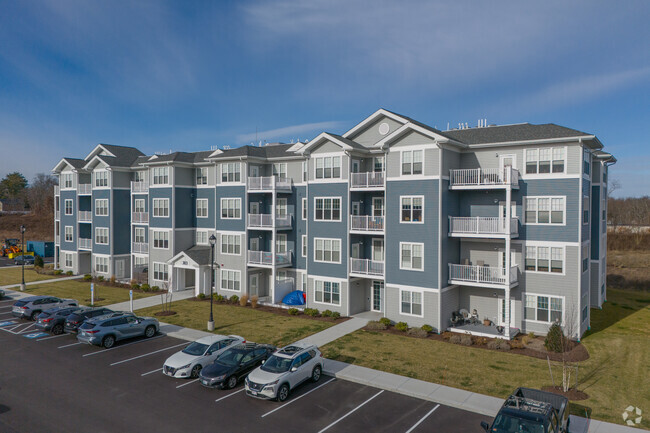
About 21 Manning St Pawtucket, RI 02860
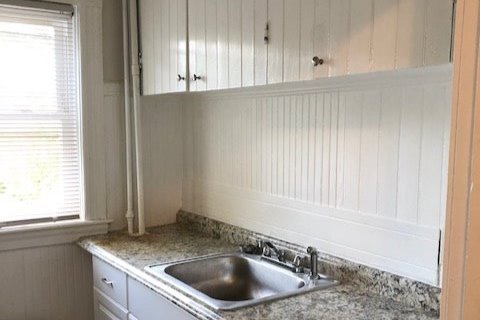
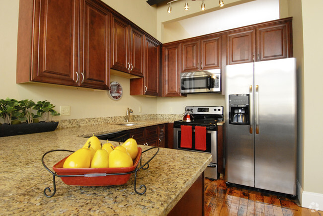
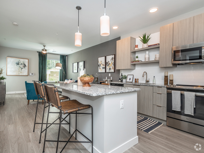
Just over East Side line in Oak hill Pawtucket beautiful 2 bed bedroom, first floor apartment. Close to Blackstone Blvd. East Side, Farmer's Markets at Lippitt park, Miriam Hospital, Shea High School, and easy access to highways. Features: first floor hardwood floors throughout Large pocket doors living room, dining room with built in cabinets, two good size bedrooms and small office off bathroom. Kitchen has recent updates to cabinets, gas stove, countertops. Lots of windows (replacement vinyl windows) Backyard and laundry facilities in the basement. Off street parking optional and on street parking is allowed. Ready June 1st Rent is $1,395.00 Tenant pays gas and electric Owner pays water and sewer Pet considered.
21 Manning St is an apartment community located in Providence County and the 02860 ZIP Code.
Apartment Features
Hardwood Floors
Smoke Free
Basement
Dining Room
- Smoke Free
- Kitchen
- Hardwood Floors
- Dining Room
- Basement
- Laundry Facilities
Fees and Policies
The fees below are based on community-supplied data and may exclude additional fees and utilities.
- Cats Allowed
-
Fees not specified
-
Weight limit--
-
Pet Limit--
- Parking
-
Surface Lot--
Details
Lease Options
-
12 Months
Property Address:
21 Manning St,
Pawtucket,
RI
02860
Located just five miles north of Providence, Pawtucket offers residents a blend of small-town charm and big-city amenities along the Rhode Island-Massachusetts border. Seekonk River – flowing into Providence River – travels directly through Pawtucket, offering scenic views from the city’s riverfront green spaces. Pawtucket fosters a strong sense of community with festive family-friendly events like the Pawtucket Arts Festival, Saint Patrick’s Day Parade, and Pawtucket’s Wonderland Spectacular.
This city is known for its sporting opportunities and events, with local mainstays like Pawtucket Red Sox games at McCoy Stadium, Slater Memorial Park, Seekonk River, and nearby Lincoln Woods State Park. Numerous historic attractions, performance venues, diverse eateries, and a burgeoning arts scene contribute to Pawtucket’s unique culture. Quick access to I-95 makes getting around from Pawtucket a breeze.
Learn more about living in PawtucketBelow are rent ranges for similar nearby apartments
Amenities
- Smoke Free
- Kitchen
- Hardwood Floors
- Dining Room
- Basement
- Laundry Facilities
Education
| Colleges & Universities | Distance | ||
|---|---|---|---|
| Colleges & Universities | Distance | ||
| Drive: | 8 min | 2.8 mi | |
| Drive: | 9 min | 3.5 mi | |
| Drive: | 9 min | 3.9 mi | |
| Drive: | 9 min | 5.0 mi |
21 Manning St is within 8 minutes or 2.8 miles from Brown University. It is also near Rhode Island School of Design and C.C. of Rhode Island, Downcity.
Transportation options available in Pawtucket include Mattapan Station, located 35.0 miles from 21 Manning St. 21 Manning St is near Rhode Island Tf Green International, located 13.0 miles or 24 minutes away.
| Transit / Subway | Distance | ||
|---|---|---|---|
| Transit / Subway | Distance | ||
|
|
Drive: | 47 min | 35.0 mi |
|
|
Drive: | 48 min | 35.4 mi |
|
|
Drive: | 48 min | 35.5 mi |
|
|
Drive: | 47 min | 36.4 mi |
|
|
Drive: | 50 min | 37.2 mi |
| Commuter Rail | Distance | ||
|---|---|---|---|
| Commuter Rail | Distance | ||
| Drive: | 3 min | 1.4 mi | |
|
|
Drive: | 8 min | 3.4 mi |
|
|
Drive: | 6 min | 3.8 mi |
|
|
Drive: | 13 min | 8.7 mi |
| Drive: | 20 min | 12.2 mi |
| Airports | Distance | ||
|---|---|---|---|
| Airports | Distance | ||
|
Rhode Island Tf Green International
|
Drive: | 24 min | 13.0 mi |
Time and distance from 21 Manning St.
| Shopping Centers | Distance | ||
|---|---|---|---|
| Shopping Centers | Distance | ||
| Walk: | 8 min | 0.4 mi | |
| Walk: | 12 min | 0.6 mi | |
| Drive: | 3 min | 1.3 mi |
21 Manning St has 3 shopping centers within 1.3 miles, which is about a 3-minute drive. The miles and minutes will be for the farthest away property.
| Parks and Recreation | Distance | ||
|---|---|---|---|
| Parks and Recreation | Distance | ||
|
Ladd Observatory
|
Drive: | 5 min | 2.0 mi |
|
Roger Williams National Memorial
|
Drive: | 8 min | 3.1 mi |
|
Blackstone Valley Outfitters
|
Drive: | 7 min | 3.7 mi |
|
Lincoln Woods State Park
|
Drive: | 9 min | 4.6 mi |
|
Caratunk Wildlife Refuge
|
Drive: | 11 min | 5.2 mi |
21 Manning St has 5 parks within 5.2 miles, including Ladd Observatory, Roger Williams National Memorial, and Blackstone Valley Outfitters.
| Hospitals | Distance | ||
|---|---|---|---|
| Hospitals | Distance | ||
| Drive: | 3 min | 1.3 mi | |
| Drive: | 4 min | 1.5 mi | |
| Drive: | 8 min | 4.4 mi |
21 Manning St has 3 hospitals within 4.4 miles, the nearest is The Miriam Hospital which is 1.3 miles away and a 3 minutes drive.
| Military Bases | Distance | ||
|---|---|---|---|
| Military Bases | Distance | ||
| Drive: | 39 min | 25.3 mi | |
| Drive: | 58 min | 38.4 mi |
21 Manning St is 25.3 miles from Rhode Island National Gaurd, and is convenient to other military bases, including US Military Reservation.
You May Also Like
Similar Rentals Nearby


What Are Walk Score®, Transit Score®, and Bike Score® Ratings?
Walk Score® measures the walkability of any address. Transit Score® measures access to public transit. Bike Score® measures the bikeability of any address.
What is a Sound Score Rating?
A Sound Score Rating aggregates noise caused by vehicle traffic, airplane traffic and local sources