Education
| Colleges & Universities | Distance | ||
|---|---|---|---|
| Colleges & Universities | Distance | ||
| Drive: | 17 min | 9.4 mi | |
| Drive: | 20 min | 12.0 mi | |
| Drive: | 25 min | 14.7 mi | |
| Drive: | 26 min | 18.1 mi |
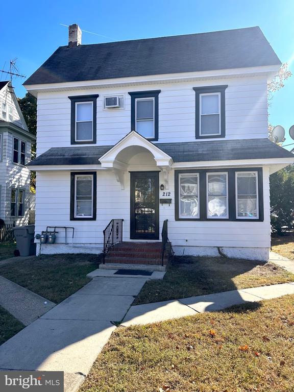
212 W Broad St is within 17 minutes or 9.4 miles from Gloucester County College. It is also near Widener University and Swarthmore College.
Schools
Public Elementary School
Grades PK-2
310 Students
Attendance Zone
Public Elementary School
Grades 3-6
352 Students
Attendance Zone
3
Out of 10
Public Middle School
Grades 7-8
184 Students
Nearby
1
Out of 10
Public High School
Grades 9-12
384 Students
Attendance Zone
1
Out of 10
Private Elementary, Middle & High School
Grades PK-12
21 Students
Nearby
Private Elementary & Middle School
Grades PK-8
236 Students
Nearby
School data provided by
GreatSchools
The GreatSchools Rating helps parents compare schools within a state based on a variety of school quality indicators and provides a helpful picture of how effectively each school serves all of its students. Ratings are on a scale of 1 (below average) to 10 (above average) and can include test scores, college readiness, academic progress, advanced courses, equity, discipline and attendance data. We also advise parents to visit schools, consider other information on school performance and programs, and consider family needs as part of the school selection process.
Transportation options available in Paulsboro include Island Avenue And 76Th Street, located 18.8 miles from 212 W Broad St. 212 W Broad St is near Philadelphia International, located 18.2 miles or 29 minutes away.
| Transit / Subway | Distance | ||
|---|---|---|---|
| Transit / Subway | Distance | ||
|
|
Drive: | 30 min | 18.8 mi |
|
|
Drive: | 29 min | 19.0 mi |
|
|
Drive: | 31 min | 19.0 mi |
|
|
Drive: | 29 min | 19.2 mi |
|
|
Drive: | 29 min | 19.2 mi |
| Commuter Rail | Distance | ||
|---|---|---|---|
| Commuter Rail | Distance | ||
|
|
Drive: | 28 min | 16.7 mi |
|
|
Drive: | 28 min | 17.9 mi |
|
|
Drive: | 32 min | 18.2 mi |
|
|
Drive: | 29 min | 18.3 mi |
|
|
Drive: | 28 min | 18.7 mi |
| Airports | Distance | ||
|---|---|---|---|
| Airports | Distance | ||
|
Philadelphia International
|
Drive: | 29 min | 18.2 mi |
Time and distance from 212 W Broad St.
| Shopping Centers | Distance | ||
|---|---|---|---|
| Shopping Centers | Distance | ||
| Walk: | 11 min | 0.6 mi | |
| Walk: | 13 min | 0.7 mi | |
| Drive: | 3 min | 1.4 mi |
212 W Broad St has 3 shopping centers within 1.4 miles, which is about a 3-minute drive. The miles and minutes will be for the farthest away property.
| Parks and Recreation | Distance | ||
|---|---|---|---|
| Parks and Recreation | Distance | ||
|
Upland Park
|
Drive: | 21 min | 11.9 mi |
|
Franklin D. Roosevelt Park
|
Drive: | 24 min | 15.6 mi |
|
Scott Arboretum
|
Drive: | 29 min | 15.6 mi |
|
Bartram's Garden
|
Drive: | 28 min | 18.1 mi |
|
John Heinz National Wildlife Refuge
|
Drive: | 30 min | 19.4 mi |
212 W Broad St has 5 parks within 19.4 miles, including Upland Park, Franklin D. Roosevelt Park, and Scott Arboretum.
| Hospitals | Distance | ||
|---|---|---|---|
| Hospitals | Distance | ||
| Drive: | 11 min | 6.5 mi | |
| Drive: | 22 min | 15.1 mi | |
| Drive: | 25 min | 17.9 mi |
212 W Broad St has 3 hospitals within 17.9 miles, the nearest is Inspira Medical Center Woodbury which is 6.5 miles away and a 11 minutes drive.
| Military Bases | Distance | ||
|---|---|---|---|
| Military Bases | Distance | ||
| Drive: | 23 min | 15.7 mi |
212 W Broad St is 15.7 miles and a 23 minutes from Philadelphia Naval Busi Center.
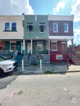
You May Also Like
Similar Rentals Nearby
-
-
-
-
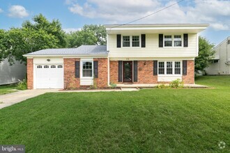
 $2,1953 Beds, 2 Baths, 1,490 sq ftHouse for Rent
 -
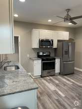
 $2,7952 Beds, 1 Bath, 1,084 sq ftHouse for Rent
 -
-
 $1,2004 Beds, 1 Bath, 1,396 sq ftHouse for Rent
 -
-
 $3,2004 Beds, 2 Baths, 1,734 sq ftHouse for Rent
 -
 $2,0003 Beds, 2 Baths, 1,550 sq ftHouse for Rent
What Are Walk Score®, Transit Score®, and Bike Score® Ratings?
Walk Score® measures the walkability of any address. Transit Score® measures access to public transit. Bike Score® measures the bikeability of any address.
What is a Sound Score Rating?
A Sound Score Rating aggregates noise caused by vehicle traffic, airplane traffic and local sources