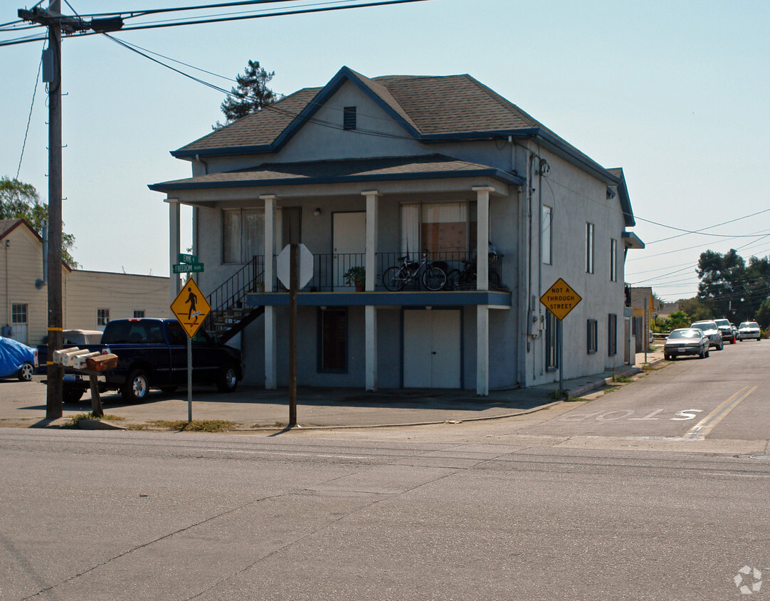
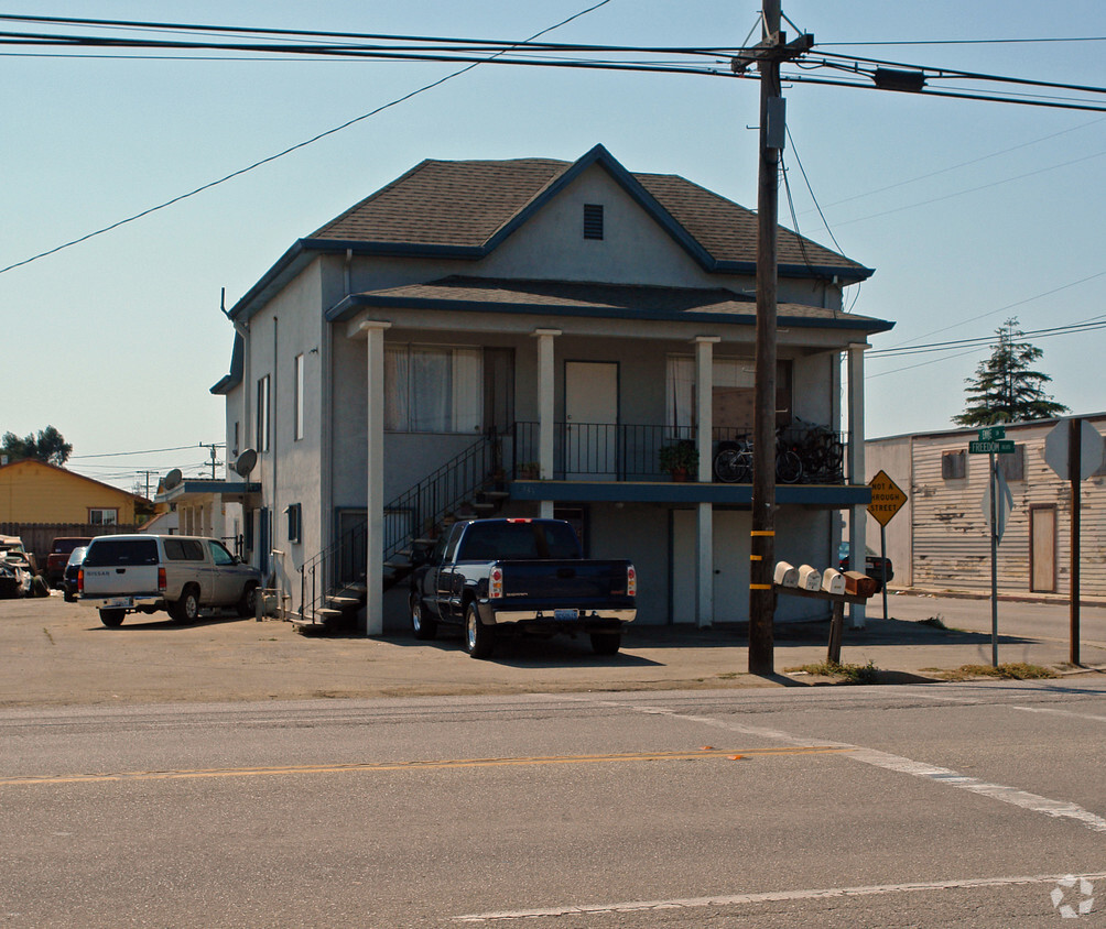
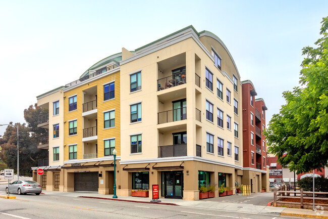
2133 Freedom Blvd
2133 Freedom Blvd,
Freedom,
CA
95019
2 Weeks Ago
Favorites
2133 Freedom Blvd
Favorites
Check Back Soon for Upcoming Availability
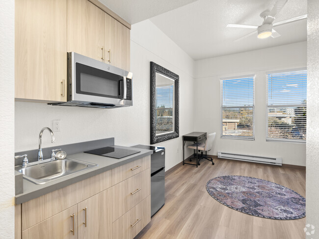
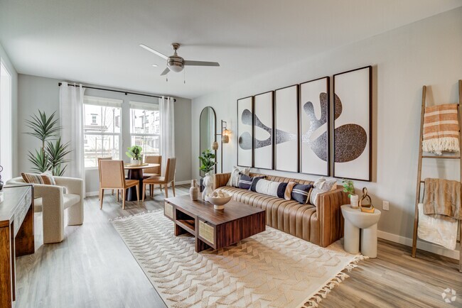
About 2133 Freedom Blvd Freedom, CA 95019
Explore your new home at 2133 Freedom Blvd in Freedom. The 2133 Freedom Blvd location in Freedom's 95019 Zip code has much to offer its residents. From availability to location, the leasing staff is ready to help you in finding the perfect apartment. Make sure you to check out the apartment floorplan options. Drop by the leasing office to talk about leasing your new apartment.
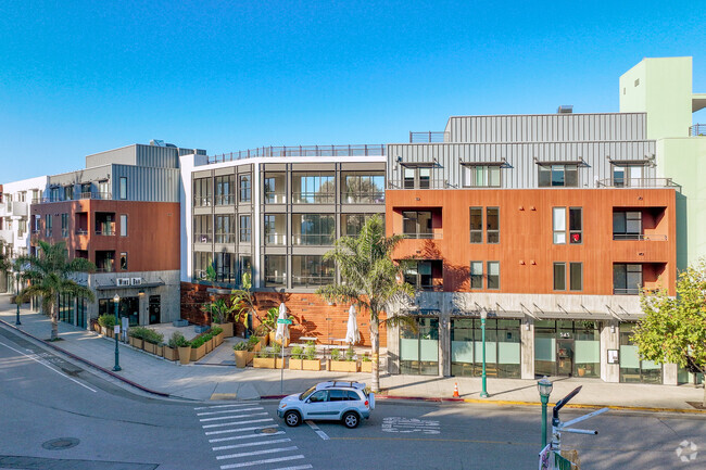
2133 Freedom Blvd is an apartment community located in Santa Cruz County and the 95019 ZIP Code. This area is served by the Pajaro Valley Unified attendance zone.
Fees and Policies
Details
Property Information
-
Built in 1952
-
2 units/2 stories
Property Address:
2133 Freedom Blvd,
Freedom,
CA
95019
Education
| Colleges & Universities | Distance | ||
|---|---|---|---|
| Colleges & Universities | Distance | ||
| Drive: | 14 min | 10.4 mi | |
| Drive: | 36 min | 20.3 mi | |
| Drive: | 32 min | 20.8 mi | |
| Drive: | 33 min | 22.4 mi |
2133 Freedom Blvd is within 14 minutes or 10.4 miles from Cabrillo College. It is also near UC Santa Cruz and Gavilan College, Gilroy.
Schools
Charter Elementary, Middle & High School
Grades K-12
165 Students
Nearby
5
Out of 10
Public Elementary & Middle School
Grades K-8
3 Students
Nearby
Public Elementary School
Grades K-6
515 Students
Attendance Zone
2
Out of 10
Public Middle School
Grades 6-8
619 Students
Attendance Zone
3
Out of 10
Public High School
Grades 9-12
1,489 Students
Attendance Zone
5
Out of 10
Private Elementary & Middle School
Grades PK-8
95 Students
Nearby
Private Elementary & Middle School
Grades PK-8
191 Students
Nearby
Private Middle School
Grades 6-8
6 Students
Nearby
School data provided by
GreatSchools
The GreatSchools Rating helps parents compare schools within a state based on a variety of school quality indicators and provides a helpful picture of how effectively each school serves all of its students. Ratings are on a scale of 1 (below average) to 10 (above average) and can include test scores, college readiness, academic progress, advanced courses, equity, discipline and attendance data. We also advise parents to visit schools, consider other information on school performance and programs, and consider family needs as part of the school selection process.
Transportation options available in Freedom include Santa Teresa Station, located 35.7 miles from 2133 Freedom Blvd. 2133 Freedom Blvd is near Monterey Regional, located 29.5 miles or 37 minutes away, and Norman Y Mineta San Jose International, located 46.2 miles or 60 minutes away.
| Transit / Subway | Distance | ||
|---|---|---|---|
| Transit / Subway | Distance | ||
|
|
Drive: | 60 min | 35.7 mi |
|
|
Drive: | 56 min | 36.0 mi |
|
|
Drive: | 58 min | 37.6 mi |
|
|
Drive: | 58 min | 43.8 mi |
|
|
Drive: | 58 min | 44.6 mi |
| Commuter Rail | Distance | ||
|---|---|---|---|
| Commuter Rail | Distance | ||
| Drive: | 33 min | 18.8 mi | |
| Drive: | 39 min | 22.2 mi | |
|
|
Drive: | 32 min | 22.5 mi |
| Drive: | 43 min | 22.9 mi | |
| Drive: | 58 min | 36.8 mi |
| Airports | Distance | ||
|---|---|---|---|
| Airports | Distance | ||
|
Monterey Regional
|
Drive: | 37 min | 29.5 mi |
|
Norman Y Mineta San Jose International
|
Drive: | 60 min | 46.2 mi |
Time and distance from 2133 Freedom Blvd.
| Shopping Centers | Distance | ||
|---|---|---|---|
| Shopping Centers | Distance | ||
| Walk: | 7 min | 0.4 mi | |
| Walk: | 15 min | 0.8 mi | |
| Drive: | 2 min | 1.2 mi |
2133 Freedom Blvd has 3 shopping centers within 1.2 miles, which is about a 2-minute drive. The miles and minutes will be for the farthest away property.
| Parks and Recreation | Distance | ||
|---|---|---|---|
| Parks and Recreation | Distance | ||
|
City of Watsonville Nature Center
|
Drive: | 5 min | 2.8 mi |
|
Manresa State Beach
|
Drive: | 13 min | 6.6 mi |
|
Sunset State Beach
|
Drive: | 18 min | 8.1 mi |
|
Mt. Madonna County Park
|
Drive: | 18 min | 9.8 mi |
|
Zmudowski State Beach
|
Drive: | 21 min | 11.2 mi |
2133 Freedom Blvd has 5 parks within 11.2 miles, including City of Watsonville Nature Center, Manresa State Beach, and Sunset State Beach.
| Hospitals | Distance | ||
|---|---|---|---|
| Hospitals | Distance | ||
| Drive: | 2 min | 1.4 mi |
2133 Freedom Blvd is 1.4 miles and a 2 minutes drive from Watsonville Community Hospital.
| Military Bases | Distance | ||
|---|---|---|---|
| Military Bases | Distance | ||
| Drive: | 39 min | 29.8 mi | |
| Drive: | 45 min | 32.1 mi |
2133 Freedom Blvd is 29.8 miles from Presidio of Monterey, and is convenient to other military bases, including Coast Guard Facilities.
You May Also Like
Similar Rentals Nearby


What Are Walk Score®, Transit Score®, and Bike Score® Ratings?
Walk Score® measures the walkability of any address. Transit Score® measures access to public transit. Bike Score® measures the bikeability of any address.
What is a Sound Score Rating?
A Sound Score Rating aggregates noise caused by vehicle traffic, airplane traffic and local sources
Responded To This Review