
$1,150 / Month
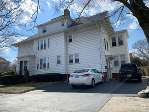
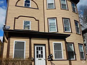
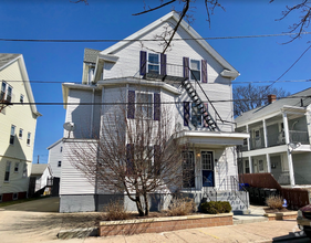
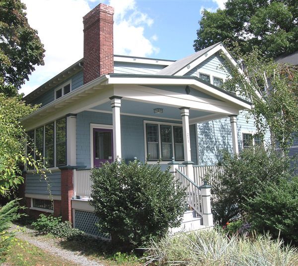
214 Cypress St
Providence, RI 02906
2 Weeks Ago
Favorites
214 Cypress St

Favorites
Check Back Soon for Upcoming Availability
| Beds | Baths | Average SF |
|---|---|---|
| 1 Bedroom 1 Bedroom 1 Br | 1 Bath 1 Bath 1 Ba | — |
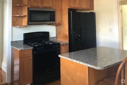
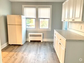
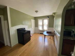
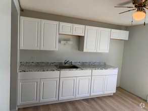
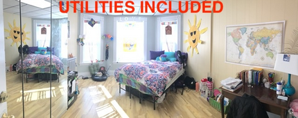
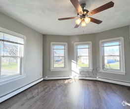
About This Property
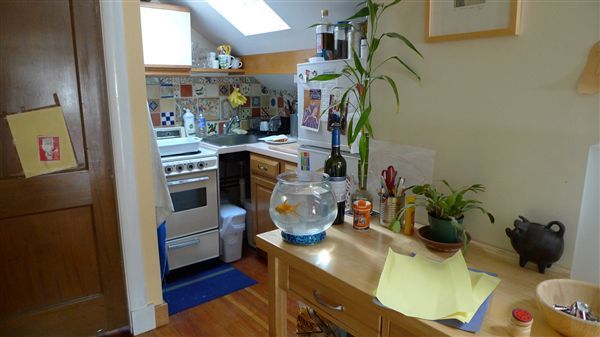
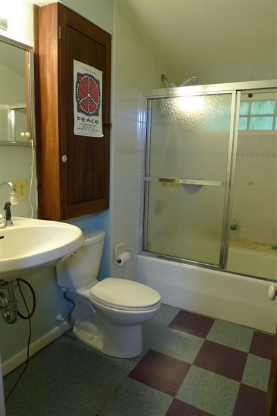
(401) 419-9216 - This one bedroom apartment is located in East Side. Nice and quiet location. Right off Hope Street, near bus line, near Brown University, walking distance to stores, banks, restaurants in Hope Street. Great location. (RLNE120463) Other Amenities - Parking. Appliances - Refrigerator, Range, Oven, Washer & Dryer. Details regarding this property's Utilities - Heat Included, Electricity Included, Gas Included, Water Included. Pet policies - Cats Allowed.
214 Cypress St is a condo located in Providence County and the 02906 ZIP Code. This area is served by the Providence attendance zone.
Location
Get Directions
Mount Hope is an urban neighborhood located about three miles northeast of historic Downtown Providence. Mount Hope’s strongest assets is its excellent location. Along with easy access to the heart of the city, Mount hope rests within 10 minutes of College Hill, home to the prestigious Brown University and Rhode Island School of Design. There are a variety of grocers, offices, casual restaurants, and shops in the neighborhood, but residents also flock to College Hill for dining, shopping, studying, and more. Short commutes to two popular districts make this neighborhood a great choice for renters looking for excellent rentals without a huge price tag. Mount Hope offers affordable to mid-range housing options. Traveling around Providence is made east by Interstate 95 and U.S. Highway 1.
Learn more about living in Mt HopeBelow are rent ranges for similar nearby apartments
Education
| Colleges & Universities | Distance | ||
|---|---|---|---|
| Colleges & Universities | Distance | ||
| Walk: | 20 min | 1.0 mi | |
| Drive: | 4 min | 1.5 mi | |
| Drive: | 6 min | 2.0 mi | |
| Drive: | 6 min | 3.3 mi |
214 Cypress St is within 20 minutes or 1.0 miles from Brown University. It is also near Rhode Island School of Design and C.C. of Rhode Island, Downcity.
Schools


Public Elementary School
Grades K-5
251 Students
Nearby
Public Elementary School
Grades PK-5
539 Students
Attendance Zone
Public Elementary School
Grades PK-5
407 Students
Attendance Zone
Public Middle School
Grades 6-8
435 Students
Attendance Zone
Public Middle School
Grades 6-8
608 Students
Attendance Zone
Public High School
Grades 9-12
1,113 Students
Attendance Zone
Private Elementary, Middle & High School
Grades PK-12
71 Students
Nearby
School data provided by
 The GreatSchools Rating helps parents compare schools within a state based on a variety of school quality indicators and provides a helpful picture of how effectively each school serves all of its students. Ratings are on a scale of 1 (below average) to 10 (above average) and can include test scores, college readiness, academic progress, advanced courses, equity, discipline and attendance data. We also advise parents to visit schools, consider other information on school performance and programs, and consider family needs as part of the school selection process.
View GreatSchools Rating Methodology
View GreatSchools Rating Methodology
Transportation options available in Providence include Mattapan Station, located 36.8 miles from 214 Cypress St. 214 Cypress St is near Rhode Island Tf Green International, located 11.1 miles or 21 minutes away.
| Transit / Subway | Distance | ||
|---|---|---|---|
| Transit / Subway | Distance | ||
|
|
Drive: | 51 min | 36.8 mi |
|
|
Drive: | 52 min | 37.2 mi |
|
|
Drive: | 52 min | 37.3 mi |
|
|
Drive: | 52 min | 38.2 mi |
|
|
Drive: | 55 min | 39.0 mi |
| Commuter Rail | Distance | ||
|---|---|---|---|
| Commuter Rail | Distance | ||
|
|
Drive: | 4 min | 1.6 mi |
| Drive: | 7 min | 3.6 mi | |
|
|
Drive: | 11 min | 5.6 mi |
| Drive: | 17 min | 10.4 mi | |
|
|
Drive: | 18 min | 10.4 mi |
| Airports | Distance | ||
|---|---|---|---|
| Airports | Distance | ||
|
Rhode Island Tf Green International
|
Drive: | 21 min | 11.1 mi |
Time and distance from 214 Cypress St.
| Shopping Centers | Distance | ||
|---|---|---|---|
| Shopping Centers | Distance | ||
| Walk: | 10 min | 0.6 mi | |
| Walk: | 13 min | 0.7 mi | |
| Drive: | 3 min | 1.3 mi |
214 Cypress St has 3 shopping centers within 1.3 miles, which is about a 3-minute walk. The miles and minutes will be for the farthest away property.
| Parks and Recreation | Distance | ||
|---|---|---|---|
| Parks and Recreation | Distance | ||
|
Ladd Observatory
|
Walk: | 3 min | 0.2 mi |
|
Roger Williams National Memorial
|
Drive: | 4 min | 1.3 mi |
|
Providence Children's Museum
|
Drive: | 6 min | 2.4 mi |
|
Woonasquatucket River Greenway - Riverside Park
|
Drive: | 8 min | 4.9 mi |
|
Roger Williams Park Zoo
|
Drive: | 11 min | 5.6 mi |
214 Cypress St has 5 parks within 5.6 miles, including Ladd Observatory, Roger Williams National Memorial, and Providence Children's Museum.
| Hospitals | Distance | ||
|---|---|---|---|
| Hospitals | Distance | ||
| Walk: | 15 min | 0.8 mi | |
| Walk: | 19 min | 1.0 mi | |
| Drive: | 5 min | 2.8 mi |
214 Cypress St has 3 hospitals within 2.8 miles, the nearest is The Miriam Hospital which is 0.8 mile away and a 15 minute walk.
| Military Bases | Distance | ||
|---|---|---|---|
| Military Bases | Distance | ||
| Drive: | 36 min | 23.4 mi | |
| Drive: | 62 min | 40.2 mi |
214 Cypress St is 23.4 miles from Rhode Island National Gaurd, and is convenient to other military bases, including US Military Reservation.
You May Also Like
Similar Rentals Nearby

What Are Walk Score®, Transit Score®, and Bike Score® Ratings?
Walk Score® measures the walkability of any address. Transit Score® measures access to public transit. Bike Score® measures the bikeability of any address.
What is a Sound Score Rating?
A Sound Score Rating aggregates noise caused by vehicle traffic, airplane traffic and local sources
214 Cypress St
Providence, RI 02906