2160 State Hwy 13 Hwy Unit 220
Mendota Heights, MN 55120

Check Back Soon for Upcoming Availability
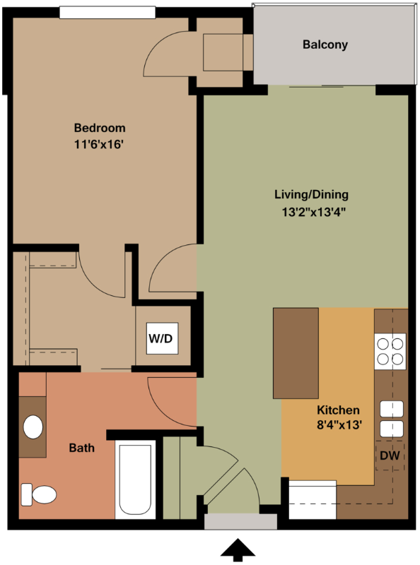
| Beds | Baths | Average SF |
|---|---|---|
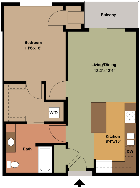
| 1 Bedroom 1 Bedroom 1 Br | 1 Bath 1 Bath 1 Ba | 772 SF |
About This Property
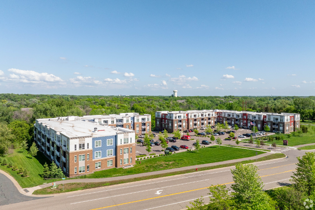
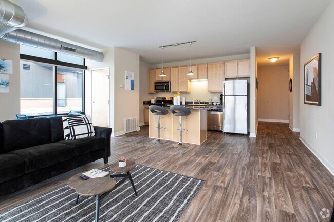
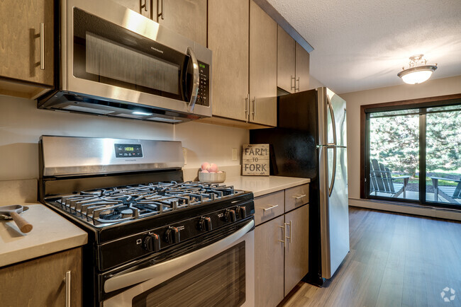
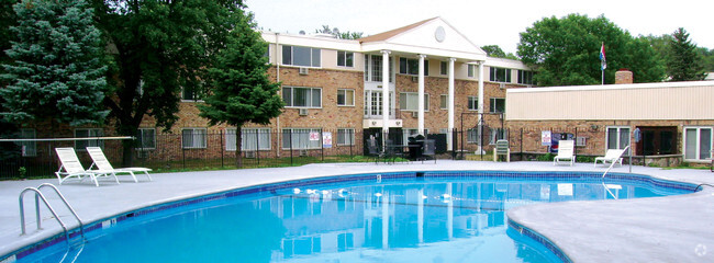
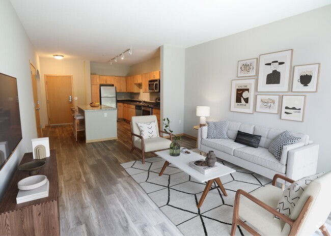
Property Id: 1571138 Independent Living at The Heights of Mendota. Our apartments are non-smoking, well-designed and maintained. Pets are welcome here, see our office for breed restrictions Dog park nearby Washer Dryer, Central A/C in all apartments! Community Club rooms to enjoy! FREE High-Speed Internet is provided for you Cable is available-Xfinity and Century Link at your cost Guest Suite on Site for nightly rentals Underground parking available $75 per month Outside surface lot parking available Free Gas grills on all patios and balconies Located in a quiet spot of Mendota Heights
2160 State Hwy 13 Hwy is an apartment community located in Dakota County and the 55120 ZIP Code.
Features
Washer/Dryer
Dishwasher
Microwave
Refrigerator
- Washer/Dryer
- Cable Ready
- Security System
- Fireplace
- Intercom
- Dishwasher
- Disposal
- Microwave
- Oven
- Refrigerator
- Freezer
- Fitness Center
- Bicycle Storage
- Lawn
Fees and Policies
The fees below are based on community-supplied data and may exclude additional fees and utilities.
- Dogs Allowed
-
Fees not specified
- Cats Allowed
-
Fees not specified
- Parking
-
Garage--
Details
Utilities Included
-
Water
-
Trash Removal
-
Sewer
Located under 20 minutes from Minneapolis and Saint Paul along the Mississippi River, Mendota Heights is the perfect commuter city for renters who enjoy suburban conveniences. Residents can enjoy a breath of fresh air at the many natural spaces that dominate Mendota Heights. Fort Snelling State Park not only has a plethora of beautiful wildlife to admire, but the park is also great for swimming, snowshoeing, biking, skiing, and hiking.
Being located a few minutes south of the Twin Cities means residents can enjoy the advantages of urban lifestyles without dealing with the bustling environment every day. Mendota Heights is close to the Minneapolis−Saint Paul International Airport and several of the Twin Cities’ biggest landmarks including the Mall of America, the Xcel Energy Center, and the University of Minnesota. Move to Mendota Heights today if you want to experience the best of both worlds.
Learn more about living in Mendota Heights- Washer/Dryer
- Cable Ready
- Security System
- Fireplace
- Intercom
- Dishwasher
- Disposal
- Microwave
- Oven
- Refrigerator
- Freezer
- Lawn
- Fitness Center
- Bicycle Storage
| Colleges & Universities | Distance | ||
|---|---|---|---|
| Colleges & Universities | Distance | ||
| Drive: | 6 min | 3.3 mi | |
| Drive: | 11 min | 4.9 mi | |
| Drive: | 11 min | 5.5 mi | |
| Drive: | 12 min | 5.8 mi |
Transportation options available in Mendota Heights include Fort Snelling Station, located 2.9 miles from 2160 State Hwy 13 Hwy Unit 220. 2160 State Hwy 13 Hwy Unit 220 is near Minneapolis-St Paul International/Wold-Chamberlain, located 4.7 miles or 9 minutes away.
| Transit / Subway | Distance | ||
|---|---|---|---|
| Transit / Subway | Distance | ||
|
|
Drive: | 5 min | 2.9 mi |
|
|
Drive: | 5 min | 3.1 mi |
|
|
Drive: | 7 min | 3.8 mi |
| Drive: | 8 min | 4.7 mi | |
|
|
Drive: | 9 min | 5.2 mi |
| Commuter Rail | Distance | ||
|---|---|---|---|
| Commuter Rail | Distance | ||
|
|
Drive: | 12 min | 8.1 mi |
|
|
Drive: | 21 min | 10.2 mi |
|
|
Drive: | 29 min | 18.7 mi |
|
|
Drive: | 43 min | 31.4 mi |
|
|
Drive: | 45 min | 33.1 mi |
| Airports | Distance | ||
|---|---|---|---|
| Airports | Distance | ||
|
Minneapolis-St Paul International/Wold-Chamberlain
|
Drive: | 9 min | 4.7 mi |
Time and distance from 2160 State Hwy 13 Hwy Unit 220.
| Shopping Centers | Distance | ||
|---|---|---|---|
| Shopping Centers | Distance | ||
| Drive: | 4 min | 2.4 mi | |
| Drive: | 4 min | 2.6 mi | |
| Drive: | 5 min | 2.7 mi |
| Parks and Recreation | Distance | ||
|---|---|---|---|
| Parks and Recreation | Distance | ||
|
Crosby Farm Regional Park
|
Drive: | 5 min | 3.1 mi |
|
Hidden Falls Park
|
Drive: | 9 min | 4.0 mi |
|
Highland Park and Golf Course
|
Drive: | 7 min | 4.4 mi |
|
Minnesota Valley Wetland Management District
|
Drive: | 10 min | 4.9 mi |
|
Fort Snelling State Park
|
Drive: | 11 min | 5.7 mi |
| Hospitals | Distance | ||
|---|---|---|---|
| Hospitals | Distance | ||
| Drive: | 11 min | 7.5 mi | |
| Drive: | 12 min | 7.7 mi | |
| Drive: | 13 min | 8.5 mi |
| Military Bases | Distance | ||
|---|---|---|---|
| Military Bases | Distance | ||
| Drive: | 7 min | 3.6 mi |
You May Also Like
Similar Rentals Nearby
What Are Walk Score®, Transit Score®, and Bike Score® Ratings?
Walk Score® measures the walkability of any address. Transit Score® measures access to public transit. Bike Score® measures the bikeability of any address.
What is a Sound Score Rating?
A Sound Score Rating aggregates noise caused by vehicle traffic, airplane traffic and local sources
