
219 Tremont St
219 Tremont St,
Boston,
MA
02116
2 Weeks Ago
Favorites
219 Tremont St

Favorites
Check Back Soon for Upcoming Availability
About 219 Tremont St Boston, MA 02116
Not what you're looking for? Marc Roos Realty has one of the largest databases all over Boston. Let me know what you're looking for, and I'll find the perfect fit for you!
219 Tremont St is an apartment community located in Suffolk County and the 02116 ZIP Code.
Property Address:
219 Tremont St,
Boston,
MA
02116
With all due respect to the rest of the Emerald Necklace, Boston Common is arguably the city’s most beautiful and famous green space, and folks who live in the apartments surrounding it enjoy some of the best views in town—and the greatest front yard anyone could hope for. Aside from the park itself, the architecture is gorgeous, with classic historic mid-rises and sleek modern designs side by side.
Emerson College occupies a considerable amount of real estate on Boylston Street, making this area ideal for students, faculty, and staff. Folks who like to go out on the town don’t have to travel far: the community is jam packed with restaurants, coffee shops, bars, night clubs, and performing arts venues, ensuring that there is truly something for every taste.
Learn more about living in Boston CommonBelow are rent ranges for similar nearby apartments
| Beds | Average Size | Lowest | Typical | Premium |
|---|---|---|---|---|
| Studio Studio Studio | 1111 Sq Ft | $1,750 | $2,729 | $13,000 |
| 1 Bed 1 Bed 1 Bed | 1758-1761 Sq Ft | $1,517 | $3,590 | $6,900 |
| 2 Beds 2 Beds 2 Beds | 3296-3298 Sq Ft | $2,525 | $5,114 | $14,950 |
| 3 Beds 3 Beds 3 Beds | 4335 Sq Ft | $4,000 | $7,788 | $26,000 |
| 4 Beds 4 Beds 4 Beds | 2350 Sq Ft | $875 | $7,100 | $20,000 |
Education
| Colleges & Universities | Distance | ||
|---|---|---|---|
| Colleges & Universities | Distance | ||
| Walk: | 2 min | 0.1 mi | |
| Walk: | 6 min | 0.4 mi | |
| Walk: | 9 min | 0.5 mi | |
| Drive: | 4 min | 1.4 mi |
219 Tremont St is within 2 minutes or 0.1 mile from Emerson College. It is also near Tufts University, Boston and Suffolk University.
Transportation options available in Boston include Boylston Street Station, located 0.1 mile from 219 Tremont St. 219 Tremont St is near General Edward Lawrence Logan International, located 4.7 miles or 11 minutes away.
| Transit / Subway | Distance | ||
|---|---|---|---|
| Transit / Subway | Distance | ||
|
|
Walk: | 1 min | 0.1 mi |
|
|
Walk: | 3 min | 0.2 mi |
|
|
Walk: | 4 min | 0.2 mi |
|
|
Walk: | 7 min | 0.4 mi |
|
|
Walk: | 7 min | 0.4 mi |
| Commuter Rail | Distance | ||
|---|---|---|---|
| Commuter Rail | Distance | ||
|
|
Walk: | 12 min | 0.6 mi |
|
|
Walk: | 14 min | 0.7 mi |
|
|
Drive: | 5 min | 1.7 mi |
|
|
Drive: | 6 min | 1.9 mi |
| Drive: | 5 min | 2.3 mi |
| Airports | Distance | ||
|---|---|---|---|
| Airports | Distance | ||
|
General Edward Lawrence Logan International
|
Drive: | 11 min | 4.7 mi |
Time and distance from 219 Tremont St.
| Shopping Centers | Distance | ||
|---|---|---|---|
| Shopping Centers | Distance | ||
| Walk: | 17 min | 0.9 mi | |
| Drive: | 4 min | 1.3 mi | |
| Drive: | 10 min | 5.8 mi |
219 Tremont St has 3 shopping centers within 5.8 miles, which is about a 10-minute walk. The miles and minutes will be for the farthest away property.
| Parks and Recreation | Distance | ||
|---|---|---|---|
| Parks and Recreation | Distance | ||
|
Boston Public Garden
|
Walk: | 7 min | 0.4 mi |
|
Boston African American National Historic Site
|
Walk: | 9 min | 0.5 mi |
|
Boston National Historical Park
|
Walk: | 14 min | 0.8 mi |
|
Boston Harbor Islands National Recreation Area
|
Walk: | 16 min | 0.9 mi |
|
Boston Children's Museum
|
Walk: | 17 min | 0.9 mi |
219 Tremont St has 5 parks within 0.9 mile, including Boston Public Garden, Boston African American National Historic Site, and Boston National Historical Park.
| Hospitals | Distance | ||
|---|---|---|---|
| Hospitals | Distance | ||
| Walk: | 4 min | 0.2 mi | |
| Drive: | 4 min | 1.3 mi | |
| Drive: | 4 min | 1.4 mi |
219 Tremont St has 3 hospitals within 1.4 miles, the nearest is Tufts Medical Center which is 0.2 mile away and a 4 minute walk.
| Military Bases | Distance | ||
|---|---|---|---|
| Military Bases | Distance | ||
| Drive: | 30 min | 16.5 mi |
219 Tremont St is 16.5 miles and a 30 minute drive from Hanscom Air Force Base.
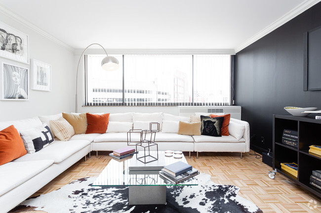
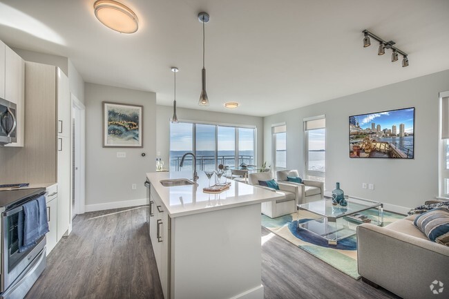
You May Also Like
Similar Rentals Nearby


What Are Walk Score®, Transit Score®, and Bike Score® Ratings?
Walk Score® measures the walkability of any address. Transit Score® measures access to public transit. Bike Score® measures the bikeability of any address.
What is a Sound Score Rating?
A Sound Score Rating aggregates noise caused by vehicle traffic, airplane traffic and local sources