
$2,150 / Month
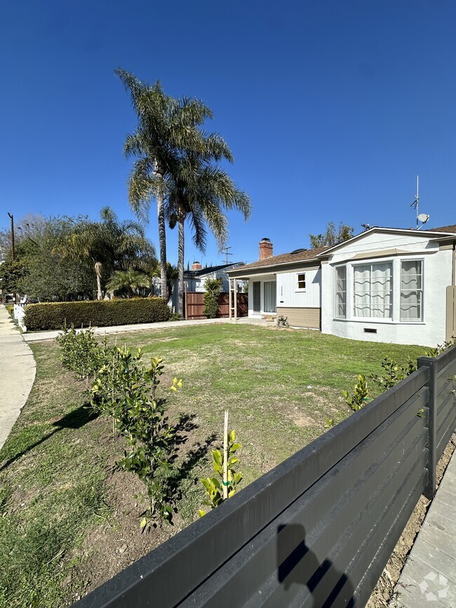
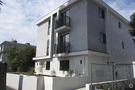
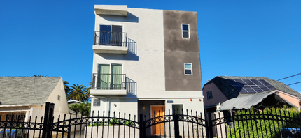
219 W Ash Ave
Burbank, CA 91502
2 Weeks Ago
Favorites
219 W Ash Ave

Favorites
Check Back Soon for Upcoming Availability
| Beds | Baths | Average SF |
|---|---|---|
| 2 Bedrooms 2 Bedrooms 2 Br | 1 Bath 1 Bath 1 Ba | 500 SF |
About This Property
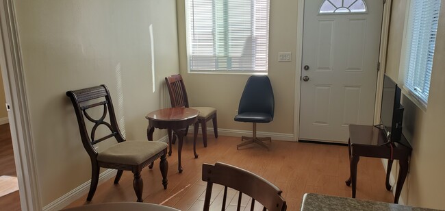
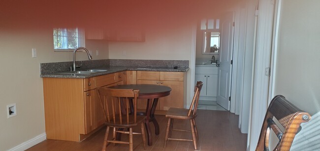
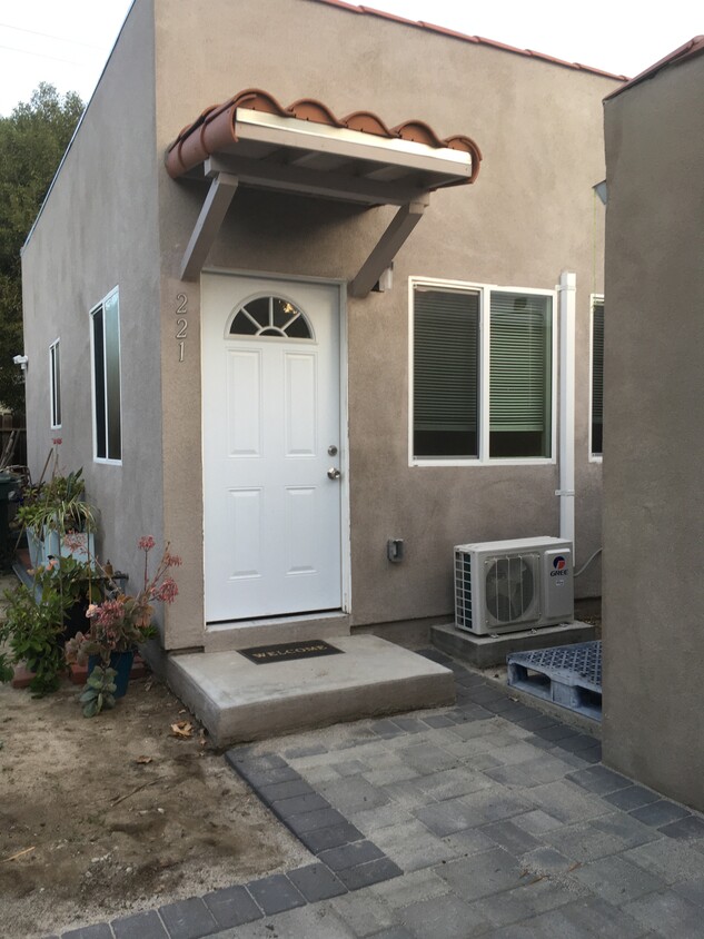
2 bedroom I bath Back House in Burbank for Starters - Privacy and Security - Starter home for Small Household with Few Furniture - No Oven – Electric Cook Top only. - No Pet Allowed - Conveniently located - within walking distance to markets, restaurants, bike route, parks and schools - Gated Backyard, Patio and fruit trees - 1 assigned Parking - **Section 8 welcome** - Rent: $2150/ month, = Security Deposit: $2150 - Requirements with application: - 3 months of most current pay stubs - 3 months of most current rent receipts - Credit Check and $4300 to move in.
219 W Ash Ave is a house located in Los Angeles County and the 91502 ZIP Code. This area is served by the Burbank Unified attendance zone.
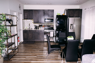
House Features
Air Conditioning
Washer/Dryer Hookup
Microwave
Refrigerator
- Washer/Dryer Hookup
- Air Conditioning
- Heating
- Smoke Free
- Storage Space
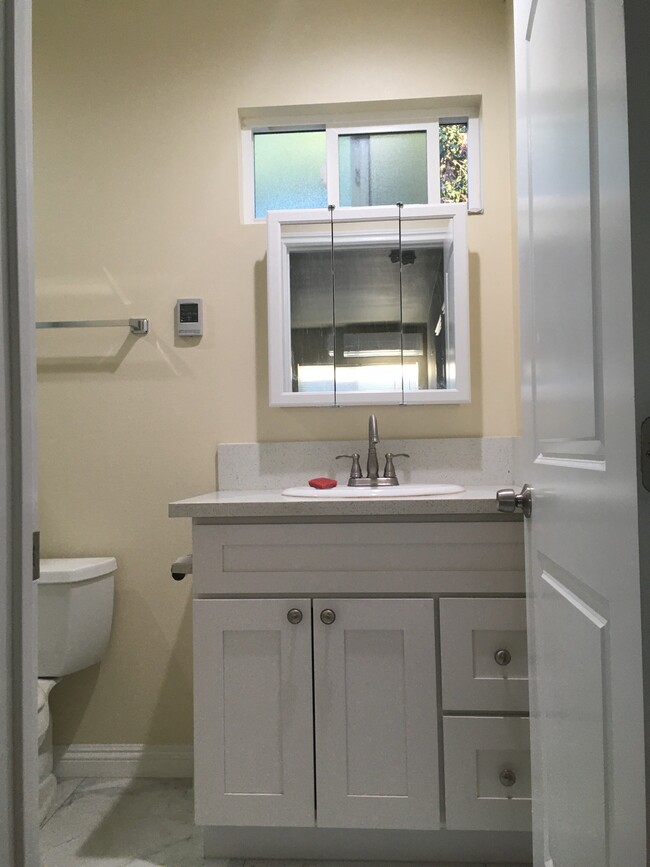
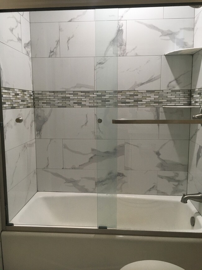
- Tub/Shower
- Kitchen
- Microwave
- Refrigerator
- Gated
- Patio
Fees and Policies
The fees below are based on community-supplied data and may exclude additional fees and utilities.
- Parking
-
Other--
Details
Utilities Included
-
Gas
-
Water
-
Sewer
Property Information
-
Built in 2020
Property Address:
219 W Ash Ave,
Burbank,
CA
91502
Rancho Adjacent, near the center of Burbank, combines a mixture of single-family homes, apartments, small and large commercial areas, industrial zones, and city government buildings. Residents enjoy the convenience of having a variety goods and services within a short drive. Rancho Adjacent borders the horse-oriented neighborhood known as Rancho just south of the community.
Bordered by Verdugo and Alameda Avenues, Rancho Adjacent stretches from Hollywood Way across Interstate 5 to Glenoaks Boulevard. Olive Avenue cuts diagonally through the neighborhood and is lined with restaurants and small businesses. Rancho Adjacent also lies just north of the Ventura Freeway, a major east-west link across the San Fernando Valley. Downtown Los Angeles rests 13 miles south of Rancho Adjacent, making this compact community a great choice no matter where your commute takes you.
Learn more about living in Rancho AdjacentBelow are rent ranges for similar nearby apartments
Amenities
- Washer/Dryer Hookup
- Air Conditioning
- Heating
- Smoke Free
- Storage Space
- Tub/Shower
- Kitchen
- Microwave
- Refrigerator
- Gated
- Patio
Expenses
Utilities Included
Gas, Water, Sewer
Included
Education
| Colleges & Universities | Distance | ||
|---|---|---|---|
| Colleges & Universities | Distance | ||
| Drive: | 5 min | 2.6 mi | |
| Drive: | 7 min | 4.2 mi | |
| Drive: | 8 min | 5.6 mi | |
| Drive: | 13 min | 6.5 mi |
219 W Ash Ave is within 5 minutes or 2.6 miles from New York Film Academy. It is also near Woodbury University and Glendale Community College.
Schools


Charter Elementary School
Grades K-5
75 Students
Nearby
Public Elementary School
Grades K-5
452 Students
Attendance Zone
Public Middle School
Grades 6-8
950 Students
Attendance Zone
Public High School
Grades 9-12
2,305 Students
Attendance Zone
Private Elementary School
Grades PK-1
21 Students
Nearby
Private Elementary & Middle School
Grades K-8
119 Students
Nearby
Private Elementary School
Grades K-1
41 Students
Nearby
Private Elementary School
Grades K
12 Students
Nearby
Private Middle & High School
Grades 6-12
263 Students
Nearby
School data provided by
 The GreatSchools Rating helps parents compare schools within a state based on a variety of school quality indicators and provides a helpful picture of how effectively each school serves all of its students. Ratings are on a scale of 1 (below average) to 10 (above average) and can include test scores, college readiness, academic progress, advanced courses, equity, discipline and attendance data. We also advise parents to visit schools, consider other information on school performance and programs, and consider family needs as part of the school selection process.
View GreatSchools Rating Methodology
View GreatSchools Rating Methodology
Transportation options available in Burbank include Universal City/Studio City, located 5.1 miles from 219 W Ash Ave. 219 W Ash Ave is near Bob Hope, located 6.8 miles or 11 minutes away, and Los Angeles International, located 25.3 miles or 38 minutes away.
| Transit / Subway | Distance | ||
|---|---|---|---|
| Transit / Subway | Distance | ||
|
|
Drive: | 9 min | 5.1 mi |
|
|
Drive: | 9 min | 5.5 mi |
|
|
Drive: | 10 min | 6.7 mi |
|
|
Drive: | 12 min | 6.8 mi |
|
|
Drive: | 11 min | 7.2 mi |
| Commuter Rail | Distance | ||
|---|---|---|---|
| Commuter Rail | Distance | ||
|
|
Drive: | 3 min | 1.1 mi |
|
|
Drive: | 7 min | 4.0 mi |
| Drive: | 7 min | 4.5 mi | |
|
|
Drive: | 7 min | 5.2 mi |
|
|
Drive: | 9 min | 6.3 mi |
| Airports | Distance | ||
|---|---|---|---|
| Airports | Distance | ||
|
Bob Hope
|
Drive: | 11 min | 6.8 mi |
|
Los Angeles International
|
Drive: | 38 min | 25.3 mi |
Time and distance from 219 W Ash Ave.
| Shopping Centers | Distance | ||
|---|---|---|---|
| Shopping Centers | Distance | ||
| Walk: | 7 min | 0.4 mi | |
| Walk: | 12 min | 0.7 mi | |
| Walk: | 14 min | 0.8 mi |
219 W Ash Ave has 3 shopping centers within 0.8 mile, which is about a 14-minute walk. The miles and minutes will be for the farthest away property.
| Parks and Recreation | Distance | ||
|---|---|---|---|
| Parks and Recreation | Distance | ||
|
Los Angeles Zoo
|
Drive: | 13 min | 4.2 mi |
|
Bird Sanctuary
|
Drive: | 11 min | 6.2 mi |
|
Griffith Observatory
|
Drive: | 14 min | 7.4 mi |
|
Griffith Park
|
Drive: | 24 min | 9.7 mi |
|
La Tuna Canyon Park
|
Drive: | 15 min | 10.2 mi |
219 W Ash Ave has 5 parks within 10.2 miles, including Los Angeles Zoo, Griffith Park, and Griffith Observatory.
| Hospitals | Distance | ||
|---|---|---|---|
| Hospitals | Distance | ||
| Drive: | 4 min | 1.7 mi | |
| Drive: | 7 min | 5.0 mi | |
| Drive: | 9 min | 5.8 mi |
219 W Ash Ave has 3 hospitals within 5.8 miles, the nearest is Providence Saint Joseph Medical Center which is 1.7 miles away and a 4 minute drive.
| Military Bases | Distance | ||
|---|---|---|---|
| Military Bases | Distance | ||
| Drive: | 35 min | 26.8 mi |
219 W Ash Ave is 26.8 miles and a 35 minute drive from Los Angeles Air Force Base.
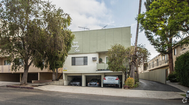
You May Also Like
Similar Rentals Nearby

What Are Walk Score®, Transit Score®, and Bike Score® Ratings?
Walk Score® measures the walkability of any address. Transit Score® measures access to public transit. Bike Score® measures the bikeability of any address.
What is a Sound Score Rating?
A Sound Score Rating aggregates noise caused by vehicle traffic, airplane traffic and local sources
219 W Ash Ave
Burbank, CA 91502