
$4,100 / Month
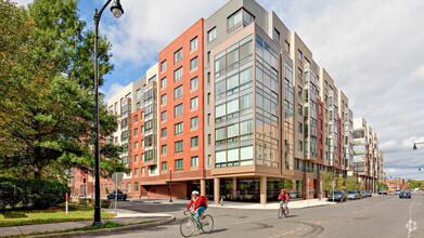
22 Boynton St Unit 1
Boston, MA 02130
Today
Favorites
617-595-7978
-
Bedrooms
4
-
Bathrooms
1
-
Square Feet
1,250 sq ft
-
Available
Available Now
Highlights
- Medical Services
- Property is near public transit
- Balcony
- No Cooling
- Park
- Shops
22 Boynton St Unit 1

Favorites
About This Home
$4,100 deposit,
Available Now
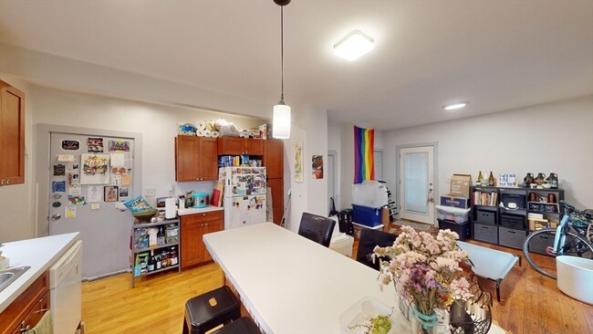
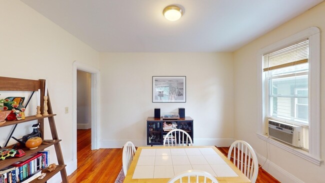
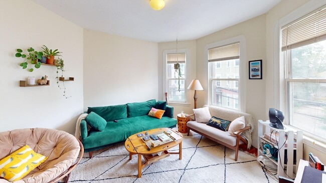
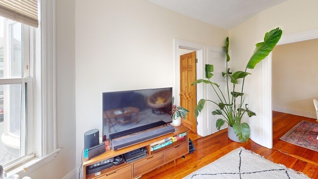
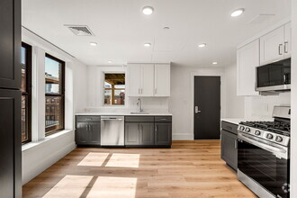
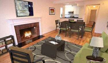
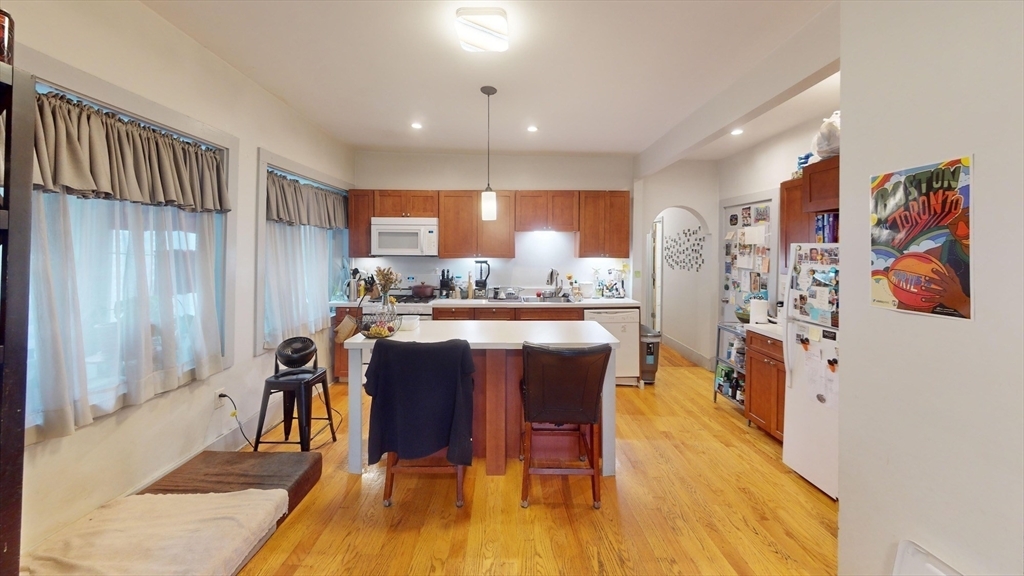
3-bedroom,1-bathroom layout with an additional bonus room perfect for a small bedroom or office. The unit features a fully equipped eat-in kitchen,a living room,and ample closet space in each bedroom. Laundry in building. Boast double balconies off the kitchen area and hallway for relaxing on summer days/nights. Ideally located near the Green St and Forest Hills T stations,Bus 39,the Emerald Necklace bike path,laundromat,shopping and the Jamaicaway. The location provides an easy commute to the Longwood Medical Area,Harvard Medical,Jamaica Pond,and JP Centre. Additionally,it is conveniently close to several local schools and universities,including Northeastern University,Simmons,Berklee,Emmanuel,and Wheelock. Can be rented as furnished.
22 Boynton St is an apartment community located in Suffolk County and the 02130 ZIP Code.
* Price shown is base rent and may not include non-optional fees and utilities.
Price, availability, fees, and any applicable rent special are subject to change without notice.
* Square footage definitions vary. Displayed square footage is approximate.
Home Details
Accessible Home Design
Entry on the 1st floor
Bedrooms and Bathrooms
1 Full Bathroom
4 Bedrooms
Home Design
Apartment
Interior Spaces
1,250 Sq Ft Home
Kitchen
Range
Freezer
Dishwasher
Disposal
Listing and Financial Details
Security Deposit $4,100
Property Available on 9/1/25
12 Month Lease Term
Assessor Parcel Number 1353071
Rent includes water, sewer
Location
Property is near public transit
Property is near schools
Lot Details
22.96 Acre Lot
Outdoor Features
Balcony
Parking
1 Car Garage
Utilities
No Cooling
Heating System Uses Natural Gas
Community Details
Amenities
Medical Services
Shops
Coin Laundry
Overview
No Home Owners Association
Pet Policy
No Pets Allowed
Recreation
Park
Contact
- Listed by Unee Washington | UW Realty Company,LLC
- Phone Number
-
Source
 MLS Property Information Network
The property listing data and information set forth herein were provided to MLS Property Information Network, Inc. from third party sources, including sellers, lessors and public records, and were compiled by MLS Property Information Network, Inc. The property listing data and information are for the personal, non-commercial use of consumers having a good faith interest in purchasing or leasing listed properties of the type displayed to them and may not be used for any purpose other than to identify prospective properties which such consumers may have a good faith interest in purchasing or leasing. MLS Property Information Network, Inc. and its subscribers disclaim any and all representations and warranties as to the accuracy of the property listing data and information set forth herein. All properties are subject to prior sale, change or withdrawal. Copyright © 2025 MLS Property Information Network, Inc. All rights reserved.
Location
Get Directions
Amenities
- Dishwasher
- Disposal
- Range
- Refrigerator
- Freezer
- Balcony
Jamaica Central-South Sumner is a section of Jamaica Plain spanning north of Arborway Road. The verdant area is made up of good schools, peaceful communities, scenic views, and easy access to surrounding cities, including Boston. Boston's excellent mass transit system, which includes buses, subways, and light rail, serves this neighborhood. The southern portion of the neighborhood partially encompasses Arnold Arboretum of Harvard University while the western side features Willow Pond Meadow as well as the Hellenic College and Holy Cross Greek Orthodox School of Theology. A variety of shopping and dining choices are located along Centre Street. The rest of the neighborhood is filled with residential homes complemented by lush greenery.
Learn more about living in Jamaica Central-South Sumner
Education
| Colleges & Universities | Distance | ||
|---|---|---|---|
| Colleges & Universities | Distance | ||
| Drive: | 6 min | 2.9 mi | |
| Drive: | 6 min | 3.4 mi | |
| Drive: | 9 min | 3.5 mi | |
| Drive: | 7 min | 3.5 mi |
22 Boynton St Unit 1 is within 6 minutes or 2.9 miles from Wentworth Inst. of Technology. It is also near MCPHS University, Boston and MassArt.
Transportation options available in Boston include Forest Hills Station, located 0.4 mile from 22 Boynton St Unit 1. 22 Boynton St Unit 1 is near General Edward Lawrence Logan International, located 8.3 miles or 17 minutes away.
| Transit / Subway | Distance | ||
|---|---|---|---|
| Transit / Subway | Distance | ||
|
|
Walk: | 7 min | 0.4 mi |
|
|
Walk: | 10 min | 0.6 mi |
|
|
Drive: | 3 min | 1.4 mi |
|
|
Drive: | 5 min | 1.7 mi |
|
|
Drive: | 4 min | 1.9 mi |
| Commuter Rail | Distance | ||
|---|---|---|---|
| Commuter Rail | Distance | ||
|
|
Walk: | 7 min | 0.4 mi |
|
|
Drive: | 5 min | 1.9 mi |
| Drive: | 6 min | 2.8 mi | |
| Drive: | 6 min | 3.2 mi | |
|
|
Drive: | 7 min | 3.7 mi |
| Airports | Distance | ||
|---|---|---|---|
| Airports | Distance | ||
|
General Edward Lawrence Logan International
|
Drive: | 17 min | 8.3 mi |
Time and distance from 22 Boynton St Unit 1.
| Shopping Centers | Distance | ||
|---|---|---|---|
| Shopping Centers | Distance | ||
| Drive: | 5 min | 1.9 mi | |
| Drive: | 5 min | 2.6 mi | |
| Drive: | 6 min | 2.6 mi |
22 Boynton St Unit 1 has 3 shopping centers within 2.6 miles, which is about a 6-minute drive. The miles and minutes will be for the farthest away property.
| Parks and Recreation | Distance | ||
|---|---|---|---|
| Parks and Recreation | Distance | ||
|
Arnold Arboretum of Harvard University
|
Drive: | 4 min | 2.1 mi |
|
Franklin Park Zoo
|
Drive: | 5 min | 2.3 mi |
|
Lower Neponset River Trail
|
Drive: | 5 min | 2.4 mi |
|
Mass Audubon's Boston Nature Center and Wildlife Sanctuary
|
Drive: | 5 min | 2.4 mi |
|
Frederick Law Olmsted National Historic Site
|
Drive: | 7 min | 3.0 mi |
22 Boynton St Unit 1 has 5 parks within 3.0 miles, including Arnold Arboretum of Harvard University, Mass Audubon's Boston Nature Center and Wildlife Sanctuary, and Lower Neponset River Trail.
| Hospitals | Distance | ||
|---|---|---|---|
| Hospitals | Distance | ||
| Walk: | 18 min | 1.0 mi | |
| Drive: | 3 min | 1.7 mi | |
| Drive: | 7 min | 2.9 mi |
22 Boynton St Unit 1 has 3 hospitals within 2.9 miles, the nearest is Arbour Hospital which is 1.0 mile away and a 18 minute walk.
| Military Bases | Distance | ||
|---|---|---|---|
| Military Bases | Distance | ||
| Drive: | 28 min | 16.1 mi | |
| Drive: | 35 min | 20.6 mi |
22 Boynton St Unit 1 is 16.1 miles from US Military Reservation, and is convenient to other military bases, including Hanscom Air Force Base.
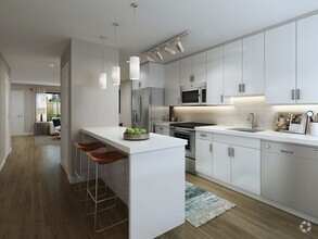
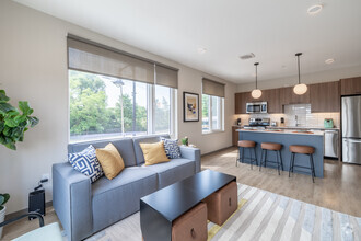
You May Also Like
Similar Rentals Nearby
-
-
-
-
-
-
1 / 8

-
-
-
1 / 20

-
1 / 18


What Are Walk Score®, Transit Score®, and Bike Score® Ratings?
Walk Score® measures the walkability of any address. Transit Score® measures access to public transit. Bike Score® measures the bikeability of any address.
What is a Sound Score Rating?
A Sound Score Rating aggregates noise caused by vehicle traffic, airplane traffic and local sources
22 Boynton St
Boston, MA 02130