
$4,600 / Month
22 Clarendon Ave Unit 3
Somerville, MA 02144
Today
Favorites
857-496-7187
-
Bedrooms
3
-
Bathrooms
2
-
Square Feet
1,121 sq ft
-
Available
Available Sep 1
22 Clarendon Ave Unit 3

Favorites
About This Home
12 Month Lease
,
Available Sep 1
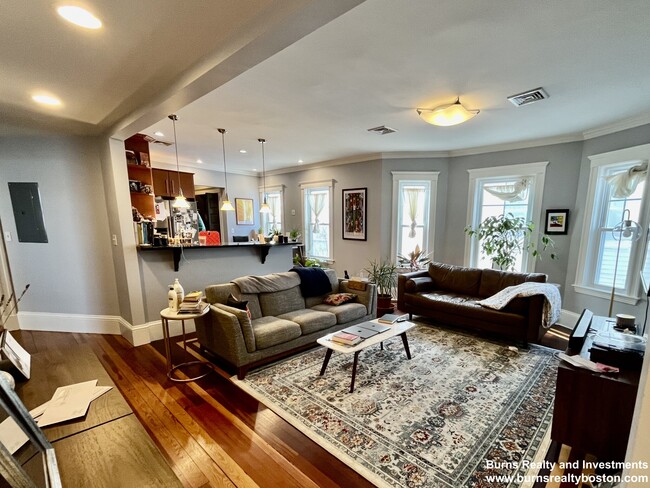
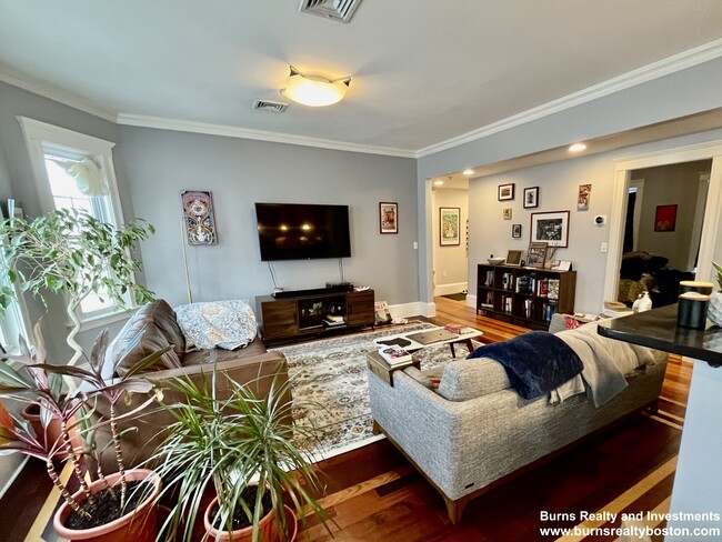
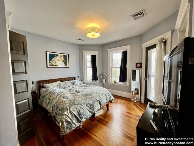
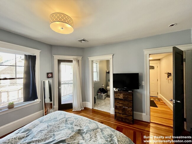
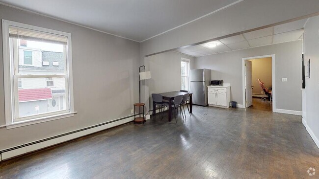
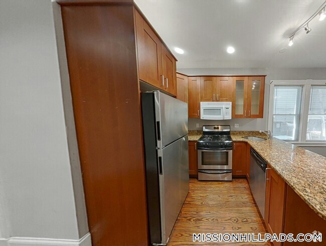
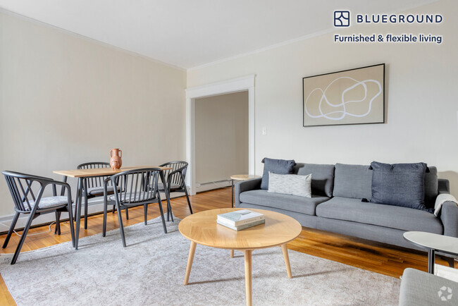
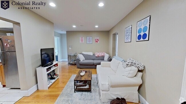
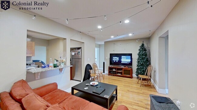
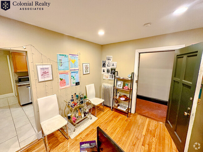
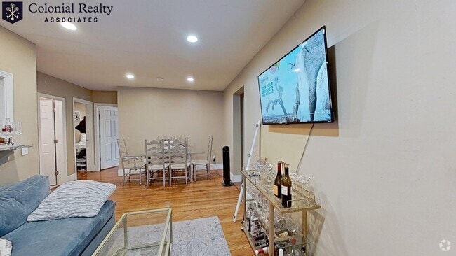
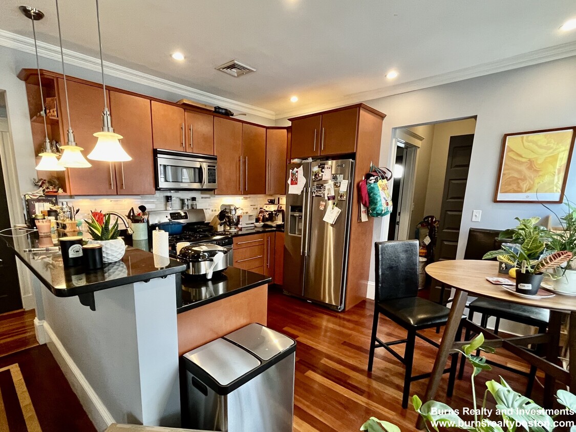
A spacious 3 bedroom, 2 bathroom apartment in Somerville! This beautiful home comes with in-unit laundry, a front AND back outdoor deck, 1 garage spot, and central air! With walking distance to the Red Line and bus transportation, this is an amazing deal. Available for rent 9/1!
22 Clarendon Ave is a condo located in Middlesex County and the 02144 ZIP Code. This area is served by the Somerville attendance zone.
* Price shown is base rent and may not include non-optional fees and utilities.
Price, availability, fees, and any applicable rent special are subject to change without notice.
* Square footage definitions vary. Displayed square footage is approximate.
Condo Features
- Washer/Dryer
Fees and Policies
The fees below are based on community-supplied data and may exclude additional fees and utilities.
- Parking
-
Garage--
Details
Lease Options
-
12 Months
Contact
- Listed by Adam Burns | Burns Realty and Investments
- Phone Number (857) 496-7187
- Contact
Location
Get Directions
Amenities
- Washer/Dryer
Northwest of the historic Powder House Square, Teele Square is a small community within walking distance of Tufts University. Teele Square has quick access to several excellent schools, including one of the top Catholic schools in Massachusetts in the western part of the neighborhood, making it a great location for families. The area features triple-decker, multiple-family units and apartment complexes available for rent.
There are delicious, independently-owned restaurants and charming cafes along Broadway and Holland Streets, which run through the center of Teele Square. For a unique coffee experience, visit Knights Moves Café, a board game café serving strong espresso and yummy sandwiches. Commercial hub Davis Square, right on the southern border of Teele Square, offers access to even more eateries and a movie theater.
Teele Square is a great location for students and professors looking for housing close to campus.
Learn more about living in Teele Square
Education
| Colleges & Universities | Distance | ||
|---|---|---|---|
| Colleges & Universities | Distance | ||
| Walk: | 14 min | 0.8 mi | |
| Drive: | 4 min | 1.5 mi | |
| Drive: | 4 min | 1.9 mi | |
| Drive: | 6 min | 2.6 mi |
22 Clarendon Ave Unit 3 is within 14 minutes or 0.8 mile from Tufts Univ., Medford. It is also near Lesley University, Porter and Lesley University.
Schools
Public Elementary & Middle School
Grades PK-8
371 Students
Nearby
5
Out of 10
Public High School
Grades 9-12
1,310 Students
Attendance Zone
4
Out of 10
Private Elementary, Middle & High School
Grades PK-12
607 Students
Nearby
Private High School
Grades 9-12
364 Students
Nearby
School data provided by
GreatSchools
The GreatSchools Rating helps parents compare schools within a state based on a variety of school quality indicators and provides a helpful picture of how effectively each school serves all of its students. Ratings are on a scale of 1 (below average) to 10 (above average) and can include test scores, college readiness, academic progress, advanced courses, equity, discipline and attendance data. We also advise parents to visit schools, consider other information on school performance and programs, and consider family needs as part of the school selection process.
Transportation options available in Somerville include Davis Station, located 0.6 mile from 22 Clarendon Ave Unit 3. 22 Clarendon Ave Unit 3 is near General Edward Lawrence Logan International, located 8.6 miles or 16 minutes away.
| Transit / Subway | Distance | ||
|---|---|---|---|
| Transit / Subway | Distance | ||
|
|
Walk: | 11 min | 0.6 mi |
| Drive: | 3 min | 1.2 mi | |
|
|
Drive: | 3 min | 1.4 mi |
|
|
Drive: | 3 min | 1.4 mi |
| Drive: | 4 min | 1.5 mi |
| Commuter Rail | Distance | ||
|---|---|---|---|
| Commuter Rail | Distance | ||
|
|
Drive: | 4 min | 1.7 mi |
|
|
Drive: | 5 min | 1.9 mi |
|
|
Drive: | 6 min | 3.2 mi |
|
|
Drive: | 8 min | 3.8 mi |
| Drive: | 15 min | 8.2 mi |
| Airports | Distance | ||
|---|---|---|---|
| Airports | Distance | ||
|
General Edward Lawrence Logan International
|
Drive: | 16 min | 8.6 mi |
Time and distance from 22 Clarendon Ave Unit 3.
| Shopping Centers | Distance | ||
|---|---|---|---|
| Shopping Centers | Distance | ||
| Drive: | 3 min | 1.3 mi | |
| Drive: | 4 min | 1.4 mi | |
| Drive: | 5 min | 1.8 mi |
22 Clarendon Ave Unit 3 has 3 shopping centers within 1.8 miles, which is about a 5-minute drive. The miles and minutes will be for the farthest away property.
| Parks and Recreation | Distance | ||
|---|---|---|---|
| Parks and Recreation | Distance | ||
|
Mineralogical and Geological Museum
|
Drive: | 5 min | 2.2 mi |
|
Harvard Museum of Natural History
|
Drive: | 5 min | 2.2 mi |
|
Mystic River Reservation
|
Drive: | 5 min | 2.5 mi |
|
Longfellow National Historic Site
|
Drive: | 6 min | 2.6 mi |
|
Harvard-Smithsonian Center for Astrophysics
|
Drive: | 6 min | 2.7 mi |
22 Clarendon Ave Unit 3 has 5 parks within 2.7 miles, including Harvard-Smithsonian Center for Astrophysics, Harvard Museum of Natural History, and Mineralogical and Geological Museum.
| Hospitals | Distance | ||
|---|---|---|---|
| Hospitals | Distance | ||
| Drive: | 7 min | 3.1 mi | |
| Drive: | 6 min | 3.1 mi | |
| Drive: | 8 min | 4.6 mi |
22 Clarendon Ave Unit 3 has 3 hospitals within 4.6 miles, the nearest is Cambridge Health Alliance which is 3.1 miles away and a 7 minute drive.
| Military Bases | Distance | ||
|---|---|---|---|
| Military Bases | Distance | ||
| Drive: | 19 min | 10.0 mi | |
| Drive: | 32 min | 17.5 mi |
22 Clarendon Ave Unit 3 is 10.0 miles from Hanscom Air Force Base, and is convenient to other military bases, including US Military Reservation.
You May Also Like
Similar Rentals Nearby
What Are Walk Score®, Transit Score®, and Bike Score® Ratings?
Walk Score® measures the walkability of any address. Transit Score® measures access to public transit. Bike Score® measures the bikeability of any address.
What is a Sound Score Rating?
A Sound Score Rating aggregates noise caused by vehicle traffic, airplane traffic and local sources
22 Clarendon Ave
Somerville, MA 02144