-
Monthly Rent
$2,500
-
Bedrooms
4 bd
-
Bathrooms
1 ba
-
Square Feet
9,999 sq ft
Details

About This Property
Great location on the border of South Boston and Dorchester in the hot Andrew Square area! Across the street from Red Line at Andrew Station, also a major bus route hub! Close to shopping, dining, and nightlife on West & East Broadway! Also convenient to Seaport District, City Point, K, L, & M Street Beaches, Joe Moakley Park with tennis courts, baseball field, and basketball courts, Dry Docks, Boston Convention Center, Design Center, and much more! Many of these large attractions are intermixed with small local shops! *Due to high demand, availability of this listing is subject to change at any time*
22 Howell St is a condo located in Suffolk County and the 02125 ZIP Code. This area is served by the Boston Public Schools attendance zone.
Condo Features
- Laundry Facilities
- Basketball Court
- Tennis Court
- Dock
Fees and Policies
The fees below are based on community-supplied data and may exclude additional fees and utilities.
Details
Utilities Included
-
Gas
-
Water
Columbia Point is located on a peninsula and its surrounding area in Dorchester, Massachusetts. This quaint, coastal neighborhood houses the University of Massachusetts Boston, offering a lively college town vibe to this waterfront suburb. Just five miles south of downtown Boston, Columbia Point offers residents quick and easy access to all of Boston’s museums, restaurants, and local shops.
Savin Hill and Malibu Beach are community areas that offer sandy beaches perfect for swimming, along with a playground and baseball fields. For your shopping needs, visit South Bay Center, a very popular shopping mall with an abundance of retailers. Visit The Banshee if you’re interested in an Irish sports pub with a cozy atmosphere and lively crowd on game days. McKenna’s Café is a local gem that’s been serving breakfast and lunch to this neighborhood since 1999.
Learn more about living in Columbia Point| Colleges & Universities | Distance | ||
|---|---|---|---|
| Colleges & Universities | Distance | ||
| Drive: | 5 min | 1.6 mi | |
| Drive: | 6 min | 2.6 mi | |
| Drive: | 6 min | 2.7 mi | |
| Drive: | 7 min | 3.1 mi |
Transportation options available in Boston include Andrew Station, located 0.4 miles from 22 Howell St Unit 2. 22 Howell St Unit 2 is near General Edward Lawrence Logan International, located 5.5 miles or 11 minutes away.
| Transit / Subway | Distance | ||
|---|---|---|---|
| Transit / Subway | Distance | ||
|
|
Walk: | 8 min | 0.4 mi |
|
|
Drive: | 2 min | 1.2 mi |
|
|
Drive: | 3 min | 1.7 mi |
|
|
Drive: | 5 min | 1.9 mi |
|
|
Drive: | 6 min | 2.5 mi |
| Commuter Rail | Distance | ||
|---|---|---|---|
| Commuter Rail | Distance | ||
|
|
Walk: | 12 min | 0.6 mi |
|
|
Drive: | 2 min | 1.1 mi |
| Drive: | 2 min | 1.1 mi | |
| Drive: | 4 min | 2.1 mi | |
|
|
Drive: | 9 min | 3.1 mi |
| Airports | Distance | ||
|---|---|---|---|
| Airports | Distance | ||
|
General Edward Lawrence Logan International
|
Drive: | 11 min | 5.5 mi |
Time and distance from 22 Howell St Unit 2.
| Shopping Centers | Distance | ||
|---|---|---|---|
| Shopping Centers | Distance | ||
| Walk: | 8 min | 0.4 mi | |
| Walk: | 16 min | 0.8 mi | |
| Drive: | 5 min | 1.9 mi |
| Parks and Recreation | Distance | ||
|---|---|---|---|
| Parks and Recreation | Distance | ||
|
Dorchester Shores Reservation
|
Drive: | 4 min | 1.6 mi |
|
Lower Neponset River Trail
|
Drive: | 5 min | 2.3 mi |
|
Castle Island
|
Drive: | 5 min | 2.5 mi |
|
Roxbury Heritage State Park
|
Drive: | 5 min | 2.6 mi |
|
Boston Children's Museum
|
Drive: | 5 min | 2.7 mi |
| Hospitals | Distance | ||
|---|---|---|---|
| Hospitals | Distance | ||
| Drive: | 3 min | 1.6 mi | |
| Drive: | 5 min | 2.4 mi | |
| Drive: | 7 min | 3.4 mi |
- Laundry Facilities
- Dock
- Basketball Court
- Tennis Court
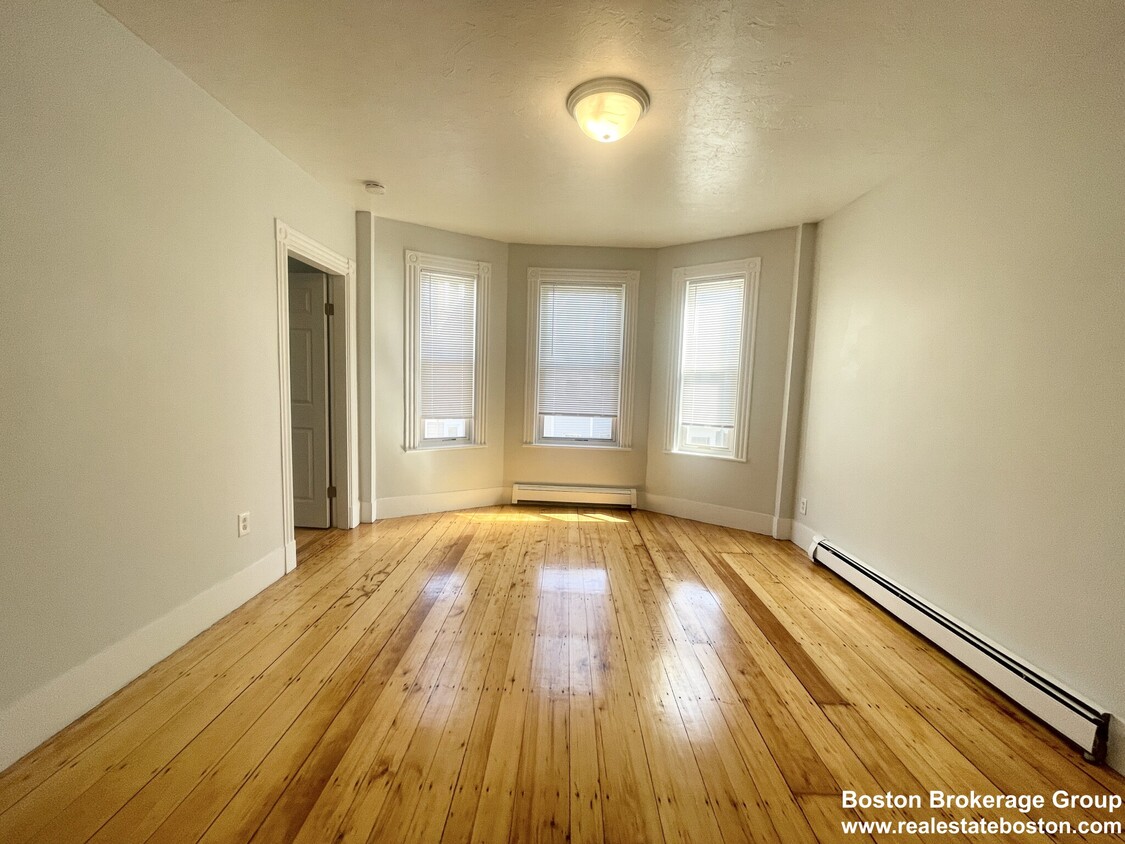
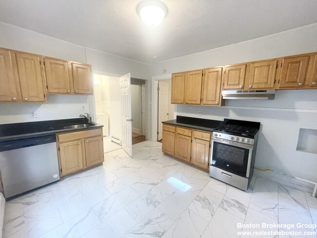
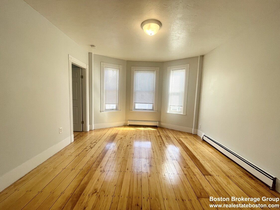
22 Howell St Unit 2 Photos
What Are Walk Score®, Transit Score®, and Bike Score® Ratings?
Walk Score® measures the walkability of any address. Transit Score® measures access to public transit. Bike Score® measures the bikeability of any address.
What is a Sound Score Rating?
A Sound Score Rating aggregates noise caused by vehicle traffic, airplane traffic and local sources


