
$1,900 / Month
22 King St Unit 2
Taunton, MA 02780
Today
Favorites
617-461-1491
-
Bedrooms
2
-
Bathrooms
1
-
Square Feet
1,672 sq ft
-
Available
Available Now
Highlight
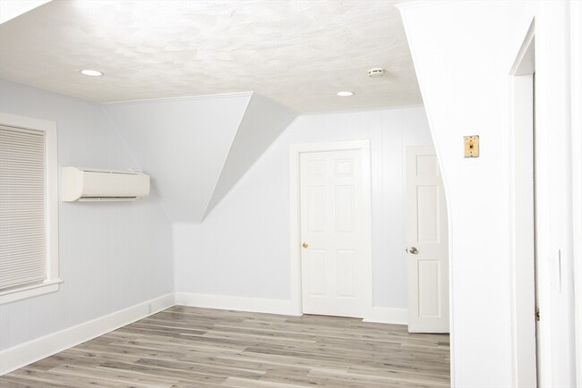
- No Cooling
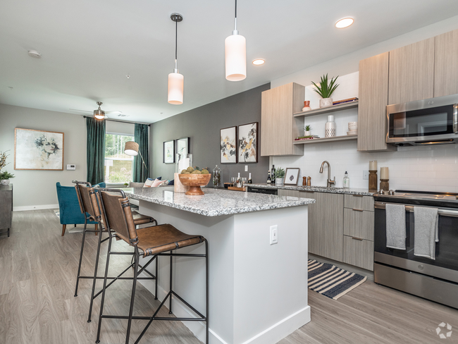
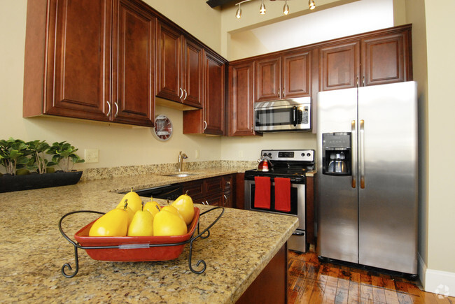
22 King St Unit 2

Favorites
About This Home
$1,900 deposit,
Available Now
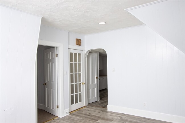
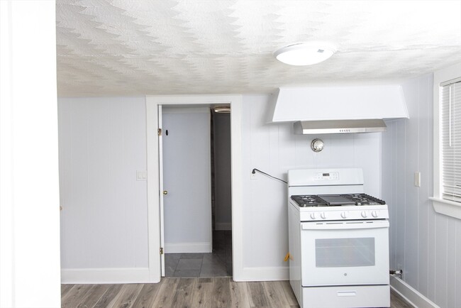
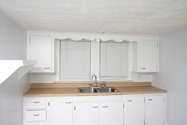
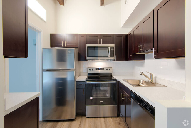
This delightful 2-bedroom,1-bath apartment is located on a serene street,providing an ideal escape from the city's noise. Upon entering,you'll find a spacious and light-filled living area. The inviting bedrooms serve as a tranquil retreat. Enjoy cooking on the brand-new stovetop,making meal preparation a pleasure. With convenient access to nearby parks,shops,and restaurants,you'll appreciate the perfect mix of serenity and accessibility this location provides. Don’t miss the opportunity to make this neighborhood your home—schedule your viewing today!
22 King St is an apartment community located in Bristol County and the 02780 ZIP Code.
* Price shown is base rent and may not include non-optional fees and utilities.
Price, availability, fees, and any applicable rent special are subject to change without notice.
* Square footage definitions vary. Displayed square footage is approximate.
Home Details
Year Built
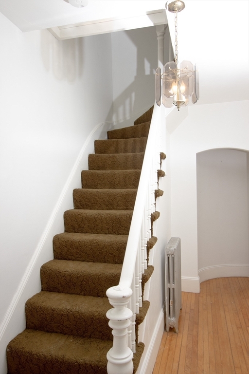
Built in 1900
Accessible Home Design
Entry on the 2nd floor
Bedrooms and Bathrooms
Primary bedroom located on second floor
1 Full Bathroom
2 Bedrooms
Home Design
Apartment
Interior Spaces
1,672 Sq Ft Home
Listing and Financial Details
Security Deposit $1,900
12 Month Lease Term
Assessor Parcel Number M:38 L:436 U:,2982771
Rent includes water, sewer
Lot Details
3,485 Sq Ft Lot
Utilities
No Cooling
Community Details
Overview
No Home Owners Association
Contact
- Listed by Karen Samedi | eXp Realty
- Phone Number (617) 461-1491
-
Source
 MLS Property Information Network
The property listing data and information set forth herein were provided to MLS Property Information Network, Inc. from third party sources, including sellers, lessors and public records, and were compiled by MLS Property Information Network, Inc. The property listing data and information are for the personal, non-commercial use of consumers having a good faith interest in purchasing or leasing listed properties of the type displayed to them and may not be used for any purpose other than to identify prospective properties which such consumers may have a good faith interest in purchasing or leasing. MLS Property Information Network, Inc. and its subscribers disclaim any and all representations and warranties as to the accuracy of the property listing data and information set forth herein. All properties are subject to prior sale, change or withdrawal. Copyright © 2025 MLS Property Information Network, Inc. All rights reserved.
Location
Get Directions
Education
| Colleges & Universities | Distance | ||
|---|---|---|---|
| Colleges & Universities | Distance | ||
| Drive: | 14 min | 7.9 mi | |
| Drive: | 20 min | 10.2 mi | |
| Drive: | 19 min | 11.0 mi | |
| Drive: | 28 min | 15.0 mi |
22 King St Unit 2 is within 14 minutes or 7.9 miles from Wheaton College, Norton. It is also near Bridgewater State University and Stonehill College.
Transportation options available in Taunton include Braintree Station, located 24.9 miles from 22 King St Unit 2. 22 King St Unit 2 is near Rhode Island Tf Green International, located 26.8 miles or 47 minutes away, and General Edward Lawrence Logan International, located 37.9 miles or 55 minutes away.
| Transit / Subway | Distance | ||
|---|---|---|---|
| Transit / Subway | Distance | ||
|
|
Drive: | 41 min | 24.9 mi |
|
|
Drive: | 39 min | 26.3 mi |
|
|
Drive: | 41 min | 27.6 mi |
|
|
Drive: | 41 min | 27.8 mi |
|
|
Drive: | 41 min | 27.9 mi |
| Commuter Rail | Distance | ||
|---|---|---|---|
| Commuter Rail | Distance | ||
|
|
Drive: | 20 min | 10.9 mi |
|
|
Drive: | 23 min | 10.9 mi |
|
|
Drive: | 21 min | 12.4 mi |
|
|
Drive: | 24 min | 12.7 mi |
|
|
Drive: | 24 min | 13.8 mi |
| Airports | Distance | ||
|---|---|---|---|
| Airports | Distance | ||
|
Rhode Island Tf Green International
|
Drive: | 47 min | 26.8 mi |
|
General Edward Lawrence Logan International
|
Drive: | 55 min | 37.9 mi |
Time and distance from 22 King St Unit 2.
| Shopping Centers | Distance | ||
|---|---|---|---|
| Shopping Centers | Distance | ||
| Walk: | 10 min | 0.5 mi | |
| Drive: | 4 min | 1.5 mi | |
| Drive: | 5 min | 1.7 mi |
22 King St Unit 2 has 3 shopping centers within 1.7 miles, which is about a 5-minute walk. The miles and minutes will be for the farthest away property.
| Parks and Recreation | Distance | ||
|---|---|---|---|
| Parks and Recreation | Distance | ||
|
Boyden Refuge
|
Drive: | 8 min | 4.1 mi |
|
Dighton Rock State Park
|
Drive: | 23 min | 9.1 mi |
|
Massasoit State Park
|
Drive: | 24 min | 9.8 mi |
|
Mass Audubon's Oak Knoll Wildlife Sanctuary
|
Drive: | 22 min | 10.1 mi |
|
Freetown - Fall River State Forest
|
Drive: | 20 min | 11.6 mi |
22 King St Unit 2 has 5 parks within 11.6 miles, including Boyden Refuge, Massasoit State Park, and Dighton Rock State Park.
| Hospitals | Distance | ||
|---|---|---|---|
| Hospitals | Distance | ||
| Drive: | 3 min | 1.3 mi | |
| Drive: | 4 min | 1.4 mi | |
| Drive: | 24 min | 13.8 mi |
22 King St Unit 2 has 3 hospitals within 13.8 miles, the nearest is Morton Hospital which is 1.3 miles away and a 3 minute drive.
| Military Bases | Distance | ||
|---|---|---|---|
| Military Bases | Distance | ||
| Drive: | 62 min | 39.1 mi |
22 King St Unit 2 is 39.1 miles and a 62 minute drive from Rhode Island National Gaurd.
You May Also Like
Similar Rentals Nearby


What Are Walk Score®, Transit Score®, and Bike Score® Ratings?
Walk Score® measures the walkability of any address. Transit Score® measures access to public transit. Bike Score® measures the bikeability of any address.
What is a Sound Score Rating?
A Sound Score Rating aggregates noise caused by vehicle traffic, airplane traffic and local sources
22 King St
Taunton, MA 02780