
$1,605 / Month
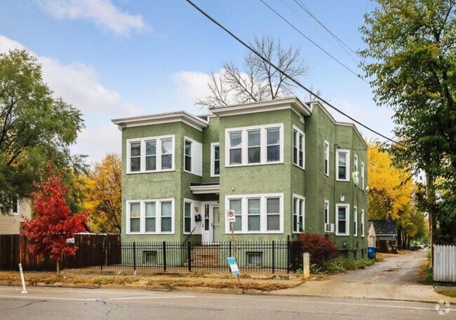
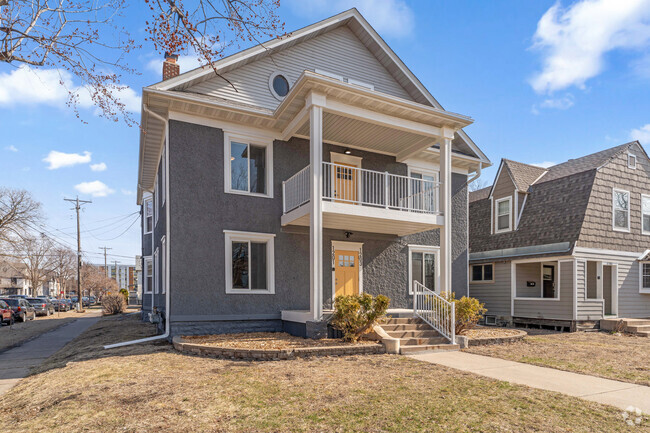
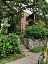
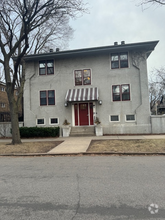
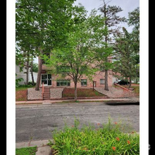
222 Otis Avenue
Saint Paul, MN 55104
2 Weeks Ago
Favorites
222 Otis Avenue

Favorites
Check Back Soon for Upcoming Availability
| Beds | Baths | Average SF |
|---|---|---|
| 2 Bedrooms 2 Bedrooms 2 Br | 1 Bath 1 Bath 1 Ba | 850 SF |
About This Property
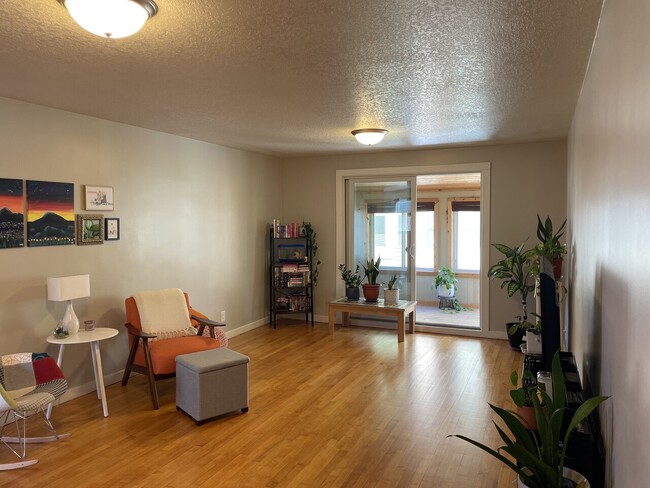
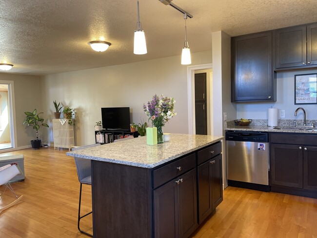
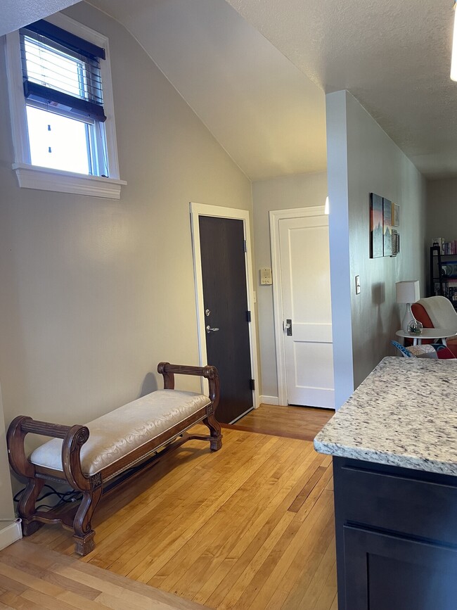
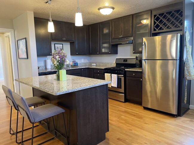
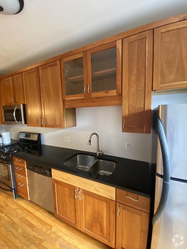
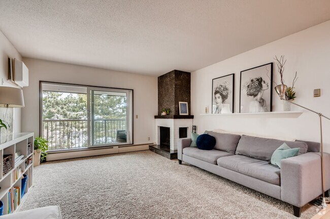
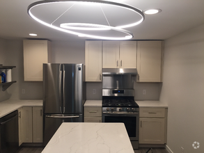
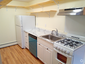
STUNNING PENTHOUSE A BLOCK FROM RIVERModern Two Bedroom Penthouse with views of Downtown Minneapolis from your three season porch. Just one block from the gorgeous Mississippi River and across from the Town and Country Golf Club, you are ideally situated near to nature and urban living.222 Otis offers a blend of quality and design. Features include granite counter tops, under mount sink, full size appliances including a dishwasher plus an open floor plan perfect for entertaining. Enjoy easy access to major highways, both downtowns and public transportation. Laundry is on-site, there is a patio area in the back with a gas grill, plenty of street parking and bike storage. Do not miss this fantastic opportunity located in the heart of a classic St Paul neighborhood.**Smoke free building**Cats Allowed (Up to 2 cats for $30/mo)Amenities:Controlled EntryHeat / Trash / Sewer / Recycling IncludedProfessional Common Area CleaningOn-site LaundryCat FriendlyOnline Resident Portal - Rent Payments and Maintenance RequestsSmoke Free BuildingBike StorageRental Terms:Rent: $1605 / month + Laundry Fee ($25 single occupancy or $40 double occupancy)Application Fee: $39 / lease holderDeposit: $500Available: 10/26/2022To qualify for renting a unit you must have:No bankruptcyNo judgmentsNo evictionsNo unlawful detainersNo criminal record (traffic violations excluded)Verifiable income (paystubs, etc)One year of positive rental history (no previous rental violations: noise, party, drug activity and/or police calls)Household income minimum of three (3) times the amount of rentNo delinquent debt (medical excluded)Valid identification (drivers license or photo ID)For more information and a tour, email Heather
222 Otis Avenue is a condo located in Ramsey County and the 55104 ZIP Code. This area is served by the St. Paul Public attendance zone.
Condo Features
- Hardwood Floors
- Laundry Facilities
- Storage Space
Fees and Policies
The fees below are based on community-supplied data and may exclude additional fees and utilities.
- Cats Allowed
-
Fees not specified
-
Weight limit--
-
Pet Limit--
Location
Get Directions
Along the shore of the Mississippi River, Merriam Park West offers riverfront parks, a large golf course, and quaint local restaurants just minutes from downtown Saint Paul, Minnesota. Stop on in at Izzy’s Ice Cream Café, or grab a treat at Black Coffee and Waffle Bar. Local businesses thrive alongside riverfront community spaces like Shadow Falls Park, a picturesque nature preserve.
The University of Saint Thomas resides on the south end of town, and the neighborhood offers a blend of private and public schools, churches, and every day conveniences. Situated just five miles southeast of Minneapolis and seven miles northeast of the Minneapolis-Saint Paul International Airport, this neighborhood is in a premier location for commuting, shopping, dining, and entertainment.
Learn more about living in Merriam Park WestBelow are rent ranges for similar nearby apartments
Amenities
- Hardwood Floors
- Laundry Facilities
- Storage Space
Education
| Colleges & Universities | Distance | ||
|---|---|---|---|
| Colleges & Universities | Distance | ||
| Walk: | 10 min | 0.6 mi | |
| Drive: | 4 min | 2.0 mi | |
| Drive: | 4 min | 2.2 mi | |
| Drive: | 7 min | 2.6 mi |
222 Otis Avenue is within 10 minutes or 0.6 mile from Univ. of St Thomas, St. Paul. It is also near Macalester College and Concordia Univ.-Saint Paul.
Schools


Public Elementary School
Grades PK-5
266 Students
Nearby
Public Elementary School
Grades PK-5
372 Students
Attendance Zone
Public Middle School
Grades 6-8
559 Students
Attendance Zone
Public High School
Grades 9-12
1,691 Students
Attendance Zone
Private Elementary, Middle & High School
Grades PK-12
965 Students
Nearby
School data provided by
 The GreatSchools Rating helps parents compare schools within a state based on a variety of school quality indicators and provides a helpful picture of how effectively each school serves all of its students. Ratings are on a scale of 1 (below average) to 10 (above average) and can include test scores, college readiness, academic progress, advanced courses, equity, discipline and attendance data. We also advise parents to visit schools, consider other information on school performance and programs, and consider family needs as part of the school selection process.
View GreatSchools Rating Methodology
View GreatSchools Rating Methodology
Transportation options available in Saint Paul include Raymond Ave Station, located 1.5 miles from 222 Otis Avenue. 222 Otis Avenue is near Minneapolis-St Paul International/Wold-Chamberlain, located 7.3 miles or 16 minutes away.
| Transit / Subway | Distance | ||
|---|---|---|---|
| Transit / Subway | Distance | ||
| Drive: | 5 min | 1.5 mi | |
| Drive: | 3 min | 1.6 mi | |
| Drive: | 5 min | 2.0 mi | |
| Drive: | 4 min | 2.1 mi | |
|
|
Drive: | 8 min | 2.6 mi |
| Commuter Rail | Distance | ||
|---|---|---|---|
| Commuter Rail | Distance | ||
|
|
Drive: | 13 min | 6.1 mi |
|
|
Drive: | 11 min | 6.1 mi |
|
|
Drive: | 22 min | 14.6 mi |
|
|
Drive: | 31 min | 23.4 mi |
|
|
Drive: | 33 min | 25.1 mi |
| Airports | Distance | ||
|---|---|---|---|
| Airports | Distance | ||
|
Minneapolis-St Paul International/Wold-Chamberlain
|
Drive: | 16 min | 7.3 mi |
Time and distance from 222 Otis Avenue.
| Shopping Centers | Distance | ||
|---|---|---|---|
| Shopping Centers | Distance | ||
| Drive: | 4 min | 2.2 mi | |
| Drive: | 5 min | 2.3 mi | |
| Drive: | 6 min | 2.8 mi |
222 Otis Avenue has 3 shopping centers within 2.8 miles, which is about a 6-minute drive. The miles and minutes will be for the farthest away property.
| Parks and Recreation | Distance | ||
|---|---|---|---|
| Parks and Recreation | Distance | ||
|
Brackett Park
|
Drive: | 4 min | 1.3 mi |
|
Longfellow Park
|
Drive: | 5 min | 1.7 mi |
|
Macalester College Observatory
|
Drive: | 4 min | 2.3 mi |
|
Hiawatha School Park
|
Drive: | 7 min | 2.4 mi |
|
Tower Hill Park
|
Drive: | 6 min | 2.4 mi |
222 Otis Avenue has 5 parks within 2.4 miles, including Brackett Park, Longfellow Park, and Tower Hill Park.
| Hospitals | Distance | ||
|---|---|---|---|
| Hospitals | Distance | ||
| Drive: | 6 min | 3.4 mi | |
| Drive: | 10 min | 3.5 mi | |
| Drive: | 10 min | 3.6 mi |
222 Otis Avenue has 3 hospitals within 3.6 miles, the nearest is University of Minnesota Medical Center, Fairview which is 3.4 miles away and a 6 minute drive.
| Military Bases | Distance | ||
|---|---|---|---|
| Military Bases | Distance | ||
| Drive: | 15 min | 6.3 mi |
222 Otis Avenue is 6.3 miles and a 15 minute drive from Fort Snelling Military Reservation.
You May Also Like
Similar Rentals Nearby
-
-
-
-
-
-
-
-

-
-
 $1,3002 Beds, 1 Bath, 1,100 sq ftApartment for Rent
What Are Walk Score®, Transit Score®, and Bike Score® Ratings?
Walk Score® measures the walkability of any address. Transit Score® measures access to public transit. Bike Score® measures the bikeability of any address.
What is a Sound Score Rating?
A Sound Score Rating aggregates noise caused by vehicle traffic, airplane traffic and local sources
222 Otis Avenue
Saint Paul, MN 55104