$3,995 / Month
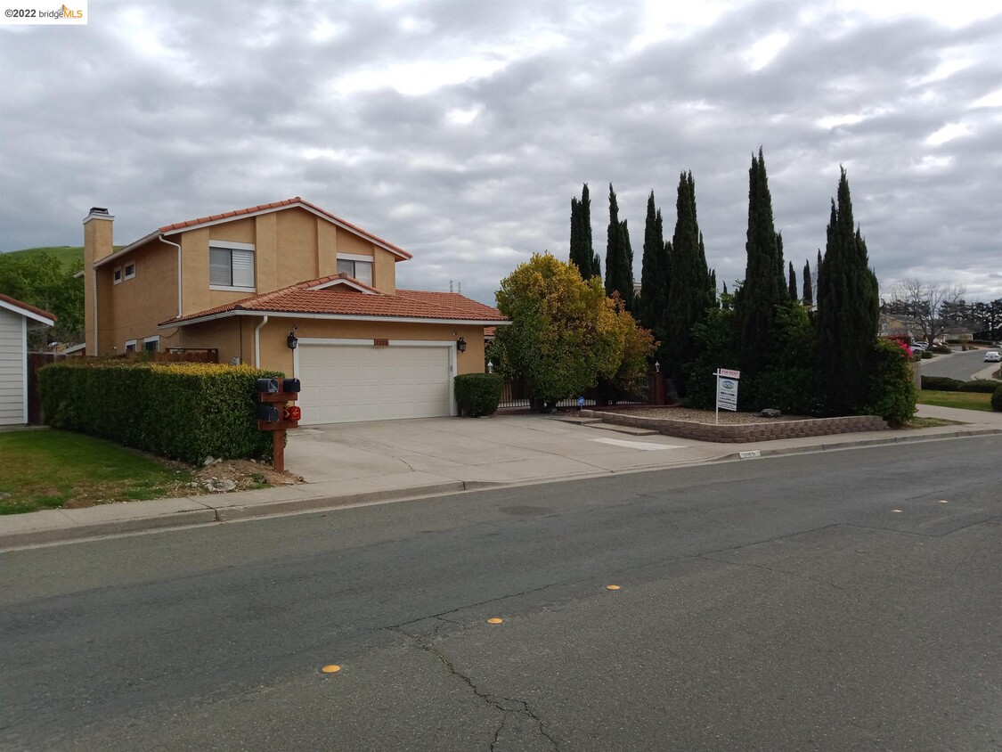
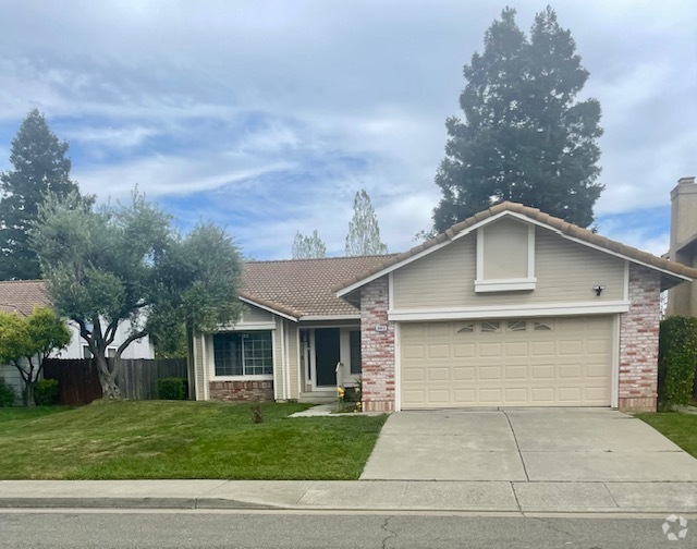
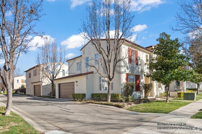
2225 Lupine Rd
Hercules, CA 94547
2 Weeks Ago
Favorites
2225 Lupine Rd

Favorites
Check Back Soon for Upcoming Availability
| Beds | Baths | Average SF |
|---|---|---|
| 4 Bedrooms 4 Bedrooms 4 Br | 3 Baths 3 Baths 3 Ba | 2,792 SF |
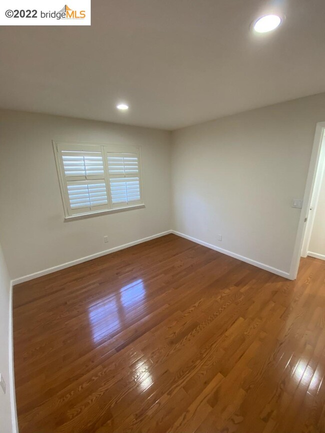
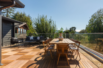
About This Property
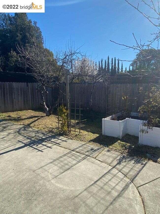
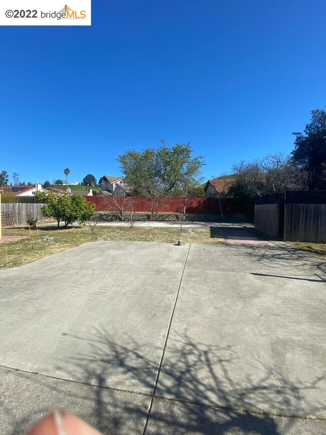
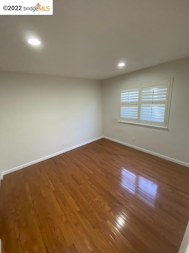
The home is much bigger than public records show. Lease includes surveillance system that can be activated by Tenant, gardener, garbage. There is a bedroom and full bath on the ground floor. Don't miss this beautiful home with a huge yard.
2225 Lupine Rd is a house located in Contra Costa County and the 94547 ZIP Code. This area is served by the West Contra Costa Unified attendance zone.
House Features
- Washer/Dryer Hookup
- Air Conditioning
- Heating
Fees and Policies
The fees below are based on community-supplied data and may exclude additional fees and utilities.
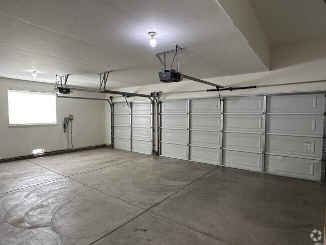
- Parking
-
Street--
-
Other--
-
Garage--
Location
Get Directions
Located midway between San Francisco and Napa along the coast of San Pablo Bay, Hercules is a stunning waterfront community with a small-town atmosphere, diverse population, and innovative plans for the future. Among Hercules’ exciting planned developments are a new waterfront, town center, and a train and ferry terminal.
Convenience to the San Pablo Bay as well as a host of parks, trails, and athletic programs allows for plenty of recreational activities in Hercules. A peaceful reprieve from city life, Hercules offers residents picturesque homes in quiet neighborhoods with dazzling views of the bay. Shopping opportunities abound at the nearby Shops at Hilltop in addition to several plazas and shopping centers in town. Getting around from Hercules is easy with access to Interstate 80 and State Route 4.
Learn more about living in Hercules
Amenities
- Washer/Dryer Hookup
- Air Conditioning
- Heating
Education
| Colleges & Universities | Distance | ||
|---|---|---|---|
| Colleges & Universities | Distance | ||
| Drive: | 13 min | 7.7 mi | |
| Drive: | 25 min | 13.6 mi | |
| Drive: | 26 min | 16.8 mi | |
| Drive: | 30 min | 17.8 mi |
2225 Lupine Rd is within 13 minutes or 7.7 miles from Contra Costa College. It is also near Touro University California and UC Berkeley.
Schools


Public Elementary School
Grades K-5
270 Students
Nearby
Public Elementary School
Grades K-5
371 Students
Attendance Zone
Public Middle School
Grades 6-8
590 Students
Attendance Zone
Public High School
Grades 9-12
734 Students
Attendance Zone
Private Elementary & Middle School
Grades PK-8
389 Students
Nearby
Private Elementary, Middle & High School
Grades K-12
16 Students
Nearby
School data provided by
 The GreatSchools Rating helps parents compare schools within a state based on a variety of school quality indicators and provides a helpful picture of how effectively each school serves all of its students. Ratings are on a scale of 1 (below average) to 10 (above average) and can include test scores, college readiness, academic progress, advanced courses, equity, discipline and attendance data. We also advise parents to visit schools, consider other information on school performance and programs, and consider family needs as part of the school selection process.
View GreatSchools Rating Methodology
View GreatSchools Rating Methodology
Transportation options available in Hercules include El Cerrito Del Norte Station, located 10.9 miles from 2225 Lupine Rd. 2225 Lupine Rd is near Metro Oakland International, located 29.8 miles or 41 minutes away, and San Francisco International, located 37.4 miles or 53 minutes away.
| Transit / Subway | Distance | ||
|---|---|---|---|
| Transit / Subway | Distance | ||
|
|
Drive: | 16 min | 10.9 mi |
|
|
Drive: | 17 min | 11.1 mi |
|
|
Drive: | 19 min | 12.7 mi |
|
|
Drive: | 30 min | 15.9 mi |
|
|
Drive: | 24 min | 16.3 mi |
| Commuter Rail | Distance | ||
|---|---|---|---|
| Commuter Rail | Distance | ||
|
|
Drive: | 18 min | 11.7 mi |
|
|
Drive: | 21 min | 15.4 mi |
|
|
Drive: | 24 min | 17.2 mi |
| Drive: | 32 min | 20.2 mi | |
|
|
Drive: | 29 min | 21.4 mi |
| Airports | Distance | ||
|---|---|---|---|
| Airports | Distance | ||
|
Metro Oakland International
|
Drive: | 41 min | 29.8 mi |
|
San Francisco International
|
Drive: | 53 min | 37.4 mi |
Time and distance from 2225 Lupine Rd.
| Shopping Centers | Distance | ||
|---|---|---|---|
| Shopping Centers | Distance | ||
| Drive: | 5 min | 1.8 mi | |
| Drive: | 5 min | 1.8 mi | |
| Drive: | 5 min | 1.9 mi |
2225 Lupine Rd has 3 shopping centers within 1.9 miles, which is about a 5-minute drive. The miles and minutes will be for the farthest away property.
| Parks and Recreation | Distance | ||
|---|---|---|---|
| Parks and Recreation | Distance | ||
|
Ohlone Wilderness
|
Drive: | 5 min | 2.0 mi |
|
Fernandez Ranch
|
Drive: | 8 min | 4.3 mi |
|
Crockett Hills Regional Park
|
Drive: | 11 min | 6.6 mi |
|
Sobrante Ridge Regional Preserve
|
Drive: | 16 min | 8.0 mi |
|
Kennedy Grove Regional Recreation Area
|
Drive: | 18 min | 9.1 mi |
2225 Lupine Rd has 5 parks within 9.1 miles, including Ohlone Wilderness, Fernandez Ranch, and Sobrante Ridge Regional Preserve.
| Hospitals | Distance | ||
|---|---|---|---|
| Hospitals | Distance | ||
| Drive: | 16 min | 10.6 mi | |
| Drive: | 18 min | 11.6 mi | |
| Drive: | 19 min | 12.4 mi |
2225 Lupine Rd has 3 hospitals within 12.4 miles, the nearest is Contra Costa Regional Medical Center which is 10.6 miles away and a 16 minute drive.
| Military Bases | Distance | ||
|---|---|---|---|
| Military Bases | Distance | ||
| Drive: | 14 min | 8.4 mi | |
| Drive: | 22 min | 13.4 mi |
2225 Lupine Rd is 8.4 miles from Armory West Contra Costa, and is convenient to other military bases, including Military Reservation.
You May Also Like
Similar Rentals Nearby


What Are Walk Score®, Transit Score®, and Bike Score® Ratings?
Walk Score® measures the walkability of any address. Transit Score® measures access to public transit. Bike Score® measures the bikeability of any address.
What is a Sound Score Rating?
A Sound Score Rating aggregates noise caused by vehicle traffic, airplane traffic and local sources

2225 Lupine Rd
Hercules, CA 94547