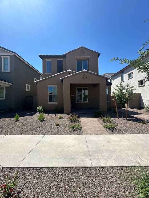
2243 W Paso Trail
Phoenix, AZ 85085
-
Bedrooms
3
-
Bathrooms
3
-
Square Feet
1,992 sq ft

About This Home
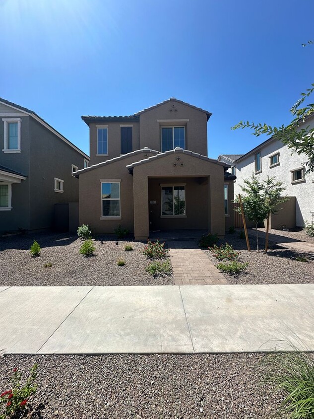
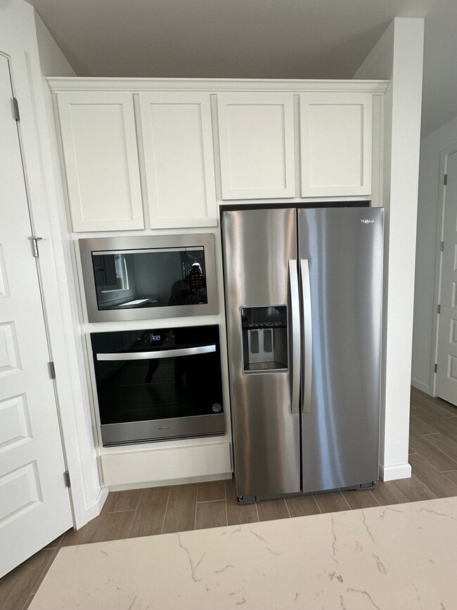
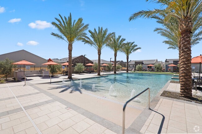
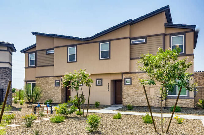
3 BD 2.5 BA 1992 SQ. FT 2 STORY HOME IN UNION PARK AT NORTERRA IN PHOENIX. ALL UPGRADED APPLIANCES, QUARTZ COUNTERTOPS, PLANK TILE IN WALKWAYS, CARPET IN BEDROOMS, GAS COOK TOP, CULTERED MARBLE IN BATHS. COMMUNITY POOL AND PLAYGROUNDS.
2243 W Paso Trail is a house located in Maricopa County and the 85085 ZIP Code. This area is served by the Deer Valley Unified District attendance zone.
Deer Valley is a family-friendly suburb and residential neighborhood that’s constantly evolving. There are abundant outdoor recreational opportunities in Deer Valley because of its proximity to several natural attractions like Deem Hills and Cave Buttes, both known for scenic hiking and mountain biking trails. Residents have easy access to abundant shopping opportunities without having to leave town at places like Deer Valley Towne Center and Bell Towne Plaza. Deer Valley is home to good public schools and is the ideal suburb for those commuting to Downtown Phoenix and beyond, located less than 20 miles south of town along Interstate 17.
Learn more about living in Deer Valley| Colleges & Universities | Distance | ||
|---|---|---|---|
| Colleges & Universities | Distance | ||
| Drive: | 11 min | 5.5 mi | |
| Drive: | 17 min | 9.3 mi | |
| Drive: | 18 min | 10.4 mi | |
| Drive: | 22 min | 12.1 mi |
 The GreatSchools Rating helps parents compare schools within a state based on a variety of school quality indicators and provides a helpful picture of how effectively each school serves all of its students. Ratings are on a scale of 1 (below average) to 10 (above average) and can include test scores, college readiness, academic progress, advanced courses, equity, discipline and attendance data. We also advise parents to visit schools, consider other information on school performance and programs, and consider family needs as part of the school selection process.
View GreatSchools Rating Methodology
Transportation options available in Phoenix include 19Th Ave/Dunlap, located 12.8 miles from 2243 W Paso Trail. 2243 W Paso Trail is near Phoenix Sky Harbor International, located 27.1 miles or 39 minutes away.
| Transit / Subway | Distance | ||
|---|---|---|---|
| Transit / Subway | Distance | ||
|
|
Drive: | 19 min | 12.8 mi |
|
|
Drive: | 20 min | 13.8 mi |
|
|
Drive: | 20 min | 14.4 mi |
|
|
Drive: | 22 min | 15.5 mi |
|
|
Drive: | 24 min | 16.8 mi |
| Airports | Distance | ||
|---|---|---|---|
| Airports | Distance | ||
|
Phoenix Sky Harbor International
|
Drive: | 39 min | 27.1 mi |
Time and distance from 2243 W Paso Trail.
| Shopping Centers | Distance | ||
|---|---|---|---|
| Shopping Centers | Distance | ||
| Walk: | 12 min | 0.6 mi | |
| Walk: | 13 min | 0.7 mi | |
| Drive: | 5 min | 1.9 mi |
| Parks and Recreation | Distance | ||
|---|---|---|---|
| Parks and Recreation | Distance | ||
|
Paseo Highlands Park
|
Drive: | 6 min | 3.0 mi |
|
Adobe Dam Regional Park
|
Drive: | 8 min | 4.3 mi |
|
Adobe Mountain Park
|
Drive: | 9 min | 4.8 mi |
|
Deem Hills Recreation Area
|
Drive: | 14 min | 7.4 mi |
|
Reach 11 Recreation Area
|
Drive: | 15 min | 7.6 mi |
| Hospitals | Distance | ||
|---|---|---|---|
| Hospitals | Distance | ||
| Drive: | 7 min | 4.0 mi | |
| Drive: | 9 min | 5.5 mi | |
| Drive: | 17 min | 10.9 mi |
| Military Bases | Distance | ||
|---|---|---|---|
| Military Bases | Distance | ||
| Drive: | 35 min | 25.4 mi | |
| Drive: | 39 min | 27.0 mi | |
| Drive: | 116 min | 88.4 mi |
You May Also Like
Similar Rentals Nearby
What Are Walk Score®, Transit Score®, and Bike Score® Ratings?
Walk Score® measures the walkability of any address. Transit Score® measures access to public transit. Bike Score® measures the bikeability of any address.
What is a Sound Score Rating?
A Sound Score Rating aggregates noise caused by vehicle traffic, airplane traffic and local sources
