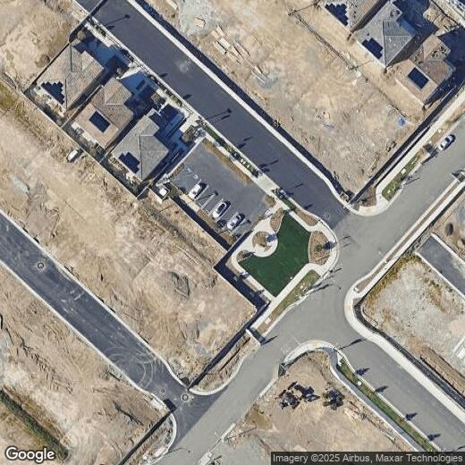
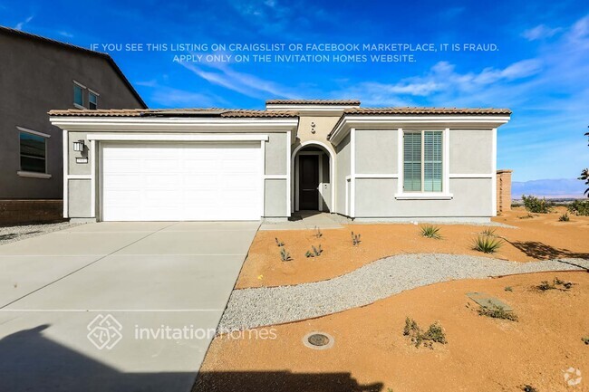
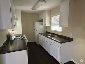
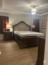
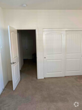
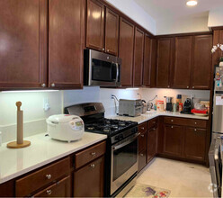
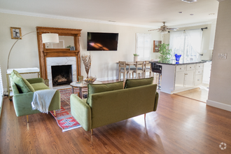
2243 Yuzu St
2243 Yuzu St
Corona, CA 92883
2 Weeks Ago
Favorites
2243 Yuzu St

Favorites
Check Back Soon for Upcoming Availability
Property Address:
2243 Yuzu St,
Corona,
CA
92883
Located between the Santa Ana Mountains, Chino Hills State Park, and Lake Mathews Estelle Mountain Reserve, Corona’s residents enjoy a diverse landscape that encompasses everything from abundant retail centers to unspoiled natural beauty. The city’s location offers easy access to both the Inland Empire and Orange County; this along with the abundance of attractive, Spanish-style homes and excellent public schools makes Corona a popular home base for many commuters. The cost of living is relatively low compared to other parts of SoCal, and rental rates for homes and apartments range from the high-end to the highly-affordable.
Corona is also known as the “Circle City”. The town is named for the three-mile circular layout found at Grand Boulevard. This circular hub houses several parks, a farmers market, local eateries, and the Corona Regional Medical Center. Grand Boulevard is one of several commercial hubs in Corona.
Learn more about living in Corona
Education
| Colleges & Universities | Distance | ||
|---|---|---|---|
| Colleges & Universities | Distance | ||
| Drive: | 15 min | 9.0 mi | |
| Drive: | 17 min | 10.0 mi | |
| Drive: | 21 min | 14.0 mi | |
| Drive: | 27 min | 17.9 mi |
2243 Yuzu St is within 15 minutes or 9.0 miles from Norco College. It is also near La Sierra University and California Baptist University.
Transportation options available in Corona include Apu / Citrus College Station, located 36.6 miles from 2243 Yuzu St. 2243 Yuzu St is near Ontario International, located 21.2 miles or 30 minutes away, and John Wayne/Orange County, located 34.8 miles or 45 minutes away.
| Transit / Subway | Distance | ||
|---|---|---|---|
| Transit / Subway | Distance | ||
| Drive: | 49 min | 36.6 mi | |
| Drive: | 48 min | 37.1 mi | |
| Drive: | 49 min | 38.4 mi | |
| Drive: | 52 min | 40.8 mi | |
|
|
Drive: | 52 min | 41.9 mi |
| Commuter Rail | Distance | ||
|---|---|---|---|
| Commuter Rail | Distance | ||
|
|
Drive: | 13 min | 7.1 mi |
|
|
Drive: | 16 min | 9.8 mi |
|
|
Drive: | 17 min | 10.3 mi |
|
|
Drive: | 25 min | 16.7 mi |
|
|
Drive: | 26 min | 18.5 mi |
| Airports | Distance | ||
|---|---|---|---|
| Airports | Distance | ||
|
Ontario International
|
Drive: | 30 min | 21.2 mi |
|
John Wayne/Orange County
|
Drive: | 45 min | 34.8 mi |
Time and distance from 2243 Yuzu St.
| Shopping Centers | Distance | ||
|---|---|---|---|
| Shopping Centers | Distance | ||
| Walk: | 11 min | 0.6 mi | |
| Walk: | 16 min | 0.9 mi | |
| Drive: | 4 min | 1.5 mi |
2243 Yuzu St has 3 shopping centers within 1.5 miles, which is about a 4-minute walk. The miles and minutes will be for the farthest away property.
| Parks and Recreation | Distance | ||
|---|---|---|---|
| Parks and Recreation | Distance | ||
|
Hidden Valley Nature Center
|
Drive: | 20 min | 13.0 mi |
|
California Citrus State Historical Park
|
Drive: | 26 min | 13.9 mi |
|
Rancho Sonado
|
Drive: | 41 min | 29.8 mi |
|
Tucker Wildlife Sanctuary
|
Drive: | 49 min | 32.6 mi |
2243 Yuzu St has 4 parks within 32.6 miles, including Hidden Valley Nature Center, California Citrus State Historical Park, and Rancho Sonado.
| Hospitals | Distance | ||
|---|---|---|---|
| Hospitals | Distance | ||
| Drive: | 11 min | 6.0 mi | |
| Drive: | 16 min | 10.3 mi | |
| Drive: | 20 min | 13.1 mi |
2243 Yuzu St has 3 hospitals within 13.1 miles, the nearest is Corona Regional Medical Center which is 6.0 miles away and a 11 minute drive.
| Military Bases | Distance | ||
|---|---|---|---|
| Military Bases | Distance | ||
| Drive: | 50 min | 25.6 mi |
2243 Yuzu St is 25.6 miles and a 50 minute drive from March Air Reserve Base.
You May Also Like
Similar Rentals Nearby
-
-
-
Single-Family Homes Discounts
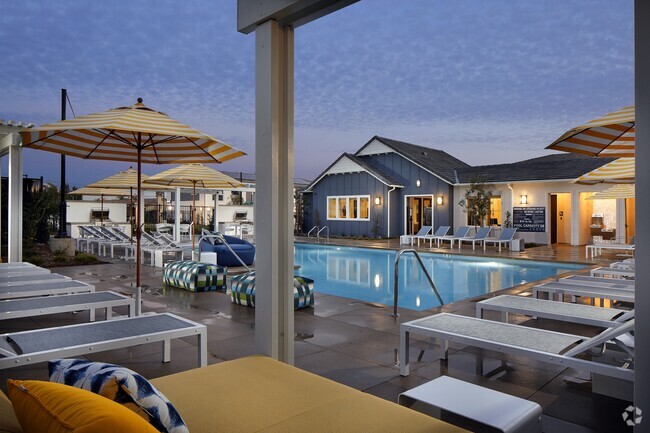
Pets Allowed Pool Refrigerator Kitchen Clubhouse Oven
-
-
-
-
-
-
 $7,5003 Beds, 2 Baths, 1,350 sq ftHouse for Rent
 -
 $3,0504 Beds, 2 Baths, 1,556 sq ftHouse for Rent
What Are Walk Score®, Transit Score®, and Bike Score® Ratings?
Walk Score® measures the walkability of any address. Transit Score® measures access to public transit. Bike Score® measures the bikeability of any address.
What is a Sound Score Rating?
A Sound Score Rating aggregates noise caused by vehicle traffic, airplane traffic and local sources