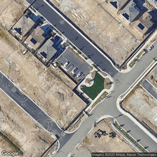
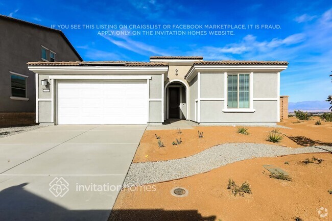
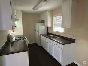
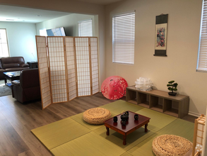
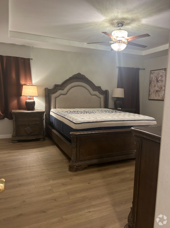
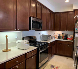
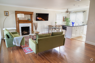
2243 Yuzu St
2243 Yuzu St
Corona, CA 92883
Hace 2 semanas
Favoritos
2243 Yuzu St

Favoritos
Consulta pronto si hay nueva disponibilidad
Dirección de la propiedad:
2243 Yuzu St,
Corona,
CA
92883
Educación
| Institutos y Universidades | Distancia de | ||
|---|---|---|---|
| Institutos y Universidades | Dist. | ||
| En coche: | 15 minutos | 9.0 mi | |
| En coche: | 17 minutos | 10.0 mi | |
| En coche: | 21 minutos | 14.0 mi | |
| En coche: | 27 minutos | 17.9 mi |
2243 Yuzu St está a 15 minutos o 9.0 millas de Norco College. También está cerca de La Sierra University et California Baptist University.
Las opciones de transporte disponibles en Corona incluyen Apu / Citrus College Station, a 36.6 millas de 2243 Yuzu St. 2243 Yuzu St está cerca de Ontario International, a 21.2 millas o 30 minutos de distancia, y de John Wayne/Orange County, a 34.8 millas o 45 minutos de distancia.
| Tránsito / metro | Distancia de | ||
|---|---|---|---|
| Tránsito / metro | Dist. | ||
| En coche: | 49 minutos | 36.6 mi | |
| En coche: | 48 minutos | 37.1 mi | |
| En coche: | 49 minutos | 38.4 mi | |
| En coche: | 52 minutos | 40.8 mi | |
|
|
En coche: | 52 minutos | 41.9 mi |
| Tren suburbano | Distancia de | ||
|---|---|---|---|
| Tren suburbano | Dist. | ||
|
|
En coche: | 13 minutos | 7.1 mi |
|
|
En coche: | 16 minutos | 9.8 mi |
|
|
En coche: | 17 minutos | 10.3 mi |
|
|
En coche: | 25 minutos | 16.7 mi |
|
|
En coche: | 26 minutos | 18.5 mi |
| Aeropuertos | Distancia de | ||
|---|---|---|---|
| Aeropuertos | Dist. | ||
|
Ontario International
|
En coche: | 30 minutos | 21.2 mi |
|
John Wayne/Orange County
|
En coche: | 45 minutos | 34.8 mi |
Tiempo y distancia desde 2243 Yuzu St.
| Centros comerciales | Distancia de | ||
|---|---|---|---|
| Centros comerciales | Dist. | ||
| A pie: | 11 minutos | 0.6 mi | |
| A pie: | 16 minutos | 0.9 mi | |
| En coche: | 4 minutos | 1.5 mi |
2243 Yuzu St tiene 3 centros comerciales en un radio de 1.5 millas, lo que supone 4 minutos caminando. Las millas y los minutos serán para la propiedad más alejada.
| Parques y recreación | Distancia de | ||
|---|---|---|---|
| Parques y recreación | Dist. | ||
|
Hidden Valley Nature Center
|
En coche: | 20 minutos | 13.0 mi |
|
California Citrus State Historical Park
|
En coche: | 26 minutos | 13.9 mi |
|
Rancho Sonado
|
En coche: | 41 minutos | 29.8 mi |
|
Tucker Wildlife Sanctuary
|
En coche: | 49 minutos | 32.6 mi |
2243 Yuzu St tiene 4 parques en un radio de 32.6 millas, incluyendo Hidden Valley Nature Center, California Citrus State Historical Park, et Rancho Sonado.
| Medico | Distancia de | ||
|---|---|---|---|
| Medico | Dist. | ||
| En coche: | 11 minutos | 6.0 mi | |
| En coche: | 16 minutos | 10.3 mi | |
| En coche: | 20 minutos | 13.1 mi |
2243 Yuzu St tiene 3 medico en un radio de 13.1 millas; la más cercana es Corona Regional Medical Center que está a 6.0 millas y a 11 minutos en automóvil.
| Bases militares | Distancia de | ||
|---|---|---|---|
| Bases militares | Dist. | ||
| En coche: | 50 minutos | 25.6 mi |
2243 Yuzu St está a 25.6 millas y a 50 minutos en automóvil de March Air Reserve Base.
También te puede gustar
Alquileres Similares Cercanos
-
-
-
Casas Unifamiliares Descuentos
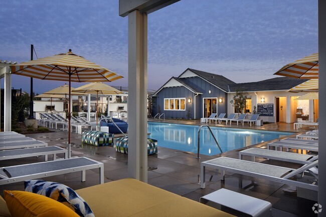
Se permiten mascotas Piscina Refrigerador Cocina Casa Club Horno
-
 $3,4093 habitaciones, 2 baños, 1,676 pies²Casa en alquiler
 -
-
 $9991 habitación, 1 baño, 300 pies²Casa en alquiler
 -
-
 $8,9003 habitaciones, 3 baños, 1,479 pies²Casa en alquiler
 -
 $1,0001 habitación, 1 bañoCasa en alquiler
 -
 $7,5003 habitaciones, 2 baños, 1,350 pies²Casa en alquiler
¿Qué son las clasificaciones Walk Score®, Transit Score® y Bike Score®?
Walk Score® mide la viabilidad peatonal de cualquier dirección. Transit Score® mide el acceso a transporte público. Bike Score® mide la infraestructura de rutas para bicicletas de cualquier dirección.
¿Qué es una clasificación de puntaje de ruido?
La clasificación de puntaje de ruido es el conjunto del ruido provocado por el transito de vehículos o de aviones y de fuentes locales.