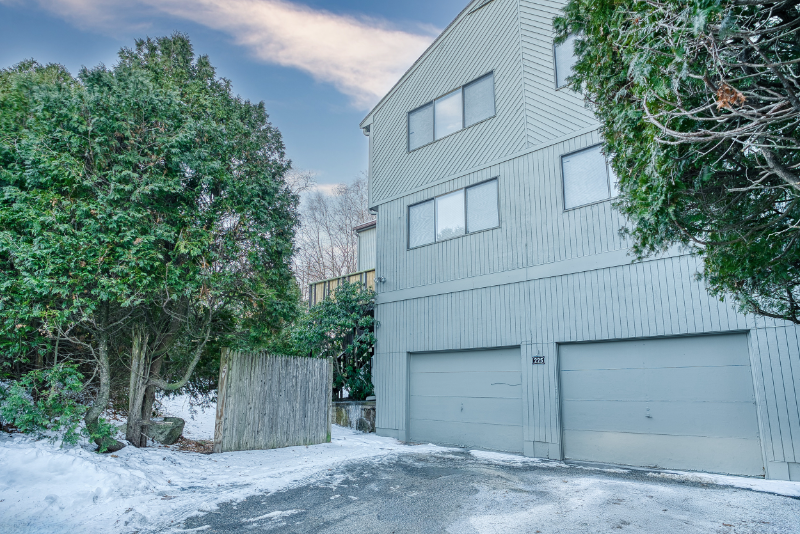
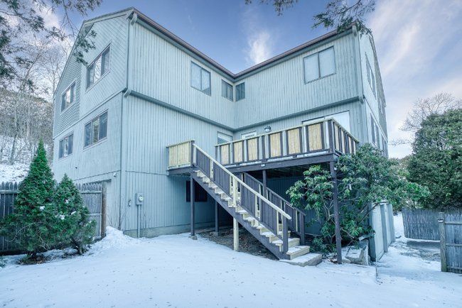
225 Eliot St
Ashland, MA 01721
-
Bedrooms
2
-
Bathrooms
2.5
-
Square Feet
1,345 sq ft
-
Available
Available Now
Highlights
- Hardwood Floors
- Smoke Free
About This Home
Property Id: 117758 Great unit available for Febuary 1st occupancy, spacious, bright, clean & neat. Large open living room with beautiful hardwood floors has a slider to large deck area. The master bedroom is spacious with a privateupdated bath, walk-in closet, and fireplace. The spacious 2nd bedroom has its own updated private bath. Additional space for office, playroom, storage or media room in the finished lower level. Updated fully applianced kitchen with separate dining area and cozy fireplace. 1 car garage. Washer and dryer on-site. Great commuting location and convenient to shopping & all major routes. Private setting & driveway parking 3 cars. Lots of updates throughout the property. Please, no pets & Smoke-free unit/ building. (Tenant to shovel deck & walks/driveway, Fireplace cleaning paid by tenant) Please do not apply without viewing & check availability status.
225 Eliot St is a house located in Middlesex County and the 01721 ZIP Code. This area is served by the Ashland attendance zone.
House Features
Dishwasher
Hardwood Floors
Microwave
Refrigerator
- Smoke Free
- Dishwasher
- Microwave
- Oven
- Refrigerator
- Hardwood Floors
Fees and Policies
The fees below are based on community-supplied data and may exclude additional fees and utilities.
- Parking
-
Garage--
Details
Utilities Included
-
Water
-
Sewer
Contact
- Phone Number (508) 922-9610
- Contact
-
Source

- Smoke Free
- Dishwasher
- Microwave
- Oven
- Refrigerator
- Hardwood Floors
495-South is a large area surrounding Interstate 495 about 20 miles south of Boston. This suburban town features peaceful neighborhoods nestled in forested areas paired with commercial developments. Renters have the choice of moderately priced to luxury apartments, condos, and single-family homes. An abundance of shopping and dining choices are scattered along the town’s major thoroughfares. Ponds, creeks, and large natural areas like Franklin State Forest and DelCarte Conservation Area provide relaxing outdoor activities. Residents have access to big-city amenities by driving a bit north into Boston, and the eclectic downtown districts of Worcester and Framingham are situated outside of the western and eastern corners of town.
Learn more about living in 495-South| Colleges & Universities | Distance | ||
|---|---|---|---|
| Colleges & Universities | Distance | ||
| Drive: | 11 min | 5.0 mi | |
| Drive: | 20 min | 9.3 mi | |
| Drive: | 22 min | 11.2 mi | |
| Drive: | 31 min | 15.9 mi |
Transportation options available in Ashland include Woodland Station, located 13.8 miles from 225 Eliot St. 225 Eliot St is near Worcester Regional, located 26.4 miles or 46 minutes away, and General Edward Lawrence Logan International, located 27.8 miles or 43 minutes away.
| Transit / Subway | Distance | ||
|---|---|---|---|
| Transit / Subway | Distance | ||
|
|
Drive: | 24 min | 13.8 mi |
|
|
Drive: | 26 min | 14.5 mi |
|
|
Drive: | 25 min | 14.6 mi |
|
|
Drive: | 27 min | 15.1 mi |
|
|
Drive: | 27 min | 15.3 mi |
| Commuter Rail | Distance | ||
|---|---|---|---|
| Commuter Rail | Distance | ||
|
|
Drive: | 5 min | 2.9 mi |
|
|
Drive: | 5 min | 2.9 mi |
|
|
Drive: | 11 min | 3.2 mi |
|
|
Drive: | 9 min | 4.3 mi |
|
|
Drive: | 11 min | 5.5 mi |
| Airports | Distance | ||
|---|---|---|---|
| Airports | Distance | ||
|
Worcester Regional
|
Drive: | 46 min | 26.4 mi |
|
General Edward Lawrence Logan International
|
Drive: | 43 min | 27.8 mi |
Time and distance from 225 Eliot St.
| Shopping Centers | Distance | ||
|---|---|---|---|
| Shopping Centers | Distance | ||
| Walk: | 6 min | 0.3 mi | |
| Walk: | 6 min | 0.3 mi | |
| Walk: | 8 min | 0.4 mi |
| Parks and Recreation | Distance | ||
|---|---|---|---|
| Parks and Recreation | Distance | ||
|
Mass Audubon's Waseeka Wildlife Sanctuary
|
Drive: | 8 min | 3.0 mi |
|
Ashland State Park
|
Drive: | 8 min | 3.3 mi |
|
Cowassock Woods and Ashland Town Forest
|
Drive: | 11 min | 5.1 mi |
|
Wilfred J. Turenne Wildlife Habitat
|
Drive: | 11 min | 5.6 mi |
|
Hopkinton State Park
|
Drive: | 19 min | 7.2 mi |
| Hospitals | Distance | ||
|---|---|---|---|
| Hospitals | Distance | ||
| Drive: | 6 min | 3.5 mi | |
| Drive: | 21 min | 10.8 mi | |
| Drive: | 21 min | 11.1 mi |
| Military Bases | Distance | ||
|---|---|---|---|
| Military Bases | Distance | ||
| Drive: | 14 min | 6.7 mi | |
| Drive: | 39 min | 20.3 mi |
You May Also Like
What Are Walk Score®, Transit Score®, and Bike Score® Ratings?
Walk Score® measures the walkability of any address. Transit Score® measures access to public transit. Bike Score® measures the bikeability of any address.
What is a Sound Score Rating?
A Sound Score Rating aggregates noise caused by vehicle traffic, airplane traffic and local sources


