$2,550
2 Beds, 1 Bath, 750 sq ft
Townhome for Rent


| Beds | Baths | Average SF |
|---|---|---|
| 2 Bedrooms 2 Bedrooms 2 Br | 1 Bath 1 Bath 1 Ba | — |
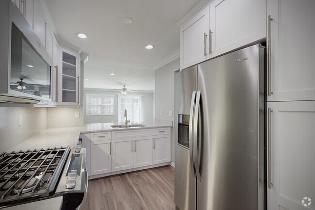
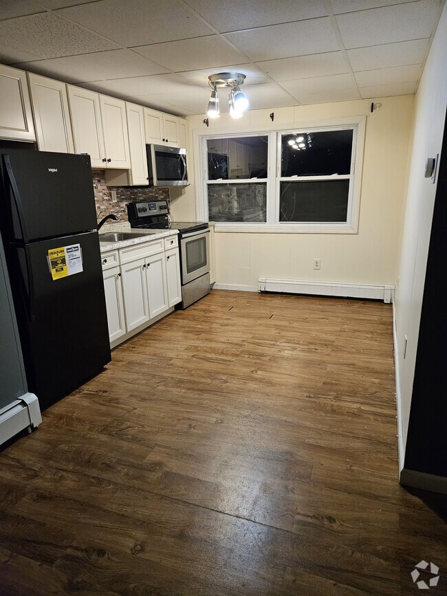
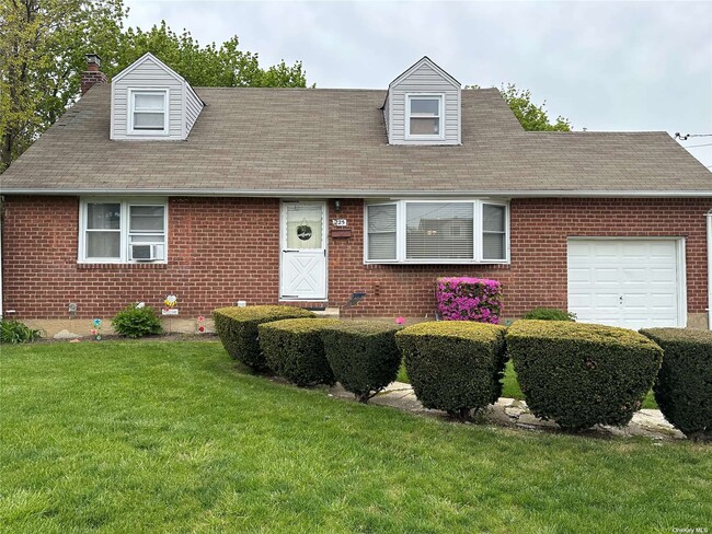
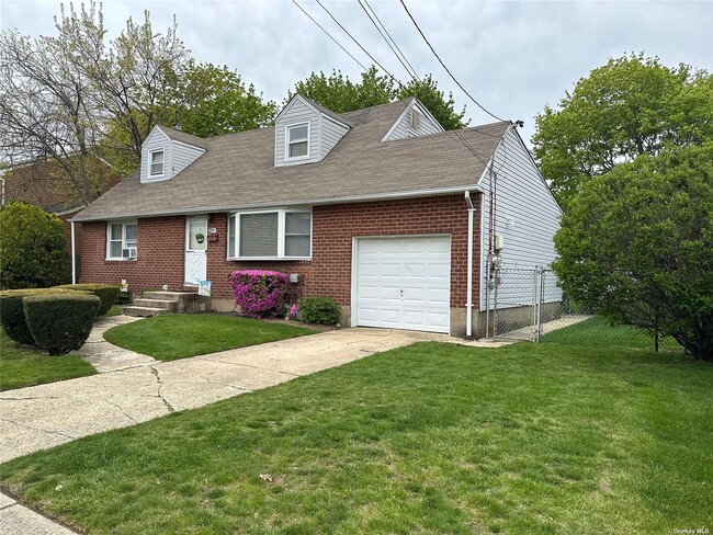
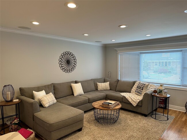
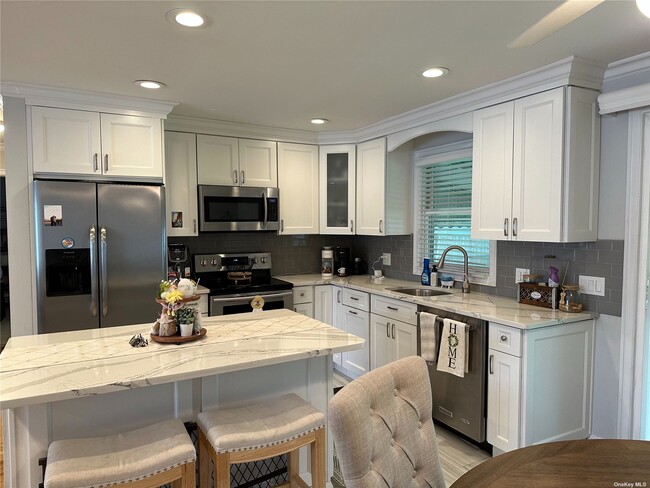
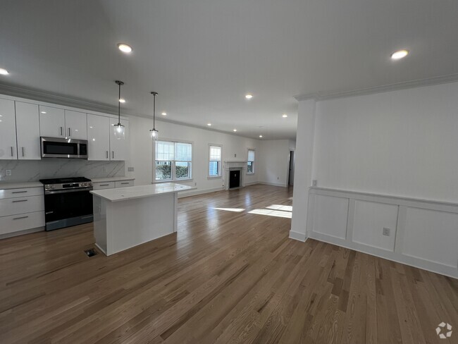
Pack Your Bags and Move Right In!! 225 N. Cedar Street Features A Stunning, Spacious, Open Floor Plan with Updates Galore! Huge Living Room, Gorgeous Eat In Kitchen with Stainless Steel Appliances, Quartz Countertops, Dishwasher & Kitchen Island, A Chef's Dream! The Dining Area Leads To Sliding Glass Doors, Covered Outdoor Patio and Beautiful Yard. Washer/Dryer, Driveway Parking, Garage & In-Ground Sprinklers. Utilities Included + Lawn Care & Snow Removal. Close to All!!
225 N Cedar St is a townhome located in Nassau County and the 11758 ZIP Code. This area is served by the Plainedge Union Free attendance zone.
 This Property
 Available Property
Located on Long Island between Seaford and Amityville, about 35 miles outside of New York City, Massapequa is a coastal town off Oyster Bay popular among families. Massapequa residents delight in a tranquil atmosphere while maintaining close access to the vibrancy of a world-class city.
Renting in Massapequa allows for a variety of outdoor activities—whether you take to Massapequa Preserve for biking, walking, and fishing or head south on Wantagh State Parkway to enjoy the beaches on Jones Beach Island.
Multiple Long Island Rail Road stations make for easy travels to and from Massapequa including to hubs such as John F. Kennedy International Airport and Penn Station.
Learn more about living in Massapequa| Colleges & Universities | Distance | ||
|---|---|---|---|
| Colleges & Universities | Distance | ||
| Drive: | 13 min | 5.0 mi | |
| Drive: | 15 min | 10.4 mi | |
| Drive: | 16 min | 10.5 mi | |
| Drive: | 17 min | 11.6 mi |
Transportation options available in Massapequa include Far Rockaway-Mott Avenue, located 19.5 miles from 225 N Cedar St. 225 N Cedar St is near John F Kennedy International, located 22.2 miles or 32 minutes away, and Long Island MacArthur, located 24.1 miles or 33 minutes away.
| Transit / Subway | Distance | ||
|---|---|---|---|
| Transit / Subway | Distance | ||
|
|
Drive: | 30 min | 19.5 mi |
|
|
Drive: | 31 min | 19.9 mi |
|
|
Drive: | 31 min | 20.0 mi |
|
|
Drive: | 32 min | 22.3 mi |
|
|
Drive: | 33 min | 22.3 mi |
| Commuter Rail | Distance | ||
|---|---|---|---|
| Commuter Rail | Distance | ||
|
|
Drive: | 6 min | 2.3 mi |
|
|
Drive: | 6 min | 2.6 mi |
|
|
Drive: | 6 min | 3.3 mi |
|
|
Drive: | 7 min | 3.5 mi |
|
|
Drive: | 7 min | 4.5 mi |
| Airports | Distance | ||
|---|---|---|---|
| Airports | Distance | ||
|
John F Kennedy International
|
Drive: | 32 min | 22.2 mi |
|
Long Island MacArthur
|
Drive: | 33 min | 24.1 mi |
Time and distance from 225 N Cedar St.
| Shopping Centers | Distance | ||
|---|---|---|---|
| Shopping Centers | Distance | ||
| Drive: | 4 min | 1.7 mi | |
| Drive: | 4 min | 1.8 mi | |
| Drive: | 4 min | 2.0 mi |
| Parks and Recreation | Distance | ||
|---|---|---|---|
| Parks and Recreation | Distance | ||
|
Bethpage State Park
|
Drive: | 6 min | 3.0 mi |
|
Tackapausha Museum & Preserve
|
Drive: | 7 min | 3.7 mi |
|
Belmont Lake State Park
|
Drive: | 13 min | 8.7 mi |
|
Hofstra University Arboretum
|
Drive: | 14 min | 10.4 mi |
|
Long Island Children's Museum
|
Drive: | 17 min | 11.2 mi |
| Hospitals | Distance | ||
|---|---|---|---|
| Hospitals | Distance | ||
| Drive: | 6 min | 3.2 mi | |
| Drive: | 10 min | 6.2 mi | |
| Drive: | 10 min | 6.7 mi |
| Military Bases | Distance | ||
|---|---|---|---|
| Military Bases | Distance | ||
| Drive: | 35 min | 24.8 mi | |
| Drive: | 47 min | 26.8 mi | |
| Drive: | 53 min | 32.4 mi |

What Are Walk Score®, Transit Score®, and Bike Score® Ratings?
Walk Score® measures the walkability of any address. Transit Score® measures access to public transit. Bike Score® measures the bikeability of any address.
What is a Sound Score Rating?
A Sound Score Rating aggregates noise caused by vehicle traffic, airplane traffic and local sources
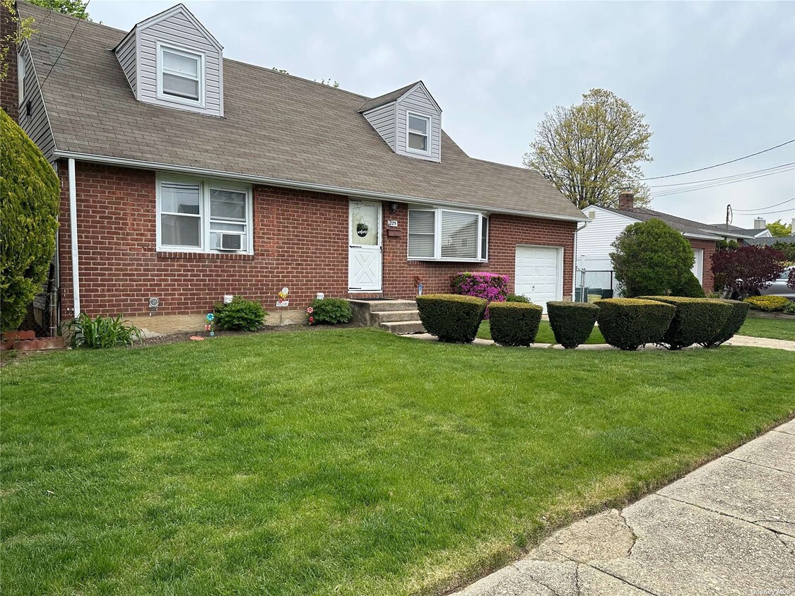
225 N Cedar St
Massapequa, NY 11758