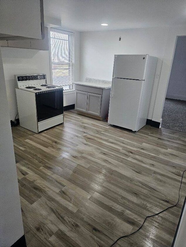
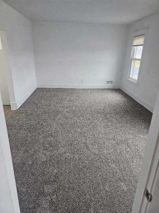
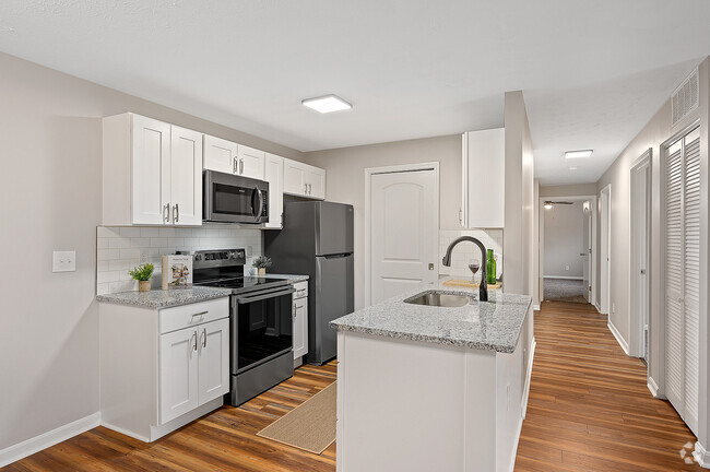
2263-2265 Pleasant Ave Unit 2265 Pleasant Ave #2
Hamilton, OH 45015
-
Bedrooms
2
-
Bathrooms
1
-
Square Feet
1,020 sq ft
-
Available
Available Now

Contact
- Listed by 2263 PLEASANT AVE LLC | 2263 PLEASANT AVE LLC
- Phone Number
- Contact
Hamilton is a suburban city in southeastern Ohio, about thirty miles north of Cincinnati. The community is known for wearing its colorful history on its sleeve: the Lindenwald neighborhood is designated as a National Historic District, and beautiful examples of vintage architecture are on display all over the city, from the numerous Victorian homes to the magnificent Butler County Courthouse.
While the Downtown district is a great place to enjoy breakfast at a cozy café or have a locally-brewed pint while taking in views of the river, the city also features a large cluster of shopping centers on the northwest side of town, offering everything from grocers to hardware stores to the local multiplex movie theater. The diverse rental market features a broad range of apartments, condos, and houses, with options to suit any taste or budget.
Learn more about living in Hamilton| Colleges & Universities | Distance | ||
|---|---|---|---|
| Colleges & Universities | Distance | ||
| Walk: | 14 min | 0.7 mi | |
| Drive: | 28 min | 15.0 mi | |
| Drive: | 28 min | 15.3 mi | |
| Drive: | 32 min | 20.5 mi |
Transportation options available in Hamilton include Findlay Market-Race Station, Race & Elder, located 20.0 miles from 2263-2265 Pleasant Ave Unit 2265 Pleasant Ave #2. 2263-2265 Pleasant Ave Unit 2265 Pleasant Ave #2 is near Cincinnati/Northern Kentucky International, located 43.3 miles or 60 minutes away.
| Transit / Subway | Distance | ||
|---|---|---|---|
| Transit / Subway | Distance | ||
| Drive: | 37 min | 20.0 mi | |
| Drive: | 37 min | 20.1 mi | |
| Drive: | 37 min | 24.6 mi | |
| Drive: | 38 min | 24.6 mi | |
| Drive: | 38 min | 24.7 mi |
| Commuter Rail | Distance | ||
|---|---|---|---|
| Commuter Rail | Distance | ||
|
|
Drive: | 36 min | 24.4 mi |
| Airports | Distance | ||
|---|---|---|---|
| Airports | Distance | ||
|
Cincinnati/Northern Kentucky International
|
Drive: | 60 min | 43.3 mi |
Time and distance from 2263-2265 Pleasant Ave Unit 2265 Pleasant Ave #2.
| Shopping Centers | Distance | ||
|---|---|---|---|
| Shopping Centers | Distance | ||
| Walk: | 14 min | 0.7 mi | |
| Drive: | 2 min | 1.1 mi | |
| Drive: | 3 min | 1.4 mi |
| Parks and Recreation | Distance | ||
|---|---|---|---|
| Parks and Recreation | Distance | ||
|
Triple Creek Park
|
Drive: | 12 min | 6.9 mi |
|
Richardson Forest Preserve
|
Drive: | 16 min | 8.1 mi |
|
Winton Woods Park
|
Drive: | 19 min | 9.8 mi |
|
Maud Hughes Incline Park
|
Drive: | 13 min | 9.8 mi |
|
Wilhelmina Park
|
Drive: | 19 min | 12.8 mi |
| Hospitals | Distance | ||
|---|---|---|---|
| Hospitals | Distance | ||
| Drive: | 7 min | 3.4 mi | |
| Drive: | 12 min | 6.3 mi | |
| Drive: | 15 min | 7.8 mi |
| Military Bases | Distance | ||
|---|---|---|---|
| Military Bases | Distance | ||
| Drive: | 57 min | 40.9 mi | |
| Drive: | 63 min | 45.9 mi | |
| Drive: | 65 min | 49.2 mi |
You May Also Like
Similar Rentals Nearby
What Are Walk Score®, Transit Score®, and Bike Score® Ratings?
Walk Score® measures the walkability of any address. Transit Score® measures access to public transit. Bike Score® measures the bikeability of any address.
What is a Sound Score Rating?
A Sound Score Rating aggregates noise caused by vehicle traffic, airplane traffic and local sources
