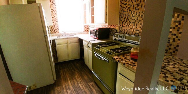
$1,000 / Month
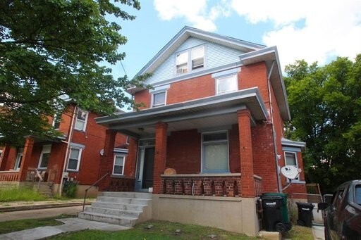
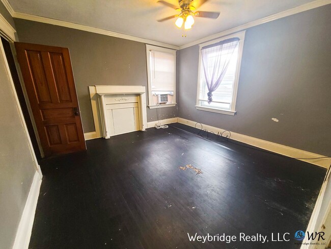
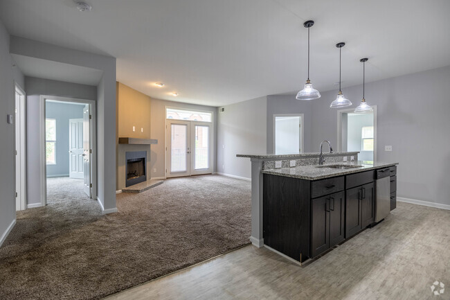
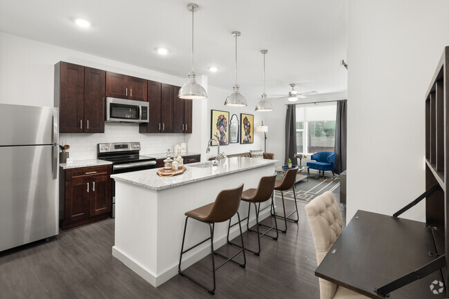
2266 Harrison Ave Unit # 2
Cincinnati, OH 45211
Today
Favorites
513-206-8650
-
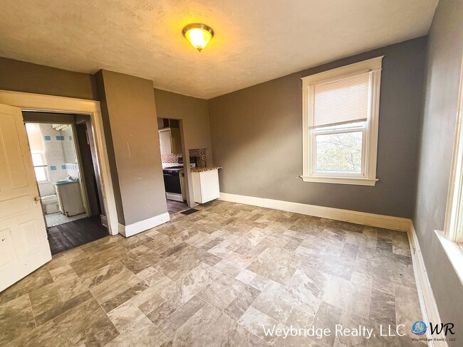
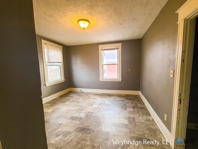
Bedrooms
2
-
Bathrooms
1
-
Square Feet
1,000 sq ft
-
Available
Available Now
2266 Harrison Ave Unit # 2

Favorites
Contact
- Listed by Weybridge Realty LLC | Weybridge Realty LLC
- Phone Number
- Contact
Location
Get Directions
Situated about five miles northwest of Downtown Cincinnati, Westwood is the largest neighborhood in the city. Residents flock to Westwood for its many affordable historic homes and modern apartments available for rent in addition to its close proximity to I-74, I-75, and all that Downtown Cincinnati has to offer.
While Westwood is a predominantly residential neighborhood, it is also home to a slew of convenient stores and restaurants. Shopping opportunities abound in Westwood, with plenty of national retailers in Western Hills Plaza and local shops in the growing Town Hall District. Numerous neighborhood parks provide ample space to enjoy the outdoors in town as well as the sprawling 1,400-acre Mount Airy Forest, which is partially located in Westwood.
Learn more about living in Westwood
Education
| Colleges & Universities | Distance | ||
|---|---|---|---|
| Colleges & Universities | Distance | ||
| Drive: | 11 min | 4.6 mi | |
| Drive: | 12 min | 4.9 mi | |
| Drive: | 12 min | 5.1 mi | |
| Drive: | 15 min | 6.6 mi |
2266 Harrison Ave Unit # 2 is within 12 minutes or 4.9 miles from Cincinnati State. It is also near University of Cincinnati and Univ. of Cincinnati, Medical.
Transportation options available in Cincinnati include Brewery District Station, Elm & Henry, located 3.6 miles from 2266 Harrison Ave Unit # 2. 2266 Harrison Ave Unit # 2 is near Cincinnati/Northern Kentucky International, located 17.9 miles or 33 minutes away.
| Transit / Subway | Distance | ||
|---|---|---|---|
| Transit / Subway | Distance | ||
| Drive: | 8 min | 3.6 mi | |
| Drive: | 8 min | 3.8 mi | |
| Drive: | 9 min | 3.8 mi | |
| Drive: | 9 min | 3.9 mi | |
| Drive: | 9 min | 4.1 mi |
| Commuter Rail | Distance | ||
|---|---|---|---|
| Commuter Rail | Distance | ||
|
|
Drive: | 8 min | 3.8 mi |
| Airports | Distance | ||
|---|---|---|---|
| Airports | Distance | ||
|
Cincinnati/Northern Kentucky International
|
Drive: | 33 min | 17.9 mi |
Time and distance from 2266 Harrison Ave Unit # 2.
| Shopping Centers | Distance | ||
|---|---|---|---|
| Shopping Centers | Distance | ||
| Drive: | 4 min | 1.8 mi | |
| Drive: | 4 min | 2.0 mi | |
| Drive: | 6 min | 2.5 mi |
2266 Harrison Ave Unit # 2 has 3 shopping centers within 2.5 miles, which is about a 6-minute drive. The miles and minutes will be for the farthest away property.
| Parks and Recreation | Distance | ||
|---|---|---|---|
| Parks and Recreation | Distance | ||
|
Imago Earth Center
|
Drive: | 9 min | 3.4 mi |
|
Wilson Commons
|
Drive: | 9 min | 3.8 mi |
|
Museum of Natural History and Science
|
Drive: | 8 min | 3.8 mi |
|
Cincinnati History Museum
|
Drive: | 8 min | 3.8 mi |
|
Mt. Airy Forest
|
Drive: | 10 min | 4.0 mi |
2266 Harrison Ave Unit # 2 has 5 parks within 4.0 miles, including Imago Earth Center, Wilson Commons, and Mt. Airy Forest.
| Hospitals | Distance | ||
|---|---|---|---|
| Hospitals | Distance | ||
| Drive: | 11 min | 4.6 mi | |
| Drive: | 10 min | 4.6 mi | |
| Drive: | 12 min | 4.6 mi |
2266 Harrison Ave Unit # 2 has 3 hospitals within 4.6 miles, the nearest is Christ Hospital which is 4.6 miles away and a 11 minute drive.
| Military Bases | Distance | ||
|---|---|---|---|
| Military Bases | Distance | ||
| Drive: | 74 min | 55.8 mi | |
| Drive: | 80 min | 60.9 mi | |
| Drive: | 82 min | 64.1 mi |
2266 Harrison Ave Unit # 2 has 3 military bases within 64.1 miles, the nearest is Gentile Air Force Station which is 55.8 miles away and a 74 minute drive.
You May Also Like
Similar Rentals Nearby


What Are Walk Score®, Transit Score®, and Bike Score® Ratings?
Walk Score® measures the walkability of any address. Transit Score® measures access to public transit. Bike Score® measures the bikeability of any address.
What is a Sound Score Rating?
A Sound Score Rating aggregates noise caused by vehicle traffic, airplane traffic and local sources

2266 Harrison Ave
Cincinnati, OH 45211