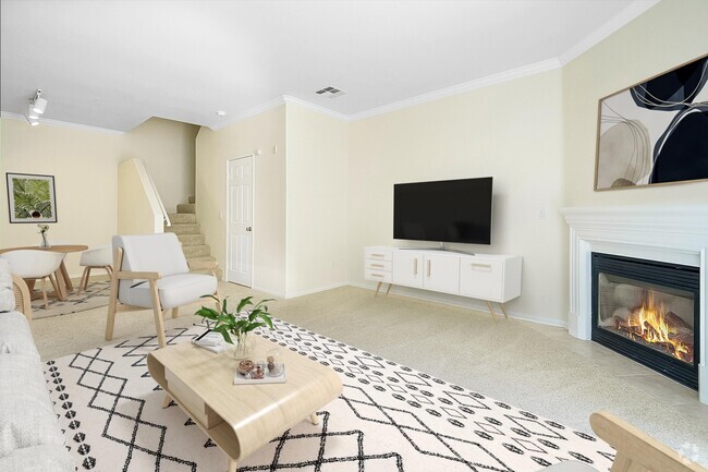
$2,695 / Month
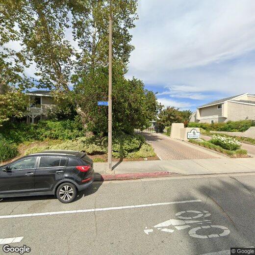
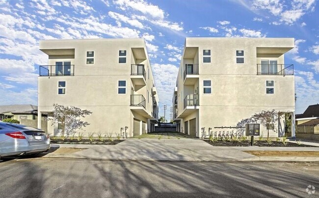
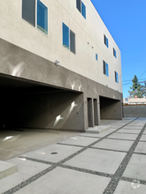
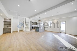
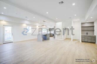
23122 Yvette Ln
Santa Clarita, CA 91355
2 Weeks Ago
Favorites
23122 Yvette Ln

Favorites
Check Back Soon for Upcoming Availability
| Beds | Baths | Average SF |
|---|---|---|
| 3 Bedrooms 3 Bedrooms 3 Br | 2 Baths 2 Baths 2 Ba | — |
Property Address:
23122 Yvette Ln,
Santa Clarita,
CA
91355
Cut by the Santa Clara River, west of the San Gabriel Mountains, and east of Castaic Lake State Park is Santa Clarita. About 35 miles northwest of Downtown Los Angeles, Santa Clarita is widely known as the home of Six Flags Magic Mountain. However, Santa Clarita is much more than just an amusement park destination. It is supported by a strong residential community and unique environment.
Drawing over 10,000 annual visitors, Santa Clarita holds a Cowboy Festival every spring to celebrate the history and culture of the Old West with food, music, and poetry performances. In juxtaposition, the Hart of the West Pow Wow serves as a celebration of Native American Indian culture and history. Summer brings free concerts in the park, fall finds the International Family Film Festival, and winter lights up with a Lighted Boat Parade at Castaic Lagoon.
In addition, Santa Clarita maintains parks and trails for a variety of outdoor activities.
Learn more about living in Santa Clarita
Education
| Colleges & Universities | Distance | ||
|---|---|---|---|
| Colleges & Universities | Distance | ||
| Drive: | 9 min | 3.5 mi | |
| Drive: | 19 min | 12.1 mi | |
| Drive: | 25 min | 13.4 mi | |
| Drive: | 36 min | 25.4 mi |
23122 Yvette Ln is within 9 minutes or 3.5 miles from College of the Canyons. It is also near Mission College and Cal State Northridge.
Schools


Public Elementary School
Grades K-6
Nearby
Public Elementary School
Grades K-6
536 Students
Attendance Zone
Public Middle School
Grades 7-8
888 Students
Attendance Zone
Public High School
Grades 9-12
2,034 Students
Attendance Zone
Private Elementary School
Grades PK-1
Nearby
Private Elementary & Middle School
Grades K-8
270 Students
Nearby
Private Middle & High School
Grades 7-12
7 Students
Nearby
School data provided by
 The GreatSchools Rating helps parents compare schools within a state based on a variety of school quality indicators and provides a helpful picture of how effectively each school serves all of its students. Ratings are on a scale of 1 (below average) to 10 (above average) and can include test scores, college readiness, academic progress, advanced courses, equity, discipline and attendance data. We also advise parents to visit schools, consider other information on school performance and programs, and consider family needs as part of the school selection process.
View GreatSchools Rating Methodology
View GreatSchools Rating Methodology
Transportation options available in Santa Clarita include North Hollywood Station, located 20.0 miles from 23122 Yvette Ln. 23122 Yvette Ln is near Bob Hope, located 19.0 miles or 28 minutes away, and Los Angeles International, located 36.1 miles or 49 minutes away.
| Transit / Subway | Distance | ||
|---|---|---|---|
| Transit / Subway | Distance | ||
|
|
Drive: | 27 min | 20.0 mi |
|
|
Drive: | 30 min | 22.3 mi |
|
|
Drive: | 35 min | 25.2 mi |
|
|
Drive: | 34 min | 25.4 mi |
|
|
Drive: | 35 min | 26.2 mi |
| Commuter Rail | Distance | ||
|---|---|---|---|
| Commuter Rail | Distance | ||
|
|
Drive: | 5 min | 2.1 mi |
|
|
Drive: | 9 min | 4.5 mi |
|
|
Drive: | 14 min | 7.4 mi |
|
|
Drive: | 19 min | 11.1 mi |
|
|
Drive: | 30 min | 17.0 mi |
| Airports | Distance | ||
|---|---|---|---|
| Airports | Distance | ||
|
Bob Hope
|
Drive: | 28 min | 19.0 mi |
|
Los Angeles International
|
Drive: | 49 min | 36.1 mi |
Time and distance from 23122 Yvette Ln.
| Shopping Centers | Distance | ||
|---|---|---|---|
| Shopping Centers | Distance | ||
| Walk: | 18 min | 1.0 mi | |
| Walk: | 19 min | 1.0 mi | |
| Drive: | 2 min | 1.1 mi |
23122 Yvette Ln has 3 shopping centers within 1.1 miles, which is about a 2-minute walk. The miles and minutes will be for the farthest away property.
| Parks and Recreation | Distance | ||
|---|---|---|---|
| Parks and Recreation | Distance | ||
|
William S. Hart Regional Park
|
Drive: | 5 min | 2.1 mi |
|
Ed Davis Park in Towsley Canyon
|
Drive: | 8 min | 4.0 mi |
|
East and Rice Canyon
|
Drive: | 10 min | 5.5 mi |
|
Placerita Canyon Nature Center
|
Drive: | 11 min | 5.9 mi |
|
Placerita Canyon State Park
|
Drive: | 13 min | 7.3 mi |
23122 Yvette Ln has 5 parks within 7.3 miles, including William S. Hart Regional Park, East and Rice Canyon, and Ed Davis Park in Towsley Canyon.
| Hospitals | Distance | ||
|---|---|---|---|
| Hospitals | Distance | ||
| Walk: | 18 min | 1.0 mi | |
| Drive: | 18 min | 10.4 mi | |
| Drive: | 16 min | 10.8 mi |
23122 Yvette Ln has 3 hospitals within 10.8 miles, the nearest is Henry Mayo Newhall Hospital which is 1.0 mile away and a 18 minute walk.
| Military Bases | Distance | ||
|---|---|---|---|
| Military Bases | Distance | ||
| Drive: | 49 min | 38.7 mi |
23122 Yvette Ln is 38.7 miles and a 49 minute drive from Los Angeles Air Force Base.
You May Also Like
Similar Rentals Nearby
What Are Walk Score®, Transit Score®, and Bike Score® Ratings?
Walk Score® measures the walkability of any address. Transit Score® measures access to public transit. Bike Score® measures the bikeability of any address.
What is a Sound Score Rating?
A Sound Score Rating aggregates noise caused by vehicle traffic, airplane traffic and local sources

23122 Yvette Ln
Santa Clarita, CA 91355