-
Monthly Rent
$4,800
-
Bedrooms
5 bd
-
Bathrooms
5 ba
-
Square Feet
1,454 sq ft
Details

About This Property
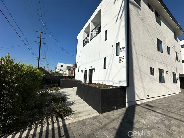
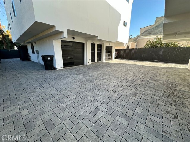
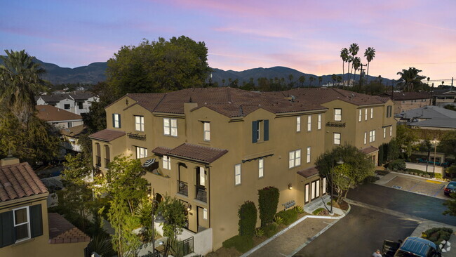
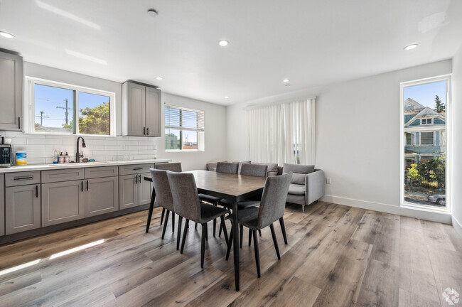
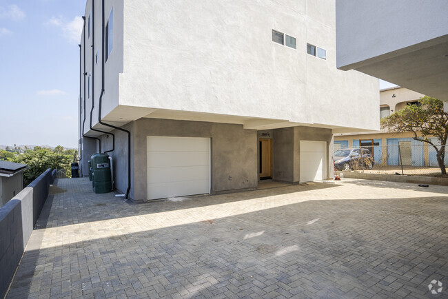
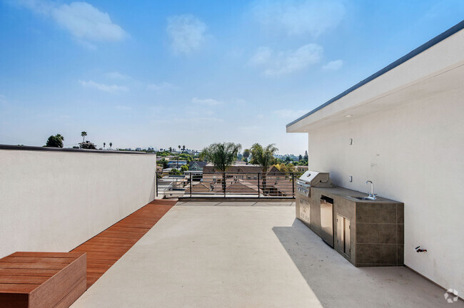
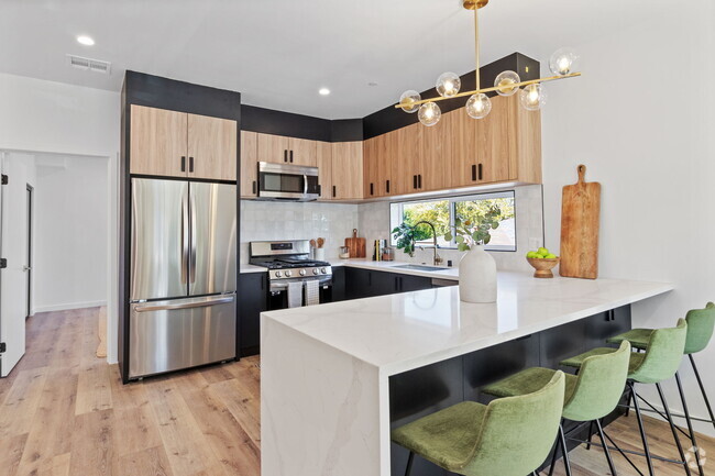
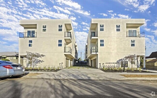
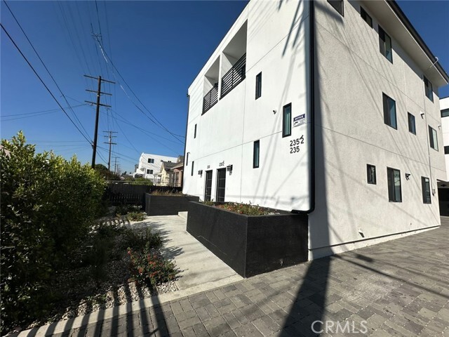
2 Units for Rent! Both Units 5bed/5Bath each for $4,800 each Introducing a splendid opportunity for comfortable urban living in Los Angeles! This freshly constructed multi-family home offers an impressive array of amenities and the space you've been dreaming of. Each unit features five well-appointed bedrooms, including expansive primary bedrooms, and five bathrooms, ensuring privacy and convenience for residents. Transport is a breeze with the Cal State LA Station and Alcazar & Ricardo Street bus stop just a stone's throw away, making your commute smoother than silk. Education is covered too, with Bravo Medical Magnet School nearby, ensuring your youngsters have access to quality learning right in the neighborhood. For your shopping needs, Northgate Market is within a short drive, perfect for picking up groceries and essentials. When it's time to unwind, Lincoln Park offers lush green spaces ideal for picnicking, jogging, or simply soaking up the California sun. Whether you're a family looking for ample living space or someone keen on sharing a stylish habitat with friends, this property promises to impress. Enjoy the benefits of living in a vibrant area, peppered with convenience and connectivity, all wrapped up in the modern comfort of a newly built residence. Welcome home to a place where every day feels just a little bit brighter!
235 E 29th St is a townhome located in Los Angeles County and the 90011 ZIP Code. This area is served by the Los Angeles Unified attendance zone.
Contact
Townhome Features
- Air Conditioning
- Furnished
Fees and Policies
The fees below are based on community-supplied data and may exclude additional fees and utilities.
Details
Property Information
-
Furnished Units Available
 This Property
 Available Property
- Air Conditioning
- Furnished
Southeast Los Angeles is directly south of the Fashion District and east of the University of Southern California (USC). This large neighborhood is minutes from downtown Los Angeles, Hollywood, and Beverly Hills, with easy access to the 110 Freeway. This great location places you near sunny beaches, nature trails, and a bevy of leading employers. Students can access both USC and California State University Long Beach from their Southeast LA apartment.
This densely populated, diverse neighborhood features everything from food trucks and corner markets to wide sidewalks and residential areas filled with bungalows, ranch, and Spanish Colonial architecture. Southeast LA features palm trees and mountain views, tampered with gritty undertones to give it a cool, funky vibe.
As for outdoor fun, take your pick between Catalina Island, Venus Beach, or the Santa Monica Pier. Nearby, you’ll find more sunny beaches like White Point, Cabrillo, and Long Beach.
Learn more about living in Southeast Los Angeles| Colleges & Universities | Distance | ||
|---|---|---|---|
| Colleges & Universities | Distance | ||
| Drive: | 3 min | 1.2 mi | |
| Drive: | 3 min | 1.2 mi | |
| Drive: | 4 min | 1.5 mi | |
| Drive: | 4 min | 2.2 mi |
Transportation options available in Los Angeles include Jefferson/Usc, located 0.8 mile from 235 E 29th St. 235 E 29th St is near Los Angeles International, located 12.4 miles or 22 minutes away, and Bob Hope, located 16.4 miles or 28 minutes away.
| Transit / Subway | Distance | ||
|---|---|---|---|
| Transit / Subway | Distance | ||
|
|
Walk: | 16 min | 0.8 mi |
|
|
Drive: | 2 min | 1.1 mi |
|
|
Drive: | 2 min | 1.2 mi |
|
|
Drive: | 3 min | 1.4 mi |
|
|
Drive: | 4 min | 1.8 mi |
| Commuter Rail | Distance | ||
|---|---|---|---|
| Commuter Rail | Distance | ||
|
|
Drive: | 7 min | 3.3 mi |
|
|
Drive: | 9 min | 3.6 mi |
| Drive: | 10 min | 7.3 mi | |
|
|
Drive: | 15 min | 8.8 mi |
|
|
Drive: | 16 min | 10.3 mi |
| Airports | Distance | ||
|---|---|---|---|
| Airports | Distance | ||
|
Los Angeles International
|
Drive: | 22 min | 12.4 mi |
|
Bob Hope
|
Drive: | 28 min | 16.4 mi |
Time and distance from 235 E 29th St.
| Shopping Centers | Distance | ||
|---|---|---|---|
| Shopping Centers | Distance | ||
| Walk: | 6 min | 0.3 mi | |
| Walk: | 17 min | 0.9 mi | |
| Walk: | 18 min | 1.0 mi |
| Parks and Recreation | Distance | ||
|---|---|---|---|
| Parks and Recreation | Distance | ||
|
California Science Center
|
Drive: | 4 min | 1.6 mi |
|
Natural History Museum of LA County
|
Drive: | 4 min | 1.7 mi |
|
Exposition Park Rose Garden
|
Drive: | 4 min | 1.8 mi |
|
Augustus Hawkins Natural Park
|
Drive: | 7 min | 3.1 mi |
|
MacArthur Park Lake
|
Drive: | 6 min | 3.6 mi |
| Hospitals | Distance | ||
|---|---|---|---|
| Hospitals | Distance | ||
| Drive: | 3 min | 1.4 mi | |
| Drive: | 6 min | 3.0 mi | |
| Drive: | 7 min | 3.9 mi |
| Military Bases | Distance | ||
|---|---|---|---|
| Military Bases | Distance | ||
| Drive: | 19 min | 13.9 mi |
You May Also Like
Similar Rentals Nearby
-
-
-
-
$5,3024 Beds, 4 Baths, 800 sq ftTownhome for Rent
-
$4,5005 Beds, 4 Baths, 2,200 sq ftTownhome for Rent
-
$6,2954 Beds, 4.5 Baths, 2,488 sq ftTownhome for Rent
-
$4,9004 Beds, 4.5 Baths, 1,800 sq ftTownhome for Rent
-
$4,9504 Beds, 3 Baths, 2,139 sq ftTownhome for Rent
-
-
$1,1007 Beds, 3.5 BathsTownhome for Rent
What Are Walk Score®, Transit Score®, and Bike Score® Ratings?
Walk Score® measures the walkability of any address. Transit Score® measures access to public transit. Bike Score® measures the bikeability of any address.
What is a Sound Score Rating?
A Sound Score Rating aggregates noise caused by vehicle traffic, airplane traffic and local sources
