
$2,025 / Month
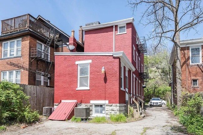
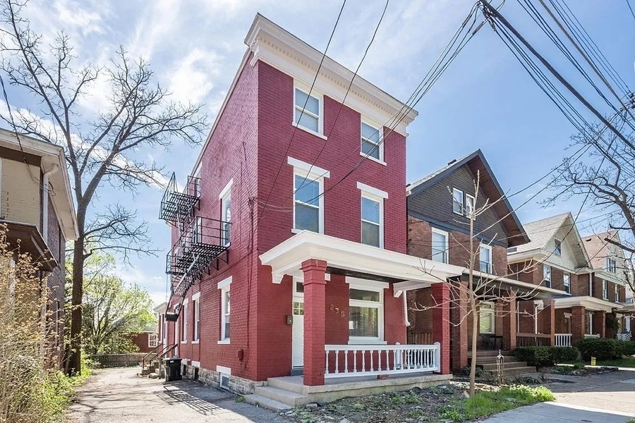
235 Emming St Unit #2
Cincinnati, OH 45219
Today
Favorites
513-650-6785
-
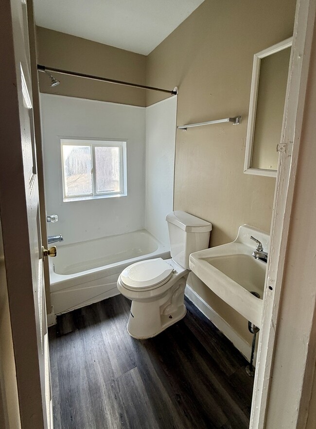
Bedrooms
3
-
Bathrooms
2
-
Square Feet
--
-
Available
Available Now
235 Emming St Unit #2

Favorites
About This Home
Available Now
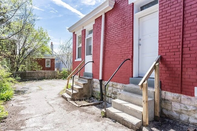
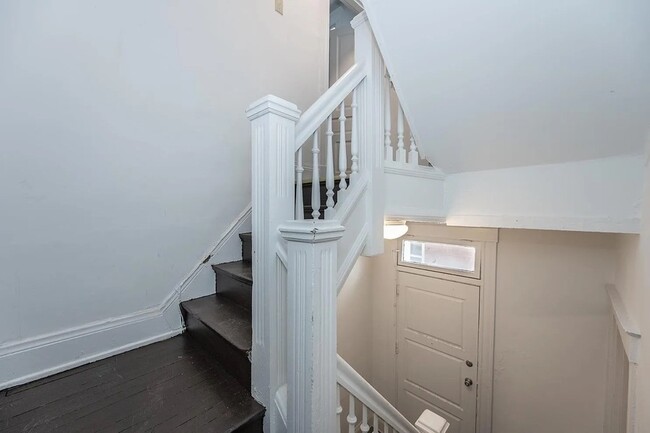
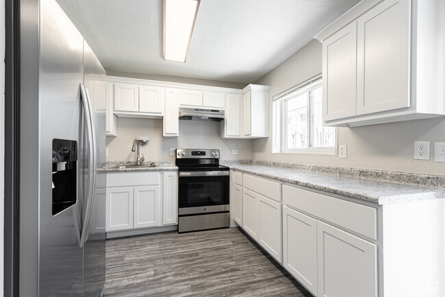
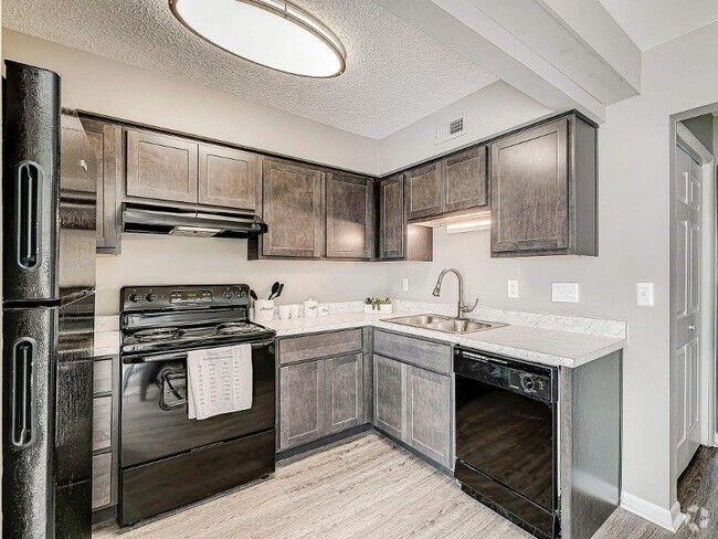
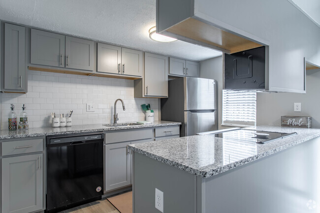
---- SCHEDULE A SHOWING ONLINE AT: ---- Looking for a spacious student rental near the University of Cincinnati? This updated 3-bedroom, 2-bath space with a small bonus room is perfect for students looking for convenience and a great location. All 3-bedrooms currently availabile either for a unit lease at $2025 per month or individual BR lease at $700 per month. ?? Features You'll Love ?? ? Layout: 3 bedrooms + bonus room—great for studying or extra storage ? Kitchen: Newer electric stove/oven, refrigerator, and dishwasher ? Comfort: central AC/heating (installed in 2022) ? Private Off-Street Parking: No more hunting for a spot! ? Utilities Included: Water & trash paid by owner ? Washer & Dryer: In-unit laundry = no quarters needed! ?? Lease Terms: ?? First & last month’s rent + security deposit due at signing ?? Sublease allowed
235 Emming St is an apartment community located in Hamilton County and the 45219 ZIP Code.
* Price shown is base rent and may not include non-optional fees and utilities.
Price, availability, fees, and any applicable rent special are subject to change without notice.
* Square footage definitions vary. Displayed square footage is approximate.
Features
- Washer/Dryer
Contact
- Listed by Real
- Phone Number
- Contact
Location
Get Directions
Amenities
- Washer/Dryer
In Clifton there’s plenty to do and see. The rolling hills, lush parks and green spaces, hip shopping, and affordable apartments create a vibrancy in Clifton that can’t be ignored.
In addition to its active art scene, the neighborhood is encompassing of Mount Storm Park, Edgewood Grove Park, and the Cincinnati State Technical and Community College. Locals enjoy the direct access to Interstate 75, making commutes in and around the city a breeze.
Clifton is just north of the 90-acre Burnet Woods Park and the University of Cincinnati campus. When you have a craving for something sweet or savory, head on over to the Clifton Gaslight District for every kind of cuisine imaginable. Clifton sits atop a hill overlooking the Northside, and Ludlow Avenue has been dubbed Cincinnati’s first “Main Street.
Learn more about living in Clifton
Education
| Colleges & Universities | Distance | ||
|---|---|---|---|
| Colleges & Universities | Distance | ||
| Drive: | 4 min | 1.6 mi | |
| Drive: | 5 min | 1.9 mi | |
| Drive: | 9 min | 3.3 mi | |
| Drive: | 11 min | 4.0 mi |
235 Emming St Unit #2 is within 4 minutes or 1.6 miles from University of Cincinnati. It is also near Univ. of Cincinnati, Medical and Cincinnati State.
Transportation options available in Cincinnati include Brewery District Station, Elm & Henry, located 0.6 mile from 235 Emming St Unit #2. 235 Emming St Unit #2 is near Cincinnati/Northern Kentucky International, located 15.8 miles or 31 minutes away.
| Transit / Subway | Distance | ||
|---|---|---|---|
| Transit / Subway | Distance | ||
| Walk: | 11 min | 0.6 mi | |
| Walk: | 12 min | 0.7 mi | |
| Walk: | 14 min | 0.8 mi | |
| Walk: | 16 min | 0.9 mi | |
| Drive: | 3 min | 1.2 mi |
| Commuter Rail | Distance | ||
|---|---|---|---|
| Commuter Rail | Distance | ||
|
|
Drive: | 7 min | 2.1 mi |
| Airports | Distance | ||
|---|---|---|---|
| Airports | Distance | ||
|
Cincinnati/Northern Kentucky International
|
Drive: | 31 min | 15.8 mi |
Time and distance from 235 Emming St Unit #2.
| Shopping Centers | Distance | ||
|---|---|---|---|
| Shopping Centers | Distance | ||
| Drive: | 4 min | 1.4 mi | |
| Drive: | 6 min | 1.8 mi | |
| Drive: | 6 min | 2.3 mi |
235 Emming St Unit #2 has 3 shopping centers within 2.3 miles, which is about a 6-minute drive. The miles and minutes will be for the farthest away property.
| Parks and Recreation | Distance | ||
|---|---|---|---|
| Parks and Recreation | Distance | ||
|
William H. Taft National Historic Site
|
Drive: | 4 min | 1.3 mi |
|
Trailside Nature Center
|
Drive: | 4 min | 1.5 mi |
|
Duke Energy Children's Museum
|
Drive: | 7 min | 2.1 mi |
|
OMNIMAX Theater
|
Drive: | 7 min | 2.1 mi |
|
Museum of Natural History and Science
|
Drive: | 7 min | 2.1 mi |
235 Emming St Unit #2 has 5 parks within 2.1 miles, including William H. Taft National Historic Site, Trailside Nature Center, and Duke Energy Children's Museum.
| Hospitals | Distance | ||
|---|---|---|---|
| Hospitals | Distance | ||
| Drive: | 4 min | 1.4 mi | |
| Drive: | 4 min | 1.6 mi | |
| Drive: | 5 min | 1.9 mi |
235 Emming St Unit #2 has 3 hospitals within 1.9 miles, the nearest is Christ Hospital which is 1.4 miles away and a 4 minute drive.
| Military Bases | Distance | ||
|---|---|---|---|
| Military Bases | Distance | ||
| Drive: | 71 min | 52.7 mi | |
| Drive: | 77 min | 57.8 mi | |
| Drive: | 80 min | 61.1 mi |
235 Emming St Unit #2 has 3 military bases within 61.1 miles, the nearest is Gentile Air Force Station which is 52.7 miles away and a 71 minute drive.
You May Also Like
Similar Rentals Nearby


What Are Walk Score®, Transit Score®, and Bike Score® Ratings?
Walk Score® measures the walkability of any address. Transit Score® measures access to public transit. Bike Score® measures the bikeability of any address.
What is a Sound Score Rating?
A Sound Score Rating aggregates noise caused by vehicle traffic, airplane traffic and local sources
235 Emming St
Cincinnati, OH 45219