$1,550 / Month
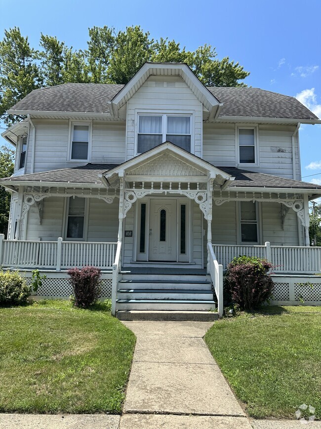
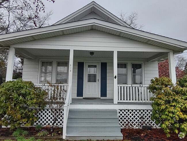
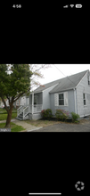
24 State St
Elmer, NJ 08318
2 Weeks Ago
Favorites
24 State St

Favorites
Check Back Soon for Upcoming Availability
| Beds | Baths | Average SF |
|---|---|---|
| 2 Bedrooms 2 Bedrooms 2 Br | 1 Bath 1 Bath 1 Ba | 3,000 SF |
About This Property
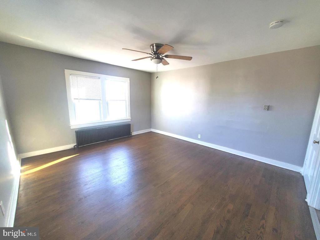
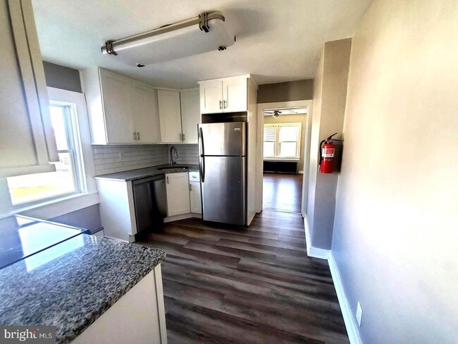
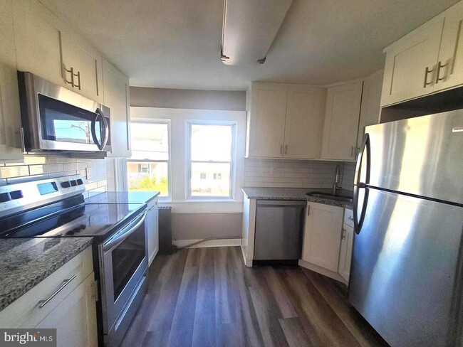
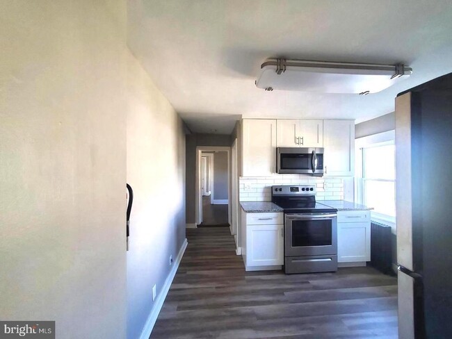
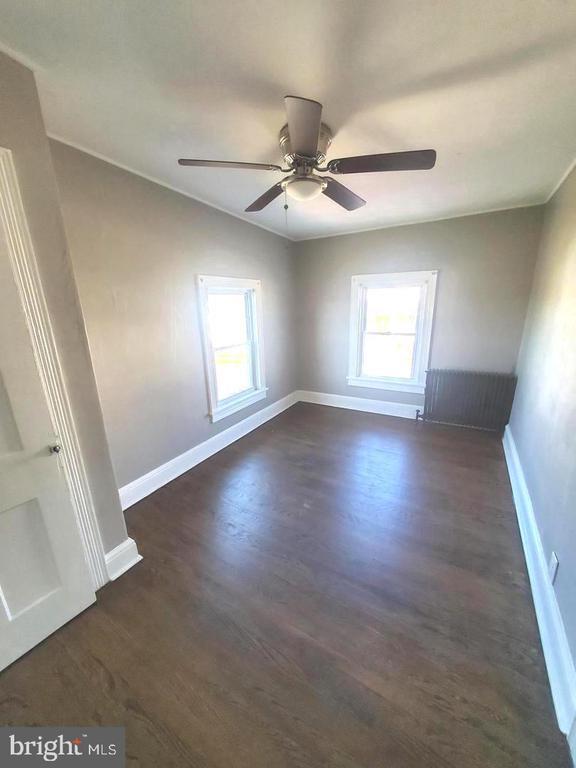
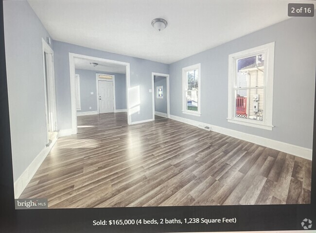
Beautiful upper 2 Bedroom 1 Bath Apartment!!! Home has hardwood floors throughout, open front porch. use of washer/dryer in unit, and a quiet/private location. Landlord pays, heat, hot-water and is responsible for Lawn & Snow Maintenance. Tenant is responsible for Electric. Great location just one block from Downtown and Convenient to Dining, Salons, Shopping and Public Transportation. Good Tenant Qualifications are required from NTN or a similar Tenant Screening platform. NO PETS!!!
24 State St is a house located in Salem County and the 08318 ZIP Code. This area is served by the Pittsgrove Township Board Of Education attendance zone.
Location
Get Directions
Education
| Colleges & Universities | Distance | ||
|---|---|---|---|
| Colleges & Universities | Distance | ||
| Drive: | 17 min | 9.8 mi | |
| Drive: | 24 min | 15.9 mi | |
| Drive: | 32 min | 18.1 mi | |
| Drive: | 42 min | 25.2 mi |
24 State St is within 17 minutes or 9.8 miles from Rowan University. It is also near Gloucester County College and Camden Co. Coll., Blackwood.
Schools


Public Elementary & Middle School
Grades PK-8
333 Students
Nearby
Public Elementary & Middle School
Grades 5-8
499 Students
Attendance Zone
Public Elementary School
Grades 2-4
342 Students
Attendance Zone
Public Elementary School
Grades K-1
212 Students
Attendance Zone
Public High School
Grades 9-12
495 Students
Attendance Zone
Private Elementary, Middle & High School
Grades 5-12
Nearby
Private Elementary & Middle School
Grades PK-8
245 Students
Nearby
School data provided by
 The GreatSchools Rating helps parents compare schools within a state based on a variety of school quality indicators and provides a helpful picture of how effectively each school serves all of its students. Ratings are on a scale of 1 (below average) to 10 (above average) and can include test scores, college readiness, academic progress, advanced courses, equity, discipline and attendance data. We also advise parents to visit schools, consider other information on school performance and programs, and consider family needs as part of the school selection process.
View GreatSchools Rating Methodology
View GreatSchools Rating Methodology
Transportation options available in Elmer include Ashland, located 24.8 miles from 24 State St. 24 State St is near Philadelphia International, located 31.4 miles or 51 minutes away, and Atlantic City International, located 39.1 miles or 76 minutes away.
| Transit / Subway | Distance | ||
|---|---|---|---|
| Transit / Subway | Distance | ||
|
|
Drive: | 36 min | 24.8 mi |
|
|
Drive: | 39 min | 26.1 mi |
|
|
Drive: | 38 min | 26.3 mi |
|
|
Drive: | 39 min | 28.0 mi |
|
|
Drive: | 48 min | 32.7 mi |
| Commuter Rail | Distance | ||
|---|---|---|---|
| Commuter Rail | Distance | ||
|
|
Drive: | 37 min | 22.4 mi |
|
|
Drive: | 34 min | 24.7 mi |
|
|
Drive: | 37 min | 26.2 mi |
|
|
Drive: | 50 min | 31.1 mi |
|
|
Drive: | 53 min | 31.4 mi |
| Airports | Distance | ||
|---|---|---|---|
| Airports | Distance | ||
|
Philadelphia International
|
Drive: | 51 min | 31.4 mi |
|
Atlantic City International
|
Drive: | 76 min | 39.1 mi |
Time and distance from 24 State St.
| Shopping Centers | Distance | ||
|---|---|---|---|
| Shopping Centers | Distance | ||
| Drive: | 18 min | 9.0 mi | |
| Drive: | 17 min | 9.9 mi | |
| Drive: | 15 min | 11.1 mi |
24 State St has 3 shopping centers within 11.1 miles, which is about a 15-minute drive. The miles and minutes will be for the farthest away property.
| Parks and Recreation | Distance | ||
|---|---|---|---|
| Parks and Recreation | Distance | ||
|
Parvin State Park
|
Drive: | 26 min | 9.9 mi |
|
Creamy Acres Farm
|
Drive: | 20 min | 10.4 mi |
24 State St has 2 parks within 10.4 miles, including Creamy Acres Farm, and Parvin State Park.
| Hospitals | Distance | ||
|---|---|---|---|
| Hospitals | Distance | ||
| Walk: | 14 min | 0.7 mi |
24 State St is 0.7 mile and a 14 minute walk from Inspira Medical Center Elmer.
| Military Bases | Distance | ||
|---|---|---|---|
| Military Bases | Distance | ||
| Drive: | 42 min | 29.2 mi | |
| Drive: | 44 min | 29.7 mi |
24 State St is 29.2 miles from Philadelphia Naval Busi Center, and is convenient to other military bases, including Ommelanden Range.
You May Also Like
Similar Rentals Nearby


What Are Walk Score®, Transit Score®, and Bike Score® Ratings?
Walk Score® measures the walkability of any address. Transit Score® measures access to public transit. Bike Score® measures the bikeability of any address.
What is a Sound Score Rating?
A Sound Score Rating aggregates noise caused by vehicle traffic, airplane traffic and local sources

24 State St
Elmer, NJ 08318