$1,200 / Month
2400 Mifflin St
Philadelphia, PA 19145
2 Weeks Ago
Favorites
2400 Mifflin St

Favorites
Check Back Soon for Upcoming Availability
| Beds | Baths | Average SF |
|---|---|---|
| 2 Bedrooms 2 Bedrooms 2 Br | 1 Bath 1 Bath 1 Ba | — |
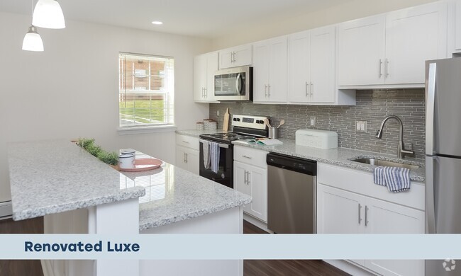
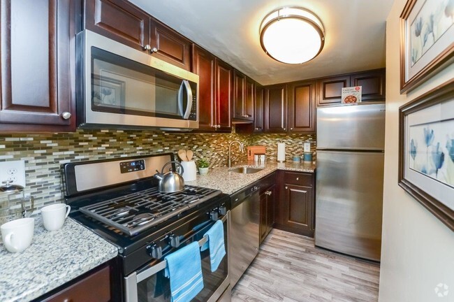
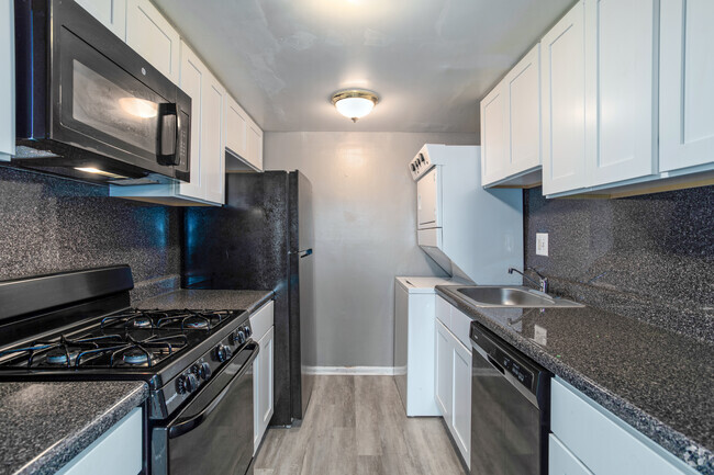
About This Property
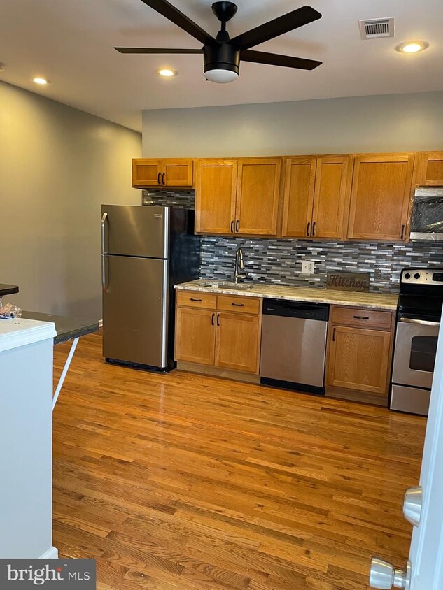
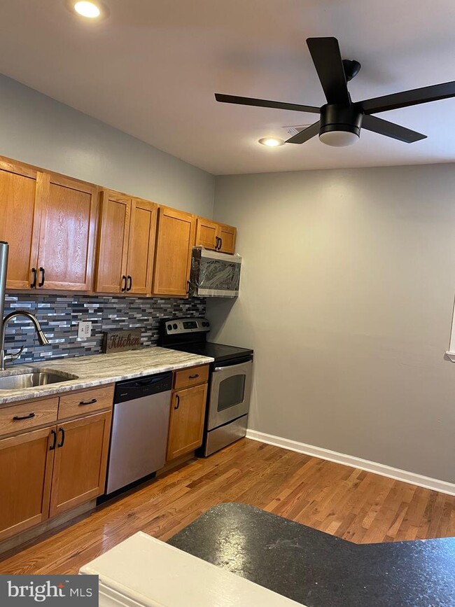
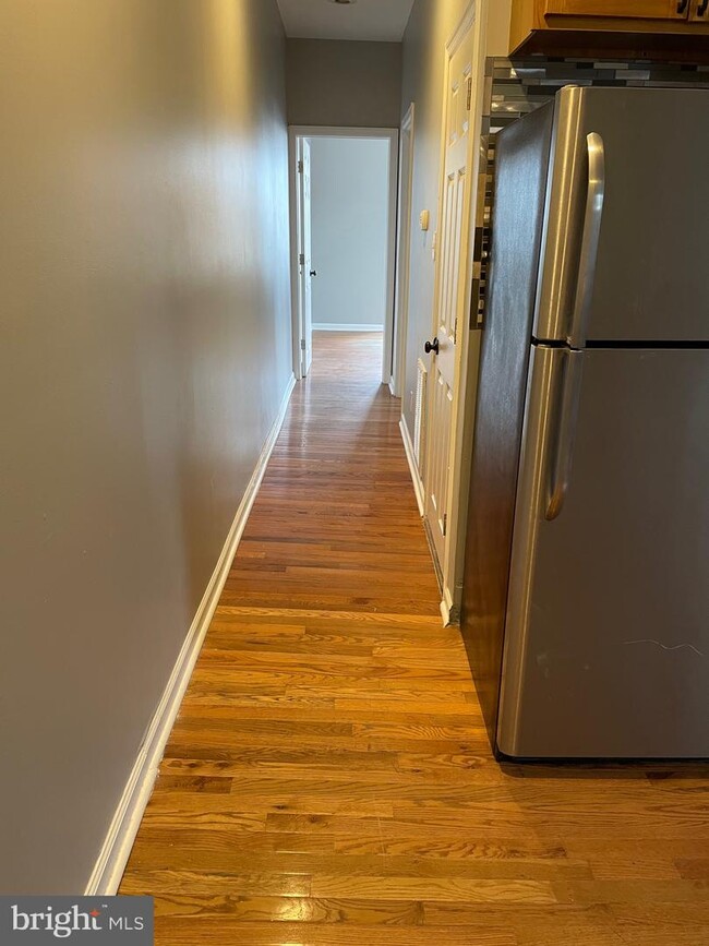
Spacious 2nd floor 2bedroom apartment in Point Breeze section with hardwood flooring throughout, stainless steel appliances, minutes from center city, sports stadiums and accessible via public transportation.
2400 Mifflin St is a townhome located in Philadelphia County and the 19145 ZIP Code. This area is served by the The School District of Philadelphia attendance zone.
Location
Get Directions
If it's cheesesteaks and sports that piqued your interest in Philadelphia, you're looking for the neighborhood of South Philadelphia West. At its southeastern tip, this area borders the Wells Fargo Center and the Lincoln Financial Field, home of the Flyers and Phillies respectively. Located south of Moore Street, between busy Broad St. and the Schuykill River, the area offers a range of densely packed urban shopping districts and a riverfront oasis, all within minutes of Center City.
Bordered by Interstate 76 and 95, South Philly West encompasses several neighborhoods and entertainment hotspots. There’s a little something for everyone here, from the urban amenities of Melrose and South Philly, to FDR Park and the nearby Philadelphia International Airport.
Learn more about living in South Philadelphia WestBelow are rent ranges for similar nearby apartments
| Beds | Average Size | Lowest | Typical | Premium |
|---|---|---|---|---|
| Studio Studio Studio | 406 Sq Ft | $1,000 | $1,044 | $1,125 |
| 1 Bed 1 Bed 1 Bed | 713 Sq Ft | $800 | $1,368 | $2,007 |
| 2 Beds 2 Beds 2 Beds | 1049 Sq Ft | $1,075 | $1,716 | $2,400 |
| 3 Beds 3 Beds 3 Beds | 1405-1416 Sq Ft | $1,450 | $2,057 | $3,000 |
| 4 Beds 4 Beds 4 Beds | 2165 Sq Ft | $1,500 | $2,258 | $2,900 |
Education
| Colleges & Universities | Distance | ||
|---|---|---|---|
| Colleges & Universities | Distance | ||
| Drive: | 7 min | 2.6 mi | |
| Drive: | 6 min | 2.6 mi | |
| Drive: | 7 min | 2.8 mi | |
| Drive: | 8 min | 3.4 mi |
2400 Mifflin St is within 7 minutes or 2.6 miles from The Art Inst. of Philadelphia. It is also near University of Pennsylvania and Drexel Univ., Univ. City Main.
Schools


Public Elementary & Middle School
Grades K-8
224 Students
Attendance Zone
Public High School
Grades PK & 9-12
611 Students
Attendance Zone
Public Elementary & Middle School
Grades PK-8
425 Students
Nearby
Private Elementary & Middle School
Grades PK-8
264 Students
Nearby
Private Elementary & Middle School
Grades PK-8
176 Students
Nearby
Private Elementary, Middle & High School
Grades 3-12
Nearby
School data provided by
 The GreatSchools Rating helps parents compare schools within a state based on a variety of school quality indicators and provides a helpful picture of how effectively each school serves all of its students. Ratings are on a scale of 1 (below average) to 10 (above average) and can include test scores, college readiness, academic progress, advanced courses, equity, discipline and attendance data. We also advise parents to visit schools, consider other information on school performance and programs, and consider family needs as part of the school selection process.
View GreatSchools Rating Methodology
View GreatSchools Rating Methodology
Transportation options available in Philadelphia include Snyder, located 1.0 miles from 2400 Mifflin St. 2400 Mifflin St is near Philadelphia International, located 7.0 miles or 16 minutes away, and Trenton Mercer, located 37.5 miles or 56 minutes away.
| Transit / Subway | Distance | ||
|---|---|---|---|
| Transit / Subway | Distance | ||
|
|
Walk: | 20 min | 1.0 mi |
|
|
Drive: | 5 min | 1.5 mi |
|
|
Drive: | 4 min | 1.8 mi |
|
|
Drive: | 5 min | 1.9 mi |
|
|
Drive: | 6 min | 2.4 mi |
| Commuter Rail | Distance | ||
|---|---|---|---|
| Commuter Rail | Distance | ||
|
|
Drive: | 7 min | 2.7 mi |
|
|
Drive: | 8 min | 3.0 mi |
|
|
Drive: | 6 min | 3.1 mi |
|
|
Drive: | 9 min | 3.3 mi |
| Drive: | 8 min | 3.5 mi |
| Airports | Distance | ||
|---|---|---|---|
| Airports | Distance | ||
|
Philadelphia International
|
Drive: | 16 min | 7.0 mi |
|
Trenton Mercer
|
Drive: | 56 min | 37.5 mi |
Time and distance from 2400 Mifflin St.
| Shopping Centers | Distance | ||
|---|---|---|---|
| Shopping Centers | Distance | ||
| Walk: | 11 min | 0.6 mi | |
| Walk: | 12 min | 0.6 mi | |
| Drive: | 3 min | 1.3 mi |
2400 Mifflin St has 3 shopping centers within 1.3 miles, which is about a 3-minute walk. The miles and minutes will be for the farthest away property.
| Parks and Recreation | Distance | ||
|---|---|---|---|
| Parks and Recreation | Distance | ||
|
Schuylkill River Park
|
Drive: | 6 min | 2.0 mi |
|
Penn Museum
|
Drive: | 6 min | 2.6 mi |
|
Franklin D. Roosevelt Park
|
Drive: | 8 min | 2.7 mi |
|
University of Pennsylvania Observatory
|
Drive: | 6 min | 2.8 mi |
|
Bartram's Garden
|
Drive: | 9 min | 3.4 mi |
2400 Mifflin St has 5 parks within 3.4 miles, including Schuylkill River Park, Penn Museum, and University of Pennsylvania Observatory.
| Hospitals | Distance | ||
|---|---|---|---|
| Hospitals | Distance | ||
| Walk: | 16 min | 0.8 mi | |
| Drive: | 6 min | 2.6 mi | |
| Drive: | 9 min | 3.3 mi |
2400 Mifflin St has 3 hospitals within 3.3 miles, the nearest is New Hanover Regional Medical Center which is 0.8 mile away and a 16 minute walk.
| Military Bases | Distance | ||
|---|---|---|---|
| Military Bases | Distance | ||
| Drive: | 8 min | 3.7 mi |
2400 Mifflin St is 3.7 miles and a 8 minute drive from Philadelphia Naval Busi Center.
You May Also Like
Similar Rentals Nearby
-
-
-
-
-
-
-
-
-
-
1 / 25


What Are Walk Score®, Transit Score®, and Bike Score® Ratings?
Walk Score® measures the walkability of any address. Transit Score® measures access to public transit. Bike Score® measures the bikeability of any address.
What is a Sound Score Rating?
A Sound Score Rating aggregates noise caused by vehicle traffic, airplane traffic and local sources

2400 Mifflin St
Philadelphia, PA 19145