
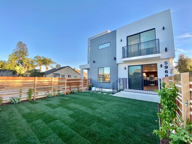
$1,600 / Month
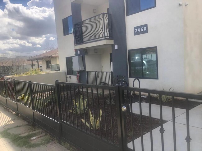
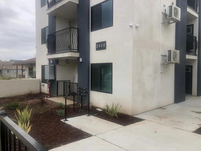
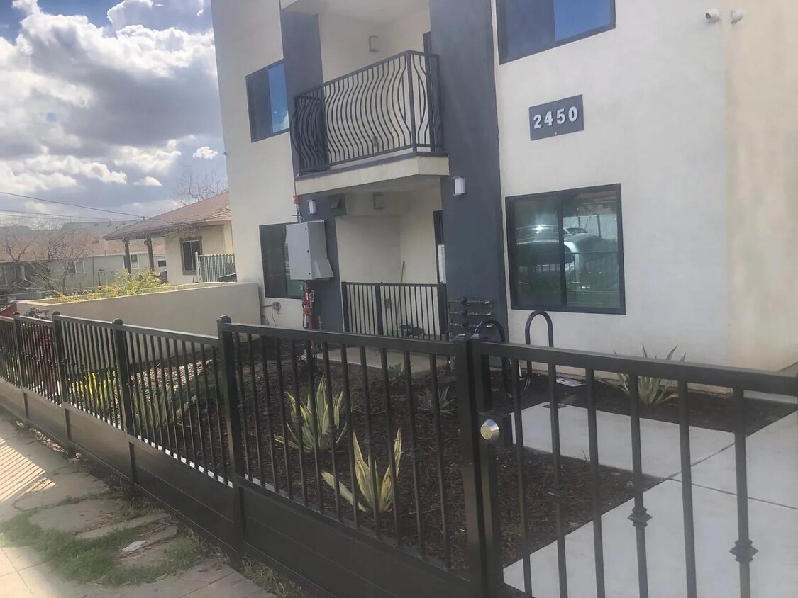
2450 Houston St
Los Angeles, CA 90033
Today
Favorites
945-354-9589
-
Bedrooms
1
-
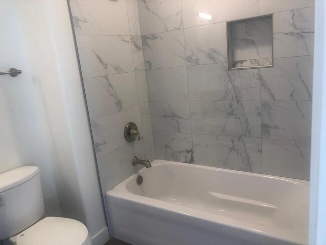
Bathrooms
1
-
Square Feet
600 sq ft
-
Available
Available Now
2450 Houston St

Favorites
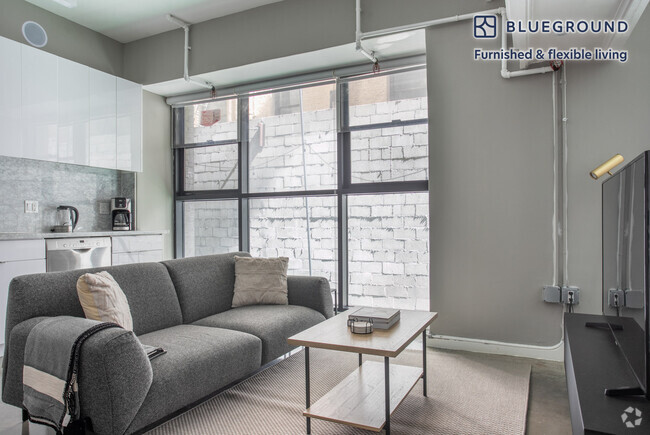
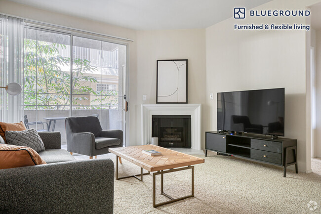
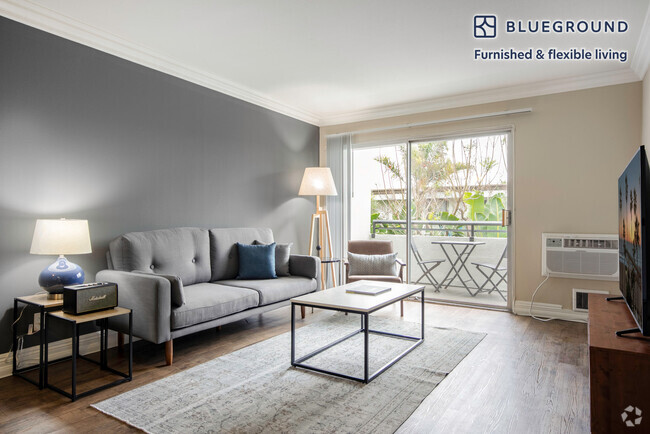
About This Home
Available Now
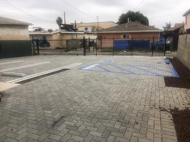
Brand new apartment building with fenced parking area, security system , designated laundry room and bicycle rack. Each apartment comes with refrigerator, stove and A/C units. MODERN & BEAUTIFUL FINISHES. Strategically centered walking distance from USC Medical and Keck Medical. 4 minute drive to DTLA. near major freeways, 10, 101, 5 and 60 fwys. Please note all the utilities are included in the monthly rent. The building is also pets friendly. Brand new apartment building with fenced parking area, security system , designated laundry room and bicycle rack. Each apartment comes with refrigerator, stove and A/C units. MODERN & BEAUTIFUL FINISHES. Strategically centered walking distance from USC Medical and Keck Medical. 4 minute drive to DTLA. near major freeways, 10, 101, 5 and 60 fwys. Please note all the utilities are included in the monthly rent. The building is also pets friendly.
2450 Houston St is a condo located in Los Angeles County and the 90033 ZIP Code.
* Price shown is base rent and may not include non-optional fees and utilities.
Price, availability, fees, and any applicable rent special are subject to change without notice.
* Square footage definitions vary. Displayed square footage is approximate.
Contact
- Listed by Jack Fleming
- Phone Number (945) 354-9589
- Contact
Location
Get Directions
Southeast Los Angeles is directly south of the Fashion District and east of the University of Southern California (USC). This large neighborhood is minutes from downtown Los Angeles, Hollywood, and Beverly Hills, with easy access to the 110 Freeway. This great location places you near sunny beaches, nature trails, and a bevy of leading employers. Students can access both USC and California State University Long Beach from their Southeast LA apartment.
This densely populated, diverse neighborhood features everything from food trucks and corner markets to wide sidewalks and residential areas filled with bungalows, ranch, and Spanish Colonial architecture. Southeast LA features palm trees and mountain views, tampered with gritty undertones to give it a cool, funky vibe.
As for outdoor fun, take your pick between Catalina Island, Venus Beach, or the Santa Monica Pier. Nearby, you’ll find more sunny beaches like White Point, Cabrillo, and Long Beach.
Learn more about living in Southeast Los Angeles
Education
| Colleges & Universities | Distance | ||
|---|---|---|---|
| Colleges & Universities | Distance | ||
| Drive: | 3 min | 1.2 mi | |
| Drive: | 6 min | 3.1 mi | |
| Drive: | 8 min | 3.6 mi | |
| Drive: | 8 min | 4.4 mi |
2450 Houston St is within 3 minutes or 1.2 miles from USC, Health Sciences Campus. It is also near Cal State Los Angeles and East Los Angeles College.
Transportation options available in Los Angeles include Soto, located 0.7 mile from 2450 Houston St. 2450 Houston St is near Bob Hope, located 17.3 miles or 24 minutes away, and Los Angeles International, located 18.8 miles or 30 minutes away.
| Transit / Subway | Distance | ||
|---|---|---|---|
| Transit / Subway | Distance | ||
|
|
Walk: | 13 min | 0.7 mi |
|
|
Drive: | 3 min | 1.3 mi |
|
|
Drive: | 4 min | 1.6 mi |
|
|
Drive: | 3 min | 1.7 mi |
|
|
Drive: | 7 min | 2.4 mi |
| Commuter Rail | Distance | ||
|---|---|---|---|
| Commuter Rail | Distance | ||
|
|
Drive: | 7 min | 2.4 mi |
|
|
Drive: | 6 min | 2.5 mi |
| Drive: | 9 min | 6.5 mi | |
|
|
Drive: | 14 min | 6.8 mi |
|
|
Drive: | 14 min | 8.5 mi |
| Airports | Distance | ||
|---|---|---|---|
| Airports | Distance | ||
|
Bob Hope
|
Drive: | 24 min | 17.3 mi |
|
Los Angeles International
|
Drive: | 30 min | 18.8 mi |
Time and distance from 2450 Houston St.
| Shopping Centers | Distance | ||
|---|---|---|---|
| Shopping Centers | Distance | ||
| Walk: | 15 min | 0.8 mi | |
| Walk: | 17 min | 0.9 mi | |
| Drive: | 3 min | 1.4 mi |
2450 Houston St has 3 shopping centers within 1.4 miles, which is about a 3-minute drive. The miles and minutes will be for the farthest away property.
| Parks and Recreation | Distance | ||
|---|---|---|---|
| Parks and Recreation | Distance | ||
|
Hollenbeck Lake
|
Drive: | 3 min | 1.3 mi |
|
Vista Hermosa Natural Park
|
Drive: | 8 min | 4.1 mi |
|
Audubon Center at Debs Park
|
Drive: | 9 min | 4.7 mi |
|
Elysian Park
|
Drive: | 12 min | 4.8 mi |
|
Chavez Ravine Arboretum
|
Drive: | 9 min | 5.6 mi |
2450 Houston St has 5 parks within 5.6 miles, including Hollenbeck Lake, Vista Hermosa Natural Park, and Elysian Park.
| Hospitals | Distance | ||
|---|---|---|---|
| Hospitals | Distance | ||
| Drive: | 3 min | 1.1 mi | |
| Drive: | 3 min | 1.3 mi | |
| Drive: | 6 min | 2.8 mi |
2450 Houston St has 3 hospitals within 2.8 miles, the nearest is LAC + USC Medical Center which is 1.1 miles away and a 3 minutes drive.
| Military Bases | Distance | ||
|---|---|---|---|
| Military Bases | Distance | ||
| Drive: | 28 min | 20.2 mi |
2450 Houston St is 20.2 miles and a 28 minutes from Los Angeles Air Force Base.
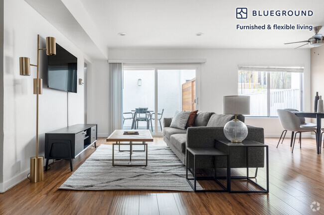
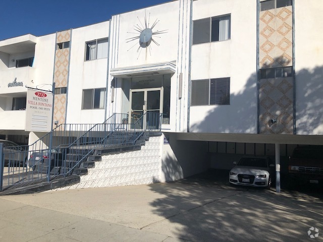
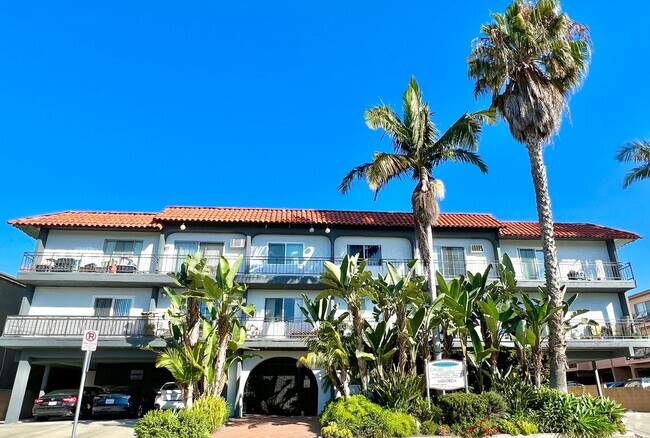
You May Also Like
Similar Rentals Nearby
What Are Walk Score®, Transit Score®, and Bike Score® Ratings?
Walk Score® measures the walkability of any address. Transit Score® measures access to public transit. Bike Score® measures the bikeability of any address.
What is a Sound Score Rating?
A Sound Score Rating aggregates noise caused by vehicle traffic, airplane traffic and local sources
2450 Houston St
Los Angeles, CA 90033