
$4,500 / Month
247 W Santa Anita Ave
Burbank, CA 91502
Today
Favorites
818-399-4066
-
Bedrooms
3
-
Bathrooms
2
-
Square Feet
1,359 sq ft
-
Available
Available Now
Highlights
- Park or Greenbelt View
- Quartz Countertops
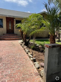
- Patio
- Park
- Laundry Room
- Foothills
247 W Santa Anita Ave

Favorites
About This Home
12 Month Lease,
$4,500 deposit,
Available Now
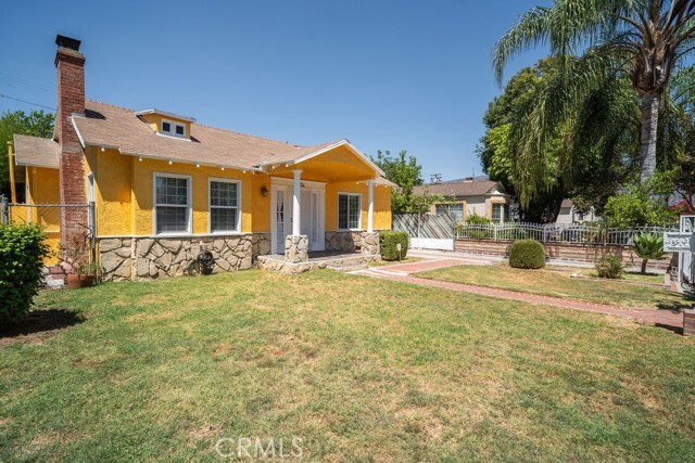
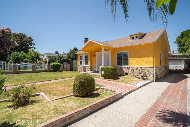
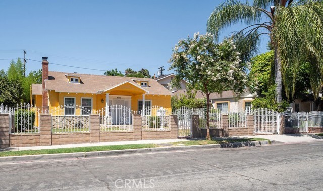
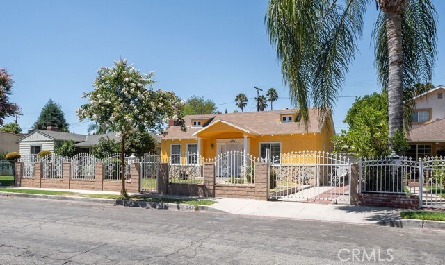
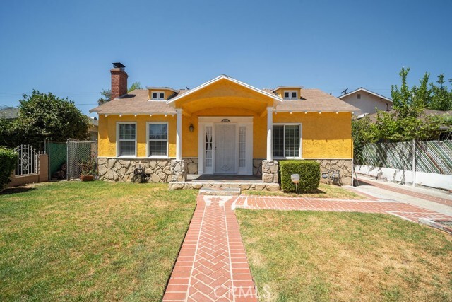
Charming 3-bed, 2-bath home with approx. 1,400 sq ft of living space! Features a spacious kitchen with quartz countertops, gas range, and newer dishwasher. Central air & heat, in-home washer/dryer, and hardwood throughout except for kitchen and bathrooms. Gated front yard, covered driveway, 2-car garage, and covered patio for outdoor enjoyment. Prime location across from Santa Anita Play Park! Less than 1 mile to L.A. Equestrian Center, 2 miles to Griffith Park, and close to studios, 134/5 freeways, Burbank Airport, and Downtown Burbank shops & dining. Don't miss this one!
247 W Santa Anita Ave is a house located in Los Angeles County and the 91502 ZIP Code. This area is served by the Burbank Unified attendance zone.
* Price shown is base rent and may not include non-optional fees and utilities.
Price, availability, fees, and any applicable rent special are subject to change without notice.
* Square footage definitions vary. Displayed square footage is approximate.
Home Details
Home Type
Single Family Detached Home
Year Built
Built in 1938
Accessible Home Design
Entry on the 1st floor
Bedrooms and Bathrooms
3 Main Level Bedrooms
2 Full Bathrooms
Exhaust Fan In Bathroom
Interior Spaces
Living Room with Fireplace
Dining Room
1,359 Sq Ft Home
1-Story Property
Kitchen
Quartz Countertops
Gas Range
Dishwasher
Laundry
Laundry Room
Dryer
Washer
Listing and Financial Details
Security Deposit $4,500
12-Month Minimum Lease Term
Available 4/15/25
Tax Lot 13
Tax Tract Number 8306
Assessor Parcel Number 2451020020
Location
Suburban Location
Lot Details
6,331 Sq Ft Lot
No Common Walls
Property is zoned BUR1*
Front Yard Sprinklers
Outdoor Features
Patio
Rain Gutters
Exterior Lighting
Parking
2 Car Garage
Parking Available
2 Open Parking Spaces
Driveway
Utilities
Central Heating and Cooling System
Gas Water Heater
Cable TV Available
Natural Gas Connected
Views
Park or Greenbelt Views
Community Details
Overview
Foothills
No Home Owners Association
Pet Policy
Pet Size Limit
Pet Deposit $500
Recreation
Park
Fees and Policies
The fees below are based on community-supplied data and may exclude additional fees and utilities.
Pet policies are negotiable.
- Parking
-
Garage--
Details
Lease Options
-
12 Months
Contact
- Listed by Julian Munoz | REMAX Empower
- Phone Number
- Contact
-
Source
 California Regional Multiple Listing Service
Copyright 2025 © California Regional MLS. All rights reserved.
Location
Get Directions
Amenities
- Washer/Dryer
- Washer/Dryer Hookup
- Air Conditioning
- Heating
- Fireplace
- Dishwasher
- Range
- Dining Room
- Patio
Rancho Adjacent, near the center of Burbank, combines a mixture of single-family homes, apartments, small and large commercial areas, industrial zones, and city government buildings. Residents enjoy the convenience of having a variety goods and services within a short drive. Rancho Adjacent borders the horse-oriented neighborhood known as Rancho just south of the community.
Bordered by Verdugo and Alameda Avenues, Rancho Adjacent stretches from Hollywood Way across Interstate 5 to Glenoaks Boulevard. Olive Avenue cuts diagonally through the neighborhood and is lined with restaurants and small businesses. Rancho Adjacent also lies just north of the Ventura Freeway, a major east-west link across the San Fernando Valley. Downtown Los Angeles rests 13 miles south of Rancho Adjacent, making this compact community a great choice no matter where your commute takes you.
Learn more about living in Rancho Adjacent
Education
| Colleges & Universities | Distance | ||
|---|---|---|---|
| Colleges & Universities | Distance | ||
| Drive: | 5 min | 2.3 mi | |
| Drive: | 7 min | 3.6 mi | |
| Drive: | 9 min | 5.9 mi | |
| Drive: | 12 min | 6.2 mi |
247 W Santa Anita Ave is within 5 minutes or 2.3 miles from New York Film Academy. It is also near Woodbury University and Glendale Community College.
Schools


Public Elementary School
Grades K-5
452 Students
Attendance Zone
Charter Elementary School
Grades K-5
75 Students
Nearby
Public Middle School
Grades 6-8
950 Students
Attendance Zone
Public High School
Grades 9-12
2,305 Students
Attendance Zone
Private Elementary School
Grades K
12 Students
Nearby
Private Elementary School
Grades K-1
41 Students
Nearby
Private Elementary & Middle School
Grades PK-8
283 Students
Nearby
Private Elementary School
Grades PK-1
21 Students
Nearby
Private Middle & High School
Grades 6-12
263 Students
Nearby
School data provided by
 The GreatSchools Rating helps parents compare schools within a state based on a variety of school quality indicators and provides a helpful picture of how effectively each school serves all of its students. Ratings are on a scale of 1 (below average) to 10 (above average) and can include test scores, college readiness, academic progress, advanced courses, equity, discipline and attendance data. We also advise parents to visit schools, consider other information on school performance and programs, and consider family needs as part of the school selection process.
View GreatSchools Rating Methodology
View GreatSchools Rating Methodology
Transportation options available in Burbank include Universal City/Studio City, located 4.4 miles from 247 W Santa Anita Ave. 247 W Santa Anita Ave is near Bob Hope, located 5.8 miles or 10 minutes away, and Los Angeles International, located 19.5 miles or 39 minutes away.
| Transit / Subway | Distance | ||
|---|---|---|---|
| Transit / Subway | Distance | ||
|
|
Drive: | 9 min | 4.4 mi |
|
|
Drive: | 9 min | 5.1 mi |
|
|
Drive: | 12 min | 6.1 mi |
|
|
Drive: | 12 min | 6.5 mi |
|
|
Drive: | 12 min | 7.6 mi |
| Commuter Rail | Distance | ||
|---|---|---|---|
| Commuter Rail | Distance | ||
|
|
Walk: | 12 min | 0.6 mi |
|
|
Drive: | 7 min | 3.5 mi |
| Drive: | 6 min | 3.6 mi | |
|
|
Drive: | 9 min | 5.3 mi |
|
|
Drive: | 9 min | 5.6 mi |
| Airports | Distance | ||
|---|---|---|---|
| Airports | Distance | ||
|
Bob Hope
|
Drive: | 10 min | 5.8 mi |
|
Los Angeles International
|
Drive: | 39 min | 19.5 mi |
Time and distance from 247 W Santa Anita Ave.
| Shopping Centers | Distance | ||
|---|---|---|---|
| Shopping Centers | Distance | ||
| Walk: | 3 min | 0.2 mi | |
| Walk: | 10 min | 0.5 mi | |
| Walk: | 12 min | 0.7 mi |
247 W Santa Anita Ave has 3 shopping centers within 0.7 mile, which is about a 12-minute walk. The miles and minutes will be for the farthest away property.
| Parks and Recreation | Distance | ||
|---|---|---|---|
| Parks and Recreation | Distance | ||
|
Los Angeles Zoo
|
Drive: | 14 min | 4.3 mi |
|
Bird Sanctuary
|
Drive: | 12 min | 6.6 mi |
|
Griffith Observatory
|
Drive: | 16 min | 7.8 mi |
|
La Tuna Canyon Park
|
Drive: | 15 min | 9.8 mi |
|
Griffith Park
|
Drive: | 25 min | 10.0 mi |
247 W Santa Anita Ave has 5 parks within 10.0 miles, including Los Angeles Zoo, Griffith Park, and Griffith Observatory.
| Hospitals | Distance | ||
|---|---|---|---|
| Hospitals | Distance | ||
| Drive: | 3 min | 1.6 mi | |
| Drive: | 8 min | 5.3 mi | |
| Drive: | 10 min | 6.2 mi |
247 W Santa Anita Ave has 3 hospitals within 6.2 miles, the nearest is Providence Saint Joseph Medical Center which is 1.6 miles away and a 3 minute drive.
| Military Bases | Distance | ||
|---|---|---|---|
| Military Bases | Distance | ||
| Drive: | 36 min | 27.2 mi |
247 W Santa Anita Ave is 27.2 miles and a 36 minute drive from Los Angeles Air Force Base.
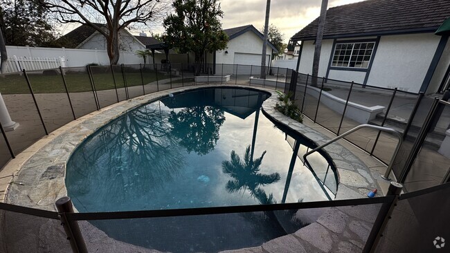
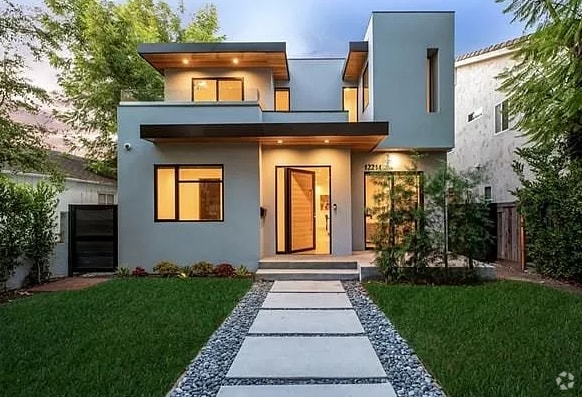
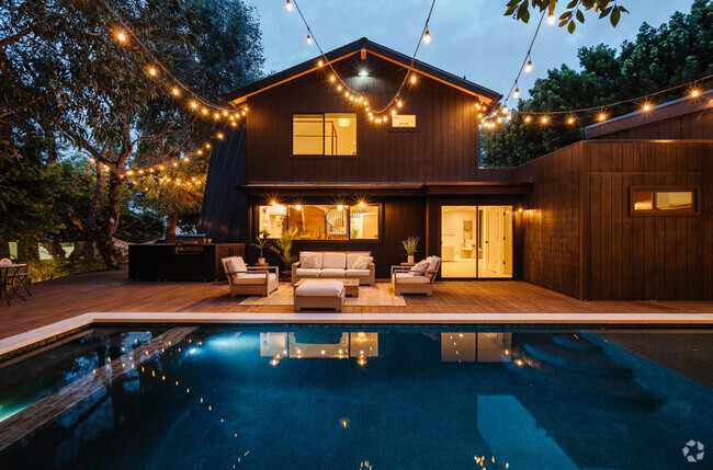
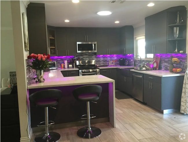
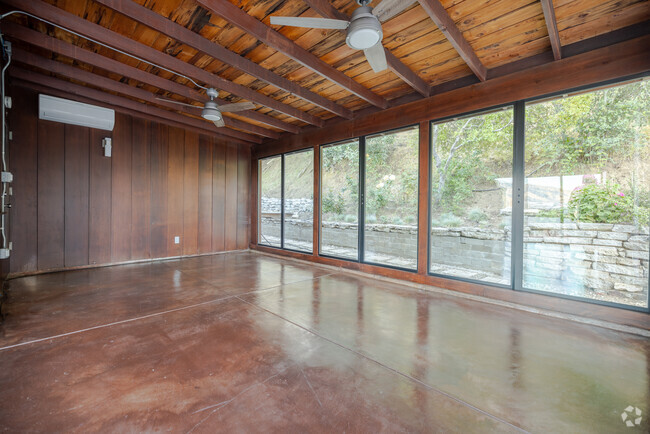
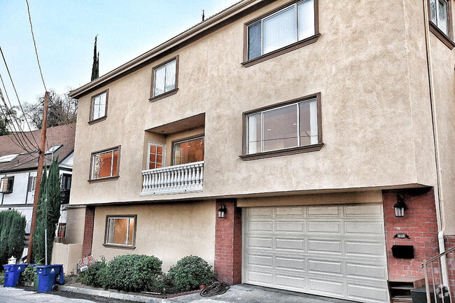
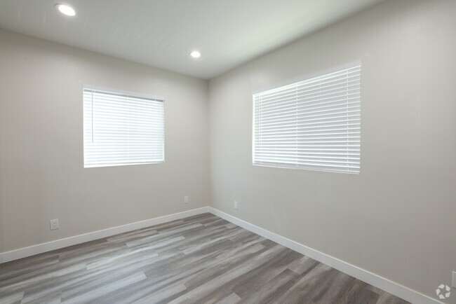
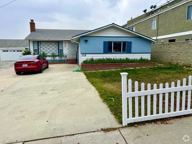
You May Also Like
Similar Rentals Nearby

What Are Walk Score®, Transit Score®, and Bike Score® Ratings?
Walk Score® measures the walkability of any address. Transit Score® measures access to public transit. Bike Score® measures the bikeability of any address.
What is a Sound Score Rating?
A Sound Score Rating aggregates noise caused by vehicle traffic, airplane traffic and local sources
247 W Santa Anita Ave
Burbank, CA 91502