

$2,799 / Month
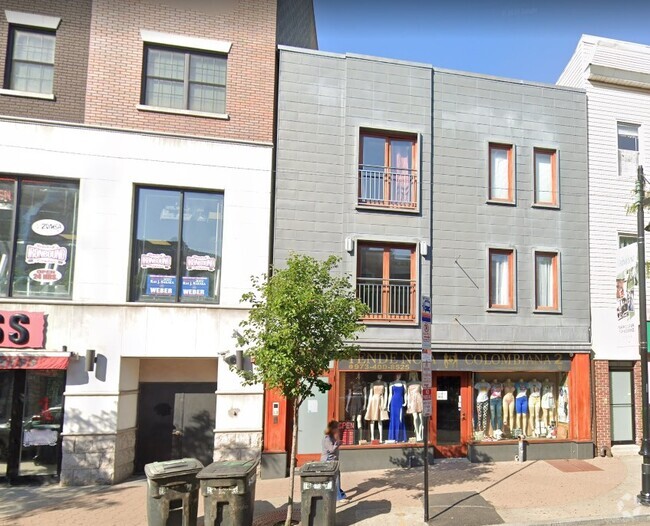
25 Bogart St
Brooklyn, NY 11206
2 Weeks Ago
Favorites
25 Bogart St

Favorites
Check Back Soon for Upcoming Availability
| Beds | Baths | Average SF |
|---|---|---|
| 2 Bedrooms 2 Bedrooms 2 Br | 2 Baths 2 Baths 2 Ba | — |
About This Property
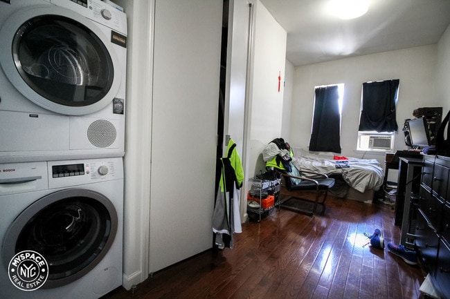
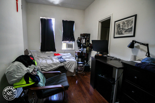
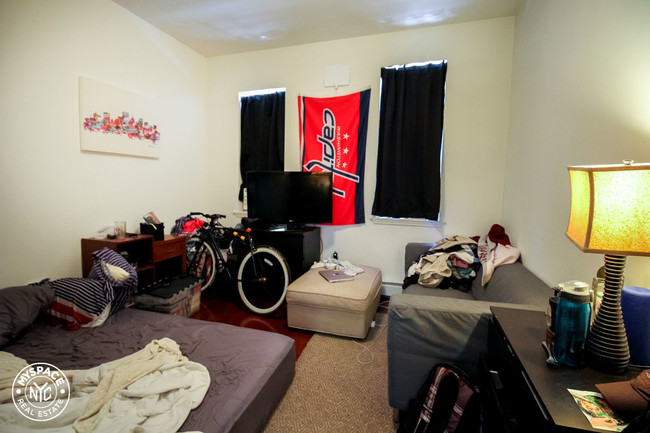
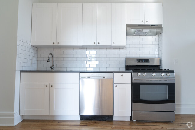
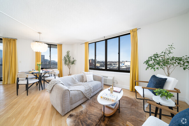
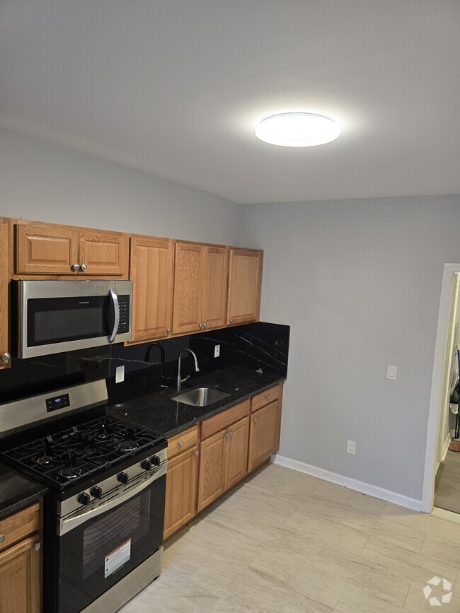
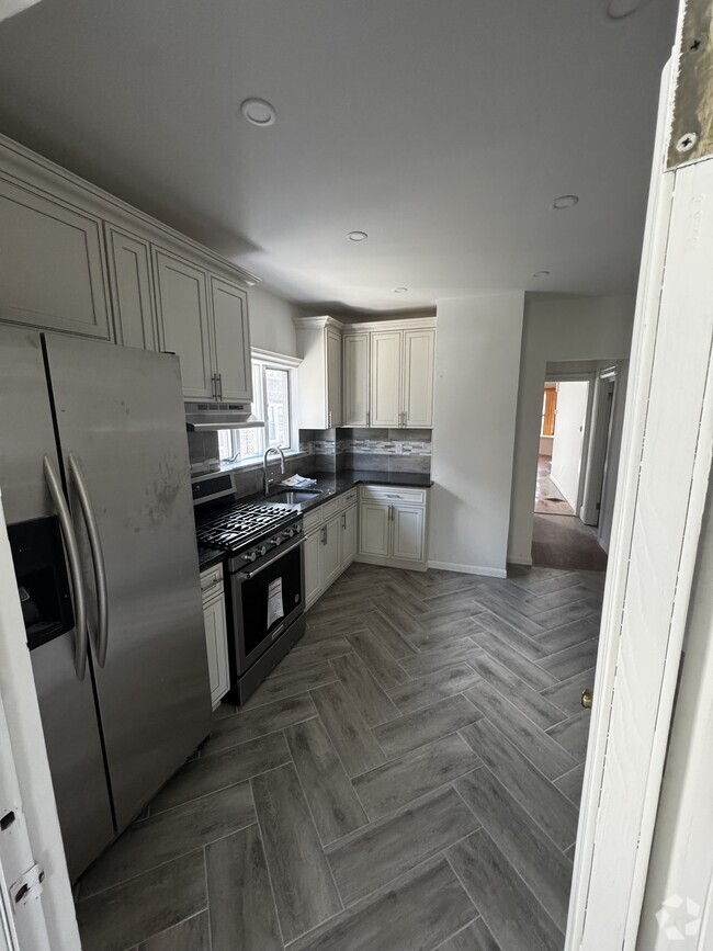
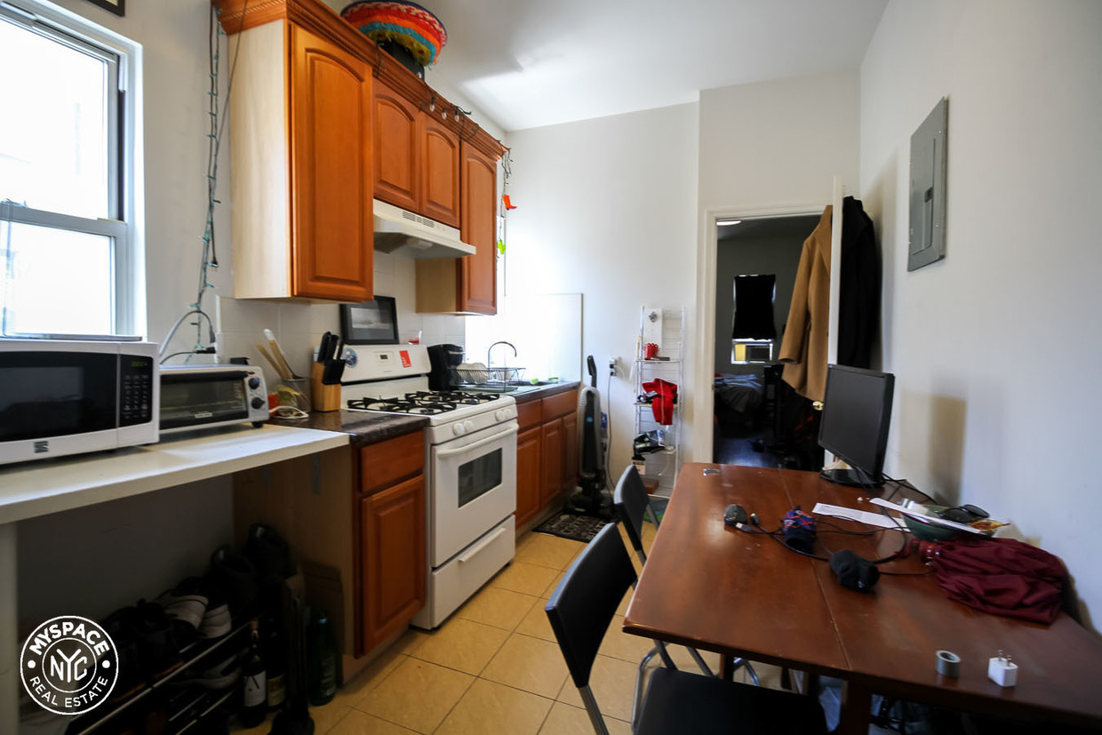
You'll love this location! Cozy two bedroom lies on the Bushwick-East Williamsburg border. The apartment features beautiful dark hardwood floors, a washer.dryer in unit and spacious bedrooms with closets. The kitchen is separated from living area, has tons of wood cabinets, expanded granite counter and a hidden refrigerator. Need to cut down on commute time? The apartment is just two short blocks to the Morgan L train stop. Enjoy many cafes, boutiques and bars in your hip neighborhood! myspaceny11172
25 Bogart St is a condo located in Kings County and the 11206 ZIP Code. This area is served by the New York City Geographic District #14 attendance zone.
Location
Get Directions
Nestled on the banks of the East River, Williamsburg’s nightlife scene glows just as bright as its art culture. Artists first moved to the area in the 1970s because of its affordability compared to surrounding areas, such as Manhattan. The neighborhood also offers larger homes, and direct access to transportation. In addition, the art community is alive and thriving, with local gallery favorites such as Front Room Gallery and Greenpoint.
To discover whether you should move to Williamsburg, find out what the neighborhood is all about. This area’s energy is unmatched, especially since the neighborhood has become a mecca for the creatives throughout the city. The luxury apartments in Williamsburg are surrounded by exceptional restaurants from authentic takeout to tapas to Michelin-rated fine dining. Longstanding spots like the Brooklyn Brewery have been providing residents with chilled pints since 1988.
Learn more about living in WilliamsburgBelow are rent ranges for similar nearby apartments
Education
| Colleges & Universities | Distance | ||
|---|---|---|---|
| Colleges & Universities | Distance | ||
| Drive: | 8 min | 2.3 mi | |
| Drive: | 7 min | 2.5 mi | |
| Drive: | 9 min | 3.2 mi | |
| Drive: | 10 min | 4.2 mi |
25 Bogart St is within 8 minutes or 2.3 miles from Pratt Institute. It is also near Saint Joseph's Coll, Brooklyn and Long Island Univ., Brooklyn.
Schools


Public Elementary School
Grades PK-5
190 Students
Attendance Zone
Public Middle & High School
Grades 6-12
273 Students
Nearby
Charter High School
Grades 9-12
968 Students
Nearby
Private Elementary, Middle & High School
Grades PK-12
Nearby
Private Elementary & Middle School
Grades PK-8
296 Students
Nearby
School data provided by
 The GreatSchools Rating helps parents compare schools within a state based on a variety of school quality indicators and provides a helpful picture of how effectively each school serves all of its students. Ratings are on a scale of 1 (below average) to 10 (above average) and can include test scores, college readiness, academic progress, advanced courses, equity, discipline and attendance data. We also advise parents to visit schools, consider other information on school performance and programs, and consider family needs as part of the school selection process.
View GreatSchools Rating Methodology
View GreatSchools Rating Methodology
Transportation options available in Brooklyn include Morgan Avenue, located 0.2 mile from 25 Bogart St. 25 Bogart St is near Laguardia, located 7.0 miles or 16 minutes away, and John F Kennedy International, located 12.0 miles or 21 minutes away.
| Transit / Subway | Distance | ||
|---|---|---|---|
| Transit / Subway | Distance | ||
|
|
Walk: | 3 min | 0.2 mi |
|
|
Walk: | 11 min | 0.6 mi |
|
|
Walk: | 11 min | 0.6 mi |
|
|
Walk: | 12 min | 0.6 mi |
|
|
Walk: | 13 min | 0.7 mi |
| Commuter Rail | Distance | ||
|---|---|---|---|
| Commuter Rail | Distance | ||
|
|
Drive: | 9 min | 2.8 mi |
|
|
Drive: | 8 min | 3.2 mi |
|
|
Drive: | 11 min | 3.6 mi |
|
|
Drive: | 10 min | 3.7 mi |
|
|
Drive: | 12 min | 3.9 mi |
| Airports | Distance | ||
|---|---|---|---|
| Airports | Distance | ||
|
Laguardia
|
Drive: | 16 min | 7.0 mi |
|
John F Kennedy International
|
Drive: | 21 min | 12.0 mi |
Time and distance from 25 Bogart St.
| Shopping Centers | Distance | ||
|---|---|---|---|
| Shopping Centers | Distance | ||
| Drive: | 4 min | 1.7 mi | |
| Drive: | 6 min | 2.0 mi | |
| Drive: | 6 min | 2.2 mi |
25 Bogart St has 3 shopping centers within 2.2 miles, which is about a 6-minute drive. The miles and minutes will be for the farthest away property.
| Parks and Recreation | Distance | ||
|---|---|---|---|
| Parks and Recreation | Distance | ||
|
Maria Hernandez Park
|
Walk: | 11 min | 0.6 mi |
|
Martinez Playground
|
Walk: | 18 min | 0.9 mi |
|
Sternberg Park
|
Drive: | 4 min | 1.2 mi |
|
Hattie Carthan Garden
|
Drive: | 6 min | 2.0 mi |
|
McCarren Park
|
Drive: | 6 min | 2.2 mi |
25 Bogart St has 5 parks within 2.2 miles, including Maria Hernandez Park, Sternberg Park, and Martinez Playground.
| Hospitals | Distance | ||
|---|---|---|---|
| Hospitals | Distance | ||
| Walk: | 11 min | 0.6 mi | |
| Walk: | 19 min | 1.0 mi | |
| Drive: | 8 min | 2.4 mi |
25 Bogart St has 3 hospitals within 2.4 miles, the nearest is Woodhull Medical & Mental Health Center which is 0.6 mile away and a 11 minute walk.
| Military Bases | Distance | ||
|---|---|---|---|
| Military Bases | Distance | ||
| Drive: | 18 min | 6.8 mi | |
| Drive: | 31 min | 12.2 mi |
25 Bogart St is 6.8 miles from Governors Island Support Center, and is convenient to other military bases, including US Coast Guard Heliport.
You May Also Like
Similar Rentals Nearby


What Are Walk Score®, Transit Score®, and Bike Score® Ratings?
Walk Score® measures the walkability of any address. Transit Score® measures access to public transit. Bike Score® measures the bikeability of any address.
What is a Sound Score Rating?
A Sound Score Rating aggregates noise caused by vehicle traffic, airplane traffic and local sources
25 Bogart St
Brooklyn, NY 11206