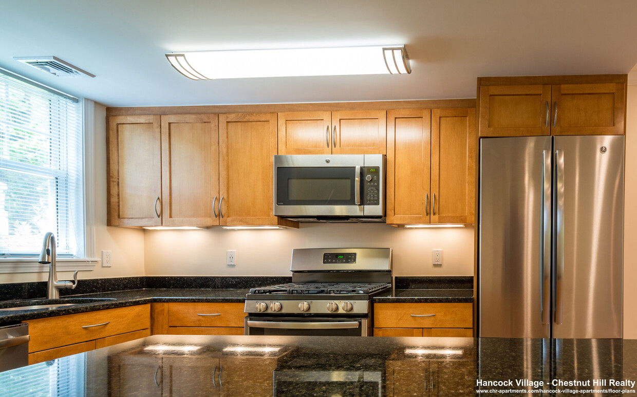
-
Monthly Rent
$3,750
-
Bedrooms
2 bd
-
Bathrooms
1 ba
-
Square Feet
911 sq ft
Details

25 Sherman Rd is an apartment community located in Norfolk County and the 02467 ZIP Code. This area is served by the Brookline attendance zone.
Contact
Apartment Features
- Washer/Dryer
Fees and Policies
The fees below are based on community-supplied data and may exclude additional fees and utilities.
As Boston's urban center expands outward, South Brookline remains one of the few truly green spaces in the greater Boston area. Known for rolling hills and large estates, a trip through the neighborhood reminds visitors of an earlier, more peaceful New England. This rural ambiance exists just a short drive from Boston proper, making South Brookline a popular location for family-minded professionals who commute into the city, yet still enjoy the family benefits of the top-rated Brookline school system.
Learn more about living in South Brookline| Colleges & Universities | Distance | ||
|---|---|---|---|
| Colleges & Universities | Distance | ||
| Drive: | 11 min | 4.8 mi | |
| Drive: | 11 min | 4.9 mi | |
| Drive: | 11 min | 5.2 mi | |
| Drive: | 11 min | 5.6 mi |
Transportation options available in Chestnut Hill include Chestnut Hill Station, located 2.9 miles from 25 Sherman Rd Unit 4. 25 Sherman Rd Unit 4 is near General Edward Lawrence Logan International, located 11.8 miles or 24 minutes away.
| Transit / Subway | Distance | ||
|---|---|---|---|
| Transit / Subway | Distance | ||
|
|
Drive: | 7 min | 2.9 mi |
|
|
Drive: | 8 min | 3.6 mi |
|
|
Drive: | 8 min | 3.7 mi |
|
|
Drive: | 8 min | 3.8 mi |
|
|
Drive: | 9 min | 3.9 mi |
| Commuter Rail | Distance | ||
|---|---|---|---|
| Commuter Rail | Distance | ||
|
|
Drive: | 5 min | 1.9 mi |
|
|
Drive: | 6 min | 2.2 mi |
|
|
Drive: | 6 min | 2.3 mi |
|
|
Drive: | 8 min | 3.2 mi |
|
|
Drive: | 8 min | 3.7 mi |
| Airports | Distance | ||
|---|---|---|---|
| Airports | Distance | ||
|
General Edward Lawrence Logan International
|
Drive: | 24 min | 11.8 mi |
Time and distance from 25 Sherman Rd Unit 4.
| Shopping Centers | Distance | ||
|---|---|---|---|
| Shopping Centers | Distance | ||
| Walk: | 5 min | 0.3 mi | |
| Drive: | 6 min | 2.7 mi | |
| Drive: | 7 min | 2.8 mi |
| Parks and Recreation | Distance | ||
|---|---|---|---|
| Parks and Recreation | Distance | ||
|
Brook Farm Historic Site
|
Drive: | 5 min | 2.1 mi |
|
Arnold Arboretum of Harvard University
|
Drive: | 5 min | 2.3 mi |
|
Frederick Law Olmsted National Historic Site
|
Drive: | 7 min | 3.1 mi |
|
Hammond Pond Reservation
|
Drive: | 7 min | 3.3 mi |
|
Chestnut Hill Reservation
|
Drive: | 8 min | 3.8 mi |
| Hospitals | Distance | ||
|---|---|---|---|
| Hospitals | Distance | ||
| Drive: | 6 min | 2.7 mi | |
| Drive: | 10 min | 4.9 mi | |
| Drive: | 11 min | 5.0 mi |
| Military Bases | Distance | ||
|---|---|---|---|
| Military Bases | Distance | ||
| Drive: | 25 min | 13.6 mi | |
| Drive: | 32 min | 18.0 mi |
- Washer/Dryer
25 Sherman Rd Unit 4 Photos
What Are Walk Score®, Transit Score®, and Bike Score® Ratings?
Walk Score® measures the walkability of any address. Transit Score® measures access to public transit. Bike Score® measures the bikeability of any address.
What is a Sound Score Rating?
A Sound Score Rating aggregates noise caused by vehicle traffic, airplane traffic and local sources


