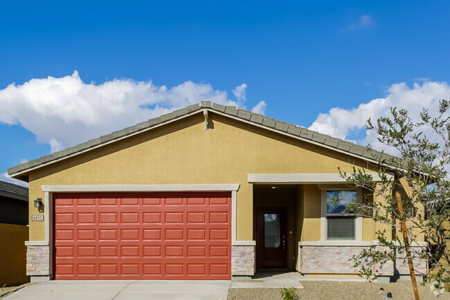
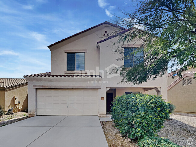
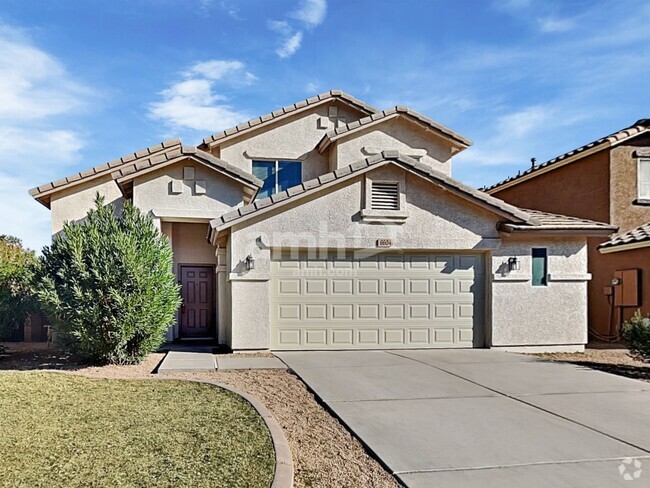
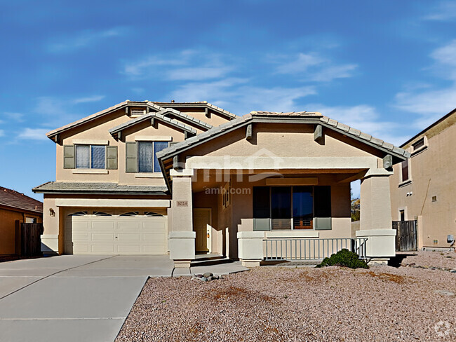
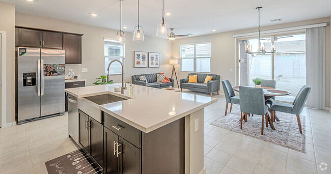
$1,899 / Month
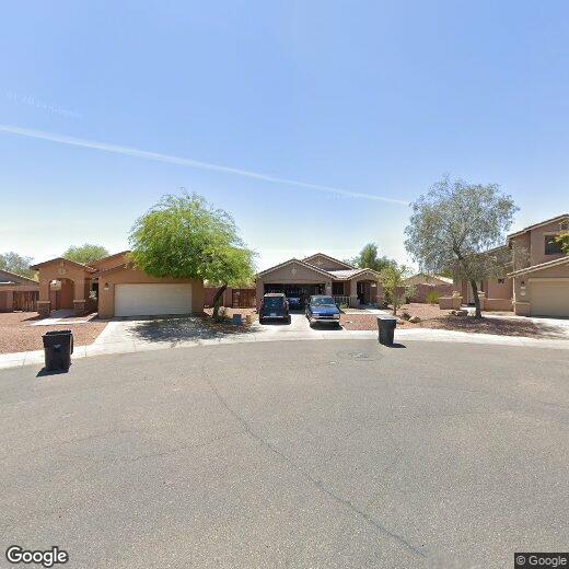
2526 S 110th Dr
Avondale, AZ 85323
Today
Favorites
480-254-9197
-
Bedrooms
4
-
Bathrooms
2
-
Square Feet
1,560 sq ft
-
Available
Available Now
2526 S 110th Dr

Favorites
Living in Avondale Gateway, you’re surrounded by a wide variety of restaurants, including Culver’s famous frozen custard and butterburgers, Ruby Tuesday’s, Carrabba’s Italian Grill, Red Robin, and Raising Cane’s chicken fingers.
Residents have direct access to Interstate 10, which makes for convenient commuting. The multi-use fields at Friendship Park are just a short drive away, as are the picnic areas at Cashion Community Park. Avondale Fiesta plaza encompasses a lot of convenient services, from fast-food establishments to UPS and a local supermarket. Phoenix’s international airport is about a half hour drive from Avondale Gateway, and the shops and cinema at Gateway Pavilions are under a 10-minute drive.
Learn more about living in Avondale Gateway
Education
| Colleges & Universities | Distance | ||
|---|---|---|---|
| Colleges & Universities | Distance | ||
| Drive: | 13 min | 6.9 mi | |
| Drive: | 27 min | 15.9 mi | |
| Drive: | 27 min | 15.9 mi | |
| Drive: | 26 min | 16.9 mi |
2526 S 110th Dr is within 13 minutes or 6.9 miles from Estrella Mountain Comm. Coll.. It is also near Grand Canyon University and Glendale Community College.
Schools
Public Elementary & Middle School
Grades K-8
885 Students
Attendance Zone
4
Out of 10
Public Elementary & Middle School
Grades PK-8
802 Students
Attendance Zone
3
Out of 10
Public High School
Grades 9-12
2,078 Students
Attendance Zone
4
Out of 10
Private Elementary & Middle School
Grades PK-8
461 Students
Nearby
Private Elementary, Middle & High School
Grades PK-12
34 Students
Nearby
Private Elementary, Middle & High School
Grades PK-12
Nearby
School data provided by
GreatSchools
The GreatSchools Rating helps parents compare schools within a state based on a variety of school quality indicators and provides a helpful picture of how effectively each school serves all of its students. Ratings are on a scale of 1 (below average) to 10 (above average) and can include test scores, college readiness, academic progress, advanced courses, equity, discipline and attendance data. We also advise parents to visit schools, consider other information on school performance and programs, and consider family needs as part of the school selection process.
Transportation options available in Avondale include Van Buren/1St Ave, located 15.9 miles from 2526 S 110th Dr. 2526 S 110th Dr is near Phoenix Sky Harbor International, located 21.6 miles or 31 minutes away.
| Transit / Subway | Distance | ||
|---|---|---|---|
| Transit / Subway | Distance | ||
|
|
Drive: | 23 min | 15.9 mi |
|
|
Drive: | 23 min | 16.1 mi |
|
|
Drive: | 24 min | 16.2 mi |
|
|
Drive: | 25 min | 16.4 mi |
|
|
Drive: | 27 min | 17.8 mi |
| Commuter Rail | Distance | ||
|---|---|---|---|
| Commuter Rail | Distance | ||
|
|
Drive: | 58 min | 43.3 mi |
| Airports | Distance | ||
|---|---|---|---|
| Airports | Distance | ||
|
Phoenix Sky Harbor International
|
Drive: | 31 min | 21.6 mi |
Time and distance from 2526 S 110th Dr.
| Shopping Centers | Distance | ||
|---|---|---|---|
| Shopping Centers | Distance | ||
| Walk: | 10 min | 0.6 mi | |
| Drive: | 3 min | 1.4 mi | |
| Drive: | 3 min | 1.5 mi |
2526 S 110th Dr has 3 shopping centers within 1.5 miles, which is about a 3-minute walk. The miles and minutes will be for the farthest away property.
| Parks and Recreation | Distance | ||
|---|---|---|---|
| Parks and Recreation | Distance | ||
|
Base and Meridian Wildlife Area
|
Drive: | 6 min | 3.6 mi |
|
Friendship Park
|
Drive: | 11 min | 4.8 mi |
|
Estrella Mountain Regional Park
|
Drive: | 15 min | 7.0 mi |
|
El Oso Park
|
Drive: | 16 min | 9.0 mi |
|
Maryvale Park
|
Drive: | 22 min | 12.7 mi |
2526 S 110th Dr has 5 parks within 12.7 miles, including Base and Meridian Wildlife Area, Friendship Park, and Estrella Mountain Regional Park.
| Hospitals | Distance | ||
|---|---|---|---|
| Hospitals | Distance | ||
| Drive: | 7 min | 3.4 mi | |
| Drive: | 11 min | 5.9 mi | |
| Drive: | 11 min | 6.2 mi |
2526 S 110th Dr has 3 hospitals within 6.2 miles, the nearest is Copper Springs Hospital which is 3.4 miles away and a 7 minute drive.
| Military Bases | Distance | ||
|---|---|---|---|
| Military Bases | Distance | ||
| Drive: | 20 min | 10.9 mi | |
| Drive: | 32 min | 21.4 mi | |
| Drive: | 87 min | 63.2 mi |
2526 S 110th Dr has 3 military bases within 63.2 miles, the nearest is Luke Air Force Base which is 10.9 miles away and a 20 minute drive.
You May Also Like
Similar Rentals Nearby
-
-
-
1 / 34
 Single-Family Homes Specials
Pets Allowed Pool Kitchen In Unit Washer & Dryer Walk-In Closets EV Charging
-
-
 $2,2504 Beds, 3 Baths, 2,228 sq ftHouse for Rent
 -
 $2,0904 Beds, 2 Baths, 1,792 sq ftHouse for Rent
 -
 $2,2254 Beds, 2 Baths, 1,821 sq ftHouse for Rent
 -
 $2,2004 Beds, 2 Baths, 1,914 sq ftHouse for Rent
 -
 $2,1004 Beds, 2.5 Baths, 2,059 sq ftHouse for Rent
 -
 $2,5304 Beds, 3 Baths, 2,719 sq ftHouse for Rent
What Are Walk Score®, Transit Score®, and Bike Score® Ratings?
Walk Score® measures the walkability of any address. Transit Score® measures access to public transit. Bike Score® measures the bikeability of any address.
What is a Sound Score Rating?
A Sound Score Rating aggregates noise caused by vehicle traffic, airplane traffic and local sources

2526 S 110th Dr
Avondale, AZ 85323