$2,000 / Month
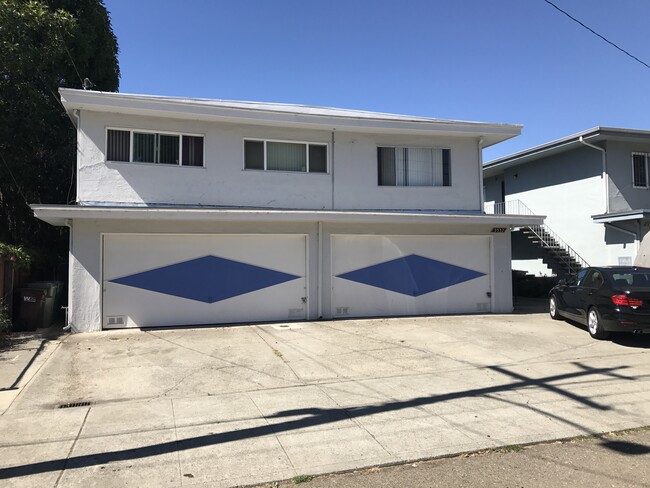
2537 34th Ave Unit A
Oakland, CA 94601
2 Days Ago
Favorites
510-281-7623
-
Bedrooms
1
-
Bathrooms
1
-
Square Feet
600 sq ft
-
Available
Available Now
Highlight
- Smoke Free
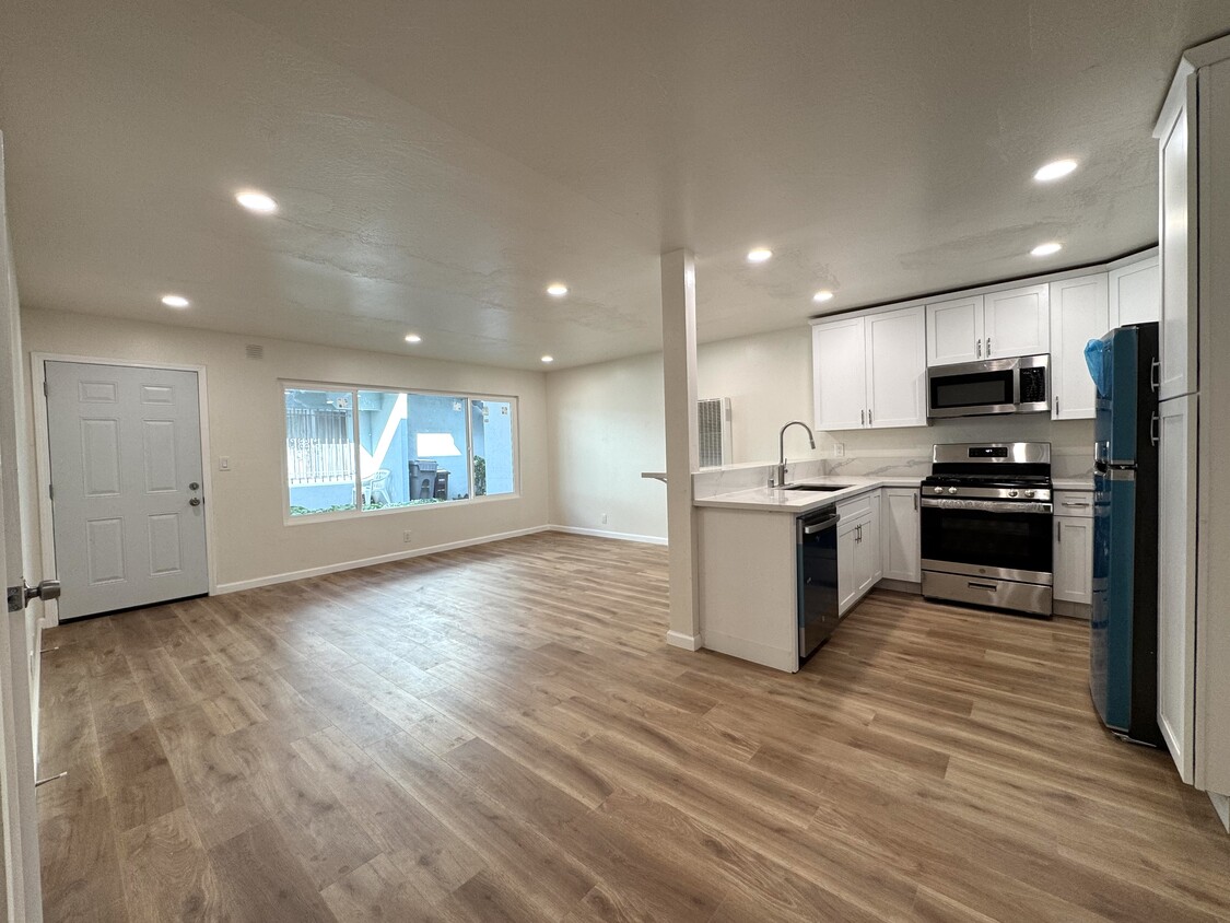
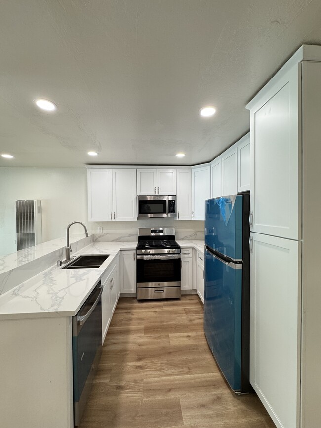
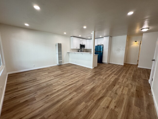
2537 34th Ave Unit A

Favorites
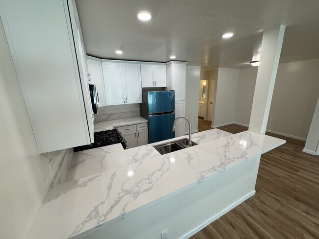
About This Home
12 Month Lease,
$2,000 deposit,
Available Now
Fruitvale 4-plex on cul-de-sac. Next to historic peralta hacienda park.
2537 34th Ave is an apartment community located in Alameda County and the 94601 ZIP Code.
* Price shown is base rent and may not include non-optional fees and utilities.
Price, availability, fees, and any applicable rent special are subject to change without notice.
* Square footage definitions vary. Displayed square footage is approximate.
Apartment Features
- Smoke Free
- Dishwasher
- Laundry Facilities
Fees and Policies
The fees below are based on community-supplied data and may exclude additional fees and utilities.
- Cats Allowed
-
Fees not specified
-
Weight limit--
-
Pet Limit--
- Parking
-
Garage$1/mo
Details
Utilities Included
-
Water
-
Trash Removal
Lease Options
-
0 - 12 Month Leases
Property Information
-
4 units
Contact
- Listed by Matt Oehrlein
- Phone Number
- Contact
Location
Get Directions
Sitting directly across the I-80 from San Francisco, Oakland is a thriving city in its own right, and in recent years has become a popular home for folks seeking more affordable (and available) living arrangements than what is available across the bay without sacrificing the distinctive atmosphere.
While shipping is still a major part of the local economy, Oakland is home to the corporate headquarters for everything from established consumer brands to younger tech businesses. The cultural diversity of the city is vast, meaning that it’s easy to find art, food, and people from every corner of the world by just walking down the street.
California College of the Arts brings a creative streak to the community, which is reflected in the eclectic shops and cafes along College Avenue; In the Mosswood area, an eclectic mix of coffee houses, taverns, arts centers, and international restaurants line Telegraph Avenue, which runs all the way up to the UC Berkeley campus.
Learn more about living in Oakland
Education
| Colleges & Universities | Distance | ||
|---|---|---|---|
| Colleges & Universities | Distance | ||
| Drive: | 8 min | 2.8 mi | |
| Drive: | 6 min | 3.1 mi | |
| Drive: | 8 min | 3.9 mi | |
| Drive: | 12 min | 5.4 mi |
2537 34th Ave Unit A is within 8 minutes or 2.8 miles from Mills College. It is also near Laney College and Lincoln University, Oakland.
Transportation options available in Oakland include Fruitvale Station, located 1.2 miles from 2537 34th Ave Unit A. 2537 34th Ave Unit A is near Metro Oakland International, located 7.1 miles or 12 minutes away, and San Francisco International, located 26.1 miles or 39 minutes away.
| Transit / Subway | Distance | ||
|---|---|---|---|
| Transit / Subway | Distance | ||
|
|
Drive: | 2 min | 1.2 mi |
|
|
Drive: | 7 min | 3.4 mi |
|
|
Drive: | 7 min | 3.5 mi |
|
|
Drive: | 8 min | 3.9 mi |
|
|
Drive: | 8 min | 4.2 mi |
| Commuter Rail | Distance | ||
|---|---|---|---|
| Commuter Rail | Distance | ||
|
|
Drive: | 8 min | 4.4 mi |
|
|
Drive: | 11 min | 7.1 mi |
|
|
Drive: | 14 min | 9.2 mi |
| Drive: | 20 min | 13.6 mi | |
| Drive: | 22 min | 14.9 mi |
| Airports | Distance | ||
|---|---|---|---|
| Airports | Distance | ||
|
Metro Oakland International
|
Drive: | 12 min | 7.1 mi |
|
San Francisco International
|
Drive: | 39 min | 26.1 mi |
Time and distance from 2537 34th Ave Unit A.
| Shopping Centers | Distance | ||
|---|---|---|---|
| Shopping Centers | Distance | ||
| Drive: | 3 min | 1.1 mi | |
| Drive: | 2 min | 1.2 mi | |
| Drive: | 2 min | 1.2 mi |
2537 34th Ave Unit A has 3 shopping centers within 1.2 miles, which is about a 2-minute drive. The miles and minutes will be for the farthest away property.
| Parks and Recreation | Distance | ||
|---|---|---|---|
| Parks and Recreation | Distance | ||
|
Lakeside Park
|
Drive: | 6 min | 3.5 mi |
|
Oakland Museum of California
|
Drive: | 7 min | 3.5 mi |
|
Rotary Nature Center
|
Drive: | 7 min | 3.8 mi |
|
Lakeside Park Garden Center
|
Drive: | 7 min | 3.8 mi |
|
Joaquin Miller Park
|
Drive: | 13 min | 5.7 mi |
2537 34th Ave Unit A has 5 parks within 5.7 miles, including Lakeside Park, Rotary Nature Center, and Oakland Museum of California.
| Hospitals | Distance | ||
|---|---|---|---|
| Hospitals | Distance | ||
| Walk: | 9 min | 0.5 mi | |
| Drive: | 5 min | 1.9 mi | |
| Drive: | 8 min | 3.3 mi |
2537 34th Ave Unit A has 3 hospitals within 3.3 miles, the nearest is Telecare Heritage Psychiatric Health Facility which is 0.5 mile away and a 9 minute walk.
| Military Bases | Distance | ||
|---|---|---|---|
| Military Bases | Distance | ||
| Drive: | 16 min | 7.0 mi | |
| Drive: | 16 min | 8.0 mi |
2537 34th Ave Unit A is 7.0 miles from Alameda/US Naval Air Station Alameda, and is convenient to other military bases, including Oakland Army Base.
Amenities
- Smoke Free
- Dishwasher
- Laundry Facilities
2537 34th Ave Unit A Photos
What Are Walk Score®, Transit Score®, and Bike Score® Ratings?
Walk Score® measures the walkability of any address. Transit Score® measures access to public transit. Bike Score® measures the bikeability of any address.
What is a Sound Score Rating?
A Sound Score Rating aggregates noise caused by vehicle traffic, airplane traffic and local sources

2537 34th Ave
Oakland, CA 94601