2580 N Soto St Unit 219
Los Angeles, CA 90032
-
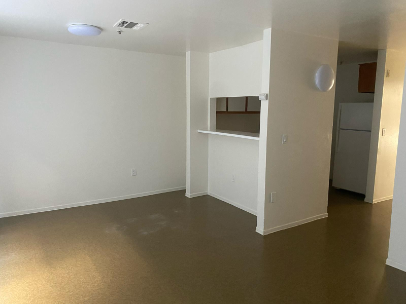
Bedrooms
4
-
Bathrooms
2
-
Square Feet
1,347 sq ft
-
Available
Available Now
Highlights
- Pets Allowed
- Security System

About This Home
Property Id: 1826632 SPECIAL OFFER: $1000 OFF on Move In!!!! WE ACCEPT SEC 8 and OTHER RENTAL ASSISTING PROGRAMS Welcome to Happy Valley City Lights: Experience great living at Happy Valley City Lights located in the Heart of Los Angeles district. You will find fine dining, antique shops, and historical area/ shops. Steps away from the light rail, along the bus route. Enjoy an urban connection, with a diverse culture, exotic art community, exciting sports and a thriving music scene. Providing an exclusive year-round experience Find Your New Home in Los Angeles: Discover spacious, affordable living in a vibrant community located in the Heart of Los Angeles.
2580 N Soto St is an apartment community located in Los Angeles County and the 90032 ZIP Code.
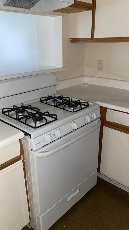
Features
Dishwasher
Microwave
Refrigerator
Security System
- Security System
- Dishwasher
- Microwave
- Refrigerator
Fees and Policies
The fees below are based on community-supplied data and may exclude additional fees and utilities.
- Dogs Allowed
-
Fees not specified
- Cats Allowed
-
Fees not specified
Details
Utilities Included
-
Water
-
Trash Removal
-
Sewer
Contact
- Phone Number
- Contact
-
Source

- Security System
- Dishwasher
- Microwave
- Refrigerator
Southeast Los Angeles is directly south of the Fashion District and east of the University of Southern California (USC). This large neighborhood is minutes from downtown Los Angeles, Hollywood, and Beverly Hills, with easy access to the 110 Freeway. This great location places you near sunny beaches, nature trails, and a bevy of leading employers. Students can access both USC and California State University Long Beach from their Southeast LA apartment.
This densely populated, diverse neighborhood features everything from food trucks and corner markets to wide sidewalks and residential areas filled with bungalows, ranch, and Spanish Colonial architecture. Southeast LA features palm trees and mountain views, tampered with gritty undertones to give it a cool, funky vibe.
As for outdoor fun, take your pick between Catalina Island, Venus Beach, or the Santa Monica Pier. Nearby, you’ll find more sunny beaches like White Point, Cabrillo, and Long Beach.
Learn more about living in Southeast Los Angeles| Colleges & Universities | Distance | ||
|---|---|---|---|
| Colleges & Universities | Distance | ||
| Drive: | 4 min | 1.9 mi | |
| Drive: | 7 min | 3.1 mi | |
| Drive: | 13 min | 5.4 mi | |
| Drive: | 11 min | 5.8 mi |
Transportation options available in Los Angeles include Lincoln Heights/Cypress Park Station, located 2.2 miles from 2580 N Soto St Unit 219. 2580 N Soto St Unit 219 is near Bob Hope, located 16.7 miles or 25 minutes away, and Los Angeles International, located 19.5 miles or 32 minutes away.
| Transit / Subway | Distance | ||
|---|---|---|---|
| Transit / Subway | Distance | ||
|
|
Drive: | 5 min | 2.2 mi |
|
|
Drive: | 6 min | 2.3 mi |
|
|
Drive: | 4 min | 2.6 mi |
|
|
Drive: | 7 min | 3.1 mi |
|
|
Drive: | 8 min | 3.2 mi |
| Commuter Rail | Distance | ||
|---|---|---|---|
| Commuter Rail | Distance | ||
|
|
Drive: | 8 min | 3.4 mi |
|
|
Drive: | 7 min | 3.5 mi |
|
|
Drive: | 11 min | 6.0 mi |
| Drive: | 10 min | 7.4 mi | |
|
|
Drive: | 17 min | 8.9 mi |
| Airports | Distance | ||
|---|---|---|---|
| Airports | Distance | ||
|
Bob Hope
|
Drive: | 25 min | 16.7 mi |
|
Los Angeles International
|
Drive: | 32 min | 19.5 mi |
Time and distance from 2580 N Soto St Unit 219.
| Shopping Centers | Distance | ||
|---|---|---|---|
| Shopping Centers | Distance | ||
| Walk: | 19 min | 1.0 mi | |
| Drive: | 4 min | 1.7 mi | |
| Drive: | 4 min | 1.7 mi |
| Parks and Recreation | Distance | ||
|---|---|---|---|
| Parks and Recreation | Distance | ||
|
Audubon Center at Debs Park
|
Drive: | 8 min | 3.1 mi |
|
Hollenbeck Lake
|
Drive: | 6 min | 3.2 mi |
|
Chavez Ravine Arboretum
|
Drive: | 9 min | 4.1 mi |
|
Elysian Park
|
Drive: | 12 min | 4.1 mi |
|
Elyria Canyon Park
|
Drive: | 10 min | 4.7 mi |
| Hospitals | Distance | ||
|---|---|---|---|
| Hospitals | Distance | ||
| Drive: | 3 min | 1.5 mi | |
| Drive: | 4 min | 2.3 mi | |
| Drive: | 7 min | 3.6 mi |
| Military Bases | Distance | ||
|---|---|---|---|
| Military Bases | Distance | ||
| Drive: | 29 min | 21.1 mi | |
| Drive: | 38 min | 26.6 mi |
You May Also Like
What Are Walk Score®, Transit Score®, and Bike Score® Ratings?
Walk Score® measures the walkability of any address. Transit Score® measures access to public transit. Bike Score® measures the bikeability of any address.
What is a Sound Score Rating?
A Sound Score Rating aggregates noise caused by vehicle traffic, airplane traffic and local sources

2580 N Soto St
Los Angeles, CA 90032