-
Monthly Rent
$2,295
-
Bedrooms
3 bd
-
Bathrooms
1 ba
-
Square Feet
1,224 sq ft
Details

About This Property
Owner is willing to work with pets on a case by case basis, depending on the strength of your application, but is not willing to work with bully breeds.
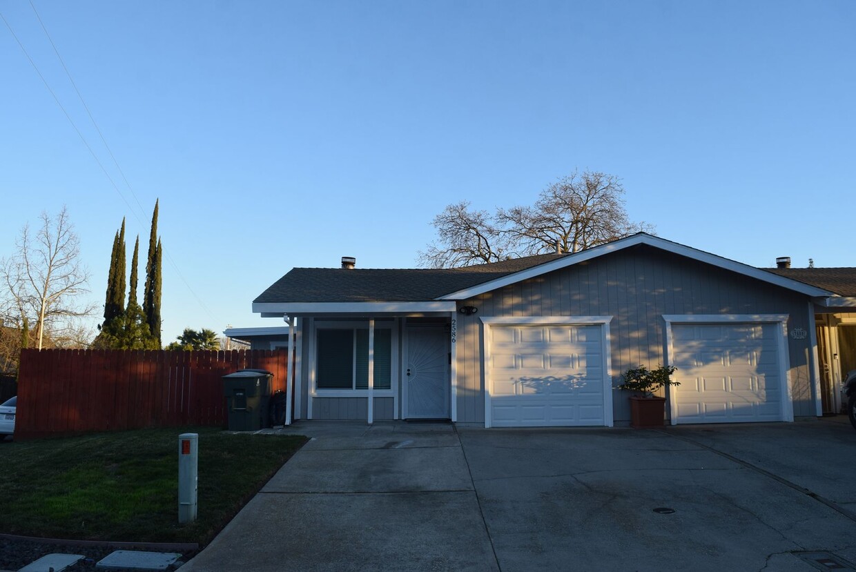
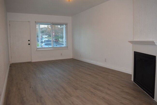
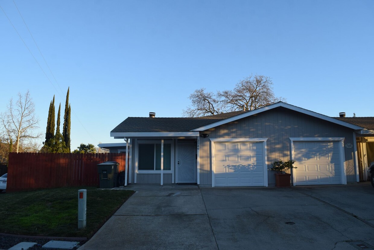
2586 S Whitney Blvd is a house located in Placer County and the 95677 ZIP Code.
Discover Homeownership
Renting vs. Buying
-
Housing Cost Per Month: $2,295
-
Rent for 30 YearsRenting doesn't build equity Future EquityRenting isn't tax deductible Mortgage Interest Tax Deduction$0 Net Return
-
Buy Over 30 Years$886K - $1.58M Future Equity$410K Mortgage Interest Tax Deduction$60K - $751K Gain Net Return
-
 This Property
 Available Property
Rocklin, California sits just 21 miles northeast of Sacramento along I-80. This busy city is more than a suburb -- it is home to Sierra College and William Jessup University. It is filled with shopping plazas, such as the large Blue Oaks Town Center, and a section of Granite Drive is known as "Toy Row." (These toys are for grown-ups -- such as RVs and boats.) Rocklin is directly north of Roseville and residents enjoy easy access to Westfield Galleria at Roseville, providing even more shopping.
You'll enjoy fantastic mountain views when you move to a Rocklin apartment -- the city is surrounded by the Sierra Nevada Mountains and the Sutter-Butte mountain range. Quarry Park features hiking trails and an amphitheater where concerts are often held.
Rocklin has a secret -- the Secret Ravine, that is, which played a large role during the California Gold Rush. Later, Rocklin became a major granite-mining town -- be sure to take some of the Quarry History Tours after moving to Rocklin.
Learn more about living in Rocklin| Colleges & Universities | Distance | ||
|---|---|---|---|
| Colleges & Universities | Distance | ||
| Drive: | 9 min | 3.4 mi | |
| Drive: | 21 min | 12.7 mi | |
| Drive: | 31 min | 16.0 mi | |
| Drive: | 31 min | 21.0 mi |
Transportation options available in Rocklin include Hazel, located 12.9 miles from 2586 S Whitney Blvd. 2586 S Whitney Blvd is near Sacramento International, located 28.5 miles or 38 minutes away.
| Transit / Subway | Distance | ||
|---|---|---|---|
| Transit / Subway | Distance | ||
|
|
Drive: | 22 min | 12.9 mi |
|
|
Drive: | 22 min | 13.3 mi |
|
|
Drive: | 18 min | 13.4 mi |
|
|
Drive: | 24 min | 14.1 mi |
|
|
Drive: | 26 min | 15.1 mi |
| Commuter Rail | Distance | ||
|---|---|---|---|
| Commuter Rail | Distance | ||
|
|
Drive: | 4 min | 1.6 mi |
|
|
Drive: | 10 min | 4.2 mi |
| Drive: | 21 min | 14.8 mi | |
|
|
Drive: | 21 min | 14.8 mi |
|
|
Drive: | 38 min | 30.2 mi |
| Airports | Distance | ||
|---|---|---|---|
| Airports | Distance | ||
|
Sacramento International
|
Drive: | 38 min | 28.5 mi |
Time and distance from 2586 S Whitney Blvd.
| Shopping Centers | Distance | ||
|---|---|---|---|
| Shopping Centers | Distance | ||
| Walk: | 10 min | 0.5 mi | |
| Walk: | 10 min | 0.6 mi | |
| Walk: | 12 min | 0.7 mi |
| Parks and Recreation | Distance | ||
|---|---|---|---|
| Parks and Recreation | Distance | ||
|
Sierra College Natural History Museum
|
Drive: | 8 min | 3.4 mi |
|
Traylor Ranch Bird Sanctuary
|
Drive: | 15 min | 7.3 mi |
|
Folsom Powerhouse State Historic Park
|
Drive: | 23 min | 12.9 mi |
|
Folsom City Zoo Sanctuary
|
Drive: | 24 min | 13.5 mi |
|
Gibson Ranch County Park
|
Drive: | 24 min | 14.1 mi |
| Hospitals | Distance | ||
|---|---|---|---|
| Hospitals | Distance | ||
| Drive: | 7 min | 3.7 mi | |
| Drive: | 17 min | 10.8 mi | |
| Drive: | 26 min | 14.9 mi |
| Military Bases | Distance | ||
|---|---|---|---|
| Military Bases | Distance | ||
| Drive: | 29 min | 15.5 mi |
You May Also Like
Similar Rentals Nearby
-
-
-
1 / 38
-
-
-
-
$3,2293 Beds, 2 Baths, 1,529 sq ftHouse for Rent
-
$3,2693 Beds, 2 Baths, 1,600 sq ftHouse for Rent
-
$2,3003 Beds, 2 Baths, 1,402 sq ftHouse for Rent
-
$2,6503 Beds, 3 Baths, 1,686 sq ftHouse for Rent
What Are Walk Score®, Transit Score®, and Bike Score® Ratings?
Walk Score® measures the walkability of any address. Transit Score® measures access to public transit. Bike Score® measures the bikeability of any address.
What is a Sound Score Rating?
A Sound Score Rating aggregates noise caused by vehicle traffic, airplane traffic and local sources
