$6,500 / Month
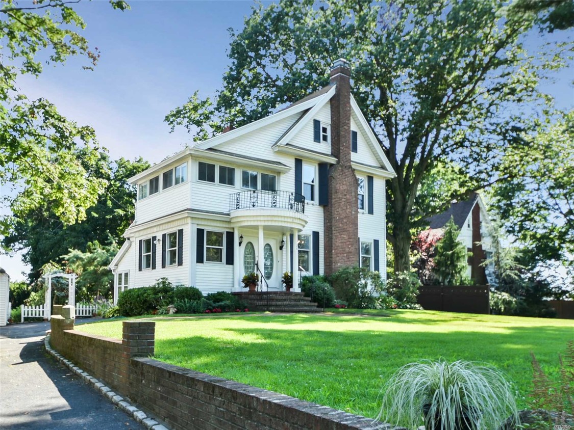
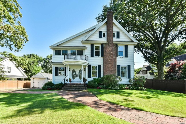
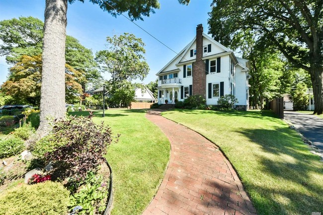
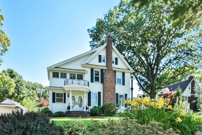
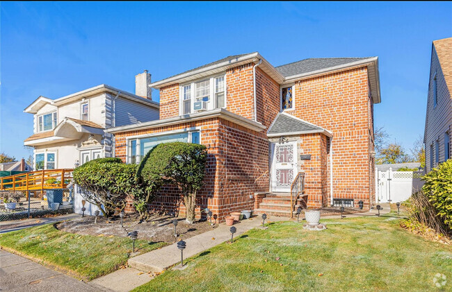
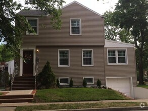
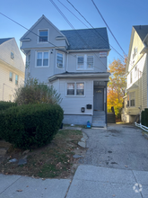
26 Cherry St
Queens, NY 11363
2 Weeks Ago
Favorites
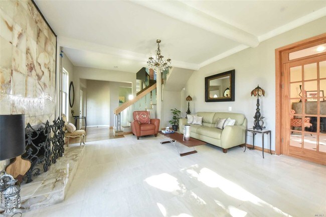
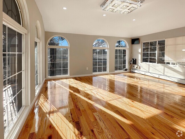
26 Cherry St

Favorites
Check Back Soon for Upcoming Availability
| Beds | Baths | Average SF |
|---|---|---|
| 3 Bedrooms 3 Bedrooms 3 Br | 3 Baths 3 Baths 3 Ba | 3,000 SF |
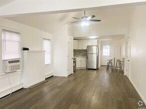
About This Property
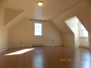
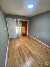
Spacious, Sunny Center Hall Colonial In Waterfront Community. 25 Minutes To Penn Station. Three Bedrooms Plus Bonus Sleeping Loft With Skylight And Full Bathroom. Large Deck Off The Kitchen Overlooks Huge Backyard. Community School District #26.
26 Cherry St is a house located in Queens County and the 11363 ZIP Code.
Location
Get Directions
Douglaston is a residential neighborhood in Queens stretching from Interstate 495 to the shore of the Little Neck Bay. Although the neighborhood is less than 20 miles from New York City, it has a surprisingly suburban feel. Rental options in Douglaston mostly consist of apartments as well as a few single-family homes. Inside town, residents enjoy parks, golf courses, and conveniently placed shops and restaurants. Douglaston’s western neighbor is Alley Park, a verdant space equipped with trails, playgrounds, sports fields and more. East of Douglaston, a plethora of dining and retail destinations are situated along Interstate 495 and Northern Boulevard.
Learn more about living in DouglastonBelow are rent ranges for similar nearby apartments
Education
| Colleges & Universities | Distance | ||
|---|---|---|---|
| Colleges & Universities | Distance | ||
| Drive: | 5 min | 2.0 mi | |
| Drive: | 11 min | 5.7 mi | |
| Drive: | 12 min | 6.8 mi | |
| Drive: | 15 min | 8.3 mi |
26 Cherry St is within 5 minutes or 2.0 miles from Queensborough Comm. Coll.. It is also near St. John's University and Queens College.
Transportation options available in Queens include Flushing-Main Street, located 5.4 miles from 26 Cherry St. 26 Cherry St is near Laguardia, located 10.4 miles or 18 minutes away, and John F Kennedy International, located 13.5 miles or 22 minutes away.
| Transit / Subway | Distance | ||
|---|---|---|---|
| Transit / Subway | Distance | ||
|
|
Drive: | 12 min | 5.4 mi |
|
|
Drive: | 14 min | 6.3 mi |
|
|
Drive: | 11 min | 6.7 mi |
|
|
Drive: | 12 min | 7.2 mi |
|
|
Drive: | 13 min | 7.8 mi |
| Commuter Rail | Distance | ||
|---|---|---|---|
| Commuter Rail | Distance | ||
|
|
Walk: | 6 min | 0.3 mi |
|
|
Walk: | 10 min | 0.6 mi |
|
|
Drive: | 5 min | 2.2 mi |
|
|
Drive: | 5 min | 2.6 mi |
|
|
Drive: | 7 min | 3.3 mi |
| Airports | Distance | ||
|---|---|---|---|
| Airports | Distance | ||
|
Laguardia
|
Drive: | 18 min | 10.4 mi |
|
John F Kennedy International
|
Drive: | 22 min | 13.5 mi |
Time and distance from 26 Cherry St.
| Shopping Centers | Distance | ||
|---|---|---|---|
| Shopping Centers | Distance | ||
| Drive: | 3 min | 1.5 mi | |
| Drive: | 3 min | 1.6 mi | |
| Drive: | 4 min | 1.7 mi |
26 Cherry St has 3 shopping centers within 1.7 miles, which is about a 4-minute drive. The miles and minutes will be for the farthest away property.
| Parks and Recreation | Distance | ||
|---|---|---|---|
| Parks and Recreation | Distance | ||
|
Alley Pond Environmental Center
|
Drive: | 4 min | 1.6 mi |
|
Alley Pond Park
|
Drive: | 4 min | 2.2 mi |
|
Queens County Farm Museum
|
Drive: | 7 min | 2.9 mi |
|
Crocheron Park
|
Drive: | 8 min | 3.1 mi |
|
Fort Totten Park
|
Drive: | 8 min | 4.1 mi |
26 Cherry St has 5 parks within 4.1 miles, including Alley Pond Environmental Center, Alley Pond Park, and Crocheron Park.
| Hospitals | Distance | ||
|---|---|---|---|
| Hospitals | Distance | ||
| Drive: | 5 min | 2.7 mi | |
| Drive: | 7 min | 3.9 mi | |
| Drive: | 11 min | 4.8 mi |
26 Cherry St has 3 hospitals within 4.8 miles, the nearest is Creedmoor Psychiatric Center which is 2.7 miles away and a 5 minute drive.
| Military Bases | Distance | ||
|---|---|---|---|
| Military Bases | Distance | ||
| Drive: | 8 min | 4.1 mi | |
| Drive: | 44 min | 22.3 mi |
26 Cherry St is 4.1 miles from Fort Totten US Govt Reservation, and is convenient to other military bases, including US Coast Guard Heliport.
You May Also Like
Similar Rentals Nearby

What Are Walk Score®, Transit Score®, and Bike Score® Ratings?
Walk Score® measures the walkability of any address. Transit Score® measures access to public transit. Bike Score® measures the bikeability of any address.
What is a Sound Score Rating?
A Sound Score Rating aggregates noise caused by vehicle traffic, airplane traffic and local sources

26 Cherry St
Queens, NY 11363