
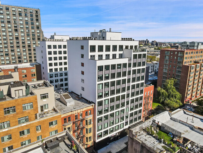
26 Kearny St
Newark, NJ 07104
Favorites

26 Kearny St
Favorites
Check Back Soon for Upcoming Availability
| Beds | Baths | Average SF |
|---|---|---|
| 4 Bedrooms 4 Bedrooms 4 Br | 1.5 Baths 1.5 Baths 1.5 Ba | — |
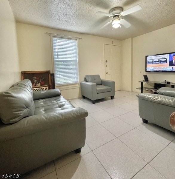
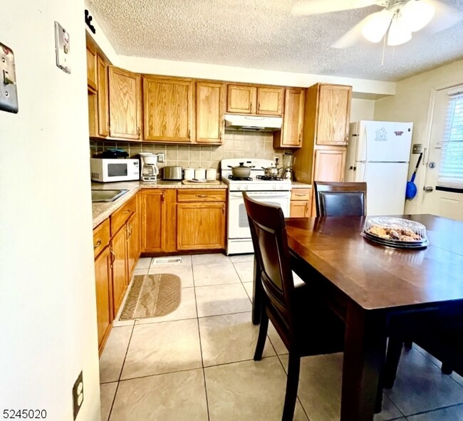
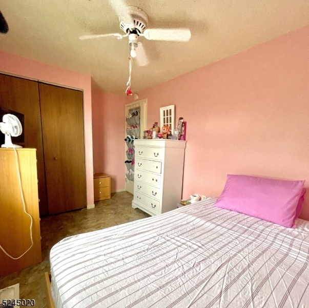
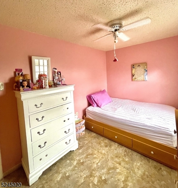
About This Property
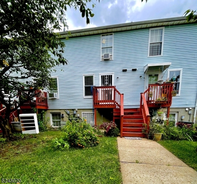
Spacious apartment features living room, eat-in-kitchen, 4 bedrooms, 1.5 bathrooms, 1 parking space and access to the yard. Close to transportation to NYC and schools and shopping center.
26 Kearny St is an apartment community located in Essex County and the 07104 ZIP Code.
Features
- Tile Floors
- Deck
Fees and Policies
The fees below are based on community-supplied data and may exclude additional fees and utilities.
Property Address:
26 Kearny St,
Newark,
NJ
07104
 This Property
 Available Property
Framed on the right by the Passaic River is the suburban neighborhood of Mount Pleasant-Lower Broadway. This community is ideal for commuters as it provides easy access to Interstate 280 and Highway 21, and it is situated just miles north of Downtown Newark. The suburb’s primarily residential streets are home to historic places of worship. Admire the impressive architecture of the community’s long-standing churches, including Saint Lucy's Church and the Archdiocese of Newark. Next, visit the city’s longest operating synagogue, the stunning Jewish Museum of New Jersey.
Moments away in Newark, renters in the Mount Pleasant-Lower Broadway area can enjoy exciting attractions including historic house museums, scenic parks, and a planetarium. To the west of the suburb is Branch Brook Park. Although good for recreation and fresh air year-round, this park really comes to life during the Cherry Blossom Festival.
Learn more about living in Mount Pleasant-Lower BroadBelow are rent ranges for similar nearby apartments
Amenities
- Tile Floors
- Deck
Education
| Colleges & Universities | Distance | ||
|---|---|---|---|
| Colleges & Universities | Distance | ||
| Drive: | 2 min | 1.2 mi | |
| Drive: | 3 min | 1.7 mi | |
| Drive: | 3 min | 1.7 mi | |
| Drive: | 6 min | 3.3 mi |
26 Kearny St is within 2 minutes or 1.2 miles from Rutgers, Newark Campus. It is also near N.J. Inst. of Technology and Essex County College.
Transportation options available in Newark include Bloomfield Avenue, located 0.8 mile from 26 Kearny St. 26 Kearny St is near Newark Liberty International, located 7.0 miles or 12 minutes away, and Laguardia, located 27.2 miles or 41 minutes away.
| Transit / Subway | Distance | ||
|---|---|---|---|
| Transit / Subway | Distance | ||
|
|
Walk: | 16 min | 0.8 mi |
|
|
Walk: | 18 min | 0.9 mi |
|
|
Drive: | 2 min | 1.3 mi |
|
|
Drive: | 3 min | 1.3 mi |
|
|
Drive: | 3 min | 1.5 mi |
| Commuter Rail | Distance | ||
|---|---|---|---|
| Commuter Rail | Distance | ||
|
|
Drive: | 3 min | 1.4 mi |
|
|
Drive: | 4 min | 2.0 mi |
|
|
Drive: | 4 min | 2.1 mi |
|
|
Drive: | 5 min | 2.5 mi |
|
|
Drive: | 5 min | 2.8 mi |
| Airports | Distance | ||
|---|---|---|---|
| Airports | Distance | ||
|
Newark Liberty International
|
Drive: | 12 min | 7.0 mi |
|
Laguardia
|
Drive: | 41 min | 27.2 mi |
Time and distance from 26 Kearny St.
| Shopping Centers | Distance | ||
|---|---|---|---|
| Shopping Centers | Distance | ||
| Walk: | 6 min | 0.3 mi | |
| Drive: | 3 min | 1.3 mi | |
| Drive: | 4 min | 1.6 mi |
26 Kearny St has 3 shopping centers within 1.6 miles, which is about a 4-minute drive. The miles and minutes will be for the farthest away property.
| Parks and Recreation | Distance | ||
|---|---|---|---|
| Parks and Recreation | Distance | ||
|
Branch Brook Park
|
Drive: | 3 min | 1.2 mi |
|
Newark Museum and Dreyfuss Planetarium
|
Drive: | 2 min | 1.3 mi |
|
Kearny Marsh
|
Drive: | 8 min | 3.7 mi |
|
Richard W. DeKorte Park
|
Drive: | 10 min | 4.9 mi |
|
Meadowlands Environment Center
|
Drive: | 19 min | 7.7 mi |
26 Kearny St has 5 parks within 7.7 miles, including Newark Museum and Dreyfuss Planetarium, Branch Brook Park, and Kearny Marsh.
| Hospitals | Distance | ||
|---|---|---|---|
| Hospitals | Distance | ||
| Drive: | 2 min | 1.2 mi | |
| Drive: | 4 min | 2.1 mi | |
| Drive: | 6 min | 3.0 mi |
26 Kearny St has 3 hospitals within 3.0 miles, the nearest is Saint Michael's Medical Center which is 1.2 miles away and a 2 minutes drive.
| Military Bases | Distance | ||
|---|---|---|---|
| Military Bases | Distance | ||
| Drive: | 17 min | 10.9 mi | |
| Drive: | 27 min | 12.9 mi | |
| Drive: | 33 min | 18.9 mi |
26 Kearny St has 3 military bases within 18.9 miles, the nearest is Military Ocean Terminal which is 10.9 miles away and a 17 minutes .
You May Also Like
Similar Rentals Nearby


What Are Walk Score®, Transit Score®, and Bike Score® Ratings?
Walk Score® measures the walkability of any address. Transit Score® measures access to public transit. Bike Score® measures the bikeability of any address.
What is a Sound Score Rating?
A Sound Score Rating aggregates noise caused by vehicle traffic, airplane traffic and local sources
26 Kearny St
Newark, NJ 07104