
$4,100 / Month
26 Parsons St
Boston, MA 02135
2 Weeks Ago
Favorites
-
Bedrooms
5
-
Bathrooms
2
-
Square Feet
1 sq ft
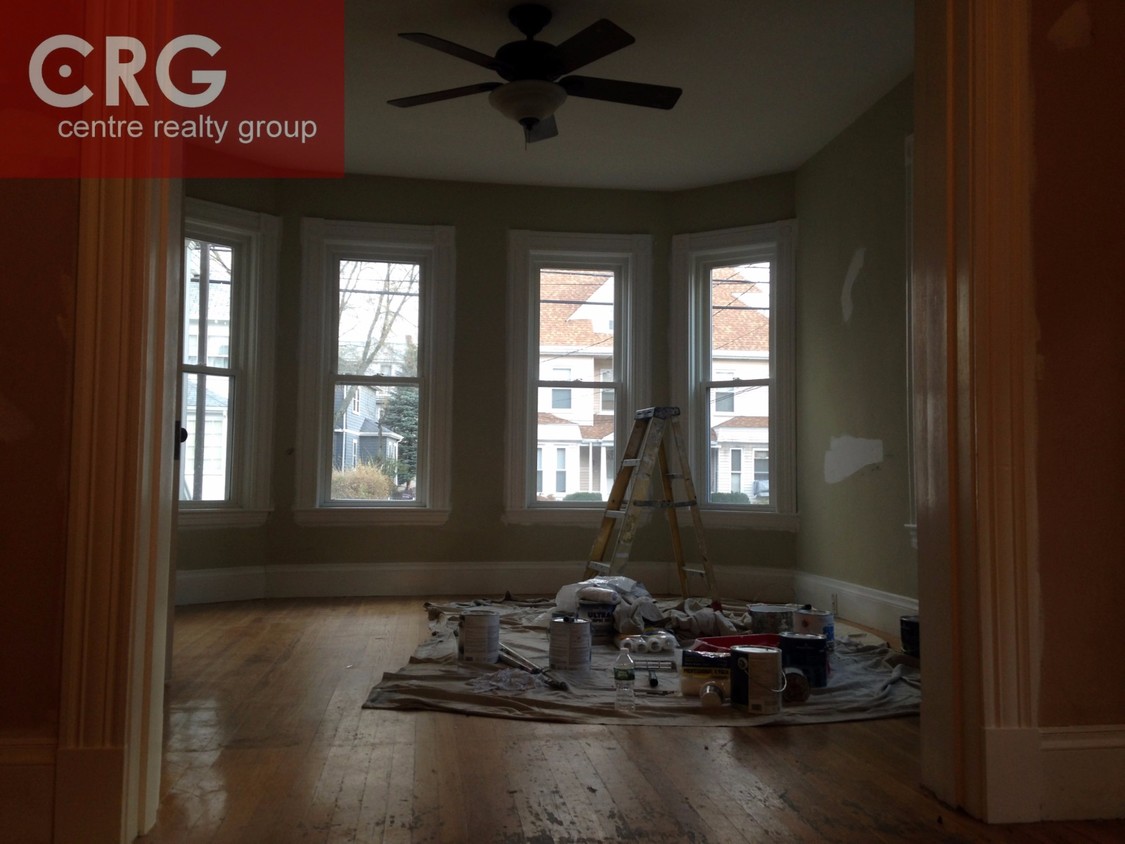
26 Parsons St

Favorites
About This Home
12 Month Lease
Please contact Micah Snyder at 413-695-7629 to set up a showing!!
Please contact Micah Snyder at 413-695-7629 to set up a showing!!
26 Parsons St is an apartment community located in Suffolk County and the 02135 ZIP Code. This area is served by the Boston Public Schools attendance zone.
* Price shown is base rent and may not include non-optional fees and utilities.
Price, availability, fees, and any applicable rent special are subject to change without notice.
* Square footage definitions vary. Displayed square footage is approximate.
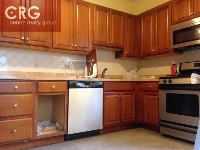
Apartment Features
- Washer/Dryer
Fees and Policies
The fees below are based on community-supplied data and may exclude additional fees and utilities.
- Parking
-
Street--
Details
Lease Options
-
12 Months
Location
Get Directions
You May Also Like
Located about nine miles away from Downtown Brighton, Oak Square is a nature lover’s dream. Spend plenty of warm days outdoors in one of Oak Square's many parks, including Gallagher Park, Foster Street Hill, and Rogers Park. These parks allow you to enjoy sports, take in views of the surrounding historic buildings, or have a picnic. Along with lush parks, Oak Square has an abundance of amenities and parking, which is a hot commodity in the area. Great for students, faculty, and staff, Oak Square is convenient to Harvard University, Boston College, and the Massachusetts Institute of Technology. Perfect for all renters, Oak Square has affordable and upscale rentals available. For more dining, shopping, and entertainment options, simply travel east along Interstate 90 to reach the cultural and economic heart of the city.
Learn more about living in Oak Square
Education
| Colleges & Universities | Distance | ||
|---|---|---|---|
| Colleges & Universities | Distance | ||
| Walk: | 14 min | 0.8 mi | |
| Drive: | 4 min | 1.4 mi | |
| Drive: | 6 min | 2.6 mi | |
| Drive: | 7 min | 2.7 mi |
26 Parsons St is within 14 minutes or 0.8 mile from Boston College, Brighton. It is also near Boston College and Boston University.
Schools
Public Elementary School
Grades PK-6
338 Students
Attendance Zone
6
Out of 10
Public Elementary & Middle School
Grades K-8
126 Students
Attendance Zone
Charter Middle & High School
Grades 6-12
476 Students
Attendance Zone
3
Out of 10
Public Middle & High School
Grades 7-12
2,423 Students
Attendance Zone
8
Out of 10
Public Middle & High School
Grades 7-12
532 Students
Attendance Zone
1
Out of 10
Public High School
Grades 9-12
116 Students
Attendance Zone
2
Out of 10
Private Elementary School
Grades PK-6
103 Students
Nearby
Private Elementary & Middle School
Grades PK-8
421 Students
Nearby
Private High School
Grades 9-12
52 Students
Nearby
School data provided by
GreatSchools
The GreatSchools Rating helps parents compare schools within a state based on a variety of school quality indicators and provides a helpful picture of how effectively each school serves all of its students. Ratings are on a scale of 1 (below average) to 10 (above average) and can include test scores, college readiness, academic progress, advanced courses, equity, discipline and attendance data. We also advise parents to visit schools, consider other information on school performance and programs, and consider family needs as part of the school selection process.
Transportation options available in Boston include Warren Street Station, located 0.9 mile from 26 Parsons St. 26 Parsons St is near General Edward Lawrence Logan International, located 9.5 miles or 17 minutes away.
| Transit / Subway | Distance | ||
|---|---|---|---|
| Transit / Subway | Distance | ||
|
|
Walk: | 16 min | 0.9 mi |
|
|
Walk: | 17 min | 0.9 mi |
|
|
Walk: | 18 min | 0.9 mi |
|
|
Drive: | 2 min | 1.1 mi |
|
|
Drive: | 3 min | 1.2 mi |
| Commuter Rail | Distance | ||
|---|---|---|---|
| Commuter Rail | Distance | ||
|
|
Drive: | 6 min | 2.9 mi |
|
|
Drive: | 7 min | 3.6 mi |
| Drive: | 7 min | 3.7 mi | |
|
|
Drive: | 9 min | 3.8 mi |
|
|
Drive: | 9 min | 4.4 mi |
| Airports | Distance | ||
|---|---|---|---|
| Airports | Distance | ||
|
General Edward Lawrence Logan International
|
Drive: | 17 min | 9.5 mi |
Time and distance from 26 Parsons St.
| Shopping Centers | Distance | ||
|---|---|---|---|
| Shopping Centers | Distance | ||
| Walk: | 16 min | 0.9 mi | |
| Walk: | 20 min | 1.1 mi | |
| Drive: | 4 min | 1.2 mi |
26 Parsons St has 3 shopping centers within 1.2 miles, which is about a 4-minute walk. The miles and minutes will be for the farthest away property.
| Parks and Recreation | Distance | ||
|---|---|---|---|
| Parks and Recreation | Distance | ||
|
Chestnut Hill Reservation
|
Drive: | 4 min | 1.3 mi |
|
John Fitzgerald Kennedy National Historic Site
|
Drive: | 4 min | 2.0 mi |
|
Hammond Pond Reservation
|
Drive: | 6 min | 2.5 mi |
|
Frederick Law Olmsted National Historic Site
|
Drive: | 7 min | 2.8 mi |
|
Coit Observatory
|
Drive: | 7 min | 3.1 mi |
26 Parsons St has 5 parks within 3.1 miles, including Chestnut Hill Reservation, John Fitzgerald Kennedy National Historic Site, and Hammond Pond Reservation.
| Hospitals | Distance | ||
|---|---|---|---|
| Hospitals | Distance | ||
| Walk: | 8 min | 0.4 mi | |
| Walk: | 12 min | 0.6 mi | |
| Drive: | 4 min | 2.1 mi |
26 Parsons St has 3 hospitals within 2.1 miles, the nearest is St. Elizabeth's Medical Center which is 0.4 mile away and a 8 minute walk.
| Military Bases | Distance | ||
|---|---|---|---|
| Military Bases | Distance | ||
| Drive: | 26 min | 12.2 mi | |
| Drive: | 23 min | 13.2 mi |
26 Parsons St is 12.2 miles from Hanscom Air Force Base, and is convenient to other military bases, including US Military Reservation.
Amenities
- Washer/Dryer
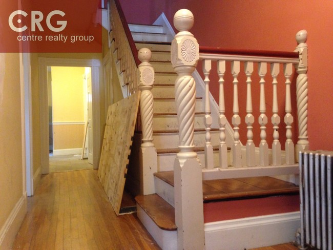
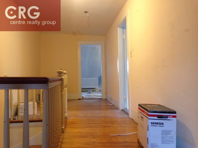
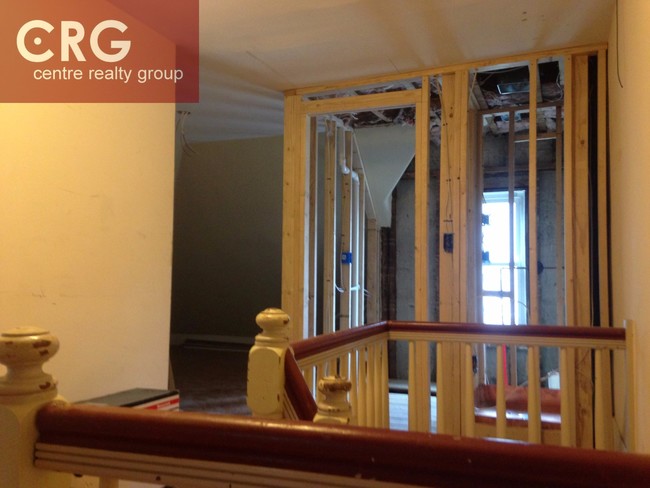
26 Parsons St Photos
What Are Walk Score®, Transit Score®, and Bike Score® Ratings?
Walk Score® measures the walkability of any address. Transit Score® measures access to public transit. Bike Score® measures the bikeability of any address.
What is a Sound Score Rating?
A Sound Score Rating aggregates noise caused by vehicle traffic, airplane traffic and local sources
26 Parsons St
Boston, MA 02135