
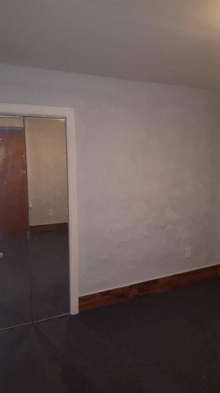
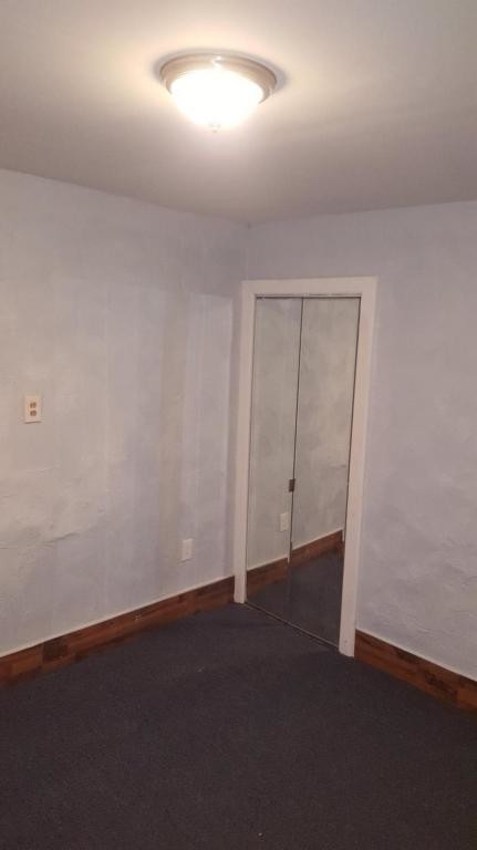

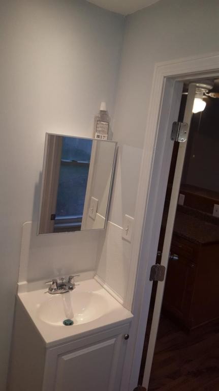
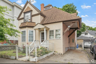
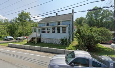
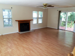
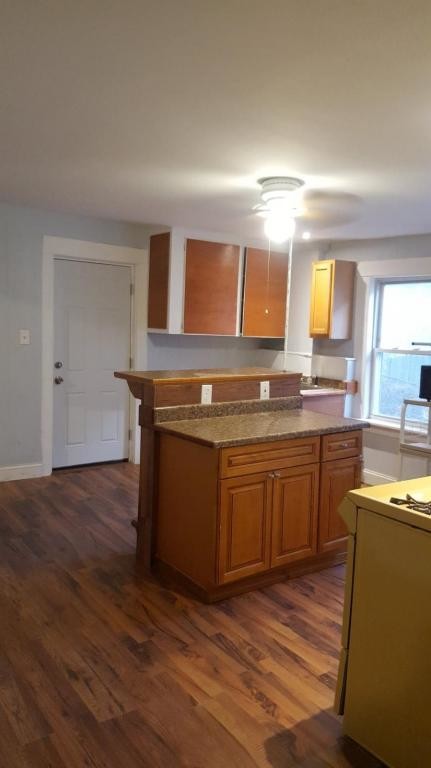
$1,100 / Month
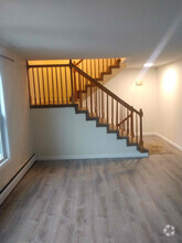
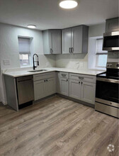
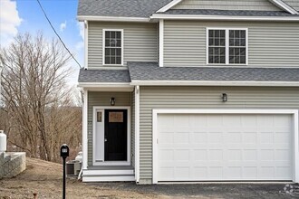
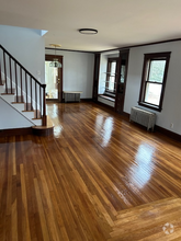
2 Jefferson St
Worcester, MA 01604
2 Weeks Ago
Favorites
2 Jefferson St

Favorites
Check Back Soon for Upcoming Availability
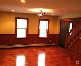
| Beds | Baths | Average SF |
|---|---|---|
| 2 Bedrooms 2 Bedrooms 2 Br | 1 Bath 1 Bath 1 Ba | 900 SF |
Location
Get Directions
Union Hill sits less than two miles southeast of Downtown Worcester, just on the other side of the I-290. Home to many historic homes and buildings, Union Hill is a primarily residential neighborhood convenient to a range of popular restaurants. Some mainstays near the neighborhood include Wholly Cannoli, Bocado Tapas Bar, BirchTree Bread Company, and Smokestack Urban Barbecue.
Union Hill’s proximity to a number of colleges and universities makes it a choice location for students and faculty. Clark University, Worcester Polytechnic Institute, Worcester State University, University of Massachusetts Medical School, College of the Holy Cross, and Becker College are all a short distance from Union Hill.
Options for outdoor recreation abound near Union Hill with the presence of Lake Quinsigamond, Crompton Park, Cristoforo Colombo Park, Crow Hill Conservation Restriction, and Broad Meadow Brook Conservation Restriction.
Learn more about living in Union HIllBelow are rent ranges for similar nearby apartments
Education
| Colleges & Universities | Distance | ||
|---|---|---|---|
| Colleges & Universities | Distance | ||
| Drive: | 3 min | 1.3 mi | |
| Drive: | 4 min | 2.0 mi | |
| Drive: | 4 min | 2.1 mi | |
| Drive: | 6 min | 2.6 mi |
2 Jefferson St is within 3 minutes or 1.3 miles from MCPHS University, Worcester. It is also near Becker College, Worcester and Clark University.
Schools


Public Elementary School
Grades PK-6
372 Students
Attendance Zone
Public Elementary School
Grades K-6
390 Students
Attendance Zone
Public Middle & High School
Grades 7-12
224 Students
Attendance Zone
Public Middle School
Grades 7-8
740 Students
Attendance Zone
Public High School
Grades 9-12
1,377 Students
Attendance Zone
Private Elementary, Middle & High School
Grades PK-12
193 Students
Nearby
Private Middle & High School
Grades 7-12
118 Students
Nearby
School data provided by
 The GreatSchools Rating helps parents compare schools within a state based on a variety of school quality indicators and provides a helpful picture of how effectively each school serves all of its students. Ratings are on a scale of 1 (below average) to 10 (above average) and can include test scores, college readiness, academic progress, advanced courses, equity, discipline and attendance data. We also advise parents to visit schools, consider other information on school performance and programs, and consider family needs as part of the school selection process.
View GreatSchools Rating Methodology
View GreatSchools Rating Methodology
Transportation options available in Worcester include Riverside Station, located 33.4 miles from 2 Jefferson St. 2 Jefferson St is near Worcester Regional, located 6.1 miles or 13 minutes away.
| Transit / Subway | Distance | ||
|---|---|---|---|
| Transit / Subway | Distance | ||
|
|
Drive: | 45 min | 33.4 mi |
|
|
Drive: | 45 min | 33.7 mi |
|
|
Drive: | 46 min | 34.4 mi |
|
|
Drive: | 49 min | 36.0 mi |
|
|
Drive: | 49 min | 36.2 mi |
| Commuter Rail | Distance | ||
|---|---|---|---|
| Commuter Rail | Distance | ||
|
|
Walk: | 12 min | 0.7 mi |
|
|
Walk: | 17 min | 0.9 mi |
|
|
Drive: | 14 min | 7.5 mi |
|
|
Drive: | 17 min | 9.7 mi |
|
|
Drive: | 29 min | 16.8 mi |
| Airports | Distance | ||
|---|---|---|---|
| Airports | Distance | ||
|
Worcester Regional
|
Drive: | 13 min | 6.1 mi |
Time and distance from 2 Jefferson St.
| Shopping Centers | Distance | ||
|---|---|---|---|
| Shopping Centers | Distance | ||
| Drive: | 4 min | 1.5 mi | |
| Drive: | 4 min | 1.6 mi | |
| Drive: | 4 min | 1.7 mi |
2 Jefferson St has 3 shopping centers within 1.7 miles, which is about a 4-minute drive. The miles and minutes will be for the farthest away property.
| Parks and Recreation | Distance | ||
|---|---|---|---|
| Parks and Recreation | Distance | ||
|
Mass Audubon's Broad Meadow Brook Conservation Center and Wildlife Sanctuary
|
Drive: | 5 min | 2.6 mi |
|
EcoTarium
|
Drive: | 7 min | 2.6 mi |
|
Quinsigamond State Park
|
Drive: | 6 min | 3.2 mi |
|
Ward Hill Ski Area
|
Drive: | 15 min | 7.9 mi |
|
Tower Hill Botanic Garden
|
Drive: | 16 min | 9.1 mi |
2 Jefferson St has 5 parks within 9.1 miles, including EcoTarium, Mass Audubon's Broad Meadow Brook Conservation Center and Wildlife Sanctuary, and Quinsigamond State Park.
| Hospitals | Distance | ||
|---|---|---|---|
| Hospitals | Distance | ||
| Drive: | 2 min | 1.2 mi | |
| Drive: | 3 min | 2.0 mi | |
| Drive: | 6 min | 3.2 mi |
2 Jefferson St has 3 hospitals within 3.2 miles, the nearest is St. Vincent Hospital which is 1.2 miles away and a 2 minute drive.
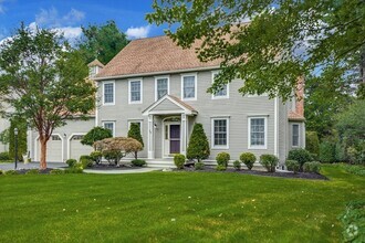
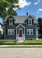
You May Also Like
Similar Rentals Nearby
What Are Walk Score®, Transit Score®, and Bike Score® Ratings?
Walk Score® measures the walkability of any address. Transit Score® measures access to public transit. Bike Score® measures the bikeability of any address.
What is a Sound Score Rating?
A Sound Score Rating aggregates noise caused by vehicle traffic, airplane traffic and local sources
2 Jefferson St
Worcester, MA 01604