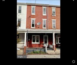
$1,300 / Month
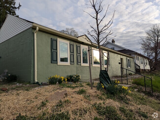
268 Elm St
Pottstown, PA 19465
Today
Favorites
215-607-9499
-
Bedrooms
1
-
Bathrooms
1
-
Square Feet
487 sq ft
-
Available
Available Now
268 Elm St

Favorites
About This Home
$1,300 deposit,
Available Now
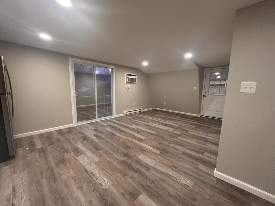
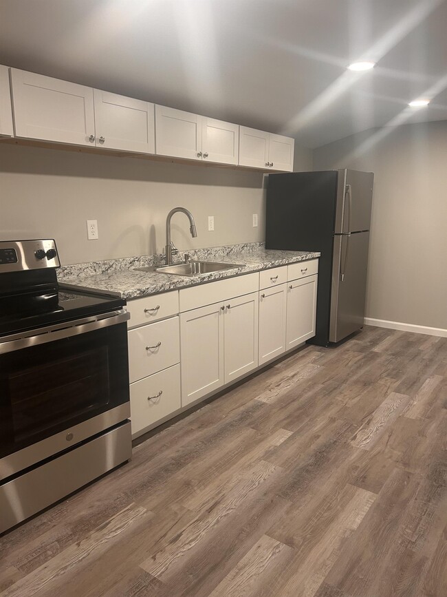
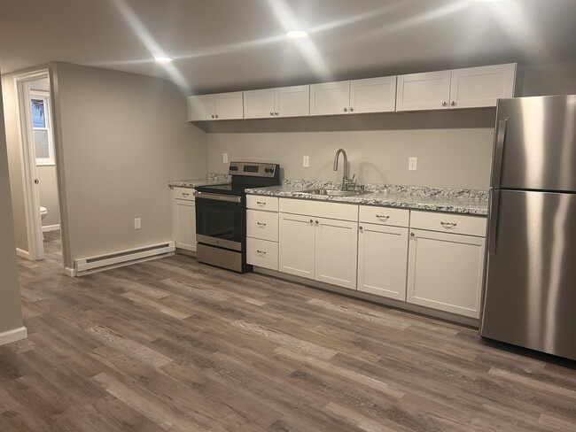
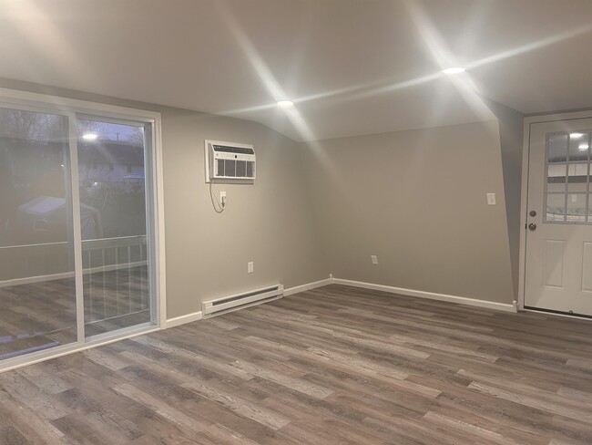
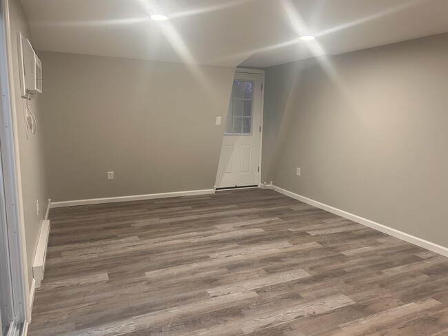
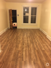
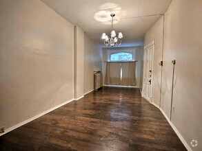
Welcome to your brand new 1-bedroom, 1-bathroom apartment in the heart of Stowe! Situated in the Pottsgrove School District, this modern living space offers the perfect opportunity for easy, hassle-free living from day one. Cable, internet, electric, heat, water, and trash an additional flat fee of $150 per month making it easy to budget for monthly utility costs. You can enjoy the convenience of a seamless move-in experience. Don't miss out on this opportunity to make this stylish, fresh space your new home sweet home!
268 Elm St is a house located in Chester County and the 19465 ZIP Code. This area is served by the Owen J Roberts attendance zone.
* Price shown is base rent and may not include non-optional fees and utilities.
Price, availability, fees, and any applicable rent special are subject to change without notice.
* Square footage definitions vary. Displayed square footage is approximate.
Contact
- Listed by Account Manager (2)
- Phone Number
- Contact
Location
Get Directions
Resting along the Schuylkill River, Pottstown is a small borough about 30 minutes from Reading and one hour from Philadelphia. Pottstown feels suburban with single-family homes on crisp lawns along tree-lined streets, and an abundance of convenient amenities.
Residents enjoy a variety of shopping and dining options. Upland Square on the edge of town offers several big-box stores, chain restaurants, and a movie theater. There are several small plazas across the town featuring local eateries, unique shops, and national stores.
Located in a verdant valley, Pottstown offers gorgeous natural areas great for outdoor recreation. Memorial Park is great for families and sports lovers with lighted ball fields, a skate park, a BMX track, a splash pad, and a playground. Visit the Pottstown Riverfront Park is a local favorite for kayaking and hiking.
Learn more about living in Pottstown
Education
| Colleges & Universities | Distance | ||
|---|---|---|---|
| Colleges & Universities | Distance | ||
| Walk: | 10 min | 0.5 mi | |
| Drive: | 21 min | 12.9 mi | |
| Drive: | 33 min | 18.7 mi | |
| Drive: | 38 min | 21.3 mi |
268 Elm St is within 10 minutes or 0.5 mile from Montgomery Co. C.C., West. It is also near Ursinus College and Alvernia University.
Schools


Public Elementary School
Grades PK-4
332 Students
Nearby
Public Elementary School
Grades K-6
561 Students
Attendance Zone
Public Middle School
Grades 7-8
910 Students
Attendance Zone
Public High School
Grades 9-12
1,820 Students
Attendance Zone
Private Elementary & Middle School
Grades PK-8
191 Students
Nearby
Private Elementary, Middle & High School
Grades PK-12
161 Students
Nearby
School data provided by
 The GreatSchools Rating helps parents compare schools within a state based on a variety of school quality indicators and provides a helpful picture of how effectively each school serves all of its students. Ratings are on a scale of 1 (below average) to 10 (above average) and can include test scores, college readiness, academic progress, advanced courses, equity, discipline and attendance data. We also advise parents to visit schools, consider other information on school performance and programs, and consider family needs as part of the school selection process.
View GreatSchools Rating Methodology
View GreatSchools Rating Methodology
Transportation options available in Pottstown include Norristown Transportation Center (100 Line), located 21.7 miles from 268 Elm St. 268 Elm St is near Lehigh Valley International, located 35.3 miles or 63 minutes away, and Philadelphia International, located 47.8 miles or 70 minutes away.
| Transit / Subway | Distance | ||
|---|---|---|---|
| Transit / Subway | Distance | ||
|
|
Drive: | 35 min | 21.7 mi |
|
|
Drive: | 36 min | 24.6 mi |
|
|
Drive: | 38 min | 25.1 mi |
|
|
Drive: | 39 min | 25.3 mi |
|
|
Drive: | 37 min | 25.4 mi |
| Commuter Rail | Distance | ||
|---|---|---|---|
| Commuter Rail | Distance | ||
|
|
Drive: | 34 min | 18.2 mi |
|
|
Drive: | 33 min | 18.4 mi |
|
|
Drive: | 34 min | 19.1 mi |
|
|
Drive: | 36 min | 19.2 mi |
|
|
Drive: | 36 min | 19.6 mi |
| Airports | Distance | ||
|---|---|---|---|
| Airports | Distance | ||
|
Lehigh Valley International
|
Drive: | 63 min | 35.3 mi |
|
Philadelphia International
|
Drive: | 70 min | 47.8 mi |
Time and distance from 268 Elm St.
| Shopping Centers | Distance | ||
|---|---|---|---|
| Shopping Centers | Distance | ||
| Walk: | 16 min | 0.8 mi | |
| Walk: | 18 min | 1.0 mi | |
| Drive: | 4 min | 1.4 mi |
268 Elm St has 3 shopping centers within 1.4 miles, which is about a 4-minute walk. The miles and minutes will be for the farthest away property.
| Parks and Recreation | Distance | ||
|---|---|---|---|
| Parks and Recreation | Distance | ||
|
Welkinweir Gardens
|
Drive: | 13 min | 6.8 mi |
|
Crow's Nest Preserve
|
Drive: | 18 min | 7.8 mi |
|
Limerick Community Park
|
Drive: | 14 min | 8.3 mi |
|
Warwick County Park
|
Drive: | 17 min | 8.5 mi |
|
Hopewell Furnace National Historic Site
|
Drive: | 21 min | 9.3 mi |
268 Elm St has 5 parks within 9.3 miles, including Welkinweir Gardens, Limerick Community Park, and Crow's Nest Preserve.
| Hospitals | Distance | ||
|---|---|---|---|
| Hospitals | Distance | ||
| Drive: | 7 min | 3.4 mi | |
| Drive: | 12 min | 8.0 mi | |
| Drive: | 17 min | 10.5 mi |
268 Elm St has 3 hospitals within 10.5 miles, the nearest is Pottstown Hospital which is 3.4 miles away and a 7 minute drive.
| Military Bases | Distance | ||
|---|---|---|---|
| Military Bases | Distance | ||
| Drive: | 61 min | 43.9 mi | |
| Drive: | 65 min | 45.8 mi |
268 Elm St is 43.9 miles from Willow Grove Naval Air Station, and is convenient to other military bases, including Naval Air Development Center.
You May Also Like
Similar Rentals Nearby


What Are Walk Score®, Transit Score®, and Bike Score® Ratings?
Walk Score® measures the walkability of any address. Transit Score® measures access to public transit. Bike Score® measures the bikeability of any address.
What is a Sound Score Rating?
A Sound Score Rating aggregates noise caused by vehicle traffic, airplane traffic and local sources

268 Elm St
Pottstown, PA 19465