269 Lexington St
269 Lexington St
Waltham, MA 02452

Check Back Soon for Upcoming Availability
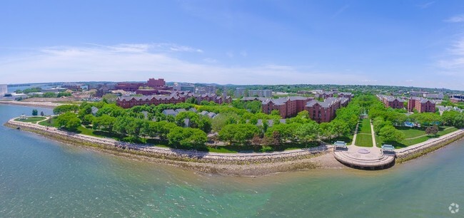
As its name implies, the Bentley College neighborhood surrounds Bentley University. The University of Massachusetts College of Agriculture is also located in the neighborhood. The presence of two college campuses fives the area an energetic feel. Bentley College is dominated by Bentley University and several large greenspaces, give the area a park-like feel. The residential areas in Bentley College consist of houses, townhomes, apartments, and condos. There are rentals available for every budget, but there are several housing options that are cheaper compared to other Waltham neighborhoods. Bentley College is about a mile from Main Street, which is home to Waltham’s downtown district. This charming thoroughfare is filled with restaurants, grocers, and shops. With Downtown Boston just 10 miles away, Bentley College attracts commuters looking for the ideal apartment just outside of Boston.
Learn more about living in Bentley CollegeBelow are rent ranges for similar nearby apartments
| Beds | Average Size | Lowest | Typical | Premium |
|---|---|---|---|---|
| Studio Studio Studio | 415 Sq Ft | $2,199 | $2,399 | $2,599 |
| 1 Bed 1 Bed 1 Bed | 714-715 Sq Ft | $1,975 | $2,421 | $2,850 |
| 2 Beds 2 Beds 2 Beds | 1109 Sq Ft | $2,270 | $2,870 | $3,800 |
| 3 Beds 3 Beds 3 Beds | 4034 Sq Ft | $2,830 | $3,458 | $5,650 |
| 4 Beds 4 Beds 4 Beds | 2703 Sq Ft | $5,200 | $5,677 | $7,200 |
| Colleges & Universities | Distance | ||
|---|---|---|---|
| Colleges & Universities | Distance | ||
| Drive: | 3 min | 1.3 mi | |
| Drive: | 7 min | 2.7 mi | |
| Drive: | 15 min | 6.3 mi | |
| Drive: | 14 min | 6.7 mi |
Transportation options available in Waltham include Riverside Station, located 3.7 miles from 269 Lexington St. 269 Lexington St is near General Edward Lawrence Logan International, located 14.7 miles or 26 minutes away, and Worcester Regional, located 41.5 miles or 60 minutes away.
| Transit / Subway | Distance | ||
|---|---|---|---|
| Transit / Subway | Distance | ||
|
|
Drive: | 8 min | 3.7 mi |
|
|
Drive: | 9 min | 4.3 mi |
|
|
Drive: | 11 min | 5.0 mi |
|
|
Drive: | 12 min | 5.3 mi |
|
|
Drive: | 12 min | 5.6 mi |
| Commuter Rail | Distance | ||
|---|---|---|---|
| Commuter Rail | Distance | ||
|
|
Walk: | 16 min | 0.9 mi |
| Walk: | 18 min | 0.9 mi | |
|
|
Drive: | 5 min | 2.6 mi |
|
|
Drive: | 5 min | 2.9 mi |
|
|
Drive: | 6 min | 3.2 mi |
| Airports | Distance | ||
|---|---|---|---|
| Airports | Distance | ||
|
General Edward Lawrence Logan International
|
Drive: | 26 min | 14.7 mi |
|
Worcester Regional
|
Drive: | 60 min | 41.5 mi |
Time and distance from 269 Lexington St.
| Shopping Centers | Distance | ||
|---|---|---|---|
| Shopping Centers | Distance | ||
| Walk: | 6 min | 0.4 mi | |
| Drive: | 2 min | 1.4 mi | |
| Drive: | 3 min | 1.6 mi |
| Parks and Recreation | Distance | ||
|---|---|---|---|
| Parks and Recreation | Distance | ||
|
Beaver Brook Reservation
|
Drive: | 4 min | 2.4 mi |
|
Mass Audubon's Habitat Education Center and Wildlife Sanctuary
|
Drive: | 9 min | 4.2 mi |
|
Land's Sake Farm
|
Drive: | 8 min | 4.3 mi |
|
Hammond Pond Reservation
|
Drive: | 13 min | 6.2 mi |
|
Hemlock Gorge Reservation
|
Drive: | 14 min | 6.3 mi |
| Hospitals | Distance | ||
|---|---|---|---|
| Hospitals | Distance | ||
| Drive: | 3 min | 1.8 mi | |
| Drive: | 5 min | 2.8 mi | |
| Drive: | 9 min | 4.3 mi |
| Military Bases | Distance | ||
|---|---|---|---|
| Military Bases | Distance | ||
| Drive: | 14 min | 6.8 mi | |
| Drive: | 21 min | 12.1 mi |
You May Also Like
Similar Rentals Nearby
What Are Walk Score®, Transit Score®, and Bike Score® Ratings?
Walk Score® measures the walkability of any address. Transit Score® measures access to public transit. Bike Score® measures the bikeability of any address.
What is a Sound Score Rating?
A Sound Score Rating aggregates noise caused by vehicle traffic, airplane traffic and local sources

