

27 Tanners Path
Marlborough, MA 01752
-
Bedrooms
3
-
Bathrooms
2.5
-
Square Feet
--
-
Available
Available Apr 15

About This Home
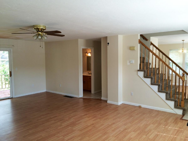
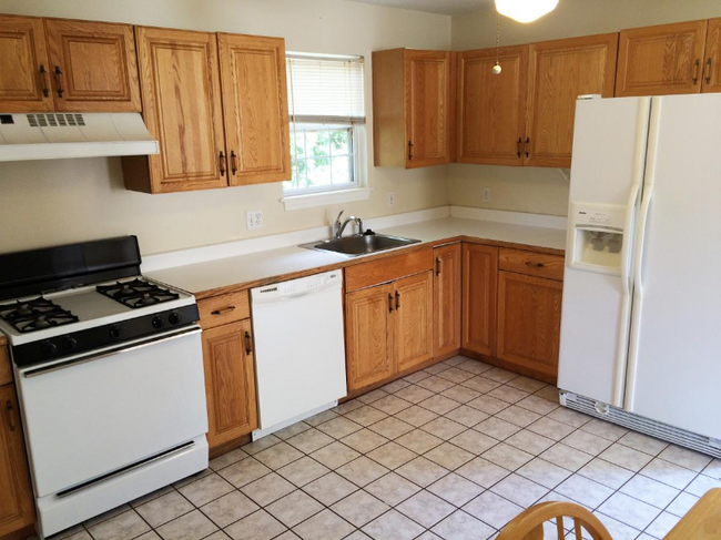
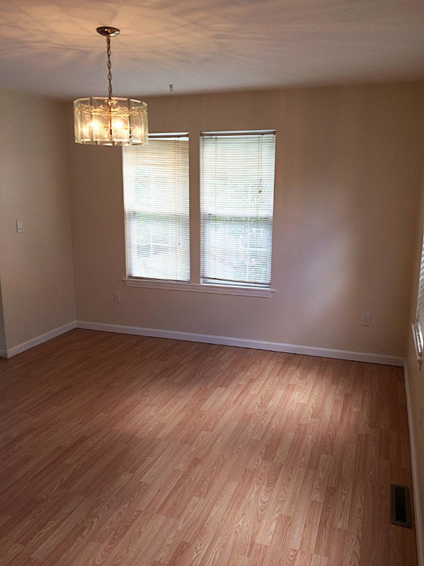
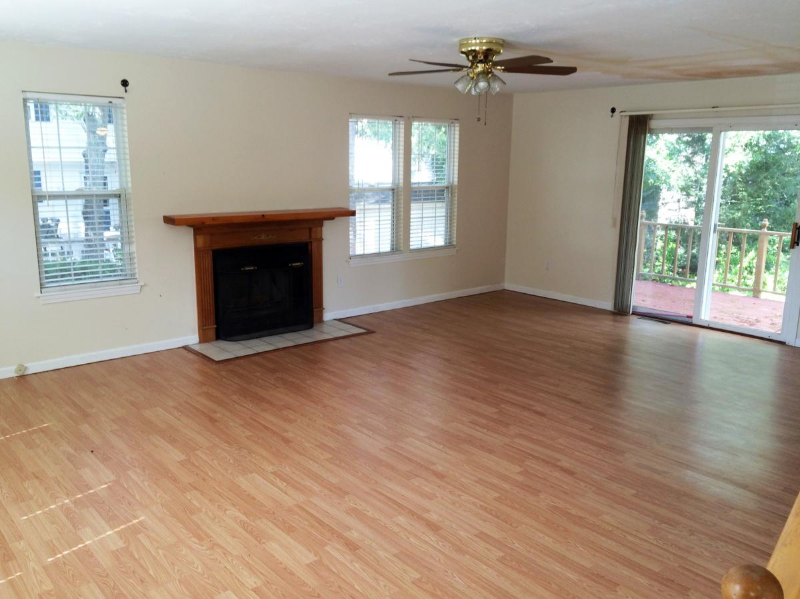
Property Id: 1759166 Welcome to your dream home at 27 Tannners Path in Marlborough, MA! This stunning single-family property features 3 bedrooms, 2.5 bathrooms, central forced air, and is available for rent starting April 15, 2025, for $3350/month. No smoking or pets allowed. Don't miss out on this amazing opportunity!
27 Tanners Path is a house located in Middlesex County and the 01752 ZIP Code. This area is served by the Marlborough attendance zone.
Contact
- Phone Number
- Contact
-
Source

Just west of Boston and East of Worcester sits Metro West, a region that houses a group of towns and cities with significant historical backgrounds. A total of 19 municipalities make up the core of this community, but other municipalities are considered to be a part of the Interstate 495/Metro West Corridor.
Learn more about living in Metro West| Colleges & Universities | Distance | ||
|---|---|---|---|
| Colleges & Universities | Distance | ||
| Drive: | 15 min | 6.7 mi | |
| Drive: | 30 min | 14.8 mi | |
| Drive: | 30 min | 14.8 mi | |
| Drive: | 30 min | 16.0 mi |


View GreatSchools Rating Methodology
Transportation options available in Marlborough include Riverside Station, located 16.1 miles from 27 Tanners Path. 27 Tanners Path is near Worcester Regional, located 25.4 miles or 39 minutes away, and General Edward Lawrence Logan International, located 29.8 miles or 50 minutes away.
| Transit / Subway | Distance | ||
|---|---|---|---|
| Transit / Subway | Distance | ||
|
|
Drive: | 30 min | 16.1 mi |
|
|
Drive: | 30 min | 16.5 mi |
|
|
Drive: | 31 min | 17.1 mi |
|
|
Drive: | 34 min | 18.7 mi |
|
|
Drive: | 34 min | 18.9 mi |
| Commuter Rail | Distance | ||
|---|---|---|---|
| Commuter Rail | Distance | ||
|
|
Drive: | 18 min | 7.2 mi |
|
|
Drive: | 19 min | 8.3 mi |
|
|
Drive: | 20 min | 8.4 mi |
|
|
Drive: | 23 min | 9.6 mi |
|
|
Drive: | 27 min | 11.0 mi |
| Airports | Distance | ||
|---|---|---|---|
| Airports | Distance | ||
|
Worcester Regional
|
Drive: | 39 min | 25.4 mi |
|
General Edward Lawrence Logan International
|
Drive: | 50 min | 29.8 mi |
Time and distance from 27 Tanners Path.
| Shopping Centers | Distance | ||
|---|---|---|---|
| Shopping Centers | Distance | ||
| Walk: | 9 min | 0.5 mi | |
| Walk: | 12 min | 0.6 mi | |
| Walk: | 13 min | 0.7 mi |
| Parks and Recreation | Distance | ||
|---|---|---|---|
| Parks and Recreation | Distance | ||
|
Memorial Forest
|
Drive: | 8 min | 2.9 mi |
|
Hop Brook Natural Area
|
Drive: | 9 min | 3.7 mi |
|
Callahan State Park
|
Drive: | 12 min | 4.7 mi |
|
Nobscot Scout Reservation
|
Drive: | 9 min | 4.7 mi |
|
Garden in the Woods
|
Drive: | 13 min | 6.2 mi |
| Hospitals | Distance | ||
|---|---|---|---|
| Hospitals | Distance | ||
| Drive: | 7 min | 3.5 mi | |
| Drive: | 17 min | 7.7 mi | |
| Drive: | 27 min | 12.2 mi |
| Military Bases | Distance | ||
|---|---|---|---|
| Military Bases | Distance | ||
| Drive: | 23 min | 11.1 mi |
You May Also Like
What Are Walk Score®, Transit Score®, and Bike Score® Ratings?
Walk Score® measures the walkability of any address. Transit Score® measures access to public transit. Bike Score® measures the bikeability of any address.
What is a Sound Score Rating?
A Sound Score Rating aggregates noise caused by vehicle traffic, airplane traffic and local sources
27 Tanners Path
Marlborough, MA 01752