
$4,800 / Month
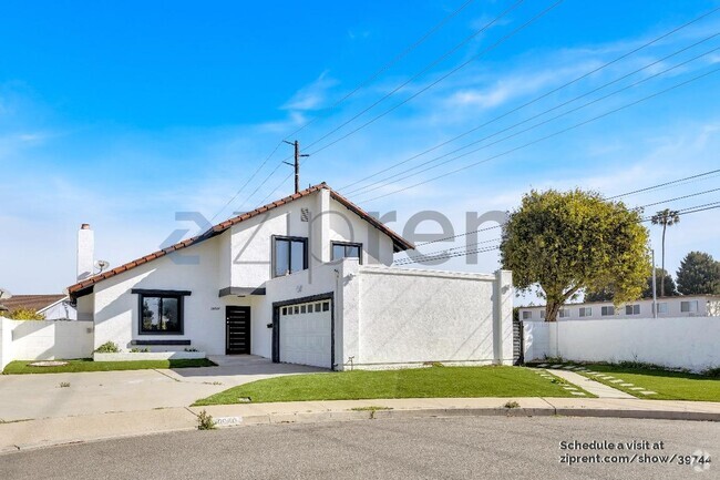
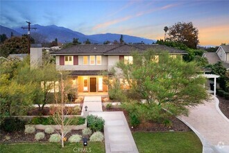
2729 Tulip tree Ln S
Rowland Heights, CA 91748
Today
Favorites
626-534-3819
-
Bedrooms
4
-
Bathrooms
3
-
Square Feet
2,507 sq ft
-
Available
Available Now
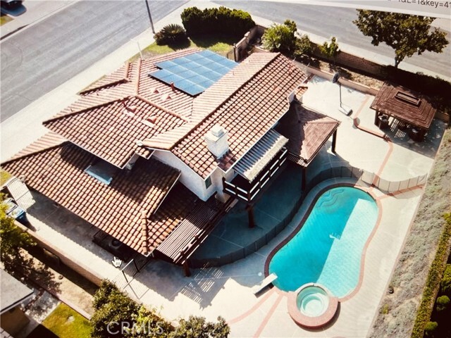
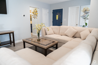
Highlights
- Pool
- Patio
- Fireplace
2729 Tulip tree Ln S

Favorites
2729 Tulip tree Ln S is a house located in Los Angeles County and the 91748 ZIP Code.
* Price shown is base rent and may not include non-optional fees and utilities.
Price, availability, fees, and any applicable rent special are subject to change without notice.
* Square footage definitions vary. Displayed square footage is approximate.
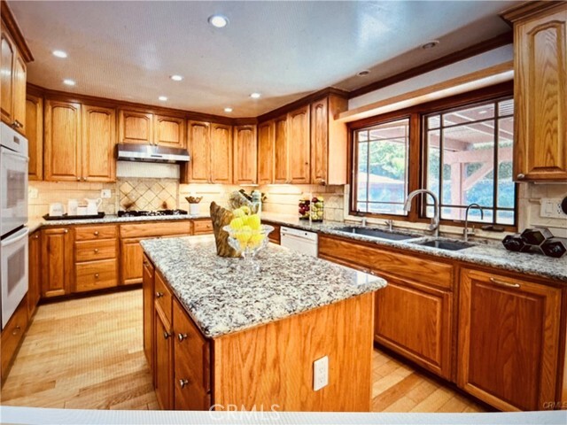
House Features
Air Conditioning
Disposal
Fireplace
Heating
- Air Conditioning
- Heating
- Fireplace
- Disposal
- Laundry Facilities
- Spa
- Pool
- Patio
Fees and Policies
The fees below are based on community-supplied data and may exclude additional fees and utilities.
- Parking
-
Other--
Details
Lease Options
-
12 Months
Contact
- Listed by Angela Xu | RE/MAX Champions
- Phone Number
- Contact
-
Source
 California Regional Multiple Listing Service
Copyright 2025 © California Regional MLS. All rights reserved.
$4,784 / month
$744,900 Listing Price
4 Beds
•3 Baths
•
1,254 Sq Ft
$5,077 / month
$790,000 Listing Price
5 Beds
•3 Baths
•
1,785 Sq Ft
$5,342 / month
$850,000 Listing Price
4 Beds
•3 Baths
•
1,635 Sq Ft
Location
Get Directions
Amenities
- Air Conditioning
- Heating
- Fireplace
- Disposal
- Laundry Facilities
- Patio
- Spa
- Pool
Located approximately 20 miles east of Los Angeles, Rowland is a small neighborhood in the City of Industry. This prosperous community sits at the south end of the San Gabriel Valley and offers a central location for commuters. With easy access to shopping and major roadways, Rowland serves its residents with plenty of convenience, while its parks and wilderness areas let you stay connected to California’s natural beauty. Residents enjoy the abundant entertainment options, including retailers, movie theaters, fitness centers, department stores, and restaurants, as well as outdoor options like Peter F. Schabarum Regional Park, a 575-acre park with tennis courts and beautiful nature trails.
Learn more about living in Rowland
Education
| Colleges & Universities | Distance | ||
|---|---|---|---|
| Colleges & Universities | Distance | ||
| Drive: | 14 min | 7.8 mi | |
| Drive: | 15 min | 9.2 mi | |
| Drive: | 17 min | 9.6 mi | |
| Drive: | 18 min | 10.0 mi |
2729 Tulip tree Ln S is within 14 minutes or 7.8 miles from Fullerton College. It is also near Mt. San Antonio College and Whittier College.
Transportation options available in Rowland Heights include Azusa Downtown Station, located 13.3 miles from 2729 Tulip tree Ln S. 2729 Tulip tree Ln S is near Ontario International, located 22.6 miles or 30 minutes away, and Long Beach (Daugherty Field), located 24.6 miles or 40 minutes away.
| Transit / Subway | Distance | ||
|---|---|---|---|
| Transit / Subway | Distance | ||
| Drive: | 22 min | 13.3 mi | |
| Drive: | 26 min | 14.4 mi | |
| Drive: | 25 min | 14.6 mi | |
|
|
Drive: | 26 min | 16.0 mi |
| Drive: | 25 min | 19.6 mi |
| Commuter Rail | Distance | ||
|---|---|---|---|
| Commuter Rail | Distance | ||
|
|
Drive: | 10 min | 5.9 mi |
|
|
Drive: | 15 min | 8.5 mi |
|
|
Drive: | 17 min | 10.2 mi |
|
|
Drive: | 19 min | 11.4 mi |
|
|
Drive: | 21 min | 12.6 mi |
| Airports | Distance | ||
|---|---|---|---|
| Airports | Distance | ||
|
Ontario International
|
Drive: | 30 min | 22.6 mi |
|
Long Beach (Daugherty Field)
|
Drive: | 40 min | 24.6 mi |
Time and distance from 2729 Tulip tree Ln S.
| Shopping Centers | Distance | ||
|---|---|---|---|
| Shopping Centers | Distance | ||
| Drive: | 3 min | 1.5 mi | |
| Drive: | 3 min | 1.6 mi | |
| Drive: | 6 min | 2.8 mi |
2729 Tulip tree Ln S has 3 shopping centers within 2.8 miles, which is about a 6-minute drive. The miles and minutes will be for the farthest away property.
| Parks and Recreation | Distance | ||
|---|---|---|---|
| Parks and Recreation | Distance | ||
|
Schabarum Regional Park
|
Drive: | 9 min | 3.7 mi |
|
La Habra Historical Museum
|
Drive: | 7 min | 4.1 mi |
|
Children's Museum at La Habra
|
Drive: | 8 min | 4.5 mi |
|
Galster Wilderness Park Nature Center
|
Drive: | 14 min | 7.8 mi |
|
Craig Regional Park
|
Drive: | 16 min | 8.1 mi |
2729 Tulip tree Ln S has 5 parks within 8.1 miles, including Schabarum Regional Park, La Habra Historical Museum, and Children's Museum at La Habra.
| Hospitals | Distance | ||
|---|---|---|---|
| Hospitals | Distance | ||
| Drive: | 10 min | 6.2 mi | |
| Drive: | 13 min | 7.5 mi | |
| Drive: | 18 min | 10.9 mi |
2729 Tulip tree Ln S has 3 hospitals within 10.9 miles, the nearest is St. Jude Medical Center which is 6.2 miles away and a 10 minute drive.
| Military Bases | Distance | ||
|---|---|---|---|
| Military Bases | Distance | ||
| Drive: | 31 min | 18.4 mi |
2729 Tulip tree Ln S is 18.4 miles and a 31 minute drive from Los Alamitos Army Airfield.
You May Also Like
Similar Rentals Nearby


What Are Walk Score®, Transit Score®, and Bike Score® Ratings?
Walk Score® measures the walkability of any address. Transit Score® measures access to public transit. Bike Score® measures the bikeability of any address.
What is a Sound Score Rating?
A Sound Score Rating aggregates noise caused by vehicle traffic, airplane traffic and local sources
2729 Tulip tree Ln S
Rowland Heights, CA 91748