
$6,999 / Month
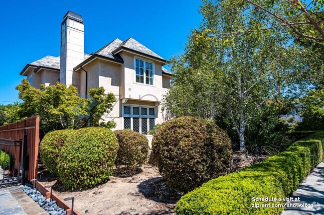
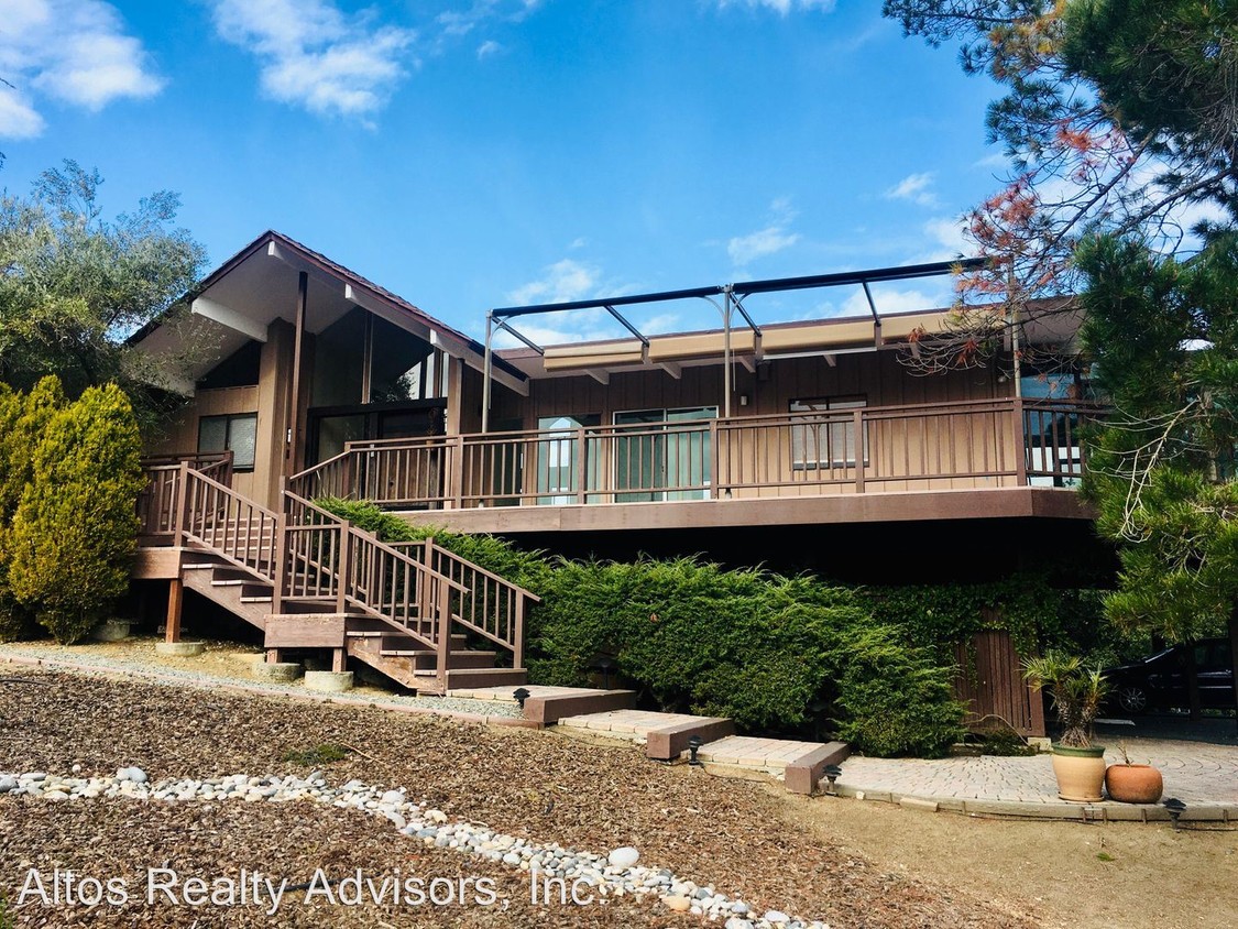
27821 Baker Ln
Los Altos Hills, CA 94022
2 Weeks Ago
Favorites
27821 Baker Ln

Favorites
Check Back Soon for Upcoming Availability
| Beds | Baths | Average SF |
|---|---|---|
| 4 Bedrooms 4 Bedrooms 4 Br | 2.5 Baths 2.5 Baths 2.5 Ba | 2,197 SF |
About This Property
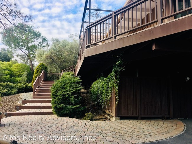
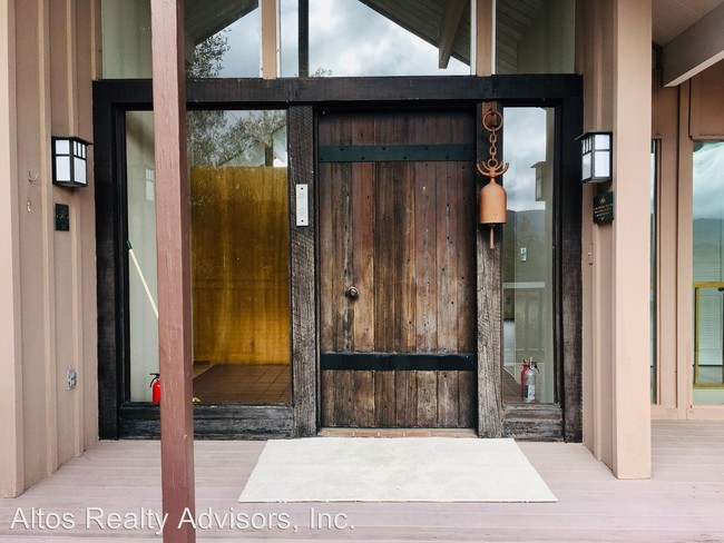
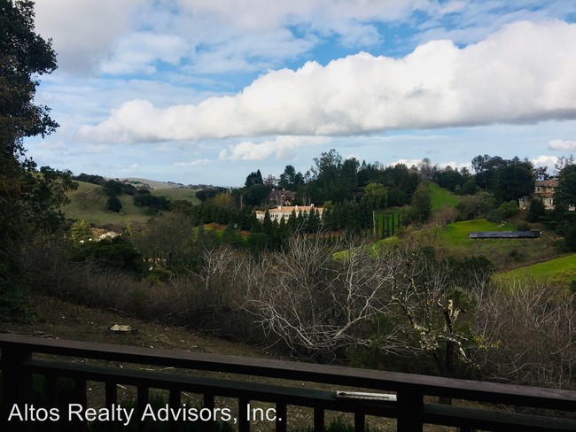
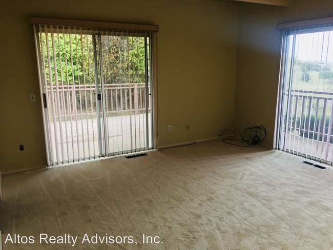
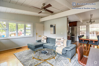
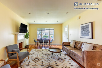
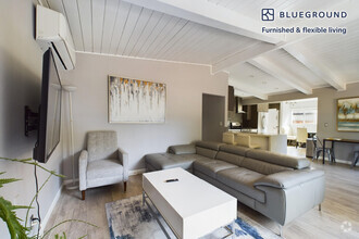
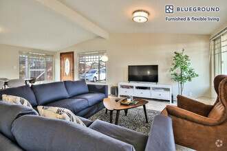
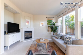
(408) 720-0920 x108 - Desirable Los Altos Hills 4 Bed 2.5 Bath Home Close To Stanford * Great Views * - This Los Altos home features just under 2,200 square feet of living space on two floors. It includes 4 bedrooms and 2.5 bathrooms, a kitchen with plenty of storage, living room with a fireplace, a family room downstairs, a laundry room upstairs, auxiliary storage room, and a sunroom sitting on the wraparound deck. Brand new carpet and fresh paint throughout. This home is made for entertaining friends and family! Close to Stanford dish, which makes for great hiking! The property is located close to Stanford, Downtown Los Altos, Foothill College, Tesla HQ and Esther Clark Park. Easy access to Highway 280 and Foothill Expressway. Parking Extended Driveway This is a non-smoking property Laundry W/D included HVAC Central Forced Air Heating Utilities All Utilities Paid by Tenant Schools(*Tenants to Verify*) Lucille M. Nixon Elementary Terman Middle School Henry M. Gunn High School If this doesn’t quite meet your needs, check out our other available properties at www.goaltos.com or give us a call at 408-720-0920. No Pets Allowed (RLNE5448449) Pet policies: No Dogs Allowed, No Cats Allowed.
27821 Baker Ln is a house located in Santa Clara County and the 94022 ZIP Code. This area is served by the Palo Alto Unified attendance zone.
Unique Features
- No Dogs Allowed, No Cats Allowed
Fees and Policies
The fees below are based on community-supplied data and may exclude additional fees and utilities.
Location
Get Directions
Home to some of Silicon Valley’s biggest movers and shakers, Los Altos is one of the most upscale towns in California and the nation. Tucked within rolling hills with gorgeous views of Silicon Valley, Los Altos Hills boast massive estates, elegant mansions, modern apartments, and posh condos available for rent. To maintain its rural feel, each new home is required to have at least one acre of land. Surrounded by golf clubs, nature preserves, parks, and more, Los Altos Hills is perfect for nature lovers. Apart from housing Foothill College, Los Altos Hills is entirely residential. Thankfully, residents don’t have to go far for shopping, dining, or entertainment since the town is convenient to several other cities such as Los Altos, Mountain View, Santa Clara, and San Francisco. Interstate 280 makes traveling throughout the Bay Area a breeze.
Learn more about living in Los Altos Hills
Amenities
- No Dogs Allowed, No Cats Allowed
Education
| Colleges & Universities | Distance | ||
|---|---|---|---|
| Colleges & Universities | Distance | ||
| Drive: | 12 min | 4.3 mi | |
| Drive: | 11 min | 4.3 mi | |
| Drive: | 9 min | 4.9 mi | |
| Drive: | 17 min | 7.7 mi |
27821 Baker Ln is within 9 minutes or 4.9 miles from Foothill Coll., Los Altos. It is also near Foothill College, Middlefield and Stanford University.
Schools


Public Elementary School
Grades K-5
358 Students
Attendance Zone
Public Elementary School
Grades K-5
367 Students
Nearby
Public Middle School
Grades 6-8
515 Students
Attendance Zone
Public High School
Grades 9-12
1,787 Students
Attendance Zone
Private Elementary, Middle & High School
Grades K-12
612 Students
Nearby
Private Elementary School
Grades K-1
Nearby
Private Elementary & Middle School
Grades K-8
268 Students
Nearby
Private Elementary & Middle School
Grades K-8
250 Students
Nearby
School data provided by
 The GreatSchools Rating helps parents compare schools within a state based on a variety of school quality indicators and provides a helpful picture of how effectively each school serves all of its students. Ratings are on a scale of 1 (below average) to 10 (above average) and can include test scores, college readiness, academic progress, advanced courses, equity, discipline and attendance data. We also advise parents to visit schools, consider other information on school performance and programs, and consider family needs as part of the school selection process.
View GreatSchools Rating Methodology
View GreatSchools Rating Methodology
Transportation options available in Los Altos Hills include Mountain View Station, located 5.9 miles from 27821 Baker Ln. 27821 Baker Ln is near Norman Y Mineta San Jose International, located 15.2 miles or 27 minutes away, and San Francisco International, located 25.8 miles or 37 minutes away.
| Transit / Subway | Distance | ||
|---|---|---|---|
| Transit / Subway | Distance | ||
|
|
Drive: | 13 min | 5.9 mi |
|
|
Drive: | 16 min | 7.1 mi |
|
|
Drive: | 17 min | 7.7 mi |
|
|
Drive: | 18 min | 7.8 mi |
|
|
Drive: | 19 min | 8.6 mi |
| Commuter Rail | Distance | ||
|---|---|---|---|
| Commuter Rail | Distance | ||
| Drive: | 10 min | 4.3 mi | |
| Drive: | 10 min | 4.6 mi | |
| Drive: | 14 min | 5.8 mi | |
| Drive: | 16 min | 6.5 mi | |
| Drive: | 16 min | 7.0 mi |
| Airports | Distance | ||
|---|---|---|---|
| Airports | Distance | ||
|
Norman Y Mineta San Jose International
|
Drive: | 27 min | 15.2 mi |
|
San Francisco International
|
Drive: | 37 min | 25.8 mi |
Time and distance from 27821 Baker Ln.
| Shopping Centers | Distance | ||
|---|---|---|---|
| Shopping Centers | Distance | ||
| Drive: | 8 min | 3.4 mi | |
| Drive: | 10 min | 3.9 mi | |
| Drive: | 10 min | 4.0 mi |
27821 Baker Ln has 3 shopping centers within 4.0 miles, which is about a 10-minute drive. The miles and minutes will be for the farthest away property.
| Parks and Recreation | Distance | ||
|---|---|---|---|
| Parks and Recreation | Distance | ||
|
Esther Clark Nature Preserve
|
Drive: | 4 min | 1.6 mi |
|
Terman Park
|
Drive: | 6 min | 2.5 mi |
|
Pearson-Arastradero Regional Preserve
|
Drive: | 7 min | 2.6 mi |
|
Redwood Grove
|
Drive: | 8 min | 3.8 mi |
|
Foothill College Observatory
|
Drive: | 10 min | 5.1 mi |
27821 Baker Ln has 5 parks within 5.1 miles, including Esther Clark Nature Preserve, Foothill College Observatory, and Pearson-Arastradero Regional Preserve.
| Hospitals | Distance | ||
|---|---|---|---|
| Hospitals | Distance | ||
| Drive: | 13 min | 5.4 mi | |
| Drive: | 12 min | 6.1 mi | |
| Drive: | 14 min | 6.2 mi |
27821 Baker Ln has 3 hospitals within 6.2 miles, the nearest is Lucile Salter Packard Children's Hospital at Stanford which is 5.4 miles away and a 13 minute drive.
| Military Bases | Distance | ||
|---|---|---|---|
| Military Bases | Distance | ||
| Drive: | 20 min | 8.1 mi |
27821 Baker Ln is 8.1 miles and a 20 minute drive from Ames Research Center.
You May Also Like
Similar Rentals Nearby

What Are Walk Score®, Transit Score®, and Bike Score® Ratings?
Walk Score® measures the walkability of any address. Transit Score® measures access to public transit. Bike Score® measures the bikeability of any address.
What is a Sound Score Rating?
A Sound Score Rating aggregates noise caused by vehicle traffic, airplane traffic and local sources
27821 Baker Ln
Los Altos Hills, CA 94022